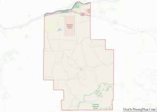
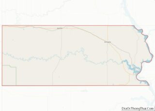
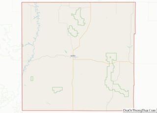
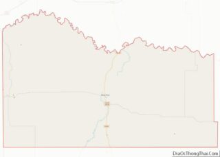
Map of Perry County, Arkansas
Perry County is a county located in the U.S. state of Arkansas. Its population was 10,019 at the 2020 United States Census. The county seat is Perryville. The county was formed on December 18, 1840, and named for Commodore Oliver Hazard Perry, naval hero in the War of 1812. It is an alcohol prohibition or ... Read more
Map of Perry County, Arkansas
Map of Stone County, Arkansas
Stone County is located in the Ozark Mountains in the U.S. state of Arkansas. The county is named for rugged, rocky area terrain of the Ozarks. Created as Arkansas’s 74th county on April 21, 1873, Stone County has two incorporated cities: Mountain View, the county seat and most populous city, and Fifty-Six. The county is ... Read more
Map of Stone County, Arkansas
Map of Fresno County, California
Fresno County (/ˈfrɛznoʊ/ (listen)), officially the County of Fresno, is a county located in the central portion of the U.S. state of California. As of the 2020 Census, the population was 1,008,654. The county seat is Fresno, the fifth-most populous city in California. Fresno County comprises the Fresno, CA Metropolitan Statistical Area, which is part ... Read more
Map of Fresno County, California
Map of Mono County, California
Mono County (/ˈmoʊnoʊ/ MOH-noh) is a county located in the east central portion of the U.S. state of California. As of the 2020 census, the population was 13,195, making it the fourth-least populous county in California. The county seat is Bridgeport. The county is located east of the Sierra Nevada between Yosemite National Park and ... Read more
Map of Mono County, California
Map of Santa Barbara County, California
Santa Barbara County, officially the County of Santa Barbara (Spanish: Condado de Santa Bárbara), is located in Southern California. As of the 2020 census, the population was 448,229. The county seat is Santa Barbara, and the largest city is Santa Maria. Santa Barbara County comprises the Santa Maria-Santa Barbara, CA Metropolitan Statistical Area. Most of ... Read more
Map of Santa Barbara County, California
Map of Yuba County, California
Yuba County (/ˈjuːbə/ (listen); Maidu: Yubu) is a county in the U.S. state of California. As of the 2020 U.S. Census, its population was 81,575. The county seat is Marysville. Yuba County is included in the Yuba Citymetropolitan statistical area, which is also included in the Sacramento–Roseville combined statistical area. The county is in the ... Read more
Map of Yuba County, California
Map of Delta County, Colorado
Delta County overview: Name: Delta County FIPS code: 08-029 State: Colorado Founded: February 11, 1883 Named for: City of Delta, Colorado Seat: Delta Largest city: Delta Total Area: 1,149 sq mi (2,980 km²) Land Area: 1,142 sq mi (2,960 km²) Total Population: 31,661 Population Density: 27/sq mi (10/km²) Time zone: UTC−7 (Mountain) Summer Time Zone (DST): UTC−6 (MDT) Website: www.deltacounty.com Delta County ... Read more
Map of Delta County, Colorado
Map of Kiowa County, Colorado
Kiowa County is a county located in the U.S. state of Colorado. As of the 2020 census, the population was 1,446, making it the fifth-least populous county in Colorado. The county seat is Eads. The county was named for the Kiowa Nation of Native Americans. Kiowa County overview: Name: Kiowa County FIPS code: 08-061 State: ... Read more
Map of Kiowa County, Colorado
Map of Park County, Colorado
Park County is a county located in the U.S. state of Colorado. As of the 2020 census, the population was 17,390. The county seat is Fairplay. The county was named after the large geographic region known as South Park, which was named by early fur traders and trappers in the area. Park County is included ... Read more
Map of Park County, Colorado
Map of Yuma County, Colorado
Yuma County overview: Name: Yuma County FIPS code: 08-125 State: Colorado Founded: March 15, 1889 Seat: Wray Largest city: Yuma Total Area: 2,369 sq mi (6,140 km²) Land Area: 2,364 sq mi (6,120 km²) Total Population: 9,988 Population Density: 4.2/sq mi (1.6/km²) Time zone: UTC−7 (Mountain) Summer Time Zone (DST): UTC−6 (MDT) Website: www.yumacounty.net Yuma County location map. Where is Yuma County? ... Read more
Map of Yuma County, Colorado
Map of Bradford County, Florida
Bradford County overview: Name: Bradford County FIPS code: 12-007 State: Florida Founded: December 31, 1858 Seat: Starke Largest city: Starke Total Area: 300 sq mi (800 km²) Land Area: 294 sq mi (760 km²) Total Population: 28,303 Population Density: 91/sq mi (35/km²) Time zone: UTC−5 (Eastern) Summer Time Zone (DST): UTC−4 (EDT) Website: www.bradfordcountyfl.gov Bradford County location map. Where is Bradford County? ... Read more
Map of Bradford County, Florida
Map of Gilchrist County, Florida
Gilchrist County overview: Name: Gilchrist County FIPS code: 12-041 State: Florida Founded: December 4, 1925 Named for: Albert W. Gilchrist Seat: Trenton Largest city: Trenton Total Area: 355 sq mi (920 km²) Land Area: 350 sq mi (900 km²) Total Population: 18,360 Population Density: 48/sq mi (19/km²) Time zone: UTC−5 (Eastern) Summer Time Zone (DST): UTC−4 (EDT) Website: gilchrist.fl.us Gilchrist County location ... Read more
Map of Gilchrist County, Florida