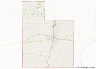
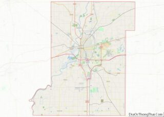
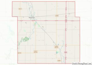
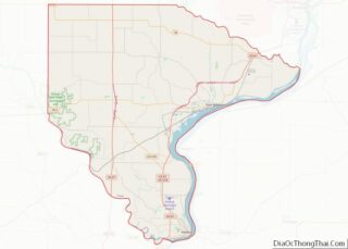
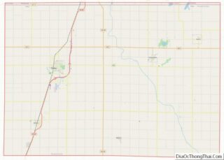
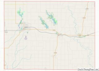
Van Zandt County overview: Name: Van Zandt County FIPS code: 48-467 State: Texas Founded: 1848 Named for: Isaac Van Zandt Seat: Canton Largest city: Canton Total Area: 860 sq mi (2,200 km²) Land Area: 843 sq mi (2,180 km²) Total Population: 59,541 Population Density: 69/sq mi (27/km²) Time zone: UTC−6 (Central) Summer Time Zone (DST): UTC−5 (CDT) Website: www.vanzandtcounty.org Van Zandt County ... Read more
Map of US Counties
Wood County is a county located in the U.S. state of Texas. As of the 2020 census, its population was 44,843. Its county seat is Quitman. The county was named for George T. Wood, governor of Texas from 1847 to 1849. Wood County overview: Name: Wood County FIPS code: 48-499 State: Texas Founded: 1850 Named ... Read more
Juab County (/ˈdʒuːæb/ JOO-ab) is a county in western Utah, United States. As of the 2010 United States Census, the population was 10,246. Its county seat and largest city is Nephi. Juab County is part of the Provo–Orem, Utah Metropolitan Statistical Area, which is also included in the Salt Lake City–Provo–Orem, Utah Combined Statistical Area. ... Read more
Wayne County is a county in the U.S. state of Utah. As of the 2010 census, the population was 2,778, making it the fourth-least populous county in Utah. Its county seat is Loa. Wayne County overview: Name: Wayne County FIPS code: 49-055 State: Utah Founded: March 10, 1892 Named for: Wayne County, Tennessee Seat: Loa ... Read more
Accomack County is a United States county located in the eastern edge of the Commonwealth of Virginia. Together, Accomack and Northampton counties make up the Eastern Shore of Virginia, which in turn is part of the Delmarva Peninsula, bordered by the Chesapeake Bay and the Atlantic Ocean. The Accomack county seat is the town of ... Read more
Buchanan County (/bə.kæn.ən/) is a United States county in far western Virginia, the only county in the state to border both West Virginia and Kentucky. The county is part of the Southwest Virginia region and lies in the rugged Appalachian Plateau portion of the Appalachian Mountains. Its county seat is Grundy. Buchanan County was established ... Read more
Culpeper County is a county located along the borderlands of the northern and central region of the Commonwealth of Virginia. As of the 2020 United States Census, the population was 52,552. Its county seat and only incorporated community is Culpeper. Culpeper County is included in the Washington–Baltimore–Arlington, DC–MD–VA–WV–PA Combined Statistical Area. Culpeper County overview: Name: ... Read more
Galax /ˈɡeɪlæks/ is an independent city in the southwestern part of the Commonwealth of Virginia. As of the 2020 census, the population was 6,720. The Bureau of Economic Analysis combines the city of Galax with neighboring Carroll County for statistical purposes. Galax is bounded to the northeast by Carroll County and to the southwest by ... Read more
James City County is a county located in the Commonwealth of Virginia. As of the 2020 census, the population was 78,254. Although politically separate from the county, the county seat is the adjacent independent city of Williamsburg. Located on the Virginia Peninsula, James City County is included in the Virginia Beach–Norfolk–Newport News, VA-NC Metropolitan Statistical ... Read more
Mecklenburg County overview: Name: Mecklenburg County FIPS code: 51-117 State: Virginia Founded: 1765 Named for: Charlotte of Mecklenburg-Strelitz Seat: Boydton Largest town: South Hill Total Area: 679 sq mi (1,760 km²) Land Area: 625 sq mi (1,620 km²) Total Population: 30,319 Population Density: 45/sq mi (17/km²) Mecklenburg County location map. Where is Mecklenburg County? History Mecklenburg County was organized on March 1, ... Read more
Poquoson (/pəˈkoʊsən/), informally known as Bull Island, is an independent city in the Commonwealth of Virginia, United States. As of the 2020 census, the population was 12,460. The Bureau of Economic Analysis combines the city of Poquoson with surrounding York County for statistical purposes. Poquoson is located on the Virginia Peninsula, in the Hampton Roads ... Read more
Scott County is a county located in the southwestern part of the U.S. state of Virginia. As of the 2020 census, the population was 21,576. Its county seat is Gate City. Scott County was formed by an act of the General Assembly on November 24, 1814, from parts of Washington, Lee, and Russell Counties and ... Read more