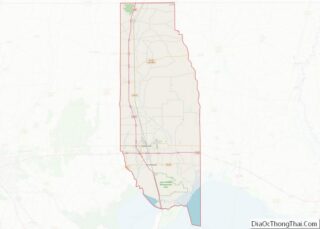
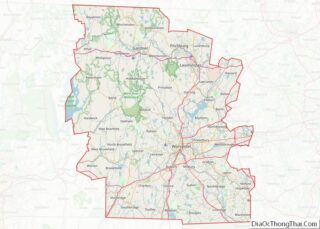
Map of Mason County

Map of Mason County, Illinois

Mason County is a county in the U.S. state of Illinois. According to the 2020 census, it had a population of 13,086. Its county seat is Havana. The county is named in honor of George Mason, a member of the Virginia legislature who campaigned for the adoption of the United States Bill of Rights. Mason … Read more

Map of Pope County

Map of Pope County, Illinois

Pope County is the southeasternmost county in the U.S. state of Illinois. According to the 2020 census, it had a population of 3,763, making it the second-least populous county in Illinois. Its county seat is Golconda. The county was organized in 1816 from portions of Gallatin and Johnson counties and named after Nathaniel Pope, a … Read more

Map of Vermilion County

Map of Vermilion County, Illinois

Vermilion County is a county in the eastern part of the U.S. state of Illinois, between the Indiana border and Champaign County. It was established in 1826 and was the 45th of Illinois’ 102 counties. According to the 2010 United States Census, it had a population of 81,625, a decrease of 2.7% in 2000. It … Read more

Map of Boone County

Map of Boone County, Indiana

Boone County is a county in the U.S. state of Indiana. As of 2020, the population was 70,812. The county seat (and the county’s only incorporated city) is Lebanon. Boone County overview: Name: Boone County FIPS code: 18-011 State: Indiana Founded: 1 April 1830 (created)1831 (organized) Named for: Daniel Boone Seat: Lebanon Largest city: Zionsville … Read more

Map of Floyd County

Map of Floyd County, Indiana

Floyd County is a county located in the U.S. state of Indiana. Its county seat is New Albany. Floyd County has the second-smallest land area in the entire state. It was formed in the year 1819 from neighboring Clark, and Harrison counties. Floyd County is part of the Louisville/Jefferson County, KY–IN Metropolitan Statistical Area. Floyd … Read more

Map of Jay County

Map of Jay County, Indiana

Jay County is a county in the U.S. state of Indiana. As of 2020, the population was 20,478. The county seat is Portland. Jay County overview: Name: Jay County FIPS code: 18-075 State: Indiana Founded: 7 February 1835 (authorized)1836 (organized) Named for: John Jay Seat: Portland Largest city: Portland Total Area: 384.08 sq mi (994.8 km²) Land Area: … Read more

Map of Monroe County

Map of Monroe County, Indiana

Monroe County is a county in the U.S. state of Indiana. In 1910 the US Census Bureau calculated the nation’s mean population center to lie in Monroe County. The population was 137,974 at the 2010 United States Census. The county seat is Bloomington. Monroe County is part of the Bloomington, Indiana, Metropolitan Statistical Area. Monroe … Read more

Map of Ripley County

Map of Ripley County, Indiana

Ripley County is a county located at the southeastern corner of the U.S. state of Indiana. According to the 2010 Census, the population was 28,818. The county seat is Versailles. Ripley County overview: Name: Ripley County FIPS code: 18-137 State: Indiana Founded: December 27, 1816 Named for: Eleazer Wheelock Ripley Seat: Versailles Largest city: Batesville … Read more

Map of Wabash County

Map of Wabash County, Indiana

Wabash County is a county located in the northern central part of the U.S. state of Indiana. As of 2020, the population was 30,976. The county seat is Wabash. Wabash County overview: Name: Wabash County FIPS code: 18-169 State: Indiana Founded: Jan., 1820; organized 1835 Named for: Wabash River Seat: Wabash Largest city: Wabash Total … Read more

Map of Bremer County

Map of Bremer County, Iowa

Bremer County overview: Name: Bremer County FIPS code: 19-017 State: Iowa Founded: 1851 Named for: Fredrika Bremer Seat: Waverly Largest city: Waverly Total Area: 439 sq mi (1,140 km²) Land Area: 435 sq mi (1,130 km²) Total Population: 24,988 Population Density: 57/sq mi (22/km²) Time zone: UTC−6 (Central) Summer Time Zone (DST): UTC−5 (CDT) Website: www.bremercounty.iowa.gov Bremer County location map. Where is … Read more

Map of Dallas County

Map of Dallas County, Iowa

Dallas County is a county located in the U.S. state of Iowa. As of the 2020 Census, the population was 99,678, making it the seventh-most populous county in Iowa. Between 2010 and 2020, it was the fastest growing county in Iowa and one of the fastest growing in the country. Its county seat is Adel, … Read more

Map of Hancock County

Map of Hancock County, Iowa

Hancock County is a county in the U.S. state of Iowa. As of the 2020 census, the population was 10,795. The county seat is Garner. The county was founded on January 15, 1851, and named in honor of John Hancock, a leader of the Continental Congress during the American Revolution. Hancock County overview: Name: Hancock … Read more