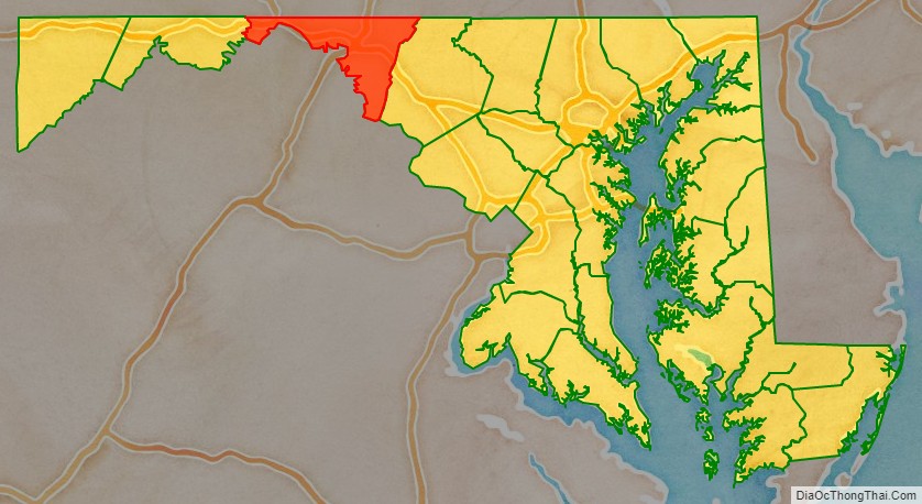
Washington County is located in the western part of the U.S. state of Maryland. As of the 2020 census, the population was 154,705. Its county seat is Hagerstown. Washington County was the first county in the United States to be named for the Revolutionary War general (and later President) George Washington. Washington County is one of three Maryland counties recognized by the Appalachian Regional Commission as being part of Appalachia. The county borders southern Pennsylvania to the north, Northern Virginia to the south, and the Eastern Panhandle of West Virginia to the south and west. Washington County is included in the Hagerstown-Martinsburg, MD-WV Metropolitan Statistical Area, which is also included in the Washington–Baltimore–Arlington, DC-MD-VA-WV-PA Combined Statistical Area.
| Name: | Washington County |
|---|---|
| FIPS code: | 24-043 |
| State: | Maryland |
| Founded: | September 6, 1776 |
| Named for: | George Washington |
| Seat: | Hagerstown |
| Largest city: | Hagerstown |
| Total Area: | 467 sq mi (1,210 km²) |
| Land Area: | 458 sq mi (1,190 km²) |
| Total Population: | 154,705 |
| Population Density: | 330/sq mi (130/km²) |
| Time zone: | UTC−5 (Eastern) |
| Summer Time Zone (DST): | UTC−4 (EDT) |
| Website: | www.washco-md.net |
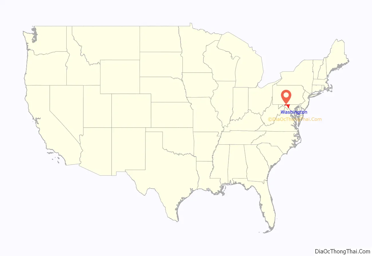
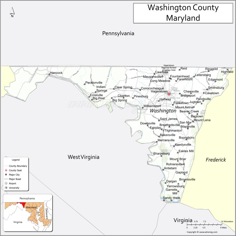
Washington County location map. Where is Washington County?
History
The western portions of the Province of Maryland (including present Washington County) were incorporated into Prince George’s County in 1696. This original county included six current counties. The first to be created was Frederick, separated from Prince George’s County in 1748.
Following independence, the sovereign State of Maryland formed Washington County on September 6, 1776, by the division of Frederick County. At the same time, a portion of Frederick County became part of the newly created Montgomery County along with portions from Prince George’s County and Charles’ County, and was named for General Richard Montgomery. Washington County as created included land later to become Allegany County (created in 1789) and Garrett County (included in Allegany County when it was created in 1789, but separated from Allegany County in 1872). Washington County thus originally included the entire western part of the state.
A number of properties in the county are listed on the National Register of Historic Places.
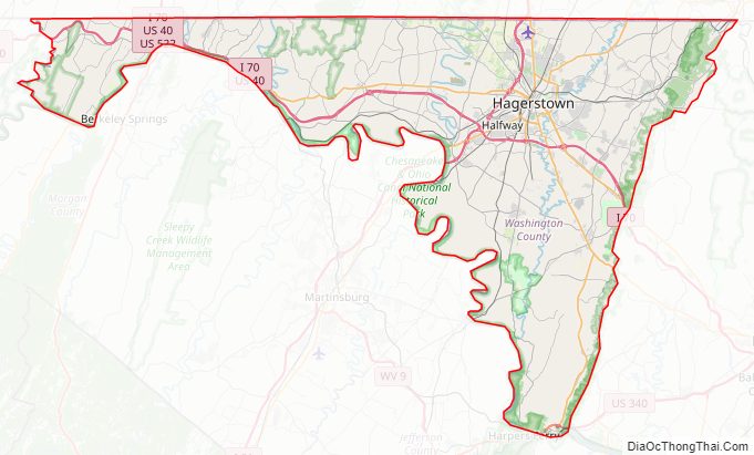
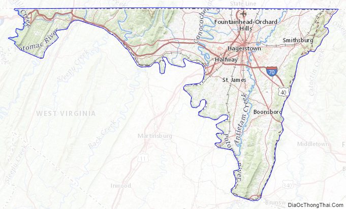
Washington County Road Map
Geography
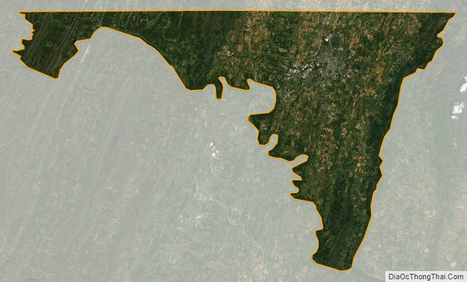
According to the U.S. Census Bureau, the county has a total area of 467 square miles (1,210 km), of which 458 square miles (1,190 km) is land and 9.6 square miles (25 km) (2.0%) is water.
Washington County is located in the Appalachian Mountains, stretching from the Ridge-and-Valley Country in the west to South Mountain in the east, which is an extension of the Blue Ridge. Much of the county lies in the broad Hagerstown Valley between these two zones; the valley is part of the Great Appalachian Valley that continues southward into Virginia and West Virginia as the Shenandoah Valley and northward into Pennsylvania as the Cumberland Valley.
The county is bordered to the north by the Mason–Dixon line with Pennsylvania, to the south by the Potomac River and the states of Virginia and West Virginia, to the west by Sideling Hill Creek and Allegany County, Maryland, and to the east by Frederick County and South Mountain.
Adjacent counties
- Fulton County, Pennsylvania (northwest)
- Allegany County (west)
- Morgan County, West Virginia (southwest)
- Berkeley County, West Virginia (south)
- Jefferson County, West Virginia (south)
- Loudoun County, Virginia (southeast)
- Frederick County (east)
- Franklin County, Pennsylvania (northeast)
Major highways
- Interstate 68
- Interstate 70
- Interstate 81
- U.S. Route 11
- U.S. Route 40
U.S. Route 40 Alternate- US 40 Scenic
- U.S. Route 340
- U.S. Route 522
- Maryland Route 34
- Maryland Route 56
- Maryland Route 57
- Maryland Route 58
- Maryland Route 60
- Maryland Route 62
- Maryland Route 63
- Maryland Route 64
- Maryland Route 65
- Maryland Route 66
- Maryland Route 67
- Maryland Route 68
- Maryland Route 77
- Maryland Route 144
- Maryland Route 180
- Maryland Route 418
- Maryland Route 491
- Maryland Route 494
- Maryland Route 550
- Maryland Route 615
- Maryland Route 632
Washington County Topographic Map
Washington County Satellite Map
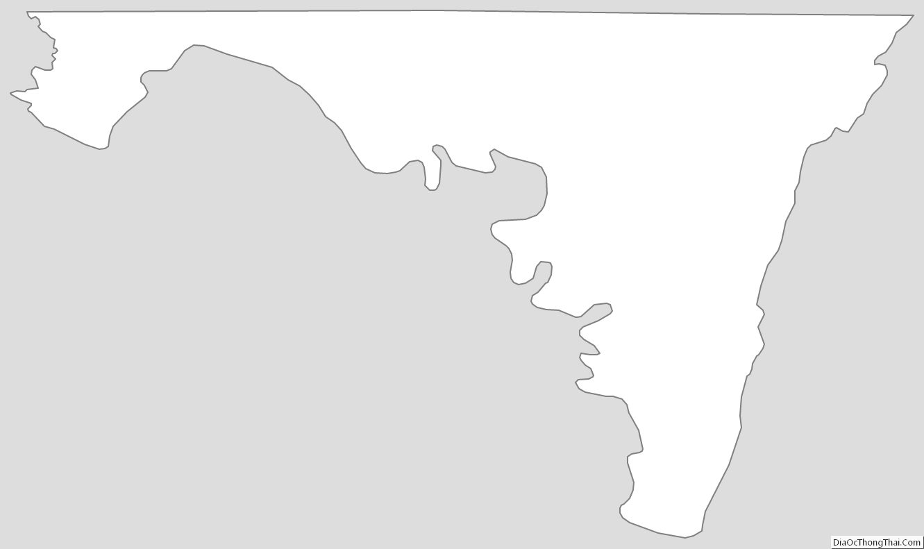
Washington County Outline Map