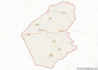
Doddridge County overview: Name: Doddridge County FIPS code: 54-017 State: West Virginia Founded: February 4, 1845 Named for: Philip Doddridge Seat: West Union Largest town: West Union Total Area: 320 sq mi (800 km²) Land Area: 320 sq mi (800 km²) Total Population: 7,808 Population Density: 24/sq mi (9.4/km²) Doddridge County location map. Where is Doddridge County? History First settlers The area ... Read more
Marshall County is a county in the U.S. state of West Virginia. At the 2020 census, the population was 30,591. Its county seat is Moundsville. With its southern border at what would be a continuation of the Mason-Dixon line to the Ohio River, it forms the base of the Northern Panhandle of West Virginia. Marshall ... Read more
Raleigh County is a county in the U.S. state of West Virginia. As of the 2020 census, the population was 74,591. Its county seat is Beckley. The county was founded in 1850 and is named for Sir Walter Raleigh. Raleigh County is included in the Beckley, West Virginia Metropolitan Statistical Area. Raleigh County overview: Name: ... Read more
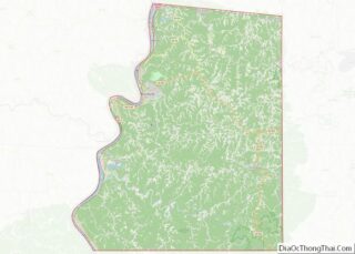
Ashland County is a county located in the U.S. state of Wisconsin. As of the 2020 census, the population was 16,027. Its county seat is Ashland. The county was formed on March 27, 1860, from La Pointe County. The county partly overlaps with the reservation of the Bad River Band of the Lake Superior Tribe ... Read more
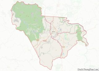
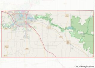
Eau Claire County overview: Name: Eau Claire County FIPS code: 55-035 State: Wisconsin Founded: 1856 Named for: Eau Claire River Seat: Eau Claire Largest city: Eau Claire Total Area: 645 sq mi (1,670 km²) Land Area: 638 sq mi (1,650 km²) Total Population: 105,710 Population Density: 165.7/sq mi (64.0/km²) Eau Claire County location map. Where is Eau Claire County? History Eau Claire ... Read more
Lake Michigan Water body overview: Name: Lake Michigan Water body State: Wisconsin Lake Michigan Water body location map. Where is Lake Michigan Water body? Lake Michigan Water body Road Map Lake Michigan Water body Topographic Map Lake Michigan Water body Satellite Map Lake Michigan Water body Outline Map
Pierce County is a county in the U.S. state of Wisconsin. As of the 2020 census, the population was 42,212. Its county seat is Ellsworth. Pierce County is part of the Minneapolis–St. Paul–Bloomington, MN-WI Metropolitan Statistical Area. Pierce County overview: Name: Pierce County FIPS code: 55-093 State: Wisconsin Founded: 1853 Named for: Franklin Pierce Seat: ... Read more
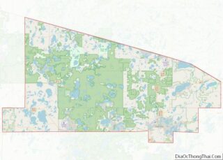
Vilas County (/vaɪləs/ VYE-ləss) is a county in the state of Wisconsin, United States. As of the 2020 census, the population was 23,047. Its county seat is Eagle River. The county partly overlaps the reservation of the Lac du Flambeau Band of Lake Superior Chippewa. Vilas County overview: Name: Vilas County FIPS code: 55-125 State: ... Read more
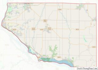
Goshen County is a county in the U.S. state of Wyoming. As of the 2020 United States Census, the population was 12,498. Its county seat is Torrington. The eastern boundary of the County borders the Nebraska state line. Goshen County produces more cattle than any other Wyoming county. In 1997, the county had a total ... Read more
Clarke County is a county located in the southwestern part of the U.S. state of Alabama. As of the 2020 census, the population was 23,087. The county seat is Grove Hill. The county’s largest city is Jackson. The county was created by the legislature of the Mississippi Territory in 1812. It is named in honor ... Read more
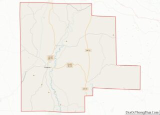
Fayette County is a county located in the U.S. state of Alabama. As of the 2020 census, the population was 16,321. Its county seat is Fayette. Its name is in honor of the Marquis de Lafayette (or de la Fayette), who aided General George Washington in the American Revolutionary War. Fayette County overview: Name: Fayette ... Read more
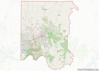
Madison County is located in the north central portion of the U.S. state of Alabama. As of the 2020 Census, the population was 388,153, making it the third-most populous county in Alabama. Its county seat is Huntsville. Since the mid-20th century it has become an area of defense and space research and industry. The county ... Read more