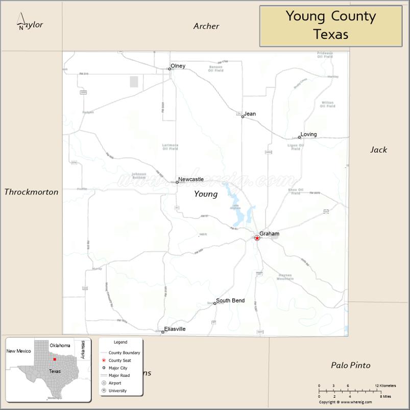
Young County is a county located in the U.S. state of Texas. As of the 2020 census, its population was 17,867. Its county seat is Graham. The county was created in 1856 and organized in 1874. It is named for William Cocke Young, an early Texas settler and soldier.
| Name: | Young County |
|---|---|
| FIPS code: | 48-503 |
| State: | Texas |
| Founded: | 1874 |
| Seat: | Graham |
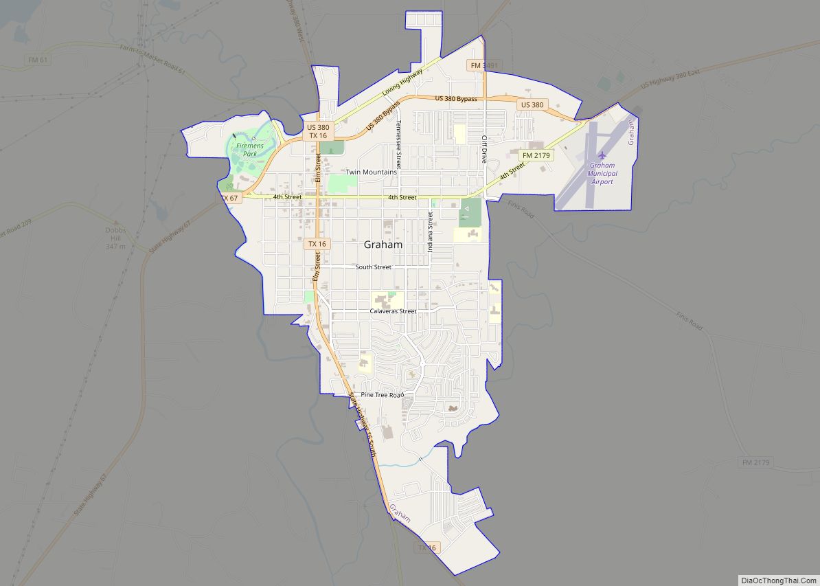
| Largest city: | Graham |
| Total Area: | 931 sq mi (2,410 km²) |
| Land Area: | 914 sq mi (2,370 km²) |
| Total Population: | 17,867 |
| Population Density: | 19/sq mi (7.4/km²) |
| Time zone: | UTC−6 (Central) |
| Summer Time Zone (DST): | UTC−5 (CDT) |
| Website: | www.co.young.tx.us |
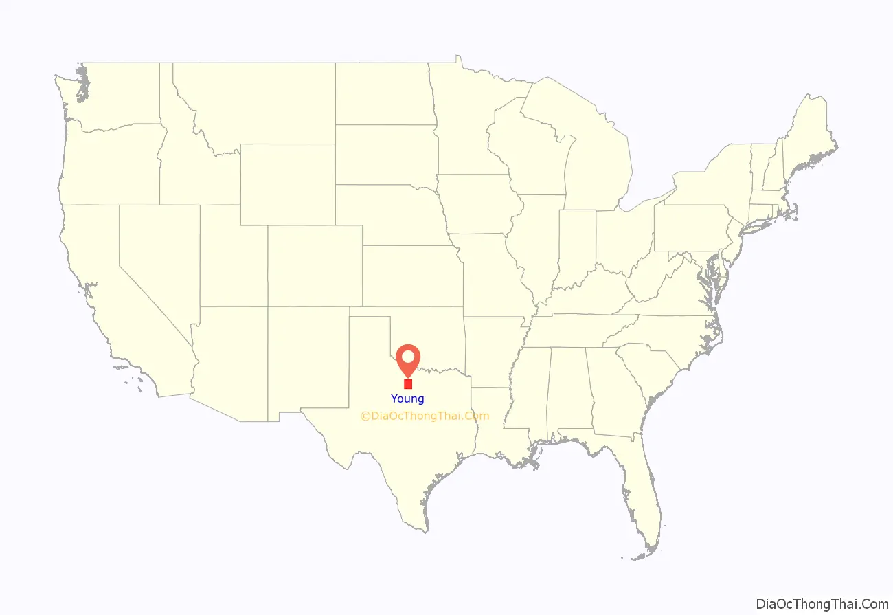
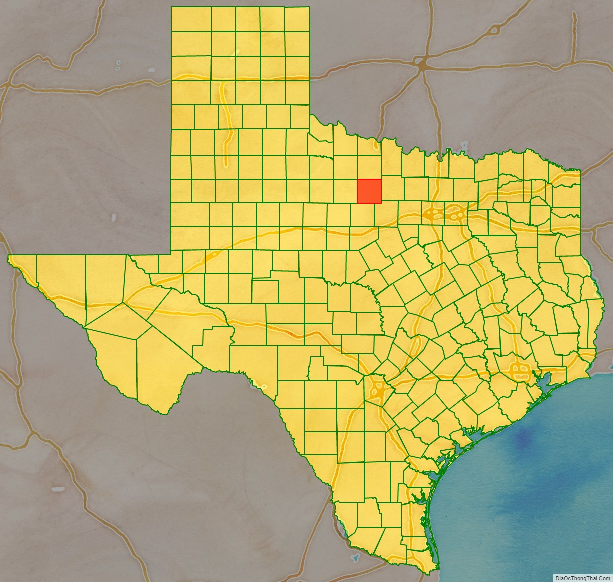
Young County location map. Where is Young County?
History
Native Americans
The Brazos Indian Reservation, founded by General Randolph B. Marcy in 1854, provided a refuge from warring Comanche for the Delaware, Shawnee, Tonkawa, Wichita, Choctaw, and Caddo peoples, who had migrated into Texas from other areas. Within the reservation, each tribe had its own village and cultivated agricultural crops. Government-contracted beef cattle were delivered each week. But most settlers were unable to distinguish between reservation and non-reservation tribes, blaming the reservation Indians for the raids by the Comanche and Kiowa. A newspaper in Jacksboro, Texas, titled The White Man (or Whiteman), advocated removal of all tribes from North Texas.
During December 1858, Choctaw Tom, a Yowani married to a Hasinai woman, at times served as an interpreter to Sam Houston. He was among a group of reservation Indians who received permission to hunt outside the reservation boundaries. But on December 27, Captain Peter Garland and a vigilante group attacked Choctaw Tom’s camp, indiscriminately murdering and injuring women and children along with the men.
Governor Hardin Richard Runnels ordered Major John Henry Brown of the state militia to the area, with 100 troops to control potential retaliation and unrest. An examining trial was conducted about the Choctaw Tom raid, but no indictments resulted of any militia.
In May 1859, John Baylor led a number of whites who confronted the United States troops defending the reservation, demanding the surrender of certain men from the tribe who they thought were responsible for raids. The military balked, and Baylor retreated, but he killed an Indian woman and an old man in the process. Baylor’s group was later attacked by Indians off the reservation, where the military had no authority to intervene.
In May 1871, Kiowa medicine man Satank (Sitting Bear), and Kiowa chiefs Satanta (White Bear), Addo-etta (Big Tree) and Maman-ti (Skywalker) led a force of over 100 Kiowa, Comanche, Kiowa-Apaches, Arapaho, and Cheyenne warriors from the Oklahoma Fort Sill Reservation into Texas. On May 18, the Indians attacked a wagon train belonging to Henry Warren, killing all but five who escaped. Commanding General of the United States Army William Tecumseh Sherman personally arrested Satank, Satanta, and Big Tree at Fort Sill and had them tried in civil court in Jacksboro. Satank was killed in an attempted escape, and others were found guilty and sentenced to hang. Their sentences were commuted by Governor Edmund J. Davis at the request of a group of Quakers, and they were later paroled. The incident was a key element that contributed to the Red River War.
Explorers and settlers
Spanish Colonel Diego Ortiz Parrilla travelled through the county en route to during the 1759 Red River Campaign. Pedro Vial came through the region in 1789 while charting the Santa Fe Trail.
The county was included in the 1841 Republic of Texas empresario Peters Colony land grant. The Young County portion of the grant remained unsettled until the 1850s.
In 1851, Bvt. Brig. Gen. William G. Belknap founded the United States Army Fort Belknap. The fort was surrendered to the Confederacy in 1861, and reoccupied by federal troops in 1867. John and Will Peveler established a ranch 2 mi (3 km) below Fort Belknap, becoming the first settlers.
County established
Young County was established by the Texas Legislature in 1856 from Bosque and Fannin Counties and organized later that same year. Belknap became the county seat. Many of the citizens abandoned the area during the American Civil War due to Indian depredations. In 1865, the county’s government was dissolved, and the county records were transferred to Jacksboro. The county was reorganized in 1874, and the county records were brought back from Jacksboro. This time, the new town of Graham, platted in 1873, was chosen as the county seat.
Gustavus and Edwin Graham began the town of Graham in 1872, and opened the saltworks in 1869. An 1876 area rancher meeting in Graham, regarding cattle rustling, became the beginnings of what is now known as the Texas and Southwestern Cattle Raisers Association. In 1891, a group of investors formed the Graham Mining Company in hopes of mining gold, silver, and coal in the area.
Between 1874 and 1910, railroad lines contributed to the county economy and facilitated transportation, including the Chicago, Rock Island and Gulf Railway, the Wichita Falls and Southern, and the Gulf, Texas and Western Railroad.
Federal programs came to the assistance of farmers and ranchers during the Great Depression. The Work Projects Administration restored old Fort Belknap in 1936. In the 1930s, Young County also joined 65 other counties to form the Brazos River Conservation and Reclamation District. Oil exploration and production opened the 20th century, and had Lindy Lou No. 1 well come in. Actual production of petroleum began in 1920, and boom towns sprang up around the county. By 1990, 3,431,000 barrels (545,500 m) had been produced.
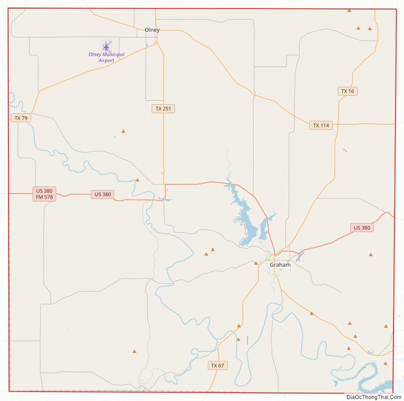
Young County Road Map
Geography
According to the U.S. Census Bureau, the county has a total area of 931 square miles (2,410 km), of which 914 square miles (2,370 km) are land and 16 square miles (41 km) (1.8%) are covered by water.
Major highways
- U.S. Highway 380
- State Highway 16
- State Highway 67
- State Highway 79
- State Highway 114
Adjacent counties
- Archer County (north)
- Jack County (east)
- Palo Pinto County (southeast)
- Stephens County (south)
- Throckmorton County (west)
Young County Topographic Map
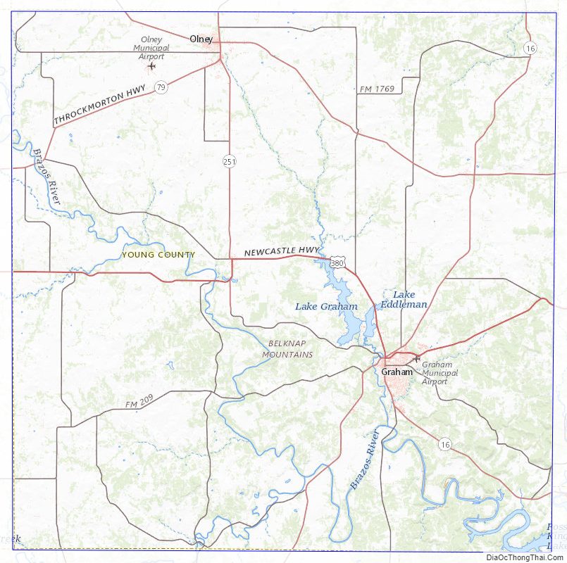
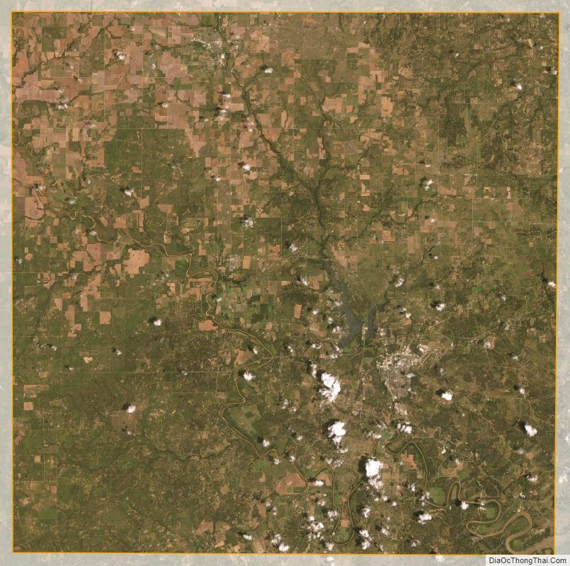
Young County Satellite Map
Young County Outline Map