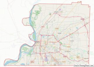
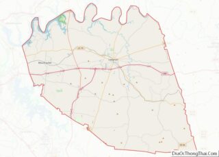
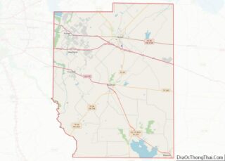
Map of Paulding County, Ohio
Paulding County is a county located in the U.S. state of Ohio. As of the 2020 census, the population was about 18,806. Its county seat is Paulding. The county was created in 1820 and later organized in 1839. It is named for John Paulding, one of the captors of Major John André in the American ... Read more
Map of Paulding County, Ohio
Map of Tuscarawas County, Ohio
Tuscarawas County (/ˌtʌskəˈrɑːwəs/ TUS-kə-RAH-wəs) is a county located in the northeastern part of the U.S. state of Ohio. As of the 2020 census, the population was 93,263. Its county seat is New Philadelphia. Its name is a Delaware Indian word variously translated as “old town” or “open mouth”. Tuscarawas County comprises the New Philadelphia–Dover, OH ... Read more
Map of Tuscarawas County, Ohio
Map of Bryan County, Oklahoma
Bryan County is a county in the U.S. state of Oklahoma. As of the 2010 census, the population was 42,416. Its county seat is Durant. It is the only county in the United States named for Democratic politician William Jennings Bryan. Bryan County comprises the Durant, OK Micropolitan Statistical Area, which is part of the ... Read more
Map of Bryan County, Oklahoma
Map of Ellis County, Oklahoma
Ellis County is a county located on the western border of the U.S. state of Oklahoma. As of the 2010 census, the population was 4,151, making it the fifth-least populous county in Oklahoma. Its county seat is Arnett. The county was named for Albert H. Ellis, vice president of the 1906 Constitutional Convention. Ellis County ... Read more
Map of Ellis County, Oklahoma
Map of Le Flore County, Oklahoma
LeFlore County is a county along the eastern border of the U.S state of Oklahoma. As of the 2010 census, the population was 50,384. Its county seat is Poteau. The county is part of the Fort Smith metropolitan area and the name honors a Choctaw family named LeFlore. The United States District Court for the ... Read more
Map of Le Flore County, Oklahoma
Map of Okmulgee County, Oklahoma
Okmulgee County is a county in the U.S. state of Oklahoma. As of the 2010 census, the population was 40,069. The county seat is Okmulgee. Located within the Muscogee Nation Reservation, the county was created at statehood in 1907. The name Okmulgee is derived from the Hitichita (Lower Creek) word okimulgi, meaning “boiling waters”. Okmulgee ... Read more
Map of Okmulgee County, Oklahoma
Map of Tulsa County, Oklahoma
Tulsa County is located in the U.S. state of Oklahoma. As of the 2020 census, the population was 669,279, making it the second-most populous county in Oklahoma, behind only Oklahoma County. Its county seat and largest city is Tulsa, the second-largest city in the state. Founded at statehood, in 1907, it was named after the ... Read more
Map of Tulsa County, Oklahoma
Map of Gilliam County, Oregon
Gilliam County is one of the 36 counties in the U.S. state of Oregon. As of the 2020 census, the population was 1,995, making it the third-least populous county in Oregon. The county seat is Condon. The county was established in 1885 and is named for Cornelius Gilliam, a colonel who commanded the forces of ... Read more
Map of Gilliam County, Oregon
Map of Polk County, Oregon
Polk County overview: Name: Polk County FIPS code: 41-053 State: Oregon Founded: December 22, 1845 Named for: James K. Polk Seat: Dallas Largest city: Salem (portion) Total Area: 744 sq mi (1,930 km²) Land Area: 741 sq mi (1,920 km²) Total Population: 87,433 Population Density: 118/sq mi (46/km²) Time zone: UTC−8 (Pacific) Summer Time Zone (DST): UTC−7 (PDT) Website: www.co.polk.or.us Polk County ... Read more
Map of Polk County, Oregon
Map of Blair County, Pennsylvania
Blair County is a county in the Commonwealth of Pennsylvania. As of the 2020 census, the population was 122,822. Its county seat is Hollidaysburg. The county was created on February 26, 1846, from parts of Huntingdon and Bedford counties. Blair County comprises the Altoona, PA metropolitan statistical area. It is also part of the Altoona-Huntingdon, ... Read more
Map of Blair County, Pennsylvania
Map of Delaware County, Pennsylvania
Delaware County overview: Name: Delaware County FIPS code: 42-045 State: Pennsylvania Founded: September 26, 1789 Named for: Delaware River Seat: Media Largest town: Upper Darby Total Area: 191 sq mi (490 km²) Land Area: 184 sq mi (480 km²) Total Population: 576,830 Population Density: 3,000/sq mi (1,200/km²) Website: delcopa.gov Delaware County location map. Where is Delaware County? History Delaware County lies in ... Read more
Map of Delaware County, Pennsylvania
Map of Lehigh County, Pennsylvania
Lehigh County (Pennsylvania Dutch: Lechaa Kaundi) is a county in the Commonwealth of Pennsylvania. As of the 2020 census, the county’s population was 374,557. Its county seat is Allentown, the state’s third largest city after Philadelphia and Pittsburgh. Lehigh County and Northampton County to its east combine to form the Lehigh Valley region of eastern ... Read more
Map of Lehigh County, Pennsylvania