Kent County is located in the U.S. state of Michigan. As of the 2020 Census, the county had a population of 657,974, making it the fourth most populous county in Michigan, and the largest outside of the Detroit area. Its county seat is Grand Rapids. The county was set off in 1831, and organized in 1836. It is named for New York jurist and legal scholar James Kent, who represented the Michigan Territory in its dispute with Ohio over the Toledo Strip.
Kent County is part of the Grand Rapids–Kentwood Metropolitan Statistical Area and is West Michigan’s economic and manufacturing center. It is home of the Frederik Meijer Gardens, a significant cultural landmark of the Midwest. The Gerald R. Ford International Airport is the county’s primary location for regional and international airline traffic.
| Name: | Kent County |
|---|---|
| FIPS code: | 26-081 |
| State: | Michigan |
| Founded: | 1831 |
| Named for: | James Kent |
| Seat: | Grand Rapids |
| Largest city: | Grand Rapids |
| Total Area: | 872 sq mi (2,260 km²) |
| Land Area: | 847 sq mi (2,190 km²) |
| Total Population: | 657,974 |
| Population Density: | 766/sq mi (296/km²) |
| Time zone: | UTC−5 (Eastern) |
| Summer Time Zone (DST): | UTC−4 (EDT) |
| Website: | www.accesskent.com |
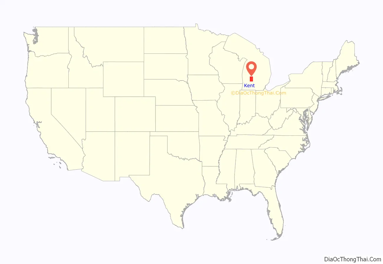
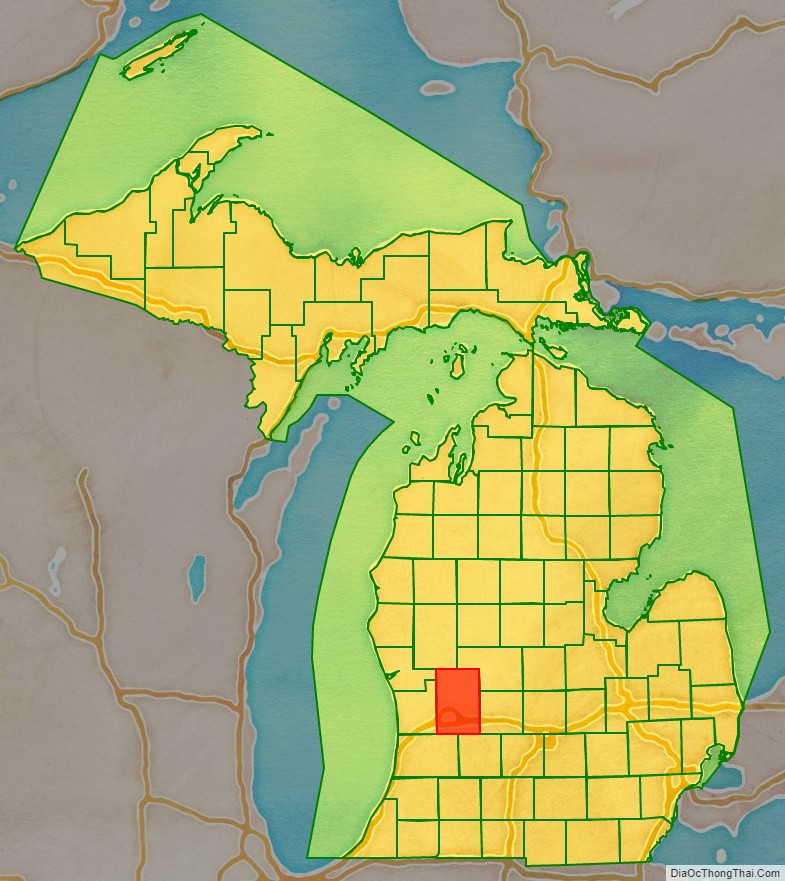
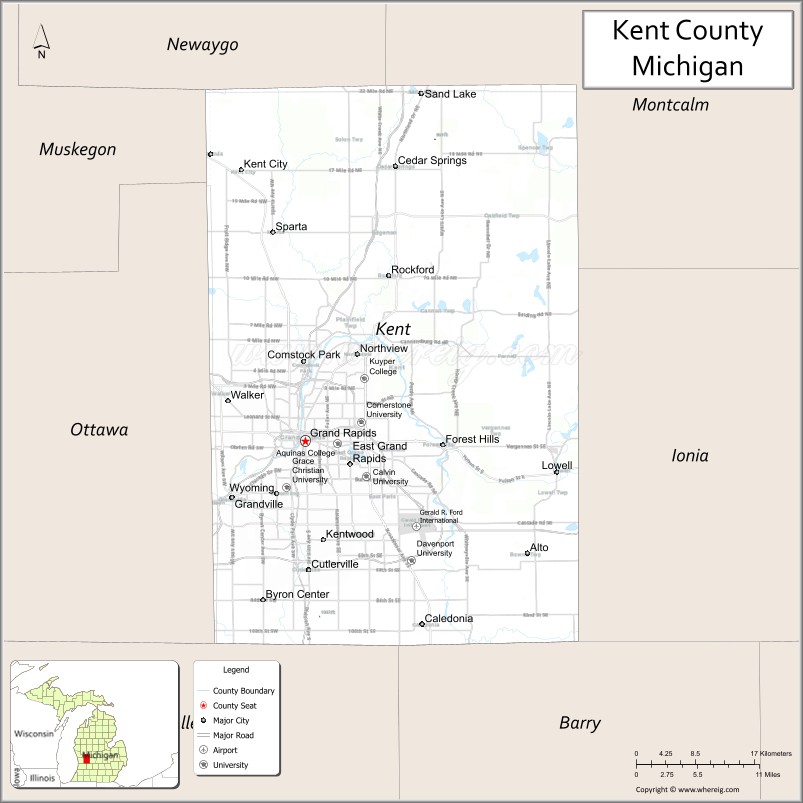
Kent County location map. Where is Kent County?
History
The Grand River runs through the county. On its west bank are burial mounds, remnants of the Hopewell Indians who lived there. The river valley was an important center for the fur trade in the early 19th century. After the War of 1812, Rix Robinson and Louis Campau were the earliest traders in the area. In 1826, Campau established a trading post in what is today Grand Rapids. In 1831, he bought land and platted the town. Campau is considered the town’s “father”. One year later, government surveyor Lucius Lyon purchased land north of Campau’s property. Campau surveyed and platted the village following Native American trails and Lyon had platted his property in an English grid format, which meant there were two adjoining villages, with different platting formats. Campau later merged the villages under the name of Grand Rapids.
In 1831, it was set off from Kalamazoo County. In 1838, Grand Rapids was incorporated as the county’s first village. By the end of the century, stimulated by the construction of several sawmills, the area was a significant center for agriculture, logging, and manufacturing furniture.
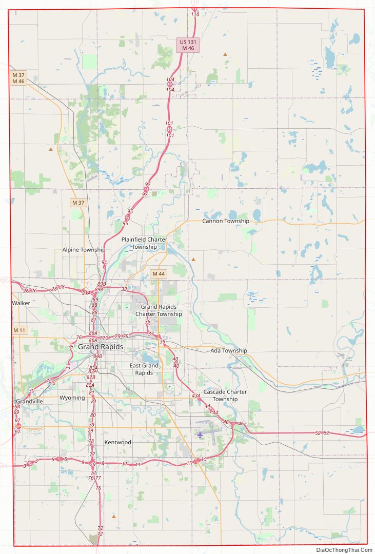
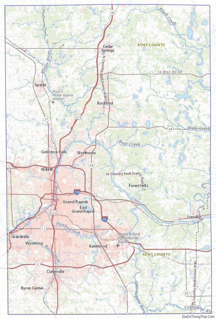
Kent County Road Map
Geography
According to the U.S. Census Bureau, the county has an area of 872 square miles (2,260 km), of which 847 square miles (2,190 km) is land and 25 square miles (65 km) (2.9%) is water. Kent County’s highest point is Fisk Knob Park, in Solon Township, at 1048 feet.
Rivers
- Grand River, flows through the county from its eastern border to the west, and after passing through Ottawa County, empties into Lake Michigan at Grand Haven. It has three tributaries in Kent County, listed in order of convergence:
- Flat River, enters the county from the east, and joins the Grand from the north, in Lowell.
- Thornapple River, enters the county from the south, and joins the Grand in Ada.
- Rogue River, enters the county from the north, and joins the Grand in Belmont.
Trails
These hiking and biking trails run through the county:
- North Country Trail, runs north–south the length of the county, passing through Cedar Springs, Grattan and Lowell. Lowell is the trail’s half-way point, and the national headquarters of the North Country Trail Association is located here.
- Thornapple Trail, begins in Kentwood and runs southeast through Dutton and Caledonia.
- White Pine Trail begins in Comstock Park and runs northeast through Belmont, Rockford, Cedar Springs, and Sand Lake.
- Kent Trails (which is singular in spite of the ‘s’) runs north–south from John Ball Park in Grand Rapids to 84th Street in Byron Township, with an extension that runs east/west along 76th Street and north–south from 76th Street to Douglas Walker Park on 84th street.
- The Frederik Meijer Trail, which, as of November, 2008, was incomplete, runs east/west mostly along the M-6 freeway and will connect the Kent Trails and the Thornapple Trail when completed.
- Cannon Township Trail runs through Cannon Township in the eastern part of the county from Cannon Township Center on M-44. It runs along M-44 then south near Sunfish Lake Road, turning east through the Cannonsburg Cemetery, and ends at Warren Townsend Park near Cannonsburg.
Adjacent counties
- Newaygo County – north
- Montcalm County – northeast
- Muskegon County – northwest
- Ionia County – east
- Ottawa County – west
- Allegan County, – southwest
- Barry County – southeast
Kent County Topographic Map
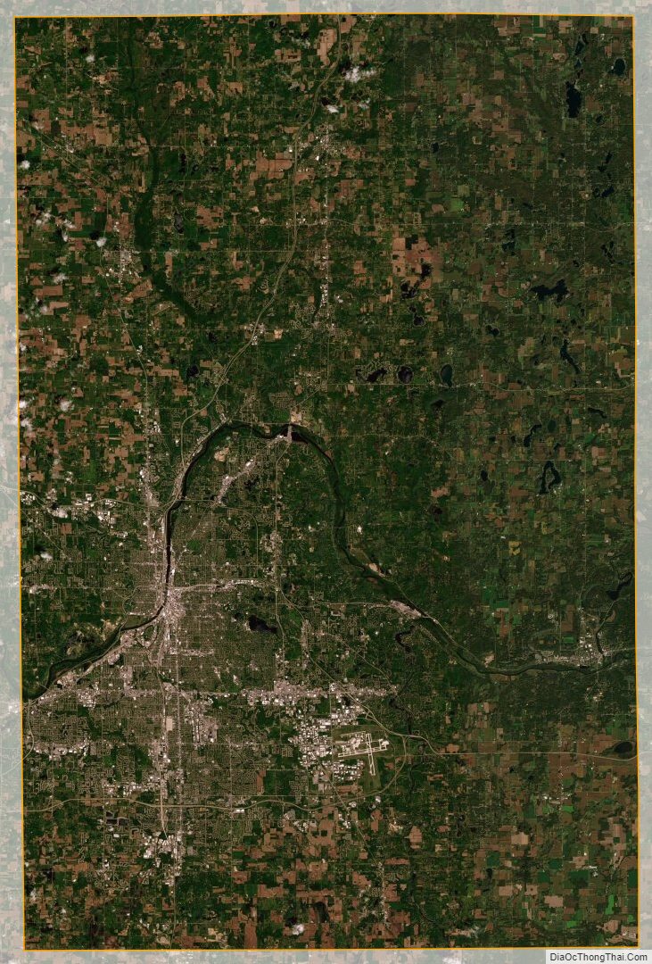
Kent County Satellite Map
Kent County Outline Map