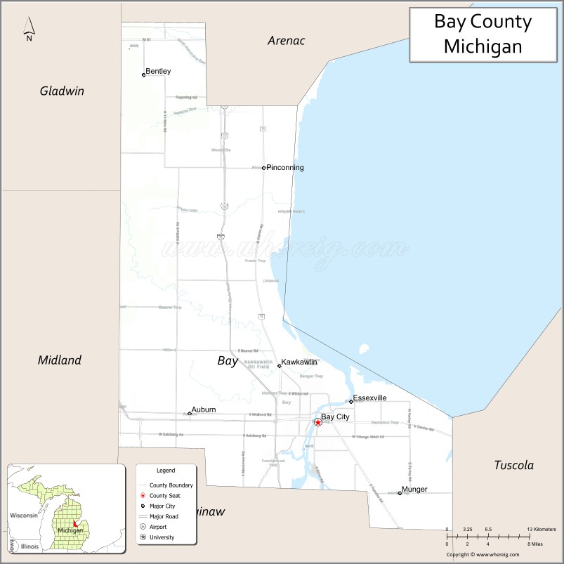
Bay County is located in the U.S. state of Michigan. As of the 2020 Census, the population was 103,856. The county seat is Bay City.
Bay County comprises the Bay City, MI Metropolitan Statistical Area and is included in the Saginaw-Midland-Bay City Combined Statistical Area in the Mid/Central Michigan region.
| Name: | Bay County |
|---|---|
| FIPS code: | 26-017 |
| State: | Michigan |
| Founded: | February 17, 1857 |
| Named for: | Saginaw Bay |
| Seat: | Bay City |
| Largest city: | Bay City |
| Total Area: | 631 sq mi (1,630 km²) |
| Land Area: | 442 sq mi (1,140 km²) |
| Total Population: | 103,856 |
| Population Density: | 236/sq mi (91/km²) |
| Time zone: | UTC−5 (Eastern) |
| Summer Time Zone (DST): | UTC−4 (EDT) |
| Website: | www.baycounty-mi.gov |
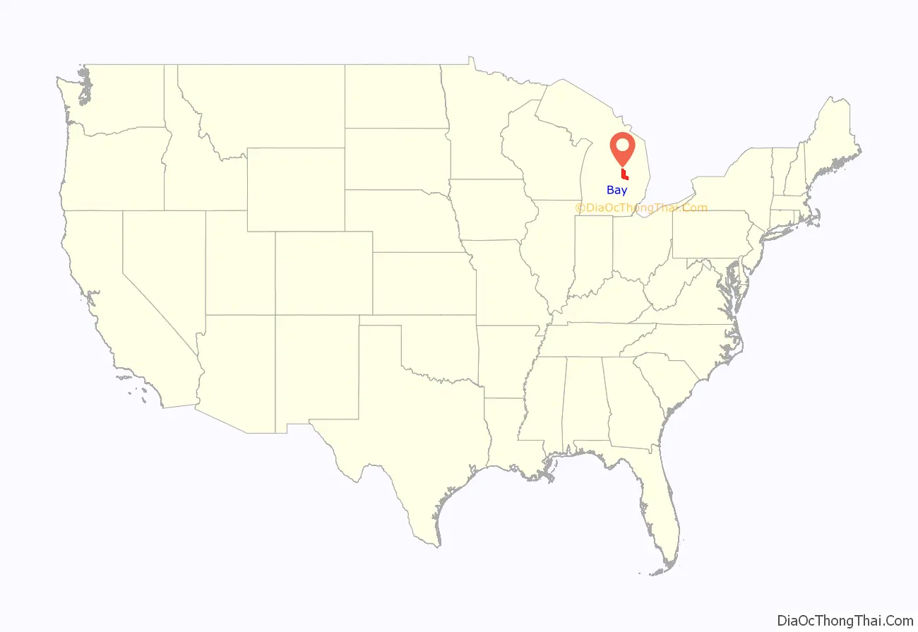
Bay County location map. Where is Bay County?
History
19th century
Bay County was created in 1857 from portions of Midland County, Saginaw County, and Arenac County. Its name references that it “surrounds Saginaw Bay.” Being only sparsely populated at that time, Arenac County government was unorganized and was attached to Saginaw County for administrative purposes. There was considerable opposition to the creation of Bay County from elected officials in both Saginaw and Midland counties. In 1854, a bill introduced to the state legislature to create Bay County was defeated by a small majority.
In 1857, a new bill was introduced into the legislature. After initial opposition from the representatives of Saginaw and Midland counties, a compromise revision that would present the matter for ratification to the voters of “in said county” was passed by the legislature on February 17, 1857. The matter was put before all the voters of Saginaw and Midland counties and was soundly defeated. However, the population within the boundaries proposed for Bay County approved the measure. The bill passed by the legislature included phrasing, which was deliberately included by the Bay City lawyer Chester H. Freeman, that allowed Bay County to claim ratification. Under the act, the county was to become effective April 20, 1857.
Residents of Bay County held elections for county officials in June 1857. However, Saginaw County did not recognize the organization of the new county government. In the winter of 1858, Freeman secured passage of a bill in the legislature that would have confirmed the organization of Bay County. But the bill was vetoed by the governor. However, a case that went before the Michigan Supreme Court in its May 1858 term settled the matter. In the case, a defendant was tried in a Saginaw County court, but filed a plea for abatement, claiming that the supposed offense was committed in Bay County and was not in the jurisdiction of the Saginaw County court. Freeman had represented the defendant and prepared arguments, but became incapacitated due to illness. At the request of Freeman’s wife, Colonel William M. Fenton argued the case before the Michigan Supreme Court, with the result that Bay County was declared a fully organized county.
20th century
During World War II, shipyards in Bay County, were used to produce US Destroyers and missile vessels.
In 1978, Bay County became the second Michigan county (after Oakland County) to adopt a County Executive form of government. Act 139 of 1973 provides for an optional unified form of county government under an appointed County Manager or an elected County Executive. With the County Executive, all departments of the county government that are not headed by a separate elected official (e.g. Treasurer, Clerk, Sheriff, etc.) are under the direction of the County Executive. The County Executive also has veto power over the motions and resolutions passed by the County Commission.
Since the adoption of this form of government, Bay County has had four County Executives: Gary Majeske (R) (1979–1989), Kim Higgs (D) (1989–1993), Thomas Hickner (D) (1993–2016), and James Barcia (D).
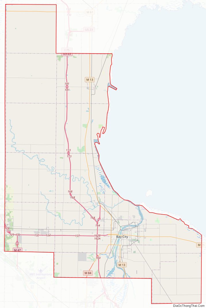
Bay County Road Map
Geography
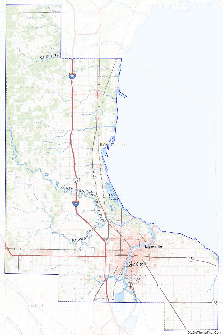
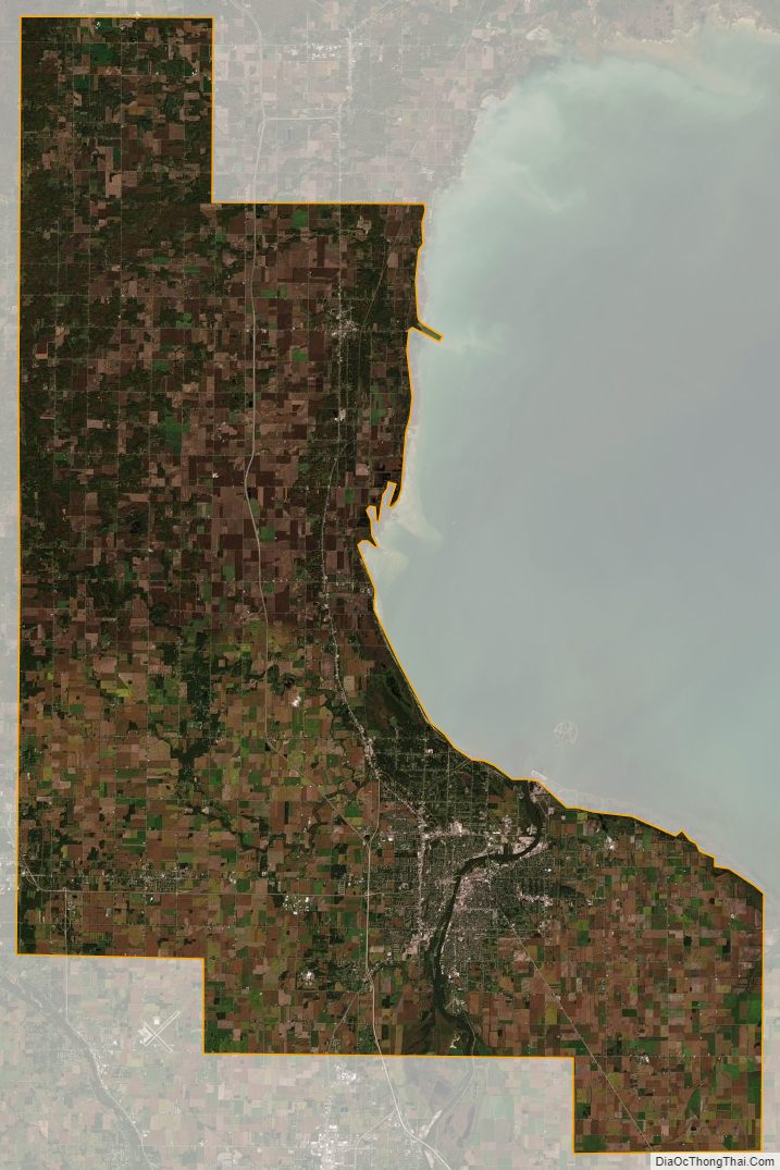
According to the U.S. Census Bureau, the county has a total area of 631 square miles (1,630 km), of which 442 square miles (1,140 km) is land and 188 square miles (490 km) (30%) is water. It is the fifth-smallest county in Michigan by land area.
The Saginaw River flows through Bay City while the Kawkawlin River drains much of the central portion of the county. The Pinconning River and Saganing Creek drain the northern portion. The Saginaw Bay of Lake Huron lies to the east, giving the county its name.
Major highways
- I-75
- BS I-75
- US 10
- Bus. US 10 in Midland
- US 23
- M-13
- Conn. M-13
- M-15
- M-20
- M-25
- M-47
- M-61
- M-84
- M-138
- M-247
Interstate 75 (I-75) and U.S. Highway 23 (US 23), which are concurrent within the county, are the major north–south route. North of Bay City, M-13 follows a parallel route a few miles to the east. US 10 has its eastern terminus in Bay City. M-25, M-15, and M-84 enter Bay City from the east, southeast and southwest respectively and terminate in or near the city. M-20 and Business US 10 end at US 10 as they enter the county.
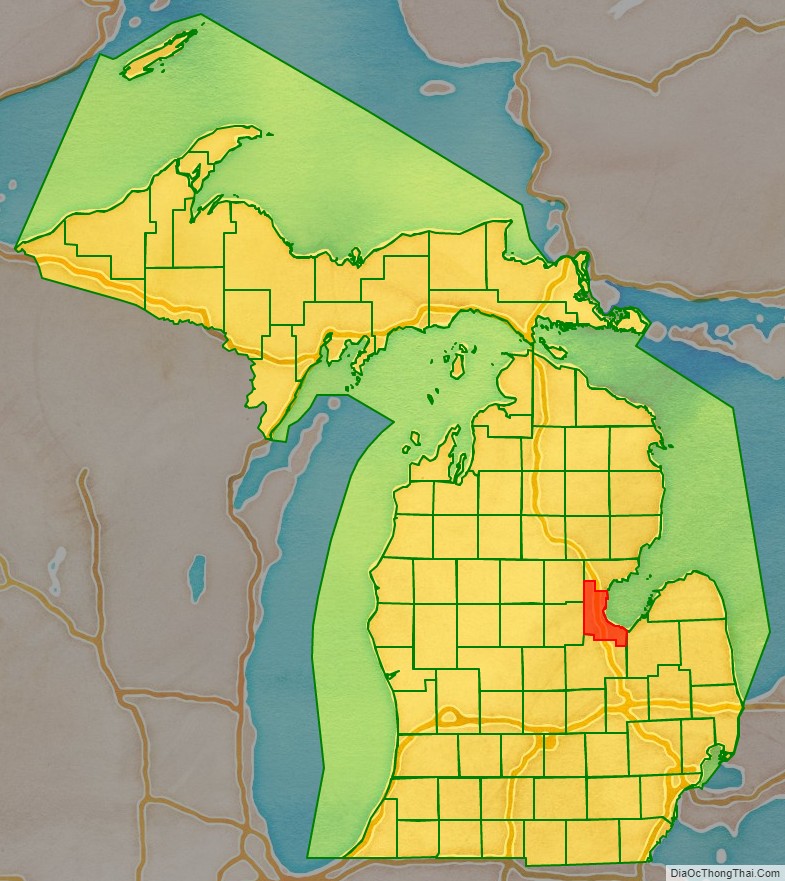
Adjacent counties
- Arenac County (north)
- Gladwin County (northwest)
- Tuscola County (southeast)
- Midland County (west)
- Saginaw County (south)
Bay County Topographic Map
Bay County Satellite Map
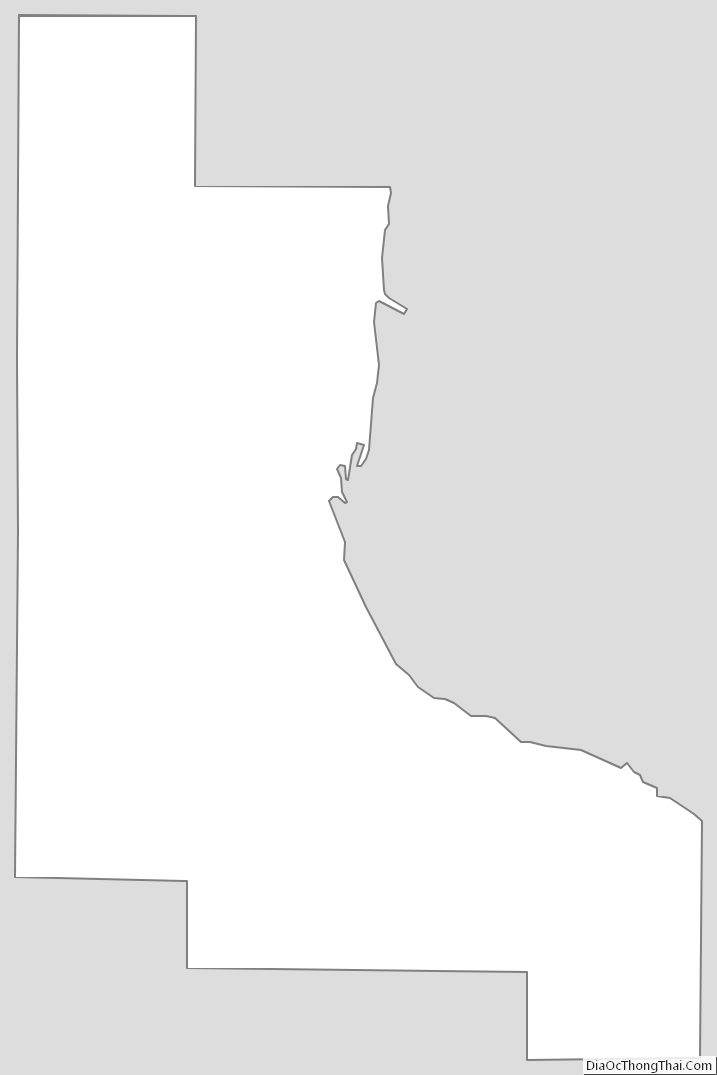
Bay County Outline Map