| Name: | Val Verde County |
|---|---|
| FIPS code: | 48-465 |
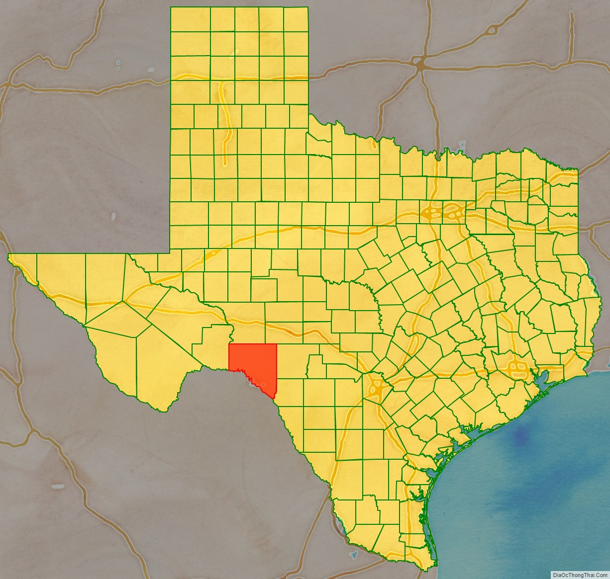
| State: | Texas |
| Founded: | 1885 |
| Named for: | Battle of Valverde |
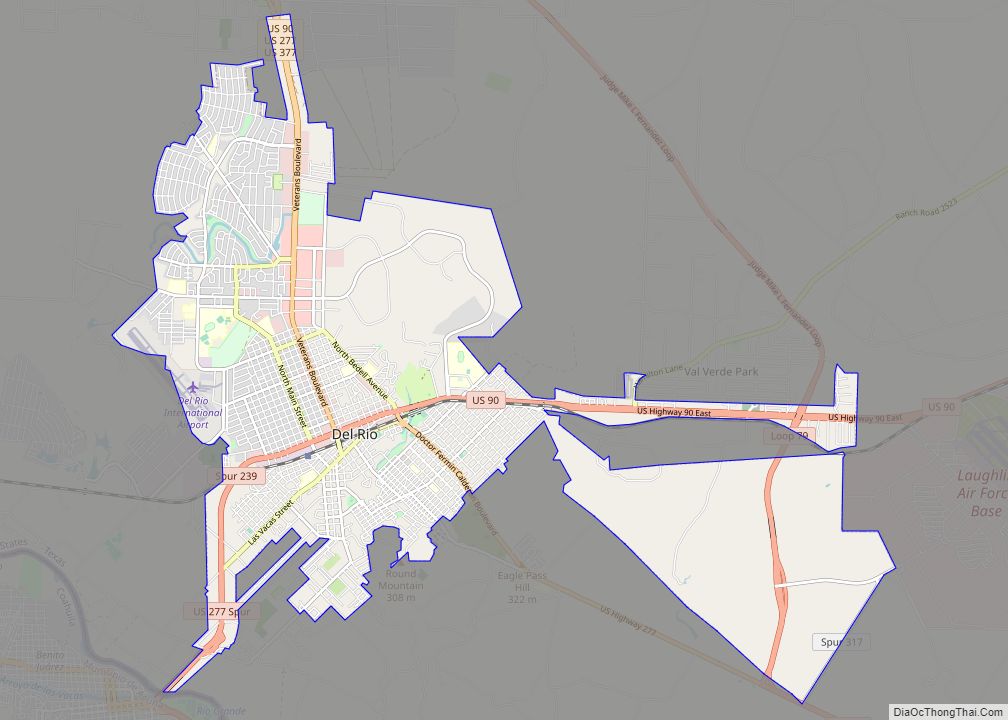
| Seat: | Del Rio |
| Largest city: | Del Rio |
| Total Area: | 3,233 sq mi (8,370 km²) |
| Land Area: | 3,145 sq mi (8,150 km²) |
| Total Population: | 47,586 |
| Population Density: | 15/sq mi (5.7/km²) |
| Time zone: | UTC−6 (Central) |
| Summer Time Zone (DST): | UTC−5 (CDT) |
| Website: | www.valverdecounty.texas.gov |
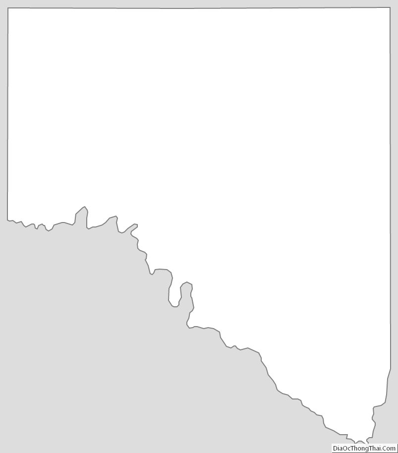
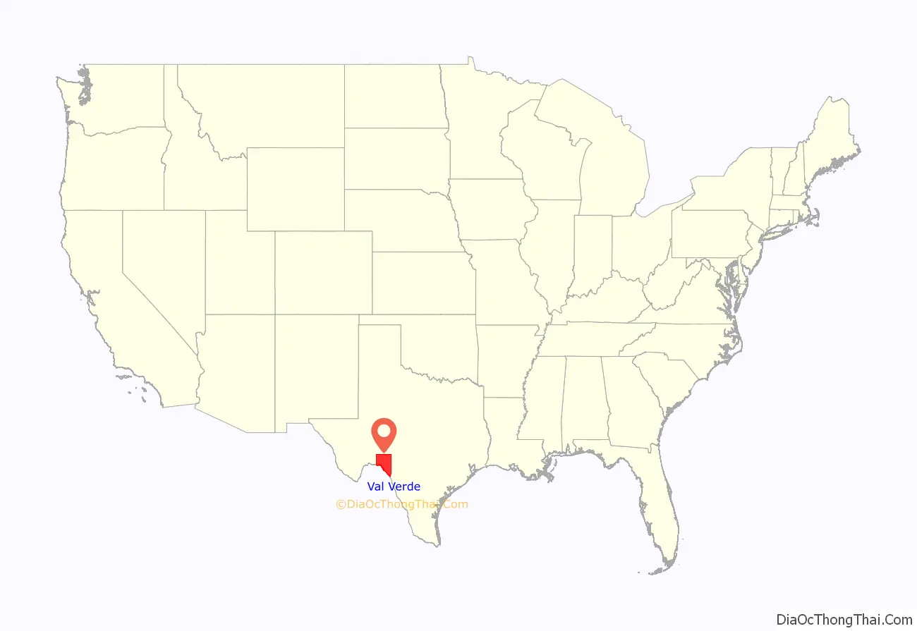
Val Verde County location map. Where is Val Verde County?
History
- First inhabitants were 6,000–10,000 years ago and later came to include Lipan Apache, Coahuiltecan, Jumanos, Tamaulipans and Comanches.
- 1590 Spanish explorer Gaspar Castaño de Sosa leads a mining expedition of 170 who pass through Devils Draw. He refers to a stream by the name of Laxas, which is believed Devils River.
- 1673 Juan Larios opens a mission school at between Del Rio and Eagle Pass.
- 1675 Traveling Franciscan priests celebrate Mass at San Felipe Springs.
- 1736 Lt. Miguel de la Garza Falcón leads 100 soldiers along the Devils River in pursuit of Apaches.
- 1834 James Grant and John Charles Beales establish settlement on San Felipe Creek, which becomes undesirable due to Indian attacks.
- 1850s Military bases to protect against Indian attacks include Camp Blake, Camp Hudson and Camp San Felipe.
- 1860 Population of 2,874, includes 108 blacks and 1,103 foreign-born.
- 1868 San Felipe Del Rio community is established on San Felipe Creek next to Camp San Felipe.
- 1869 through 1882 Seminole Negro Indian Scouts (mixed heritage Seminoles with African blood) under John Lapham Bullis, namesake of Camp Bullis, defend the Texas border against Indian attack.
- 1883 Galveston Harrisburg and San Antonio Railway is completed. Frank Qualia establishes Val Verde winery.
- 1884 Langtry community established, named after George Langtry (an engineer and foreman), but wrongly said after Lillie Langtry by Judge Roy Bean.
- 1885 Val Verde County is organized from Crockett, Kinney, and Pecos counties. Roy Bean elected justice of the peace in Langtry, operating out of the Jersey Lily Saloon and becoming renowned as “the Law West of the Pecos”.
- 1886 Juno and Devils River communities established.
- 1888 Comstock community established.
- 1889 Norris community established.
- 1928 Lake Hamilton Dam complete.
- 1904 Lillie Langtry visits the community of Langtry.
- 1929 Lake Walk Dam complete.
- 1942 Laughlin Field/Laughin Army Air Field opens to train World War II pilots.
- 1945 Laughlin Field closes.
- 1952 Laughlin Field reopens as Laughlin Air Force Base, and serves as a secret U2 unit. Major Rudolf Anderson, a U-2 pilot from Laughlin, is the only casualty of the Cuban Missile Crisis.
- 1969 Amistad Dam and Reservoir complete. The project cost $78 million.
Val Verde County Road Map
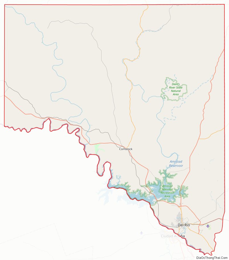
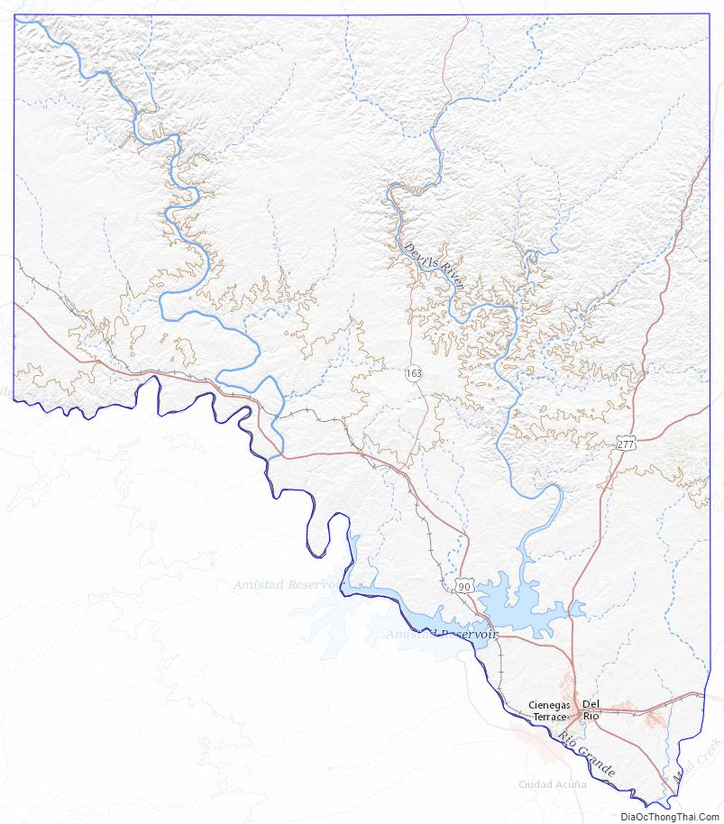
Geography
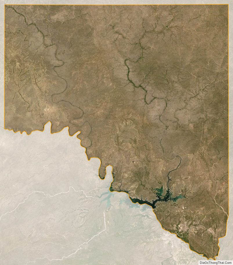
According to the U.S. Census Bureau, the county has a total area of 3,233 sq mi (8,370 km), of which 3,145 sq mi (8,150 km) are land and 88 sq mi (230 km) (2.7%) are covered by water.
Major highways
- U.S. Highway 90
- U.S. Highway 277
- U.S. Highway 377
- State Highway 163
- Loop 79
Adjacent counties and municipios
- Crockett County (north)
- Sutton County (northeast)
- Edwards County (east)
- Kinney County (east)
- Terrell County (west)
- Acuña, Coahuila, Mexico (south)
- Jiménez, Coahuila, Mexico (south)
National protected areas
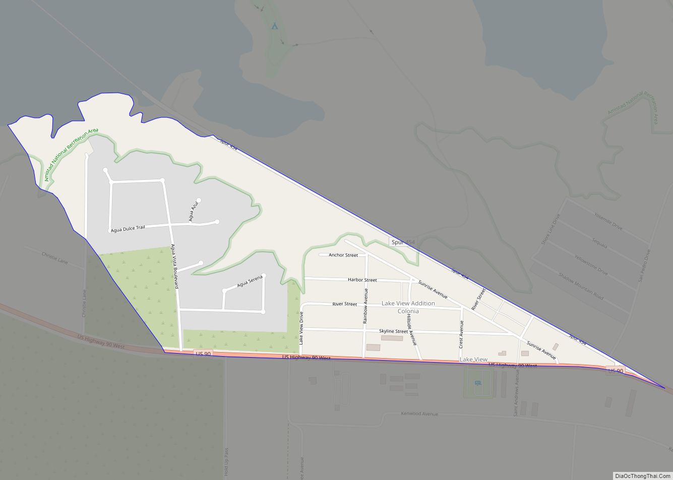
- Amistad National Recreation Area
- Rio Grande Wild and Scenic River (part)
Val Verde County Topographic Map
Val Verde County Satellite Map
Val Verde County Outline Map