Del Rio is a city and the county seat of Val Verde County in southwestern Texas, United States. The city is 152 miles west of San Antonio. As of 2020, Del Rio had a population of 34,673.
| Name: | Del Rio city |
|---|---|
| LSAD Code: | 25 |
| LSAD Description: | city (suffix) |
| State: | Texas |
| County: | Val Verde County |
| Total Area: | 20.51 sq mi (53.12 km²) |
| Land Area: | 20.44 sq mi (52.94 km²) |
| Water Area: | 0.07 sq mi (0.18 km²) |
| Total Population: | 34,673 |
| Population Density: | 1,749.60/sq mi (675.53/km²) |
| ZIP code: | 78840-78843, 78847 |
| Area code: | 830 |
| FIPS code: | 4819792 |
| Website: | CityOfDelRio.com |
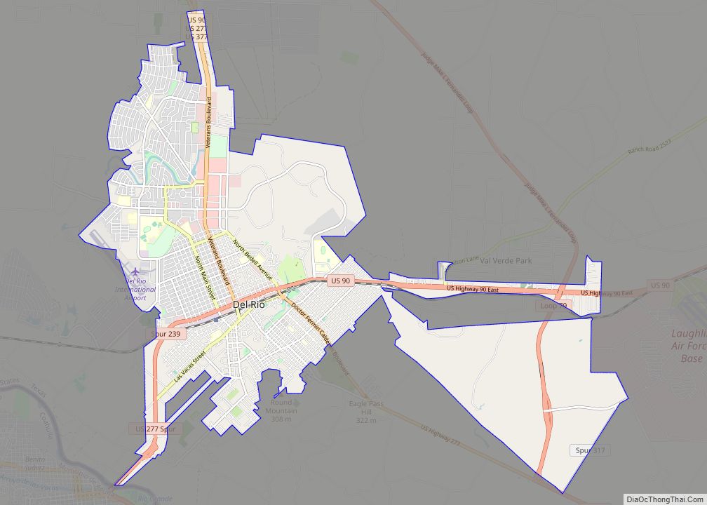
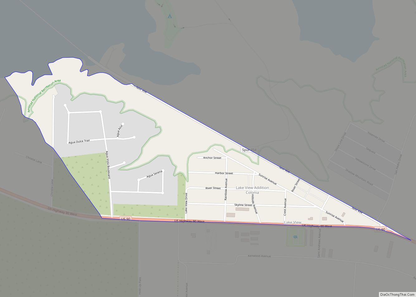
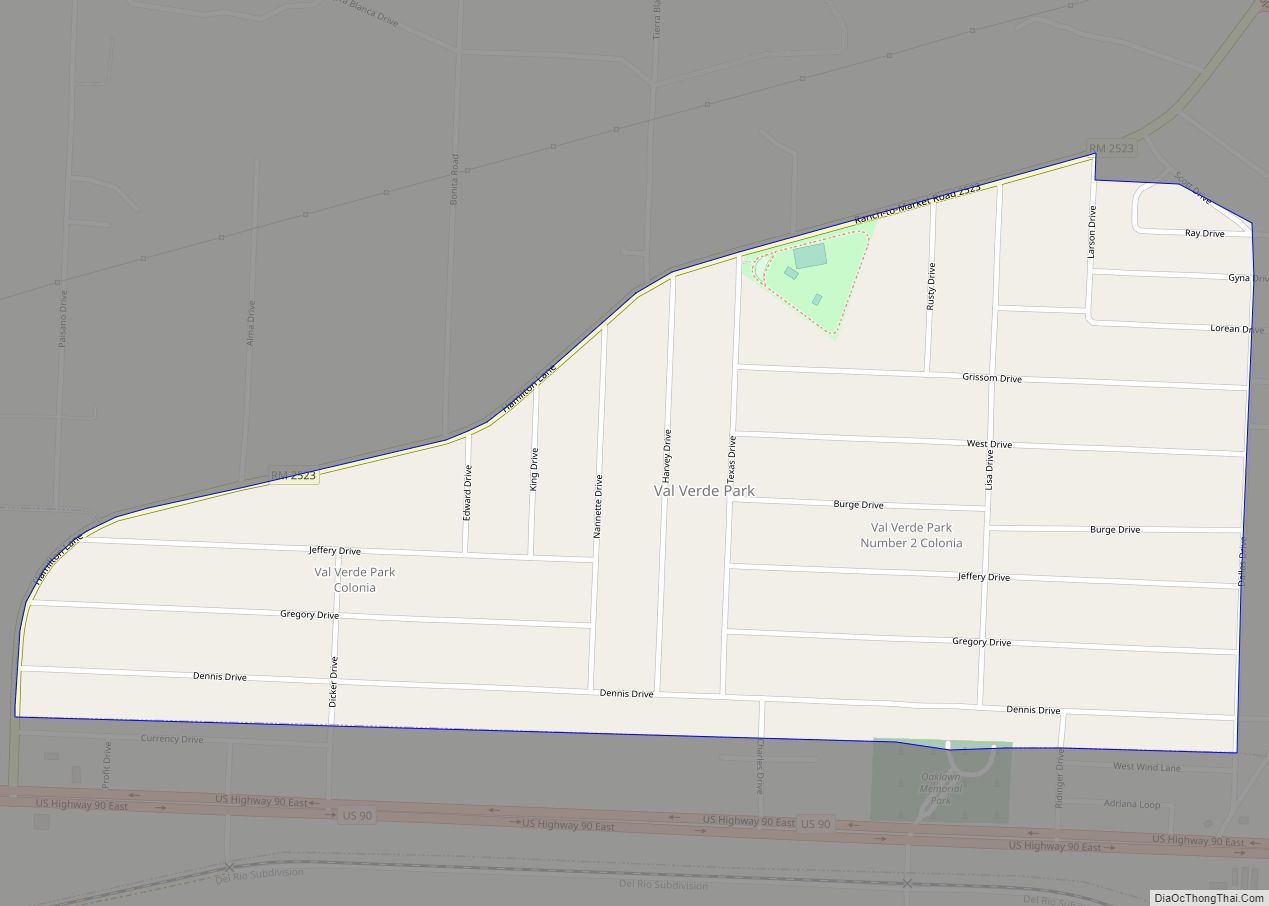
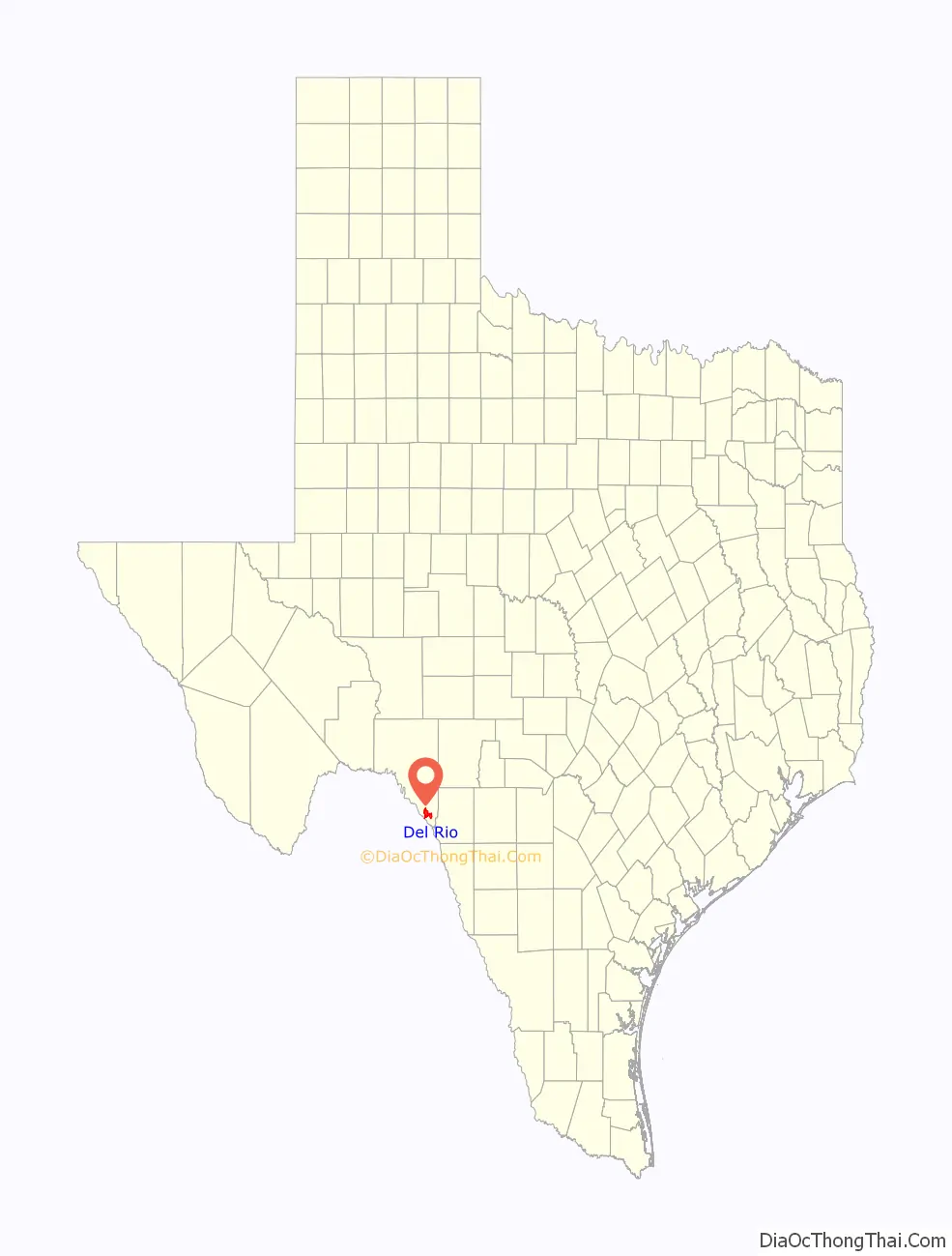
Online Interactive Map
Click on ![]() to view map in "full screen" mode.
to view map in "full screen" mode.
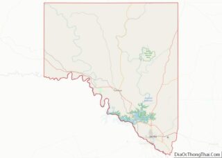
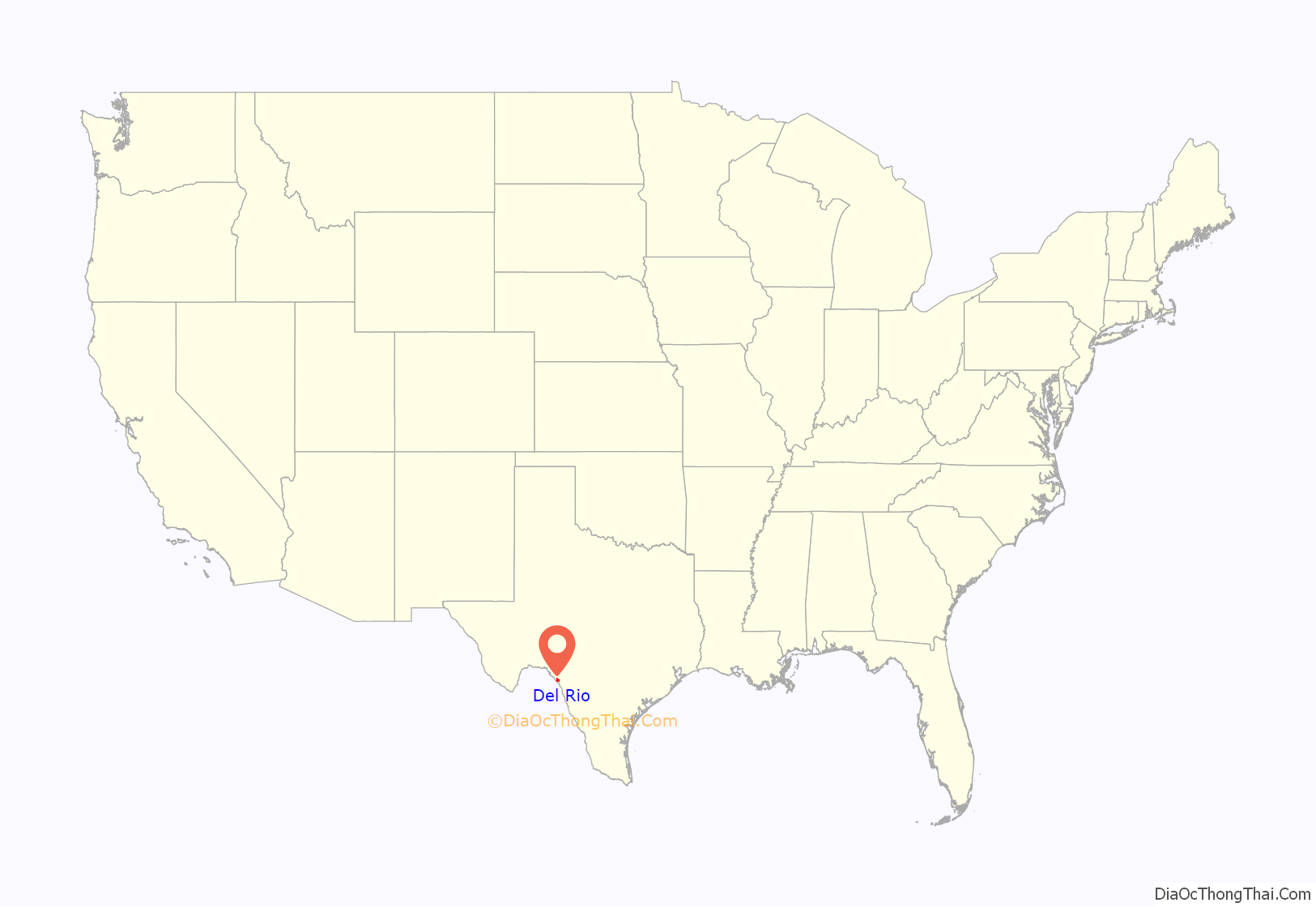
Del Rio location map. Where is Del Rio city?
History
The Spanish established a small settlement south of the Rio Grande in present-day Mexico, and some Spaniards settled on what became the United States side of the Rio Grande as early as the 18th century. Paula Losoya Taylor built the first hacienda in the area in 1862. U.S. development on the north shore of the Rio Grande did not begin until after the American Civil War.
The San Felipe Springs, about 8 mi (13 km) east of the Rio Grande on the U.S. side of the border, produces 90×10 US gal (340,000 m) of water a day. Developers acquired several thousand acres of land adjacent to the springs, and to San Felipe Creek formed by the springs, from the state of Texas in exchange for building a canal system to irrigate the area. The developers sold tracts of land surrounding the canals to recover their investment and show a profit. The initial investors (William C. Adams, Joseph M. Hudson, John P. Grove, Donald Jackson, John Perry, Joseph Ney, Randolph Pafford, A. O. Strickland, and James H Taylor) formed the San Felipe Agricultural, Manufacturing, and Irrigation Company in 1868. The organization completed construction of a network of irrigation canals in 1871. Residents referred to the slowly developing town as San Felipe Del Rio because local lore said the name came from early Spanish explorers who offered a mass at the site on St. Philip’s Day, 1635.
In 1883, local residents requested a post office be established. The United States Postal Department shortened “San Felipe del Rio” to “Del Rio” to avoid confusion with San Felipe de Austin. In 1885, Val Verde County was organized and Del Rio became the county seat. The City of Del Rio was incorporated on November 15, 1911.
The San Felipe community was started by the Arteaga family. Arteaga Street and Arteaga Park are named after them.
Many historical artifacts from Del Rio, particularly from the 19th century, are preserved at the Whitehead Memorial Museum downtown.
During September 2021, as part of the ongoing Mexico–United States border crisis, approximately 30,000 Haitians migrants illegally entered the United States at Del Rio. The United States Border Patrol moved many into a camp underneath the Del Río–Ciudad Acuña International Bridge. The squalid conditions in the camp attracted widespread national attention. A photo of a Haitian grabbing the reins of a horse-mounted Border Patrol agent was incorrectly alleged to show the agent whipping the Haitian.
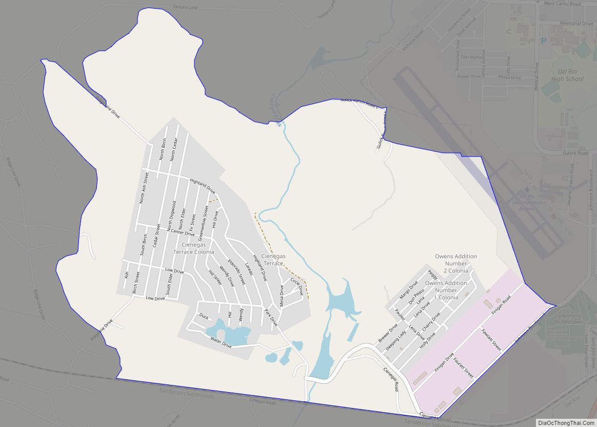
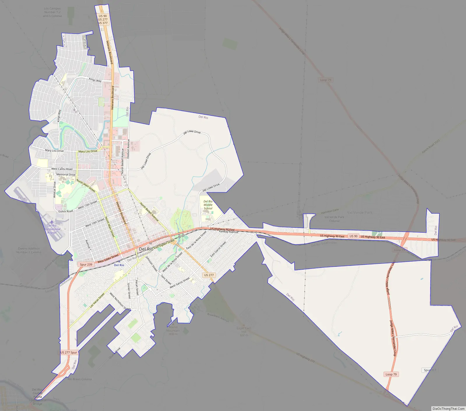
Del Rio Road Map
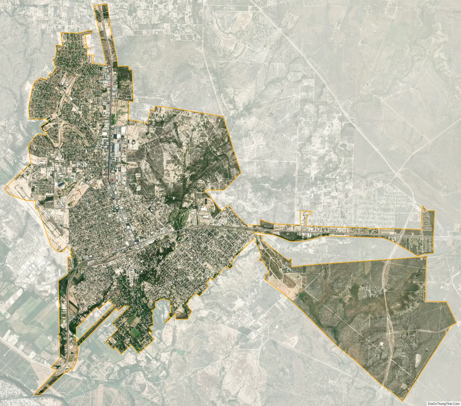
Del Rio city Satellite Map
Geography
According to the United States Census Bureau, the city has a total area of 52.3 km (20.2 sq mi), of which 52.2 km (20.2 sq mi) are land and 0.1 km (0.039 sq mi), or 0.24%, is covered by water.
Del Rio lies on the northwestern edges of the Tamaulipan mezquital, also called the South Texas brush country. It is also near the southwestern corner of the Edwards Plateau, which is the western fringe of the famous, oak savanna-covered Texas Hill Country; that area is dotted with numerous small springs; one of these is the San Felipe Springs, which provides a constant flow of water to San Felipe Creek. The creek supplied fresh water for drinking and irrigation to early settlers of Del Rio, and the springs are still the town’s water supply.
The Del Rio region, west to about the Pecos River, has a mix of desert shrub and steppe vegetation, depending on soil type, with the gray-leafed cenizo (Leucophyllum spp.), several different acacias, cactuses, and grama grasses dominant members of local flora. The terrain is mostly level, but some areas are dissected with substantial canyons and drainages, though none of the upland areas is high or large enough to be considered a mountain.
Climate
Del Rio experiences a hot semi-arid climate (Köppen BSh) with mild winters and hot summers. During the spring season, as well occasionally during the fall season, severe thunderstorms often build on the Serranías del Burro to the distant west of Del Rio. This is believed to occur due to the uplift of moisture from the Gulf of Mexico which is channeled along the Rio Grande.
See also
Map of Texas State and its subdivision:- Anderson
- Andrews
- Angelina
- Aransas
- Archer
- Armstrong
- Atascosa
- Austin
- Bailey
- Bandera
- Bastrop
- Baylor
- Bee
- Bell
- Bexar
- Blanco
- Borden
- Bosque
- Bowie
- Brazoria
- Brazos
- Brewster
- Briscoe
- Brooks
- Brown
- Burleson
- Burnet
- Caldwell
- Calhoun
- Callahan
- Cameron
- Camp
- Carson
- Cass
- Castro
- Chambers
- Cherokee
- Childress
- Clay
- Cochran
- Coke
- Coleman
- Collin
- Collingsworth
- Colorado
- Comal
- Comanche
- Concho
- Cooke
- Coryell
- Cottle
- Crane
- Crockett
- Crosby
- Culberson
- Dallam
- Dallas
- Dawson
- Deaf Smith
- Delta
- Denton
- Dewitt
- Dickens
- Dimmit
- Donley
- Duval
- Eastland
- Ector
- Edwards
- El Paso
- Ellis
- Erath
- Falls
- Fannin
- Fayette
- Fisher
- Floyd
- Foard
- Fort Bend
- Franklin
- Freestone
- Frio
- Gaines
- Galveston
- Garza
- Gillespie
- Glasscock
- Goliad
- Gonzales
- Gray
- Grayson
- Gregg
- Grimes
- Guadalupe
- Hale
- Hall
- Hamilton
- Hansford
- Hardeman
- Hardin
- Harris
- Harrison
- Hartley
- Haskell
- Hays
- Hemphill
- Henderson
- Hidalgo
- Hill
- Hockley
- Hood
- Hopkins
- Houston
- Howard
- Hudspeth
- Hunt
- Hutchinson
- Irion
- Jack
- Jackson
- Jasper
- Jeff Davis
- Jefferson
- Jim Hogg
- Jim Wells
- Johnson
- Jones
- Karnes
- Kaufman
- Kendall
- Kenedy
- Kent
- Kerr
- Kimble
- King
- Kinney
- Kleberg
- Knox
- La Salle
- Lamar
- Lamb
- Lampasas
- Lavaca
- Lee
- Leon
- Liberty
- Limestone
- Lipscomb
- Live Oak
- Llano
- Loving
- Lubbock
- Lynn
- Madison
- Marion
- Martin
- Mason
- Matagorda
- Maverick
- McCulloch
- McLennan
- McMullen
- Medina
- Menard
- Midland
- Milam
- Mills
- Mitchell
- Montague
- Montgomery
- Moore
- Morris
- Motley
- Nacogdoches
- Navarro
- Newton
- Nolan
- Nueces
- Ochiltree
- Oldham
- Orange
- Palo Pinto
- Panola
- Parker
- Parmer
- Pecos
- Polk
- Potter
- Presidio
- Rains
- Randall
- Reagan
- Real
- Red River
- Reeves
- Refugio
- Roberts
- Robertson
- Rockwall
- Runnels
- Rusk
- Sabine
- San Augustine
- San Jacinto
- San Patricio
- San Saba
- Schleicher
- Scurry
- Shackelford
- Shelby
- Sherman
- Smith
- Somervell
- Starr
- Stephens
- Sterling
- Stonewall
- Sutton
- Swisher
- Tarrant
- Taylor
- Terrell
- Terry
- Throckmorton
- Titus
- Tom Green
- Travis
- Trinity
- Tyler
- Upshur
- Upton
- Uvalde
- Val Verde
- Van Zandt
- Victoria
- Walker
- Waller
- Ward
- Washington
- Webb
- Wharton
- Wheeler
- Wichita
- Wilbarger
- Willacy
- Williamson
- Wilson
- Winkler
- Wise
- Wood
- Yoakum
- Young
- Zapata
- Zavala
- Alabama
- Alaska
- Arizona
- Arkansas
- California
- Colorado
- Connecticut
- Delaware
- District of Columbia
- Florida
- Georgia
- Hawaii
- Idaho
- Illinois
- Indiana
- Iowa
- Kansas
- Kentucky
- Louisiana
- Maine
- Maryland
- Massachusetts
- Michigan
- Minnesota
- Mississippi
- Missouri
- Montana
- Nebraska
- Nevada
- New Hampshire
- New Jersey
- New Mexico
- New York
- North Carolina
- North Dakota
- Ohio
- Oklahoma
- Oregon
- Pennsylvania
- Rhode Island
- South Carolina
- South Dakota
- Tennessee
- Texas
- Utah
- Vermont
- Virginia
- Washington
- West Virginia
- Wisconsin
- Wyoming