Vance County is a county located in the U.S. state of North Carolina. As of the 2020 census, the population was 42,578. Its county seat is Henderson.
Vance County comprises the Henderson, NC Micropolitan Statistical Area, which is also included in the Raleigh–Durham–Chapel Hill, NC Combined Statistical Area, which had a 2012 estimated population of 1,998,808.
| Name: | Vance County |
|---|---|
| FIPS code: | 37-181 |
| State: | North Carolina |
| Founded: | 1881 |
| Named for: | Zebulon Baird Vance |
| Seat: | Henderson |
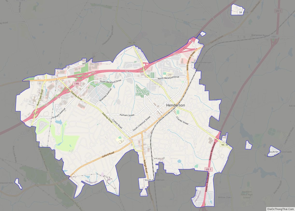
| Largest city: | Henderson |
| Total Area: | 270 sq mi (700 km²) |
| Land Area: | 254 sq mi (660 km²) |
| Total Population: | 42,185 |
| Population Density: | 166.1/sq mi (64.1/km²) |
| Time zone: | UTC−5 (Eastern) |
| Summer Time Zone (DST): | UTC−4 (EDT) |
| Website: | www.vancecounty.org |
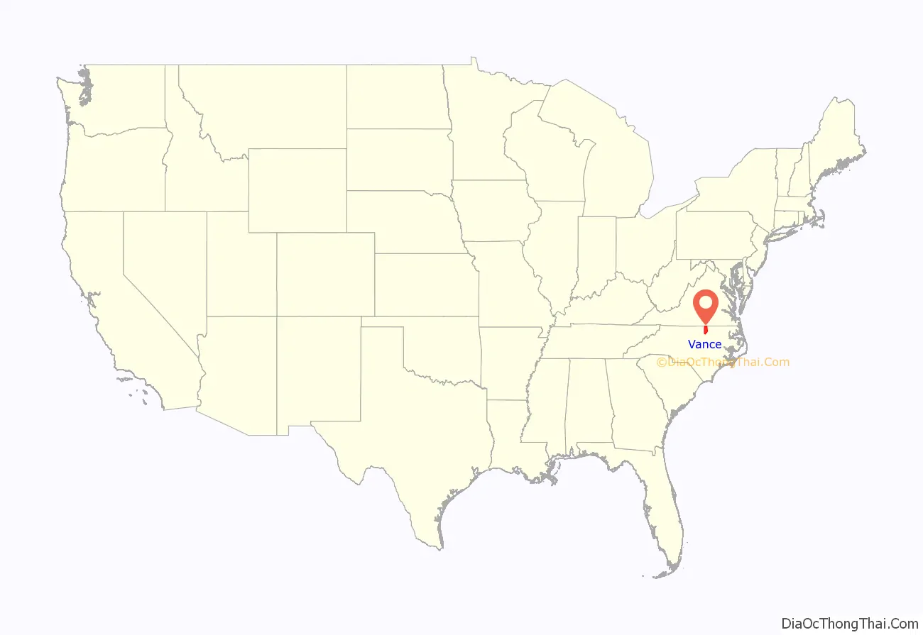
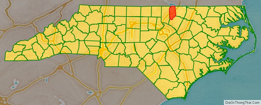
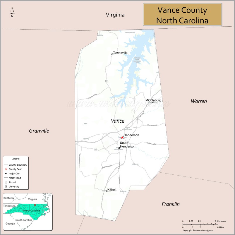
Vance County location map. Where is Vance County?
History
The Occonacheans Native Americans were the first inhabitants of what became Vance County in 1881. The first white explorer of the region was John Lederer and his Native American guide in 1670.
Originally part of colony of Virginia, King Charles of England redrew the colony lines in 1665, so what is now Vance County became part of the Province of Carolina and then the Province of North Carolina in 1725.
In 1826, the first armed forces academy, the Bingham School, was built by Captain D. H. Bingham in Williamsborough, North Carolina. It served for a short time as a training school for military officers.
In 1871, a hotel called the “Glass House” was opened near the community of Kittrell. It was so named because of the glass porches surrounding the hotel. It was a popular resort for hunters and later tuberculosis patients until it burned down in 1895.
As the area that is Vance County prospered in the mid to late 1880s, there were efforts to create a county named “Gilliam” and later as “Dortch”. However, Vance County was formed by the white Democratic-dominated legislature in 1881 following the Reconstruction Era from parts of Franklin, Granville, and Warren counties. The county is named after Zebulon Baird Vance, a Governor of North Carolina (1862–65 & 1877–79) and United States Senator (1879–94).
According to the 1955 book, Zeb’s Black Baby, by Samuel Thomas Peace, Sr., this was a political decision to concentrate blacks and Republicans in one county and keep Democratic majorities in the other counties, an example of gerrymandering:
In the 1890 Census, Vance County was more than 63 percent African American. In 1894 a biracial coalition of Populists and Republicans elected African American George Henry White to the US Congress and gained control of the state house. The Democrats were determined to forestall this happening again. White strongly opposed the new constitution, saying “I cannot live in North Carolina and be a man and be treated as a man.” He left the state after his second term expired, setting up a business in Washington, DC.
The Democrats in the North Carolina legislature settled the political competition with the Republicans by following other southern states and passing a law in 1896 making voting more difficult, and a new constitution in 1899 that disfranchised most blacks by poll taxes, literacy tests and grandfather clauses. Contemporary accounts estimated that 75,000 black male citizens of the state lost the vote. In 1900 blacks numbered 630,207 citizens, about 33% of the state’s total population. This situation held until past the mid-20th century and after passage of the federal Voting Rights Act of 1965.
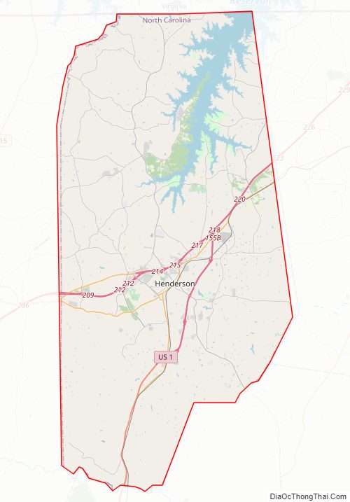
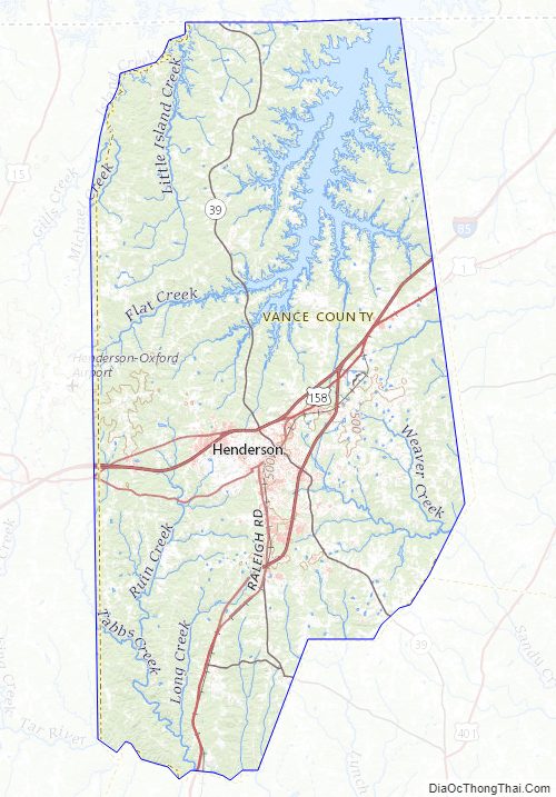
Vance County Road Map
Geography
According to the U.S. Census Bureau, the county has a total area of 270 square miles (700 km), of which 254 square miles (660 km) is land and 16 square miles (41 km) (6.0%) is water.
State and local protected areas
- Kerr Lake State Recreation Area (part)
- Satterwhite Recreation Area
Major water bodies
- Buffalo Creek
- Fishing Creek
- Flat Creek
- Island Creek Reservoir
- John H. Kerr Reservoir
- Martin Creek
- Nubush Creek
- Roanoke River
- Ruin Creek
- Sandy Creek
- Tabbs Creek
- Tar River
Adjacent counties
- Mecklenburg County, Virginia – north
- Warren County – east
- Franklin County – south
- Granville County – west
Major highways
- I-85
- US 1
- US 1 Bus.
- US 158
- US 158 Bus.
- NC 39
Vance County Topographic Map
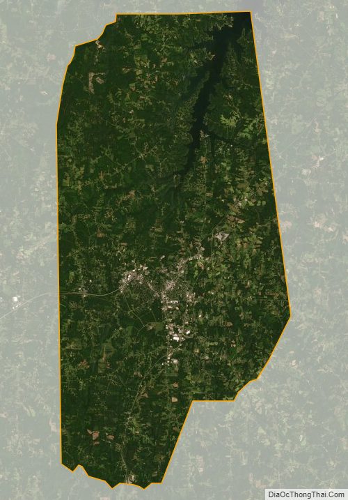
Vance County Satellite Map
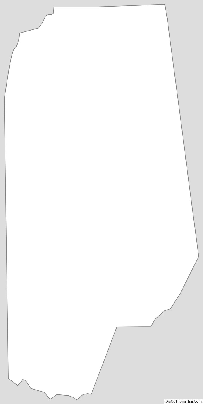
Vance County Outline Map