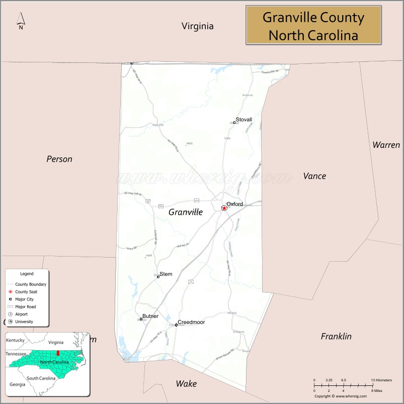
Granville County is a county located on the northern border of the U.S. state of North Carolina. As of the 2020 census, the population was 60,992. Its county seat is Oxford.
Granville County encompasses Oxford, NC Micropolitan Statistical Area, which is also included in the Raleigh-Durham-Chapel Hill, NC Combined Statistical Area.
The county has access to Kerr Lake and Falls Lake and is part of the Roanoke, Tar and Neuse River watersheds.
| Name: | Granville County |
|---|---|
| FIPS code: | 37-077 |
| State: | North Carolina |
| Founded: | 1746 |
| Named for: | John Carteret, 2nd Earl Granville |
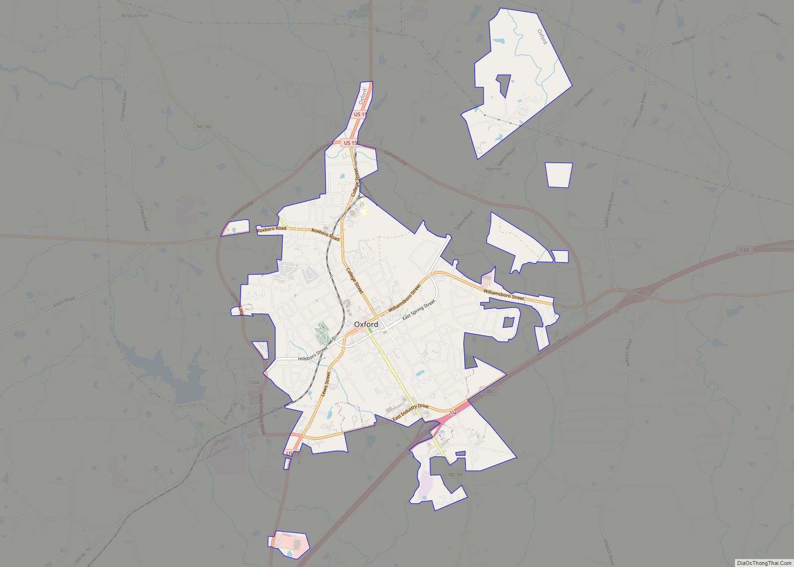
| Seat: | Oxford |
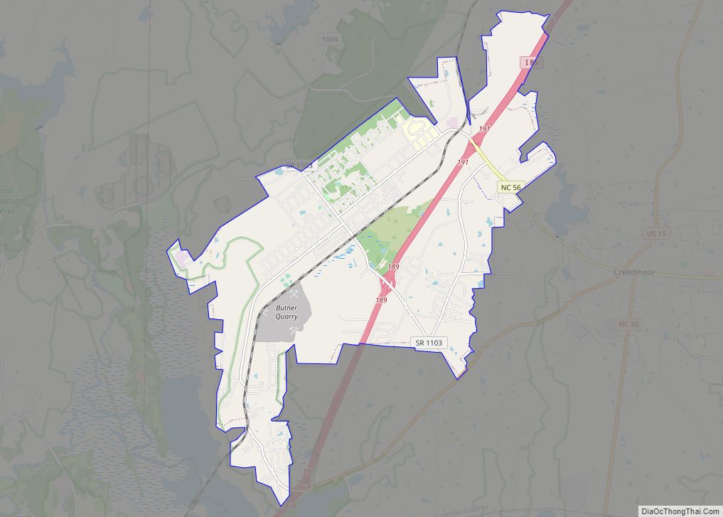
| Largest town: | Butner |
| Total Area: | 536 sq mi (1,390 km²) |
| Land Area: | 532 sq mi (1,380 km²) |
| Total Population: | 61,986 |
| Population Density: | 116.5/sq mi (45.0/km²) |
| Website: | www.granvillecounty.org |
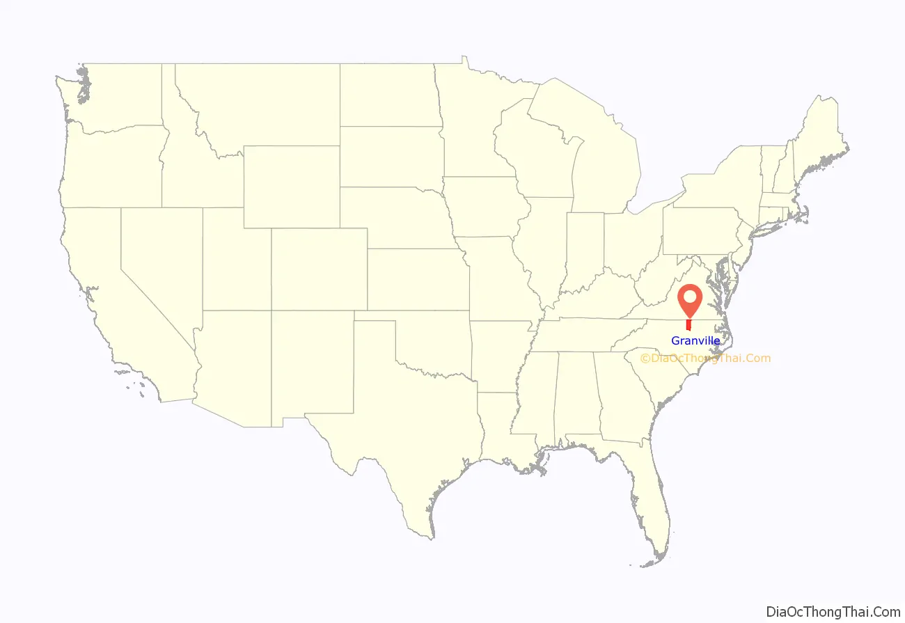
Granville County location map. Where is Granville County?
History
The county was formed by English colonists in 1746 from Edgecombe County. It was named for John Carteret, 2nd Earl Granville, who as heir to one of the eight original Lords Proprietors of the Province of Carolina, claimed one eighth of the land granted in the charter of 1665. The claim was established as consisting of approximately the northern half of North Carolina, and this territory came to be known as the Granville District, also known as Oxford.
In 1752, parts of Granville, Bladen, and Johnston counties were combined to form Orange County. In 1764, the eastern part of Granville County was reassigned to the new Bute County. Finally, in 1881, parts of Granville, Franklin, and Warren counties were taken to be combined as Vance County.
John Penn (1741-1788) was born in Caroline County, Virginia, and was a planter and politician of early America. After passing the bar, Penn moved to Granville County in 1774. The county had become the hub of Carolina’s independence campaign. A remarkable orator, Penn had earned a place at the Third Provincial Congress of 1775, and he replaced Richard Caswell, joining William Hooper and Joseph Hewes in Philadelphia for the convening of the Continental Congress in 1776. Later, John Penn, with Cornelius Harnett and John Williams, signed the Articles of Confederation for North Carolina. Penn retired to Granville County, and he died at a relatively young age of 48 years in 1788. His remains are interred at the Guilford Courthouse National Military Park in Greensboro, NC.
Like most early counties on the eastern side of the early North Carolina colony, Granville was site of the Tuscarora uprising. Once the natives were defeated in the Tuscarora War, Virginia farmers and their families settled Granville County, where they concentrated on tobacco as a commodity crop. The economy of the region was dependent on slave labor, as tobacco was very labor-intensive to cultivate and process. By the start of the Civil War, Granville planters worked more than 10,000 slaves on their farms, at a time when total county population was 23,396.
Civil War to present
During the Civil War, more than 2,000 men from Granville County served the Confederacy. One company was known as the “Granville Grays.” Most of these men fought in the major battles of the war. Surprisingly, many survived until the end of the war.
Although the Civil War brought an end to the plantation and slave labor economy that had made Granville County prosperous, the agricultural sector continued to thrive in the county. Freedmen stayed in Oxford to work, and the discovery of bright leaf tobacco stimulated the industry. Many African Americans in Granville County were already free before the start of the Civil War; some had migrated into North Carolina as free people from Virginia in the colonial era. The free people of color before the Civil War were often descendants of families formed by unions between white women (who were free) and African or African-American men before the American Revolution. They made lasting contributions to the region, particularly through their skilled labor. Several black masons constructed homes for the county’s wealthy landowners. Additionally, the bright leaf tobacco crop proved a successful agricultural product for Granville County. The sandy soil and a new tobacco crop that could be “flue-dried” proved a great incentive to farmers and tobacco manufacturers.
According to historian William S. Powell, Granville has remained a top tobacco-producing county in North Carolina for several decades. By the late 1800s and early 1900s, Oxford had become a thriving town with new industries, schools, literary institutions, and orphanages, due to jobs created by the bright tobacco crop.
In the late 1800s and early 1900s, northern Granville County, together with Halifax County, Virginia, were important mining areas. Copper, tungsten, silver and gold were mined in the region. The Richmond to Danville Railroad was a critical lifeline to the northern part of the county and provided an important link for miners and farmers to get their goods to larger markets in Richmond and Washington, D.C.
From the late 19th century into the early 20th century, whites in Granville County lynched six African Americans, a number of extralegal murders equalled by two other counties in the state. Most of these killings took place in the decades around the turn of the century. Each of the three counties is tied in having the second-highest number of lynchings per county. Among these was a double lynching in the county seat on December 1, 1881. An armed mob of masked men stormed into the county jail, forcing the jailer to give them the keys. They took out John Brodie and Shadrack Hester, two African-American men charged with murdering a local white man. They took the prisoners to a tree near where the death took place, and hanged them.
During the late 1800s and early 1900s, Granville County played a pivotal role as tobacco supplier for the southeast United States. With many farms and contracts tied to major tobacco companies, such as American Tobacco Company, Lorillard, Brown & Williamson, and Liggett Group, the local farmers became prosperous. During the Great Depression, the tobacco fields were subject to a new plant disease. The Granville Wilt Disease, as it became known, destroyed tobacco crops all across northern North Carolina. Botanists and horticulturists found a cure for the disease at the Tobacco Research Center located in Oxford.
Camp Butner, opened in 1942 as a training camp for World War II soldiers, once encompassed more than 40,000 acres in Granville, Person, and Durham counties. During the war, more than 30,000 soldiers were trained at Camp Butner, including the 35th and 89th divisions. The hilly topography at Camp Butner proved helpful in teaching soldiers how to respond to gas bombings and how to use camouflage and cross rivers. Additionally, both German and Italian prisoners served as cooks and janitors at Camp Butner. Today, most of the land that was Camp Butner now belongs to the North Carolina government. Umstead Hospital, which is no longer operational, was located at the Camp Butner site.
In the 1950s and 1960s, various manufacturing businesses built up across Granville County, and the region gradually became more industrialized. Today, the manufacturing industry produces cosmetics, tires, and clothing products in Granville County.
Granville County Courthouse
The Granville County Courthouse, of Greek Revival architecture, was built in 1840 and added to the National Register of Historic Places in 1979.
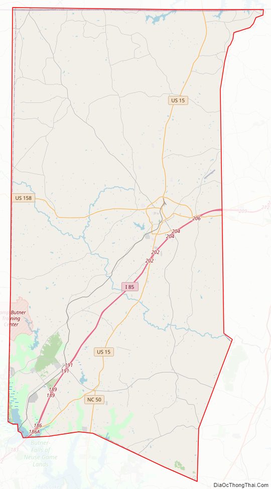
Granville County Road Map
Geography
According to the U.S. Census Bureau, the county has a total area of 536 square miles (1,390 km), of which 532 square miles (1,380 km) is land and 4.9 square miles (13 km) (0.9%) is water.
State and local protected areas
- Ledge Creek Forest Conservation Area
- Roberts Chapel Conservation Area
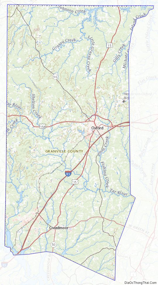
Major water bodies
- Beaver Dam Lake
- Beaverdam Creek
- Coon Creek
- Falls Lake
- Fishing Creek
- Island Creek Reservoir
- John H. Kerr Reservoir
- Lake Butner
- Lake Devin
- Roanoke River
- Smith Creek
- Tar River
Adjacent counties
- Halifax County, Virginia – north
- Mecklenburg County, Virginia – north
- Vance County – east
- Franklin County – east
- Wake County– south
- Durham County – southwest
- Person County – northwest
Major highways
- I-85
- US 15
- US 158
- US 158 Bus.
- NC 49
- NC 50
- NC 56
- NC 96
Major infrastructure
- Henderson Oxford Airport
Granville County Topographic Map
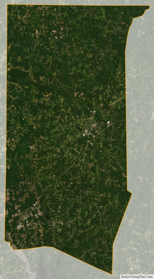
Granville County Satellite Map
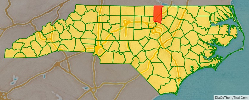
Granville County Outline Map