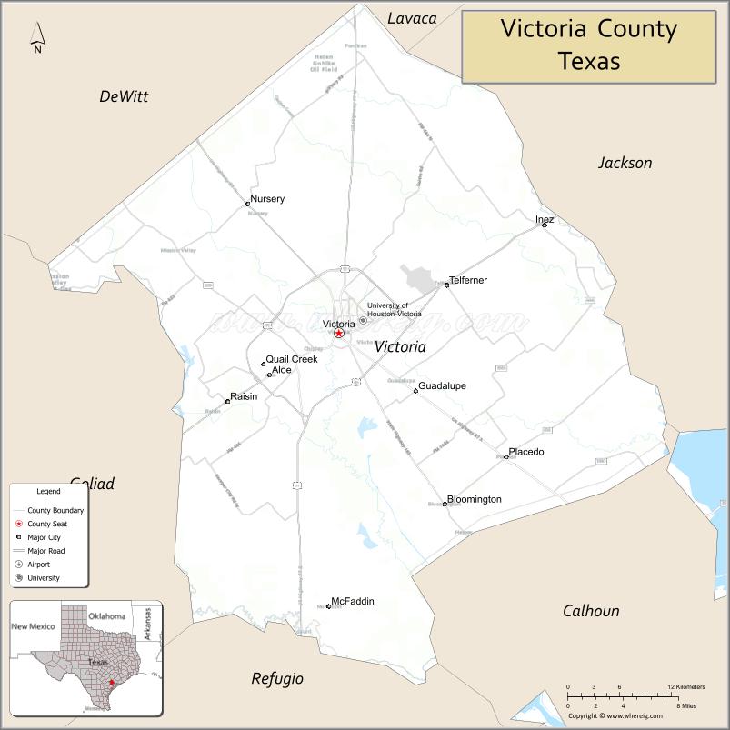
Victoria County is a county located in the U.S. state of Texas. As of the 2020 census, its population was 91,319. Its county seat is Victoria. Victoria County is included in the Victoria, TX Metropolitan Statistical Area.
| Name: | Victoria County |
|---|---|
| FIPS code: | 48-469 |
| State: | Texas |
| Founded: | 1836 |
| Named for: | Guadalupe Victoria |
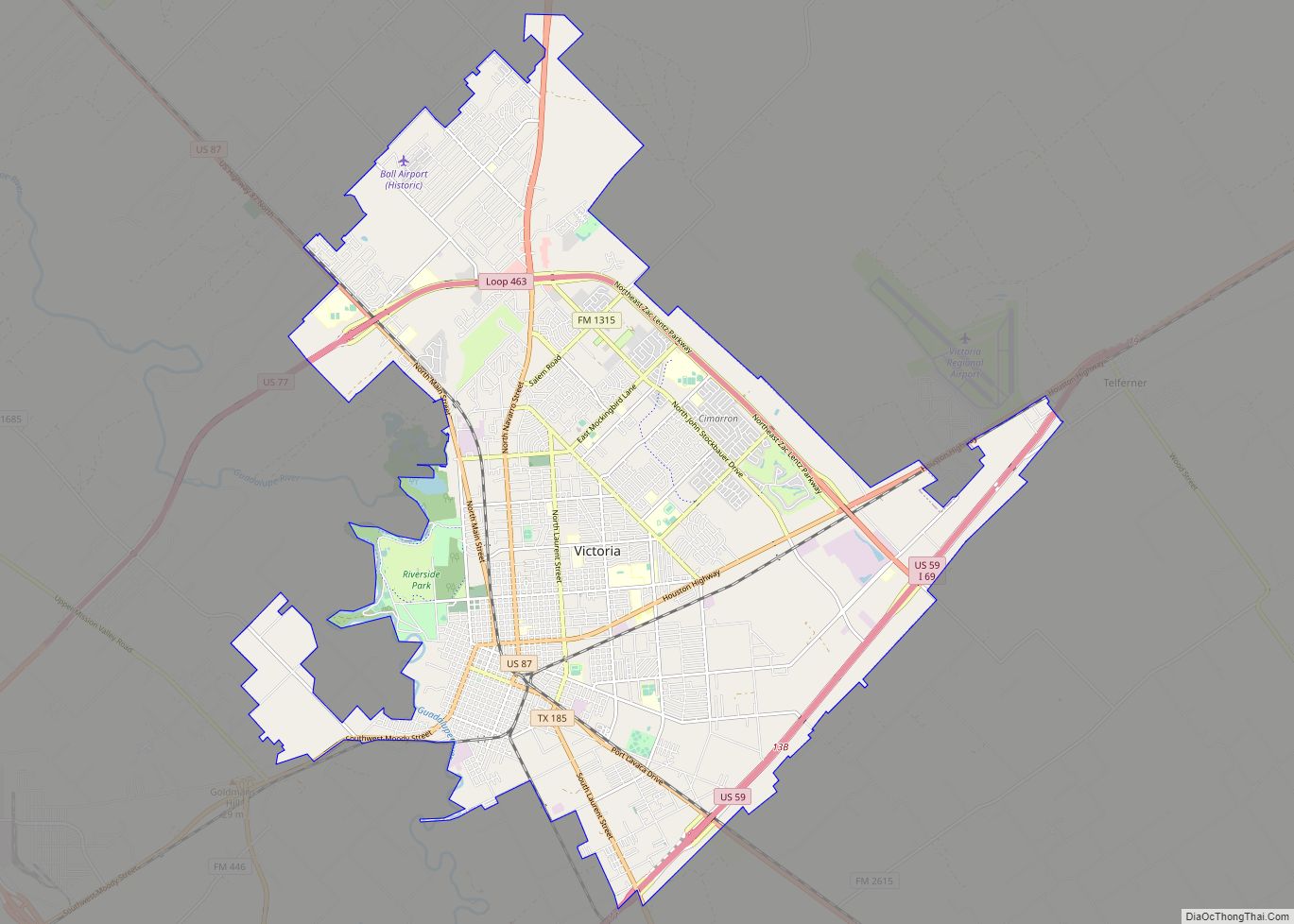
| Seat: | Victoria |
| Largest city: | Victoria |
| Total Area: | 889 sq mi (2,300 km²) |
| Land Area: | 882 sq mi (2,280 km²) |
| Total Population: | 91,319 |
| Population Density: | 100/sq mi (40/km²) |
| Time zone: | UTC−6 (Central) |
| Summer Time Zone (DST): | UTC−5 (CDT) |
| Website: | www.victoriacountytx.org |
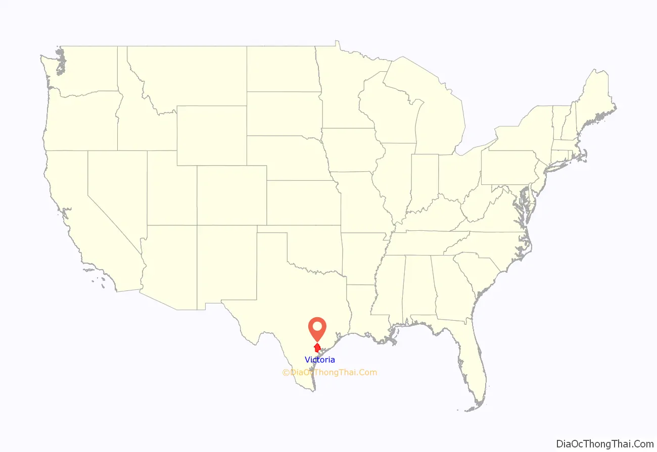
Victoria County location map. Where is Victoria County?
History
- Paleo-Indians Hunter-gatherers, and later Tonkawa, Aranamas, Tamiques, Karankawa. Tawakoni, Lipan Apache and Comanche, first inhabitants.
- 1685 René-Robert Cavelier, Sieur de La Salle establishes Fort St. Louis.
- 1689 Alonso de Leon names the Guadalupe River in honor of Our Lady of Guadalupe.
- 1722 Nuestra Señora de Loreto Presidio and Mission Nuestra Señora del Espíritu Santo de Zúñiga become the first Spanish settlement in Victoria County.
- 1824 Nuestra Señora de Guadalupe de Jesús Victoria (the future city of Victoria) is established by Martín De León, who starts his colony with 5,000 branded cattle and establishes the county’s claim as the “Cradle of the Texas Cattle Industry.” The only primarily Mexican colony in Texas.
- 1835 Victoria’s settlers supported the revolution against Antonio López de Santa Anna, but were ostracized by new incoming Americans, many of whom were adventurous soldiers or fortune hunters, who wrongly profiled them as Mexican sympathizers and forced them to flee after the revolution in 1836. Anglo-Americans resettle the area.
- 1836 Victory County is formed by the Republic of Texas. It is named after Guadalupe Victoria, the first President of Mexico. Three thousand troops of the Texas army encamp near Spring Creek, Victoria County, under the command of Gen. Thomas J. Rusk, as the main defense against a threatened attack by Mexican general José de Urrea.
- 1842 Rafael Vásquez and Adrián Woll lead Mexican forces in an invasion into the county.
- 1850 Coletoville is established by German immigrant Carl Steiner.
- 1851 Victoria County’s first toll bridge is erected across the river, built by Richard Owens and Sylvester Sutton.
- 1860 There are 1,413 slaves in the county.
- 1861 County votes 318–88 in favor of secession from the Union. Victoria County sends 300 men to fight for the Confederate States Army.
- 1863 Confederate General John B. Magruder destroys the railroad from Port Lavaca to Victoria to keep it out of Union hands. He also sinks trees and boats into the Guadalupe River.
- 1867-1869 The county is occupied by federal troops. Mob mentality violence by those same troops results in the axing death and corpse mutilation of local official Benjamin F. Hill, who is at the time incarcerated for an alleged self-defense killing of a discharged Union soldier.
- 1873 Gulf, Western Texas and Pacific Railway connects Victoria with Cuero and the coast.
- 1882 New York, Texas and Mexican Railway provides the first cross-country route to Rosenberg Junction in Fort Bend County.
- 1883 Texas Continental Meat Company is erected in the county and is the largest meat packing plant in Texas.
- 1886 Bray’s Ferry is established at the San Antonio River by G. B. Amery and John Bray.
- 1906 The Guadalupe River Navigation Company is established.
- 1930 Oil is discovered at the McFaddin Oil Field. Victoria County holds more cattle than any other county in Texas.
- 1941 Foster Air Force Base is established as Victoria Army Air Field as a training air field.
- 1967 The Victoria Barge Canal is completed, connecting Victoria County with the Intracoastal Waterway.
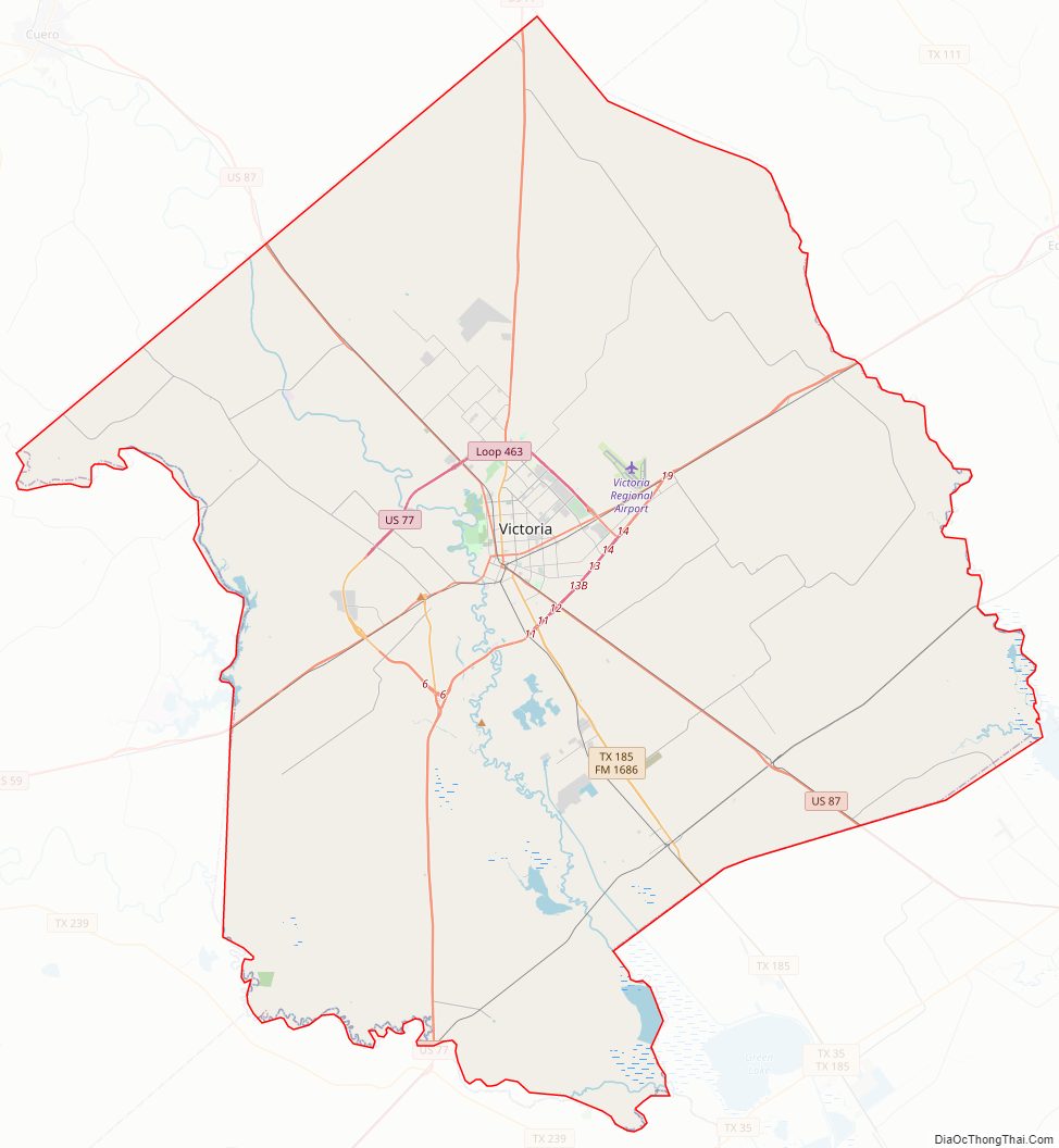
Victoria County Road Map
Geography
According to the U.S. Census Bureau, the county has a total area of 889 square miles (2,300 km), of which 882 square miles (2,280 km) is land and 6.7 square miles (17 km) (0.8%) is water.
Major highways
- U.S. Highway 59
- Interstate 69 is currently under construction and will follow the current route of U.S. 59 in most places northeast of Victoria.
- Interstate 69W is currently under construction and will follow the current route of U.S. 59 in most places southwest of Victoria.
- U.S. Highway 77
- Interstate 69E is currently under construction and will follow the current route of U.S. 77 in most places southwest of Victoria.
- U.S. Highway 87
- Farm to Market Road 444
- Farm to Market Road 616
- Farm to Market Road 622
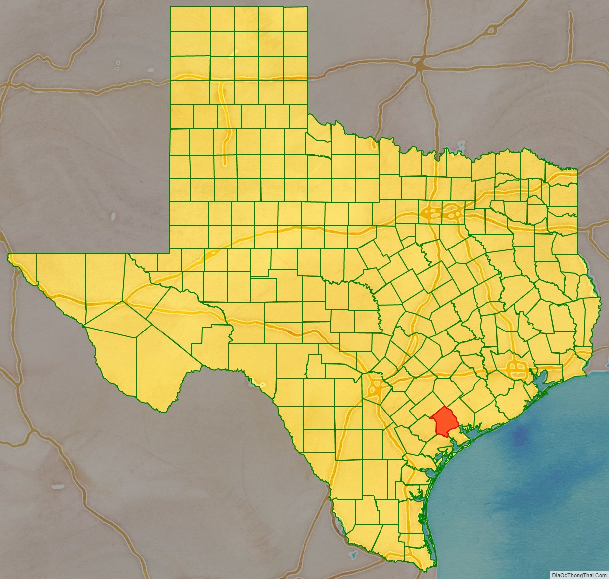
Adjacent counties
- Lavaca County (north)
- Jackson County (northeast)
- Calhoun County (southeast)
- Refugio County (south)
- Goliad County (southwest)
- DeWitt County (northwest)
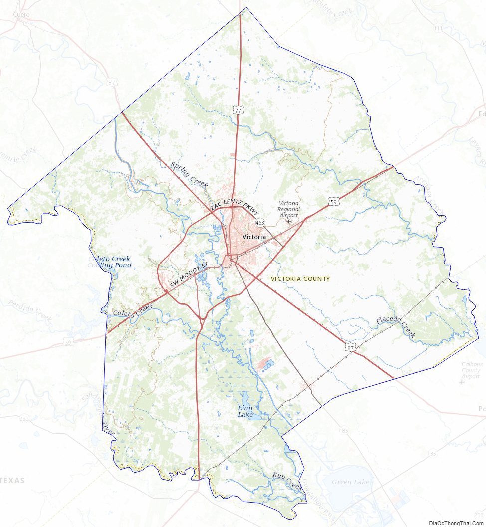
Victoria County Topographic Map
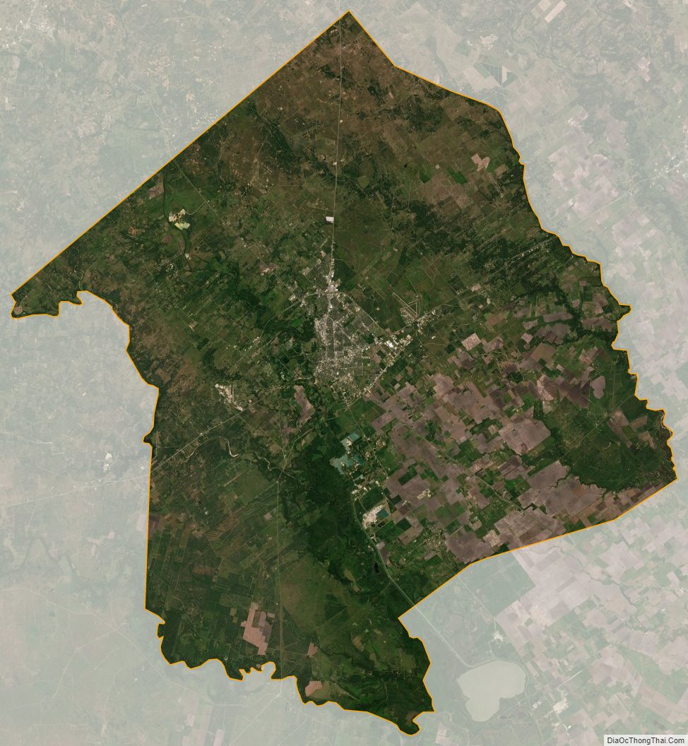
Victoria County Satellite Map
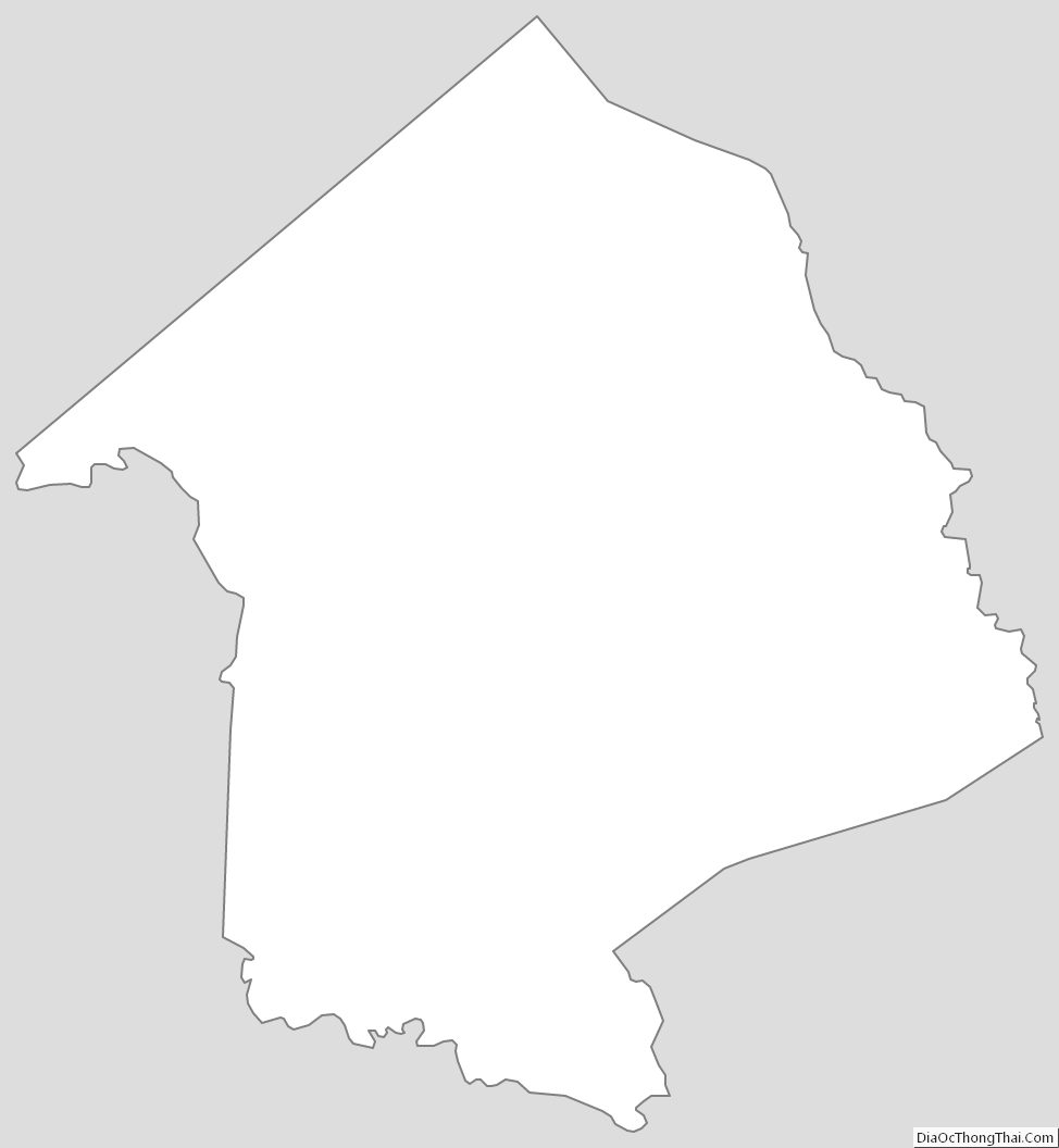
Victoria County Outline Map