Lavaca County (/ləˈvɑːkə/ (listen) lə-VAH-kə) is a county located in the U.S. state of Texas. As of the 2010 census, its population was 20,337. Its county seat is Hallettsville. The county was created in 1846. It is named for the Lavaca River, which curves its way southeast through Moulton and Hallettsville before reaching the coast at Matagorda Bay.
| Name: | Lavaca County |
|---|---|
| FIPS code: | 48-285 |
| State: | Texas |
| Founded: | 1846 |
| Named for: | Lavaca River |
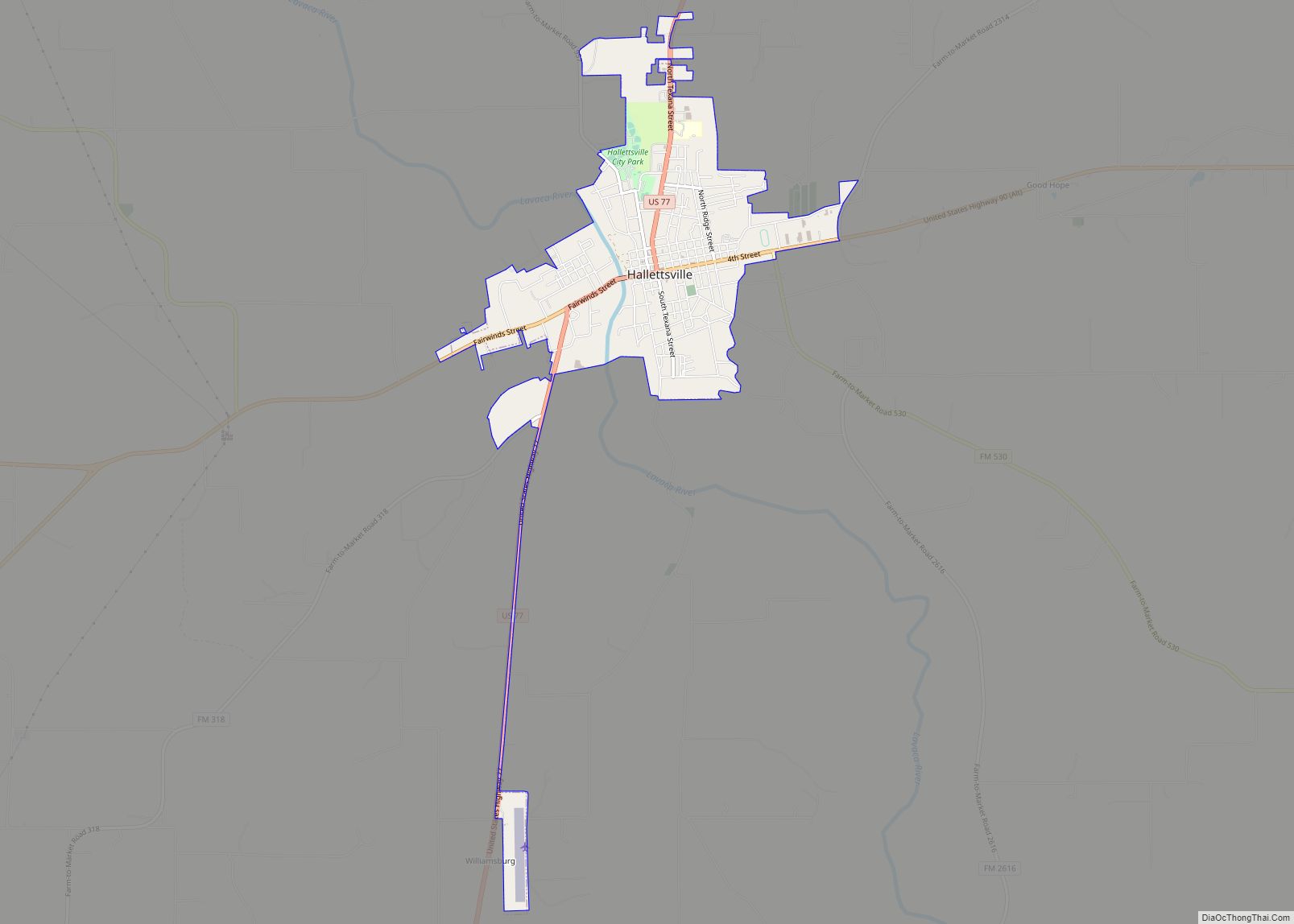
| Seat: | Hallettsville |
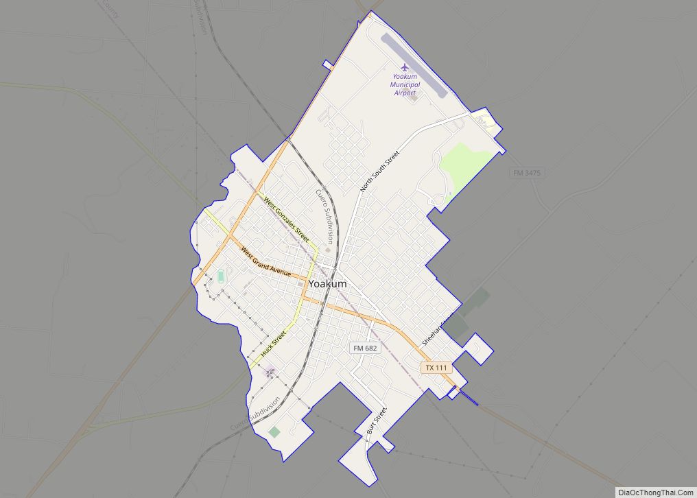
| Largest city: | Yoakum |
| Total Area: | 970 sq mi (2,500 km²) |
| Land Area: | 970 sq mi (2,500 km²) |
| Total Population: | 20,337 |
| Population Density: | 21/sq mi (8.1/km²) |
| Time zone: | UTC−6 (Central) |
| Summer Time Zone (DST): | UTC−5 (CDT) |
| Website: | www.co.lavaca.tx.us |
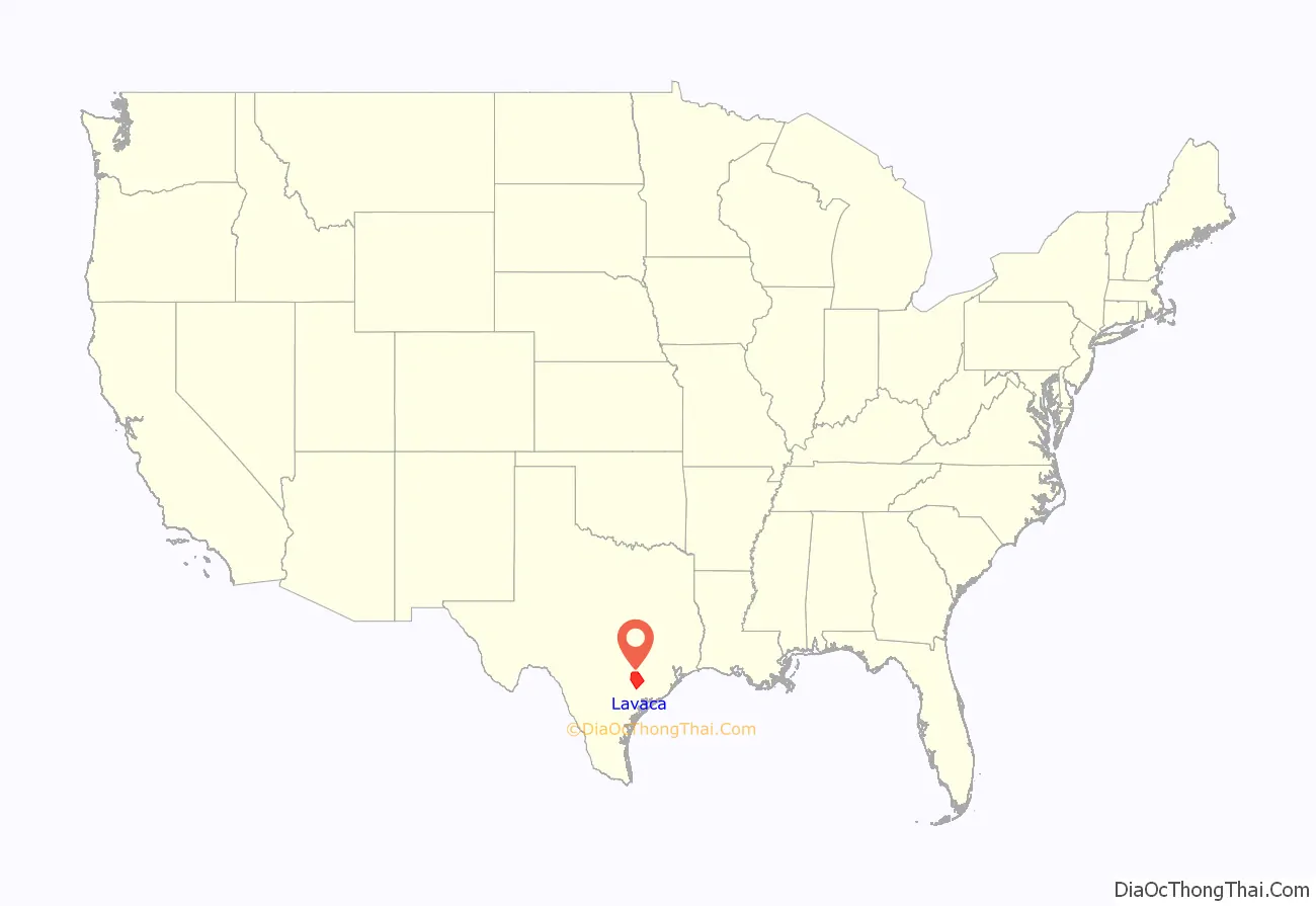
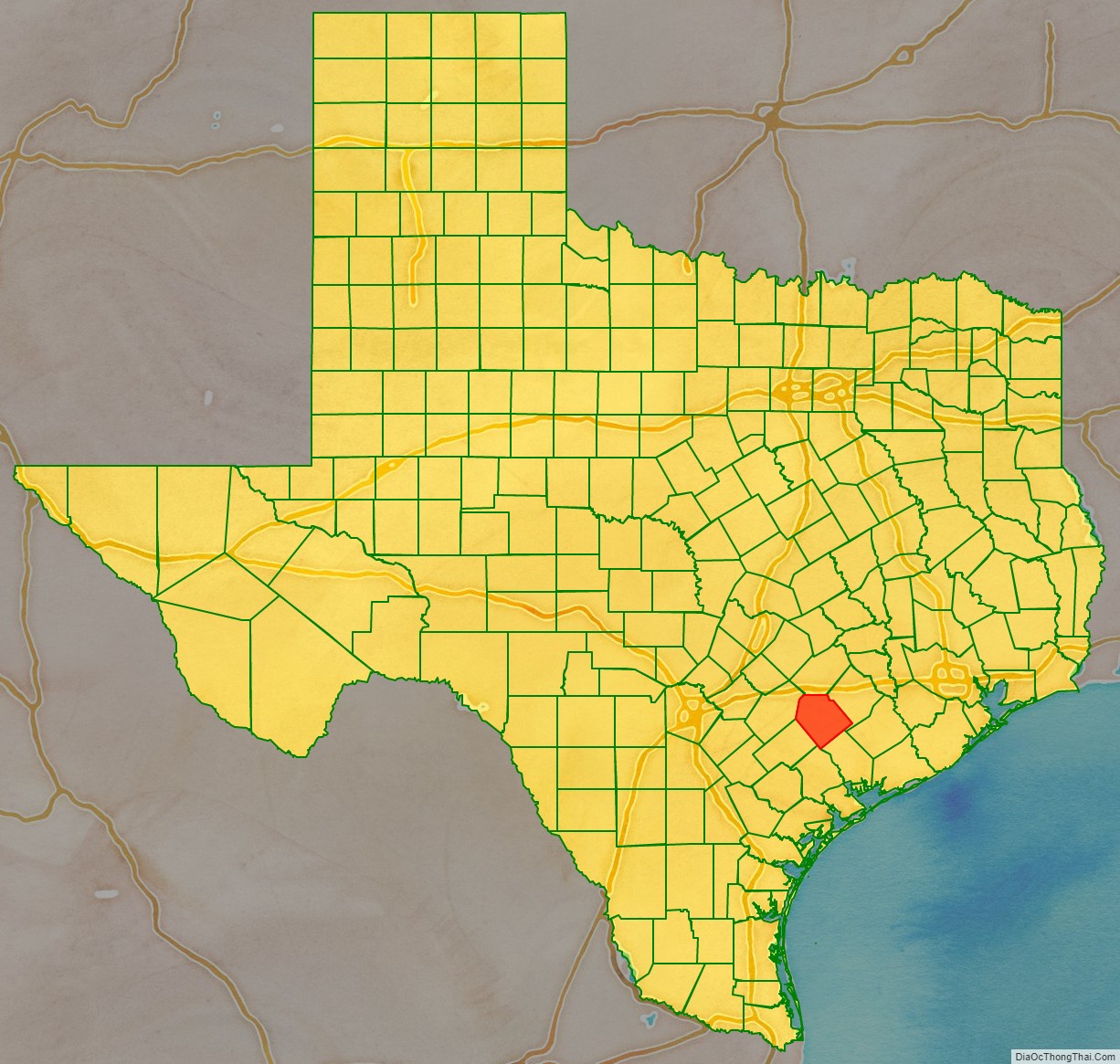
Lavaca County location map. Where is Lavaca County?
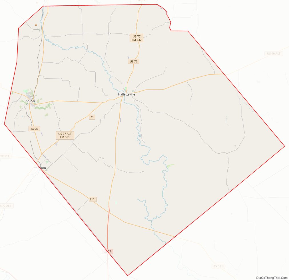
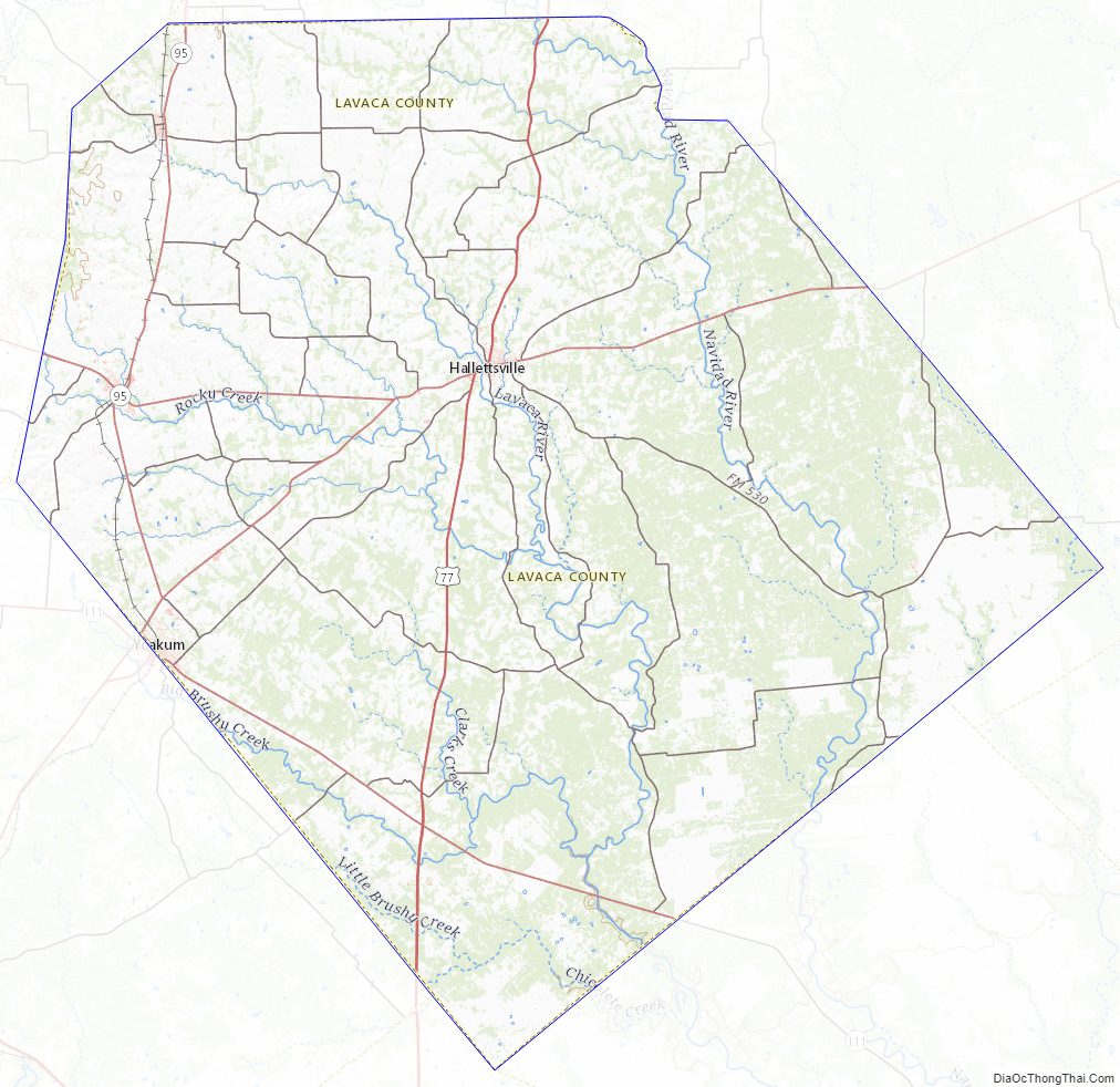
Lavaca County Road Map
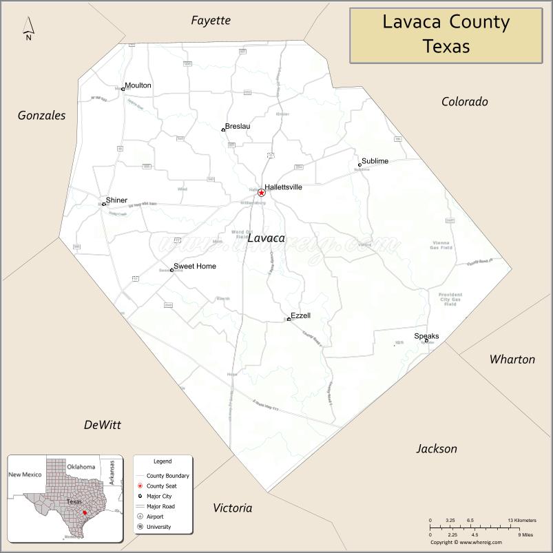
Geography
According to the U.S. Census Bureau, the county has a total area of 970 square miles (2,500 km), of which 0.7 square miles (1.8 km) (0.08%) is covered by water.
Major highways
- U.S. Highway 77
U.S. Highway 77 Alternate
U.S. Highway 90 Alternate- State Highway 95
- State Highway 111
Adjacent counties
- Fayette County (north)
- Colorado County (northeast)
- Jackson County (southeast)
- Victoria County (south)
- DeWitt County (southwest)
- Gonzales County (northwest)
Lavaca County Topographic Map
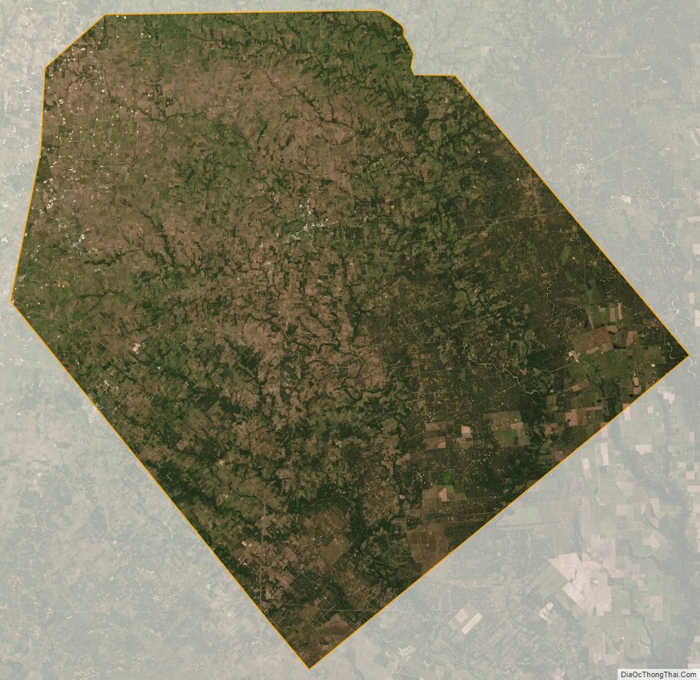
Lavaca County Satellite Map
Lavaca County Outline Map