Victoria is a small city in South Texas and county seat of Victoria County, Texas. The population was 65,534 as of the 2020 census. The three counties of the Victoria Metropolitan Statistical Area had a population of 111,163 as of the 2000 census. Its elevation is 95 ft (29 m).
Victoria is located 30 miles inland from the Gulf of Mexico. Victoria is a two-hour drive from Corpus Christi, Houston, San Antonio, and Austin.
Victoria is named for General Guadalupe Victoria, who became the first president of independent Mexico. Victoria is the cathedral city of the Roman Catholic Diocese of Victoria in Texas.
| Name: | Victoria city |
|---|---|
| LSAD Code: | 25 |
| LSAD Description: | city (suffix) |
| State: | Texas |
| County: | Victoria County |
| Elevation: | 95 ft (29 m) |
| Land Area: | 37.37 sq mi (96.78 km²) |
| Water Area: | 0.20 sq mi (0.52 km²) |
| Population Density: | 1,790.73/sq mi (691.41/km²) |
| Area code: | 361 |
| FIPS code: | 4875428 |
| GNISfeature ID: | 1370631 |
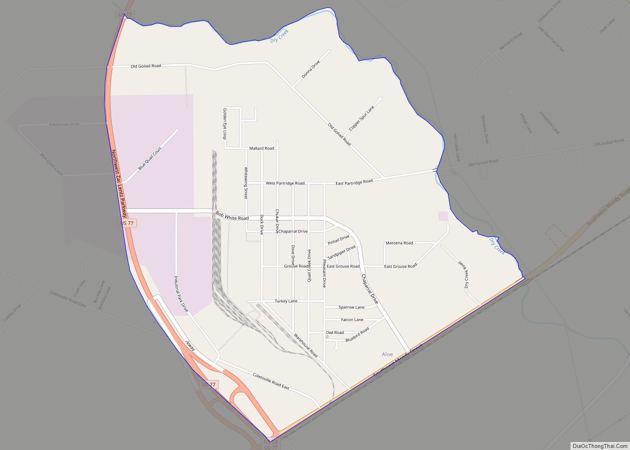
Online Interactive Map
Click on ![]() to view map in "full screen" mode.
to view map in "full screen" mode.
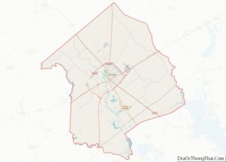
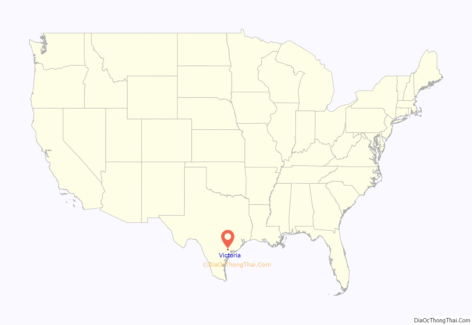
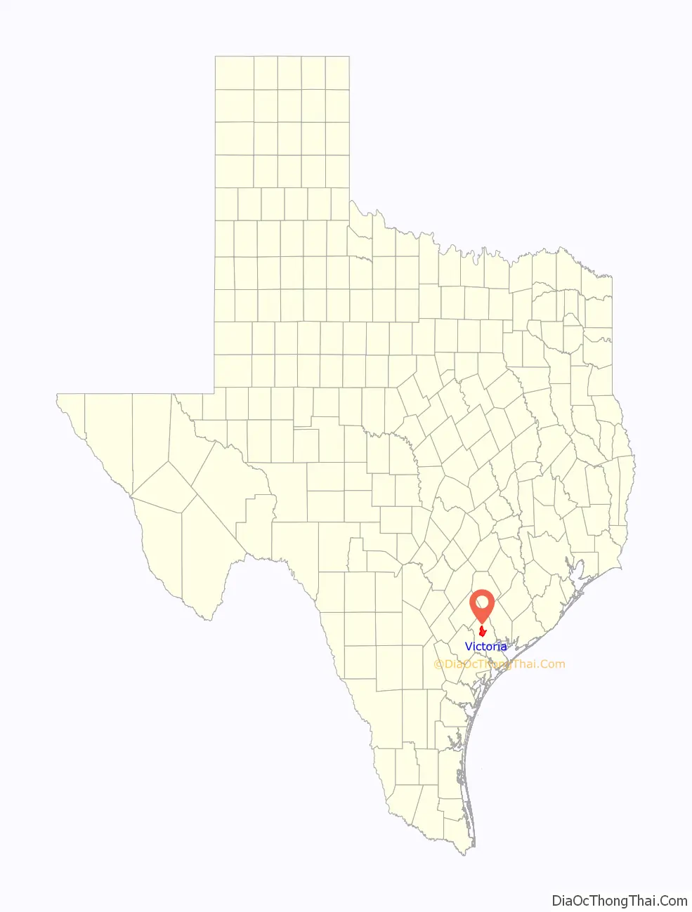
Victoria location map. Where is Victoria city?
History
The city of Guadalupe Victoria was founded in 1824 by Martín De León, a Mexican empresario, in honor of Guadalupe Victoria, the first President of the Republic of Mexico. Victoria was initially part of De León’s Colony, which had been founded that same year. By 1834, the town had a population of approximately 300.
During the Texas Revolution, Guadalupe Victoria contributed soldiers and supplies to pro-revolutionary forces. However, after James Fannin was defeated by the Mexican army at the Battle of Coleto, the town was occupied by Mexican forces. After Santa Anna was defeated at the Battle of San Jacinto, the town’s Mexican residents were driven out by Anglo settlers, who renamed it Victoria.
In 1840, a Comanche raid on nearby Linnville killed many residents of the town. A cholera outbreak occurred in 1846.
During the mid-19th century, the city developed a large population of European immigrants, particularly Germans. By the turn of the 20th century, Victoria was experiencing rapid population growth thanks to its position as a regional trade center. The city’s advantageous proximity to Gulf Coast ports, the larger cities of San Antonio, Austin, and Corpus Christi, and prosperous industries in agriculture and petrochemicals solidified its prominence.
The University of Houston–Victoria was founded in 1971 and remains there today.
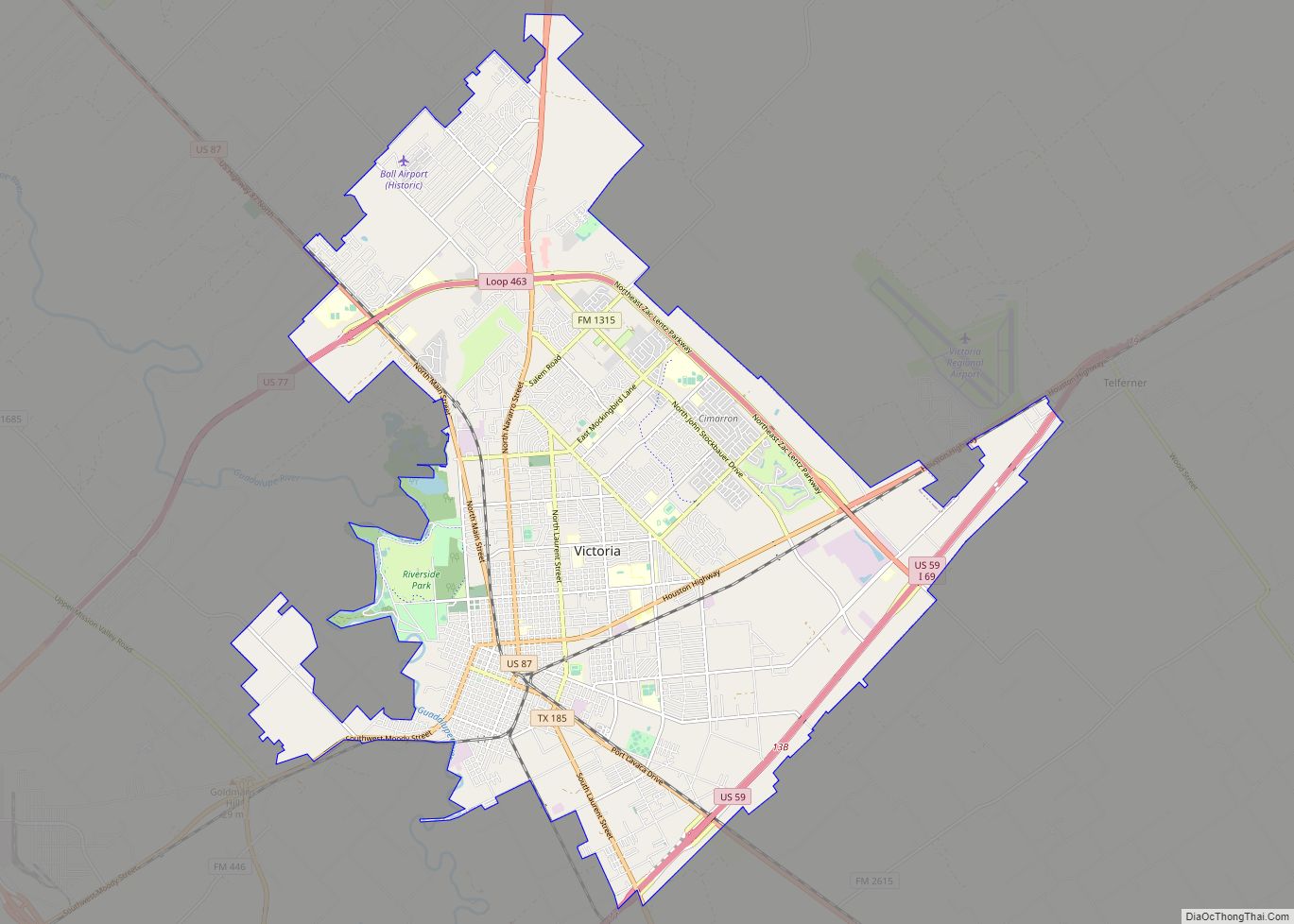
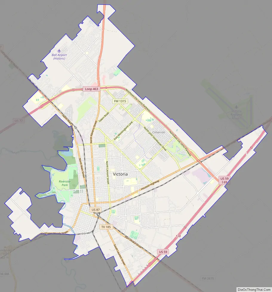
Victoria Road Map
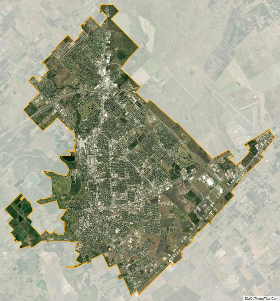
Victoria city Satellite Map
Geography
Victoria is located on the coastal plains of Texas about 50 mi (80 km) from the Gulf of Mexico and 20 mi (32 km) from the nearest bay waters. It lies along and just to the east of the Guadalupe River. The topography is mostly flat to slightly rolling with an average elevation of 95 ft (29 m). Most of the city is underlain by smectite-rich clay which is locally capped by silt or fine sand; the high shrink-swell potential associated with smectite creates major challenges to urban infrastructure. Vegetation in better-drained areas consists primarily of short grasses with post oaks and other small timber and brush. Moist sites can grow tall forests dominated by elm and pecan.
Climate
Victoria is classified as having a humid subtropical climate. June through August is very hot and humid with high temperatures regularly exceeding 100 °F (38 °C). The record high temperature of 111 °F (43.9 °C) was recorded in September 2000. Spring and autumn are generally mild to warm with lower humidity. Winters are mild with occasional cold spells. The record low temperature was recorded in December 1989, when the temperature dropped to 9 °F (−12.8 °C). Snow is very infrequent, usually occurring on average once every 11 years. On December 24–25, 2004, Victoria recorded its first White Christmas ever when 12.5 in (32 cm) of snow fell.
Average monthly precipitation is lowest in winter and has a secondary minimum in August, with intense heat and humidity prevailing. On average, the wettest months are May, June, September and October (the last two of these due to significant threat from tropical weather systems, including hurricanes, which can produce torrential rainfalls some years).
Victoria has occasional severe weather, mostly from flooding. Hurricanes have the potential to bring severe damage to the area. Hurricane Claudette in July 2003 was the last hurricane to score a direct hit on the city. During this event, winds gusted to 83 mph (134 km/h) at the Victoria Regional Airport and 90% of the city lost power. The most intense hurricane to affect Victoria remains Hurricane Carla in September 1961.
In May 2013, a rare tornado hit Victoria on a Saturday afternoon with tornado warnings everywhere from Corpus Christi to the southeast Houston/Sugarland Metro area. A short-lived tornado took a swipe at an open field northeast of Victoria, dodging all structures and causing no injuries but kicking up dirt and debris visible for miles. Tornadoes striking the area are commonly associated with hurricanes and are otherwise rare. https://www.victoriaadvocate.com/news/2013/may/26/ew_tornado_052613_210572/
See also
Map of Texas State and its subdivision:- Anderson
- Andrews
- Angelina
- Aransas
- Archer
- Armstrong
- Atascosa
- Austin
- Bailey
- Bandera
- Bastrop
- Baylor
- Bee
- Bell
- Bexar
- Blanco
- Borden
- Bosque
- Bowie
- Brazoria
- Brazos
- Brewster
- Briscoe
- Brooks
- Brown
- Burleson
- Burnet
- Caldwell
- Calhoun
- Callahan
- Cameron
- Camp
- Carson
- Cass
- Castro
- Chambers
- Cherokee
- Childress
- Clay
- Cochran
- Coke
- Coleman
- Collin
- Collingsworth
- Colorado
- Comal
- Comanche
- Concho
- Cooke
- Coryell
- Cottle
- Crane
- Crockett
- Crosby
- Culberson
- Dallam
- Dallas
- Dawson
- Deaf Smith
- Delta
- Denton
- Dewitt
- Dickens
- Dimmit
- Donley
- Duval
- Eastland
- Ector
- Edwards
- El Paso
- Ellis
- Erath
- Falls
- Fannin
- Fayette
- Fisher
- Floyd
- Foard
- Fort Bend
- Franklin
- Freestone
- Frio
- Gaines
- Galveston
- Garza
- Gillespie
- Glasscock
- Goliad
- Gonzales
- Gray
- Grayson
- Gregg
- Grimes
- Guadalupe
- Hale
- Hall
- Hamilton
- Hansford
- Hardeman
- Hardin
- Harris
- Harrison
- Hartley
- Haskell
- Hays
- Hemphill
- Henderson
- Hidalgo
- Hill
- Hockley
- Hood
- Hopkins
- Houston
- Howard
- Hudspeth
- Hunt
- Hutchinson
- Irion
- Jack
- Jackson
- Jasper
- Jeff Davis
- Jefferson
- Jim Hogg
- Jim Wells
- Johnson
- Jones
- Karnes
- Kaufman
- Kendall
- Kenedy
- Kent
- Kerr
- Kimble
- King
- Kinney
- Kleberg
- Knox
- La Salle
- Lamar
- Lamb
- Lampasas
- Lavaca
- Lee
- Leon
- Liberty
- Limestone
- Lipscomb
- Live Oak
- Llano
- Loving
- Lubbock
- Lynn
- Madison
- Marion
- Martin
- Mason
- Matagorda
- Maverick
- McCulloch
- McLennan
- McMullen
- Medina
- Menard
- Midland
- Milam
- Mills
- Mitchell
- Montague
- Montgomery
- Moore
- Morris
- Motley
- Nacogdoches
- Navarro
- Newton
- Nolan
- Nueces
- Ochiltree
- Oldham
- Orange
- Palo Pinto
- Panola
- Parker
- Parmer
- Pecos
- Polk
- Potter
- Presidio
- Rains
- Randall
- Reagan
- Real
- Red River
- Reeves
- Refugio
- Roberts
- Robertson
- Rockwall
- Runnels
- Rusk
- Sabine
- San Augustine
- San Jacinto
- San Patricio
- San Saba
- Schleicher
- Scurry
- Shackelford
- Shelby
- Sherman
- Smith
- Somervell
- Starr
- Stephens
- Sterling
- Stonewall
- Sutton
- Swisher
- Tarrant
- Taylor
- Terrell
- Terry
- Throckmorton
- Titus
- Tom Green
- Travis
- Trinity
- Tyler
- Upshur
- Upton
- Uvalde
- Val Verde
- Van Zandt
- Victoria
- Walker
- Waller
- Ward
- Washington
- Webb
- Wharton
- Wheeler
- Wichita
- Wilbarger
- Willacy
- Williamson
- Wilson
- Winkler
- Wise
- Wood
- Yoakum
- Young
- Zapata
- Zavala
- Alabama
- Alaska
- Arizona
- Arkansas
- California
- Colorado
- Connecticut
- Delaware
- District of Columbia
- Florida
- Georgia
- Hawaii
- Idaho
- Illinois
- Indiana
- Iowa
- Kansas
- Kentucky
- Louisiana
- Maine
- Maryland
- Massachusetts
- Michigan
- Minnesota
- Mississippi
- Missouri
- Montana
- Nebraska
- Nevada
- New Hampshire
- New Jersey
- New Mexico
- New York
- North Carolina
- North Dakota
- Ohio
- Oklahoma
- Oregon
- Pennsylvania
- Rhode Island
- South Carolina
- South Dakota
- Tennessee
- Texas
- Utah
- Vermont
- Virginia
- Washington
- West Virginia
- Wisconsin
- Wyoming