Graham is a city in north-central Texas. It is the county seat and largest city of Young County.
| Name: | Graham city |
|---|---|
| LSAD Code: | 25 |
| LSAD Description: | city (suffix) |
| State: | Texas |
| County: | Young County |
| Elevation: | 1,047 ft (319 m) |
| Total Area: | 5.62 sq mi (14.56 km²) |
| Land Area: | 5.60 sq mi (14.50 km²) |
| Water Area: | 0.03 sq mi (0.07 km²) |
| Total Population: | 8,903 |
| Population Density: | 1,540.47/sq mi (594.78/km²) |
| ZIP code: | 76450 |
| Area code: | 940 |
| FIPS code: | 4830392 |
| GNISfeature ID: | 1336783 |
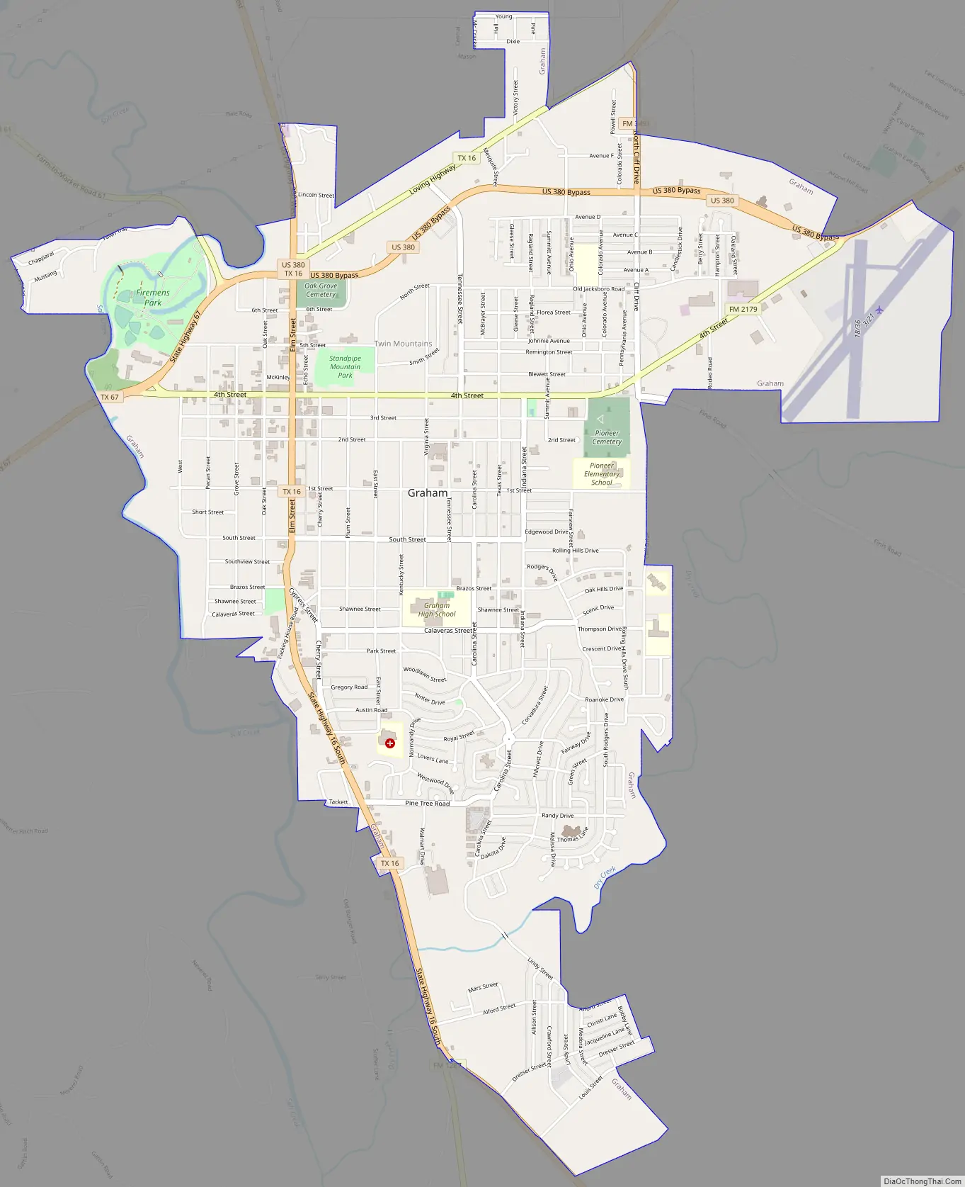
Online Interactive Map
Click on ![]() to view map in "full screen" mode.
to view map in "full screen" mode.
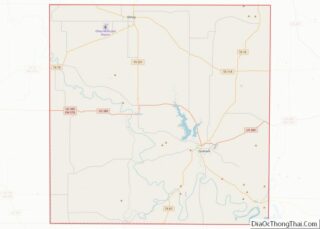
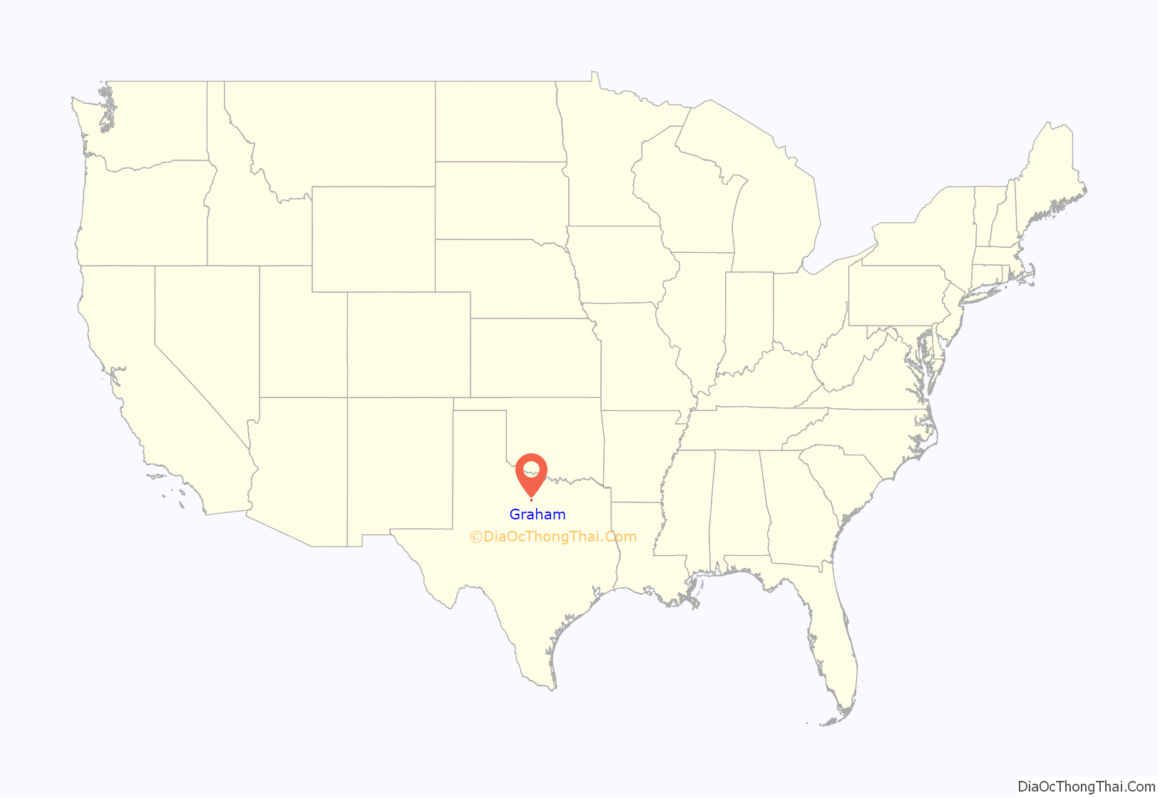
Graham location map. Where is Graham city?
History
The site was first settled in 1871 by brothers Gustavus A. and Edwin S. Graham, primary shareholders in the Texas Emigration and Land Company of Louisville, Kentucky. The brothers moved to Texas after the Civil War, and after buying 125,000 acres (510 km) in then-vast Young County, helped to revitalize the area, the population of which had become badly depleted during the war. During that same year as when Graham was settled, the Warren Wagon Train Raid occurred about 12 miles north of the city. In 1872, the Graham brothers purchased a local saltworks, established the town of Graham, and set up the Graham Land Office. The saltworks were not a profitable venture, as the salt was too expensive to ship, and were closed in a few years.
New families started to arrive, and the brothers began promoting the sale of homesites and doing civic improvements. A post office opened in 1873, and after Young County reorganized the following year, Graham became the county seat. The town’s newspaper, known as The Graham Leader and still in existence today, was first printed in 1876, the same year that the first temporary courthouse was built. Other businesses from these early years included a gristmill, sawmill, cotton gin, and brick kiln, two hotels, and several stores.
On February 15, 1877, the city was the site of the organizational meeting of the group that became the Texas and Southwestern Cattle Raisers Association, created to police ranching and put a stop to cattle rustling. Founding officers included pioneer ranchers James C. Loving (son of Oliver Loving), Col. C. L. (Kit) Carter, and C.C. Slaughter. A three-story limestone courthouse was built in 1884, and it was replaced by a new courthouse in the early 1930s. The 1884 structure’s east door still stands on the courthouse square. From 1879 to 1896, Graham was the seat of a federal district court overseen by Judge A.P. McCormick; his jurisdiction extended over all of Texas north and west to New Mexico.
Edwin Graham had married Addie Mary Kintner in 1865. They had five children. Throughout the 1870s, they divided their time between Texas and their families back north, but in 1879, with the town flourishing, they moved their wives and children to Graham permanently. Edwin and Addie lived there until 1891, then moved to Spokane, Washington, where Edwin died on May 7, 1899. His body was brought back to Graham for burial. Addie moved back to Graham and became a leading civic booster and philanthropist. In 1921, with her son Malcolm, she set up the Graham Foundation as a continuing fund for the city’s growth and improvement. Addie died in 1929; she was responsible for the establishment of the Eden Home for the aged.
By 1900, Graham had incorporated as a town, and railroad service began in 1903, through the Chicago, Rock Island & Texas Railroad, part of the Chicago, Rock Island & Pacific system. In 1921, the Wichita Falls and Southern Railroad, one of the Frank Kell and Joseph A. Kemp properties, extended its line into Graham from Newcastle. The WF&S was abandoned in 1954 and the Rock Island sold its line to the Texas Export Railroad in 1972, but was abandoned just two years later.
The population of Graham grew slowly until 1917, when oil was discovered nearby; the population tripled from 878 in 1900 to 2,544 in 1920. By 1966, Graham had 17 churches, seven schools, a hospital, a radio station, two libraries, three parks, and two newspapers. The population peaked at 9,170 in 1980, and has since gradually declined; it was 8,716 at the 2000 census and 8,518 by the July 2007 estimate.
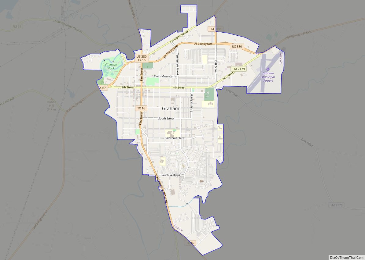
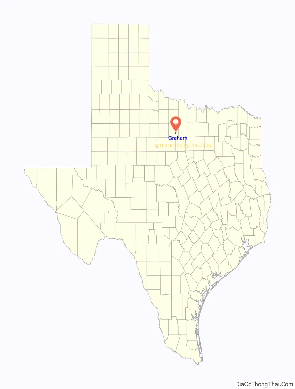
Graham Road Map
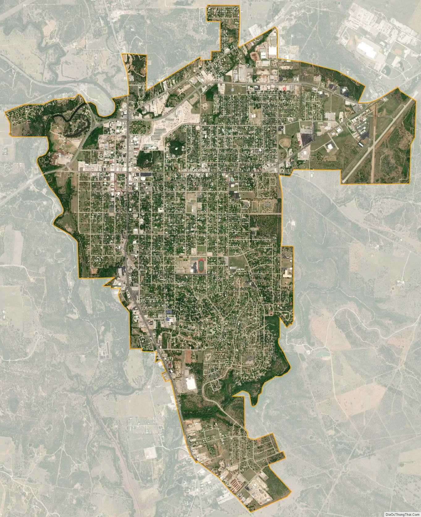
Graham city Satellite Map
Geography
Graham, the county seat of Young County, is located in the southeast portion of the county, and has an area of 5.592 sq mi (14.48 km). Geographically, Graham is located in the western Cross Timbers area of North Texas. Locally, this is known as the western portion of the Palo Pinto Mountains.
Creeks drain the area generally into the Brazos River; Dry Creek on the east side of town flows into Salt Creek towards the south and into the Brazos. Flatrock Creek drains the rural areas to the southeast and also flows into the Brazos just below where Salt Creek enters. Small impoundments located along Flatrock Creek are used for stock tanks and fish ponds.
Lake Graham is located on the Salt Creek in Young County, five miles north of Graham on US 380:
- Surface area: 2,444 acres
- Maximum depth: 45 feet
- Impounded: 1929
- Conservation pool elevation: 1,075 ft amsl
- Fluctuation: Minimal, sometimes prone to long periods with dropping water levels
- Normal clarity: Slightly stained to stained
- Reservoir controlling authority: City of Graham, PO Box 1449, Graham, Texas 76450 (940) 549-3322
- Aquatic vegetation: Bulrushes, lily pads, smartweed, pondweed
- Predominant fish species: Largemouth bass, white and hybrid striped bass, channel catfish, white crappie
- Three public boat ramps, one fishing pier, a picnic area, and sites for primitive and improved camping are available, but no boat rentals, marina, nor handicap fishing access is available. A bait shop is located about two miles south of the reservoir on US 380. Shore fishing is limited to the area around the boat ramp on the Eddleman portion of the reservoir and along the US 380 causeways.
See also
Map of Texas State and its subdivision:- Anderson
- Andrews
- Angelina
- Aransas
- Archer
- Armstrong
- Atascosa
- Austin
- Bailey
- Bandera
- Bastrop
- Baylor
- Bee
- Bell
- Bexar
- Blanco
- Borden
- Bosque
- Bowie
- Brazoria
- Brazos
- Brewster
- Briscoe
- Brooks
- Brown
- Burleson
- Burnet
- Caldwell
- Calhoun
- Callahan
- Cameron
- Camp
- Carson
- Cass
- Castro
- Chambers
- Cherokee
- Childress
- Clay
- Cochran
- Coke
- Coleman
- Collin
- Collingsworth
- Colorado
- Comal
- Comanche
- Concho
- Cooke
- Coryell
- Cottle
- Crane
- Crockett
- Crosby
- Culberson
- Dallam
- Dallas
- Dawson
- Deaf Smith
- Delta
- Denton
- Dewitt
- Dickens
- Dimmit
- Donley
- Duval
- Eastland
- Ector
- Edwards
- El Paso
- Ellis
- Erath
- Falls
- Fannin
- Fayette
- Fisher
- Floyd
- Foard
- Fort Bend
- Franklin
- Freestone
- Frio
- Gaines
- Galveston
- Garza
- Gillespie
- Glasscock
- Goliad
- Gonzales
- Gray
- Grayson
- Gregg
- Grimes
- Guadalupe
- Hale
- Hall
- Hamilton
- Hansford
- Hardeman
- Hardin
- Harris
- Harrison
- Hartley
- Haskell
- Hays
- Hemphill
- Henderson
- Hidalgo
- Hill
- Hockley
- Hood
- Hopkins
- Houston
- Howard
- Hudspeth
- Hunt
- Hutchinson
- Irion
- Jack
- Jackson
- Jasper
- Jeff Davis
- Jefferson
- Jim Hogg
- Jim Wells
- Johnson
- Jones
- Karnes
- Kaufman
- Kendall
- Kenedy
- Kent
- Kerr
- Kimble
- King
- Kinney
- Kleberg
- Knox
- La Salle
- Lamar
- Lamb
- Lampasas
- Lavaca
- Lee
- Leon
- Liberty
- Limestone
- Lipscomb
- Live Oak
- Llano
- Loving
- Lubbock
- Lynn
- Madison
- Marion
- Martin
- Mason
- Matagorda
- Maverick
- McCulloch
- McLennan
- McMullen
- Medina
- Menard
- Midland
- Milam
- Mills
- Mitchell
- Montague
- Montgomery
- Moore
- Morris
- Motley
- Nacogdoches
- Navarro
- Newton
- Nolan
- Nueces
- Ochiltree
- Oldham
- Orange
- Palo Pinto
- Panola
- Parker
- Parmer
- Pecos
- Polk
- Potter
- Presidio
- Rains
- Randall
- Reagan
- Real
- Red River
- Reeves
- Refugio
- Roberts
- Robertson
- Rockwall
- Runnels
- Rusk
- Sabine
- San Augustine
- San Jacinto
- San Patricio
- San Saba
- Schleicher
- Scurry
- Shackelford
- Shelby
- Sherman
- Smith
- Somervell
- Starr
- Stephens
- Sterling
- Stonewall
- Sutton
- Swisher
- Tarrant
- Taylor
- Terrell
- Terry
- Throckmorton
- Titus
- Tom Green
- Travis
- Trinity
- Tyler
- Upshur
- Upton
- Uvalde
- Val Verde
- Van Zandt
- Victoria
- Walker
- Waller
- Ward
- Washington
- Webb
- Wharton
- Wheeler
- Wichita
- Wilbarger
- Willacy
- Williamson
- Wilson
- Winkler
- Wise
- Wood
- Yoakum
- Young
- Zapata
- Zavala
- Alabama
- Alaska
- Arizona
- Arkansas
- California
- Colorado
- Connecticut
- Delaware
- District of Columbia
- Florida
- Georgia
- Hawaii
- Idaho
- Illinois
- Indiana
- Iowa
- Kansas
- Kentucky
- Louisiana
- Maine
- Maryland
- Massachusetts
- Michigan
- Minnesota
- Mississippi
- Missouri
- Montana
- Nebraska
- Nevada
- New Hampshire
- New Jersey
- New Mexico
- New York
- North Carolina
- North Dakota
- Ohio
- Oklahoma
- Oregon
- Pennsylvania
- Rhode Island
- South Carolina
- South Dakota
- Tennessee
- Texas
- Utah
- Vermont
- Virginia
- Washington
- West Virginia
- Wisconsin
- Wyoming