Zhytomyr Oblast (Ukrainian: Жито́мирська о́бласть, romanized: Zhytomyrska oblast), also referred to as Zhytomyrshchyna (Ukrainian: Жито́мирщина) is an oblast (province) of northern Ukraine. The administrative center of the oblast is the city of Zhytomyr. Its population is approximately 1,179,032 (2022 est.).
| Unit Name | Zhytomyr Oblast |
|---|---|
| Administrative center | Zhytomyr |
| Total area | 29.832 km² (11.518 sq mi) |
| Area Rank | Rank 5th |
| Population (2021) | 1.195.495 |
| Time zone | UTC+2 (EET) |
| Summer (DST) | UTC+3 (EEST) |
| Postal code | from 10 to 13 |
| Area code | +380-41 |
| ISO 3166 code | UA-18 |
| Website | www.zhitomir-region.gov.ua |
| Flag |  |
| Coat of arms |  |
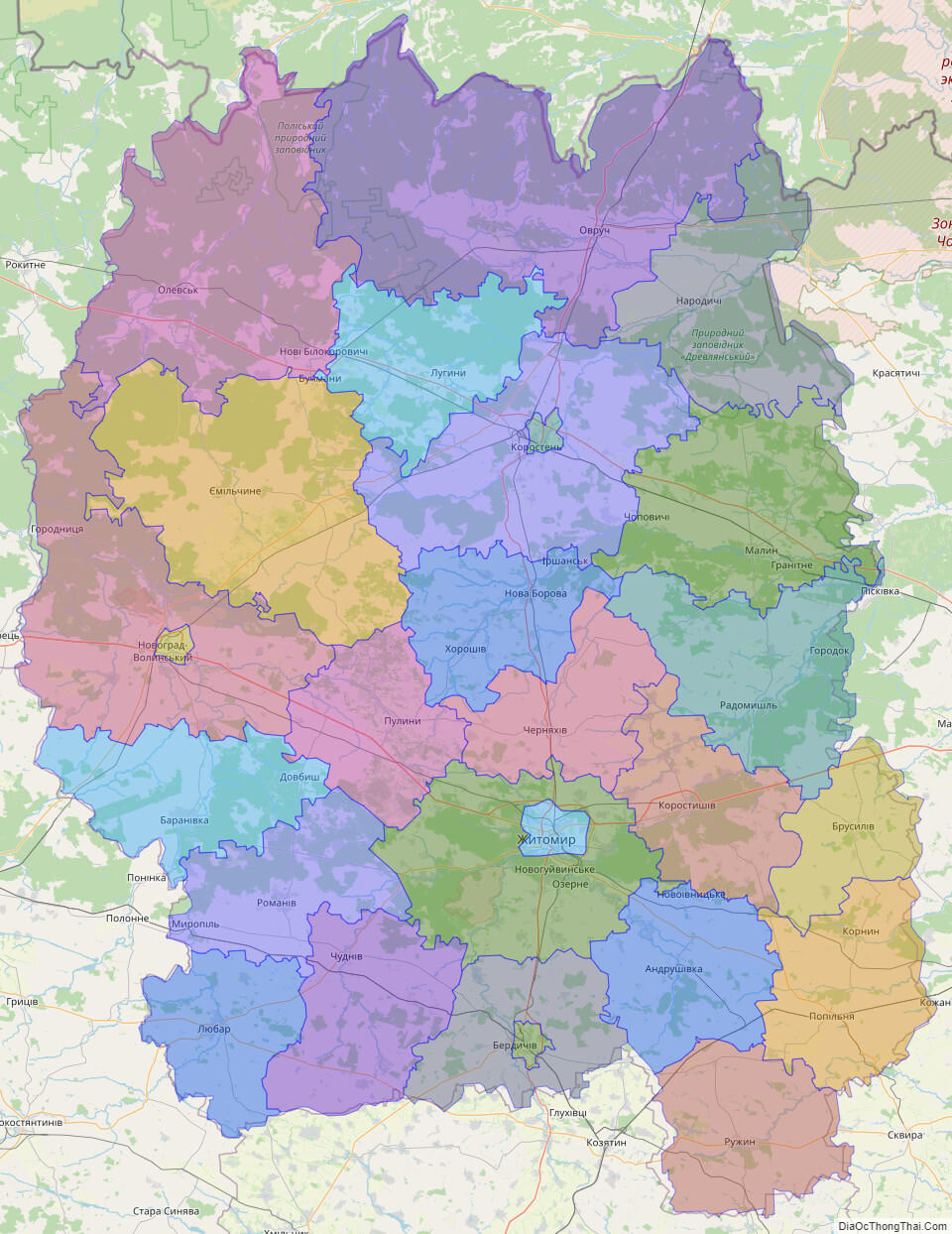
Online subdivision map of Zhytomyr oblast
Located in northern-central Ukraine, Zhytomyr Oblast boasts a rich history and diverse natural beauty. With the help of an online subdivision map, you can explore the many attractions of this fascinating region from the comfort of your own home.
Using a detailed base map, such as OpenStreetMap or satellite imagery, you can easily view the oblast and its various sub-administrative units. The map includes a cover layer with different colors to show the borders and boundaries of each area, making it easy to distinguish between them.
Zooming in and out of the map allows you to explore the various towns, villages, and cities within Zhytomyr Oblast in greater detail. You can discover the region’s unique architecture, landmarks, and natural wonders, such as the Koropets Ridge and the Teteriv River.
By using an online subdivision map, you can also access important information about the oblast, including its population, economy, and infrastructure. This can be particularly useful for researchers, students, or those interested in relocating to the region.
So why not take advantage of this valuable tool and begin exploring Zhytomyr Oblast today? Whether you’re interested in history, nature, or simply curious about the region, an online subdivision map is an excellent way to discover all that this fascinating area has to offer.
Click on ![]() to view map in "full screen" mode.
to view map in "full screen" mode.
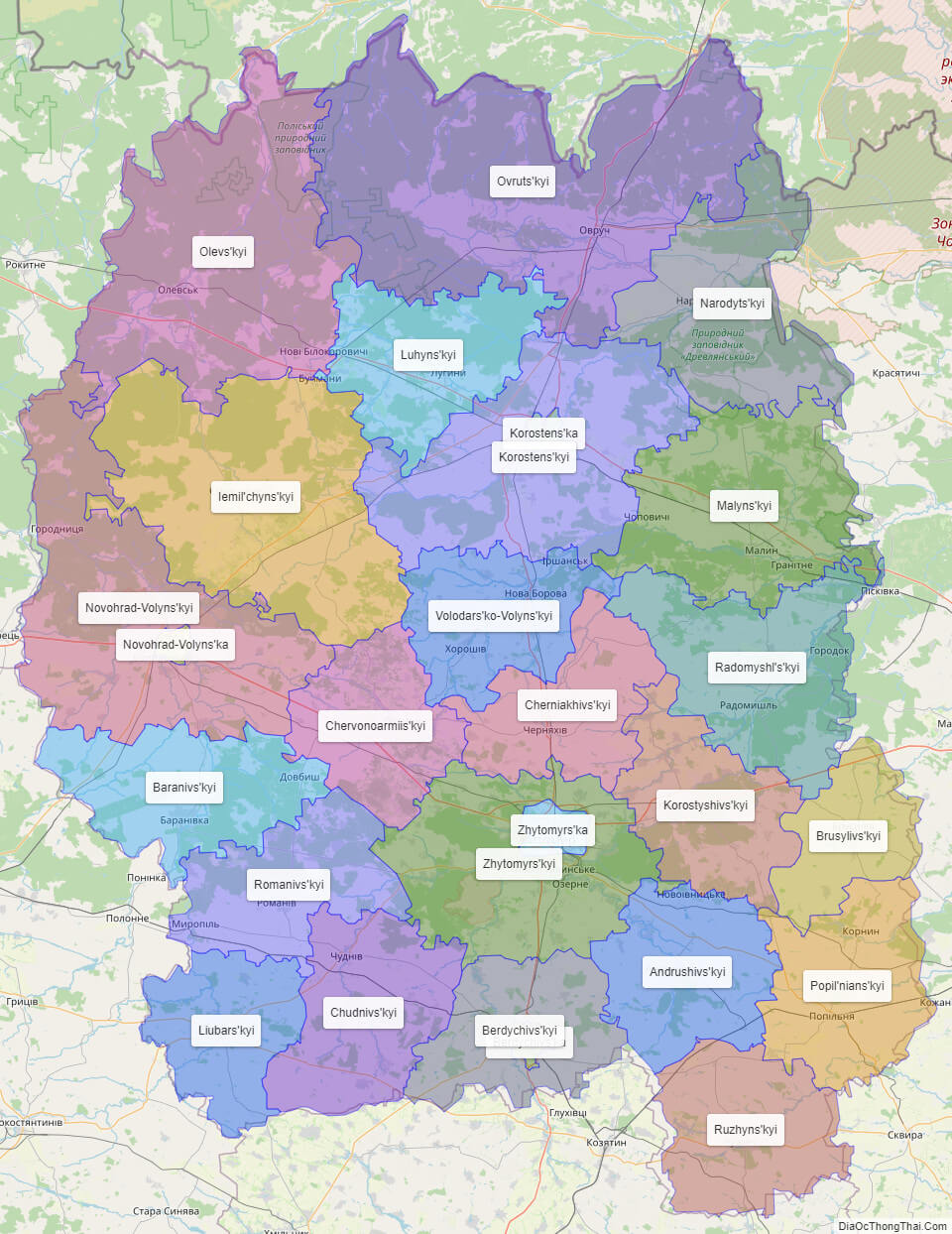
List administrative sub-division of Zhytomyr oblast
| # | Name | Type |
|---|---|---|
| 1 | Berdychivs’ka | Misto |
| 2 | Korostens’ka | Misto |
| 3 | Novohrad-Volyns’ka | Misto |
| 4 | Zhytomyrs’ka | Misto |
| 5 | Andrushivs’kyi | Raion |
| 6 | Baranivs’kyi | Raion |
| 7 | Berdychivs’kyi | Raion |
| 8 | Brusylivs’kyi | Raion |
| 9 | Cherniakhivs’kyi | Raion |
| 10 | Chervonoarmiis’kyi | Raion |
| 11 | Chudnivs’kyi | Raion |
| 12 | Iemil’chyns’kyi | Raion |
| 13 | Korostens’kyi | Raion |
| 14 | Korostyshivs’kyi | Raion |
| 15 | Liubars’kyi | Raion |
| 16 | Luhyns’kyi | Raion |
| 17 | Malyns’kyi | Raion |
| 18 | Narodyts’kyi | Raion |
| 19 | Novohrad-Volyns’kyi | Raion |
| 20 | Olevs’kyi | Raion |
| 21 | Ovruts’kyi | Raion |
| 22 | Popil’nians’kyi | Raion |
| 23 | Radomyshl’s’kyi | Raion |
| 24 | Romanivs’kyi | Raion |
| 25 | Ruzhyns’kyi | Raion |
| 26 | Volodars’ko-Volyns’kyi | Raion |
| 27 | Zhytomyrs’kyi | Raion |
Explaination:
- Mis’ka Rada: City municipalities (governed by a mayor and a city council)
- Misto: city at least 10,000 people (not a town).
- Raion: often translated as “district”.
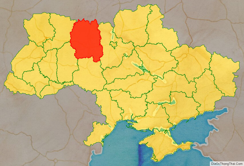
Location map of Zhytomyr oblast, Ukraine

Political map of Zhytomyr oblast
Zhytomyr oblast streeet map

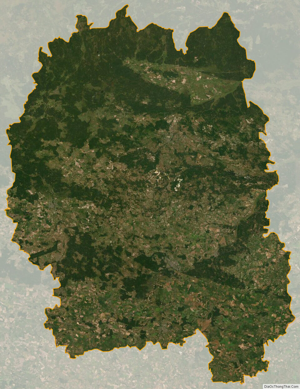
Zhytomyr oblast satellite map