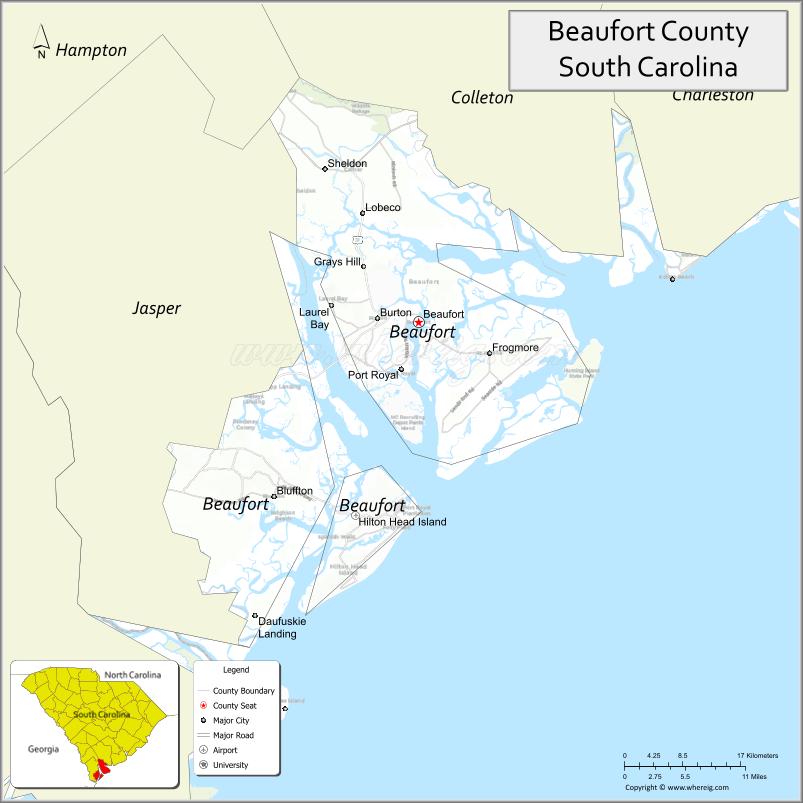
Beaufort County (/ˈbjuːfərt/ BEW-fərt) is a county in the U.S. state of South Carolina. As of the 2020 census, its population was 187,117. Its county seat is Beaufort and its largest town is Hilton Head Island.
Beaufort County is part of the Hilton Head Island–Bluffton, SC Metropolitan Statistical Area. It is one of the South’s fastest-growing counties, primarily because of development south of the Broad River clustered along the U.S. Highway 278 corridor. The county’s northern portions have also grown steadily, due in part to the strong federal military presence around the city of Beaufort. The county’s two portions are connected by the Broad River Bridge, which carries South Carolina Highway 170. Beaufort County has been identified as the most at-risk county in the contiguous United States for combined damage from climate change in the medium term.
| Name: | Beaufort County |
|---|---|
| FIPS code: | 45-013 |
| State: | South Carolina |
| Founded: | 1800 |
| Named for: | Henry Somerset, 2nd Duke of Beaufort |
| Seat: | Beaufort |
| Largest town: | Hilton Head Island |
| Total Area: | 923 sq mi (2,390 km²) |
| Land Area: | 576 sq mi (1,490 km²) |
| Total Population: | 191,748 |
| Population Density: | 332.9/sq mi (128.5/km²) |
| Time zone: | UTC−5 (Eastern) |
| Summer Time Zone (DST): | UTC−4 (EDT) |
| Website: | www.beaufortcountysc.gov |
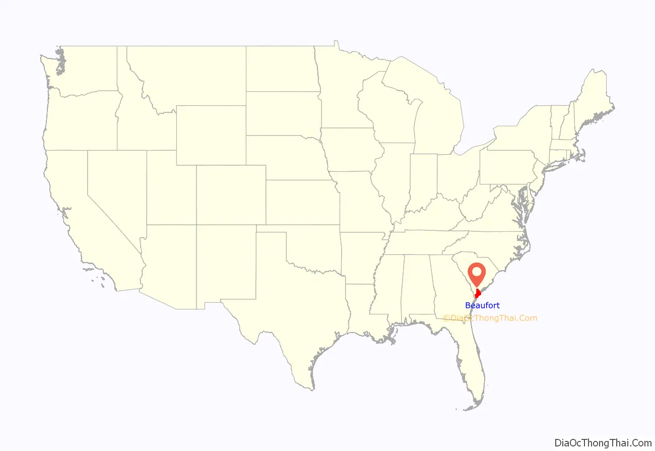
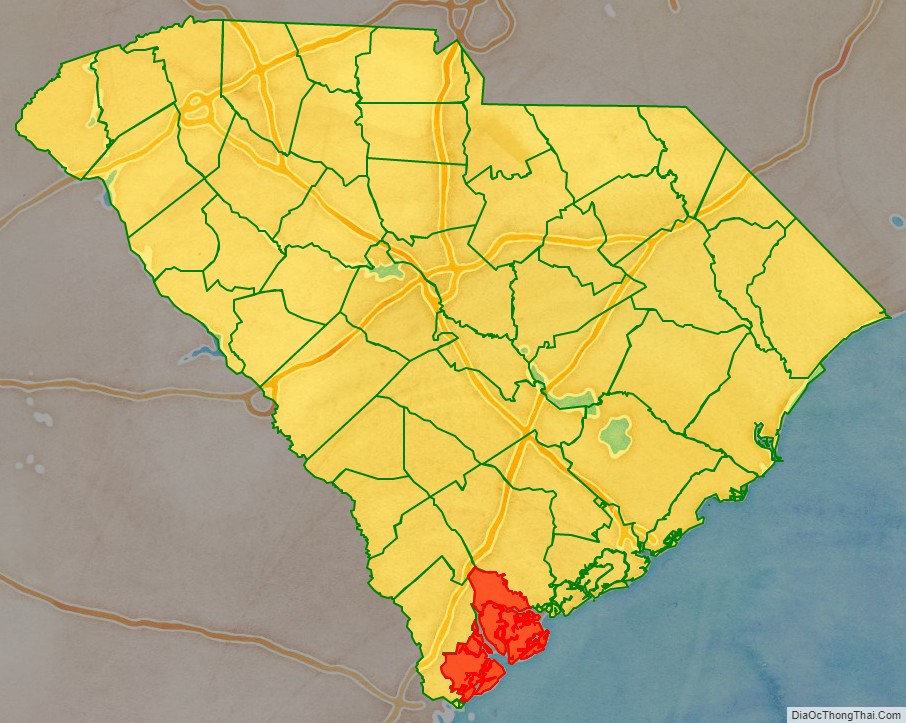
Beaufort County location map. Where is Beaufort County?
History
From the early days of plantations, African slaves outnumbered the European minority in the colony. The plantations on the Sea Islands had large concentrations of slaves, and frequently limited interaction with whites. The islands were sites of the development of the Gullah culture, which preserved elements from a variety of West African roots; the people also developed the Gullah language, a creole language. The county was majority black nearly to the mid-20th century.
Union troops took control of Beaufort County and occupied the area beginning in 1861. Many slaves escaped and went to Union lines. In some cases, planters had moved inland for refuge, leaving their slaves on the Sea Islands. Slaves began to organize schools and other parts of their communities early in the war in this county, especially on the islands. The Army founded Mitchellville on Hilton Head by March 1863 as a village where blacks could practice self-governance, and in 1865 it had 1500 residents. After the war, the Drayton family reclaimed this land for its use. In some cases, the Union Army allocated plots for blacks for housing and cultivating crops.
When freedmen were granted citizenship and the franchise after the American Civil War by constitutional amendments, most joined the Republican Party. Although not the only black majority state, South Carolina was the only southern state during Reconstruction to elect a black majority of representatives to the state legislature. Beaufort County had many prominent black leaders, such as Robert Smalls, Jonathan Jasper Wright, William James Whipper, Julius I. Washington, and Thomas E. Miller.
Increasing violence during election campaigns in the state from 1868 on was used by white insurgents and paramilitary groups to suppress black voting; results were also dependent on fraud. In 1876, the Democrats regained control of the state legislature and governor’s office, although results were disputed. While black Republicans continued to be elected to local office in Beaufort County and other areas through the next decades, in 1895 the Democrat-dominated state legislature passed a new constitution that effectively disfranchised most blacks through making voter registration and voting more difficult. They were excluded from the political system and kept in second-class status for decades. In 1903 the county “was reported to have 3,434 literate black males to 927 whites,” but due to the discriminatory practices, nearly all blacks were barred from voting.
From 1900 through 1950, Beaufort County’s economy suffered from the decline in agriculture, which together with oppressive social conditions of Jim Crow contributed to the blacks making a Great Migration out of the South. African Americans went to northern and midwestern industrial cities for jobs and became an urbanized population. The total county population of 35,495 in 1900 dropped by more than one third to 1930, and did not reach the 1900 population level again until well after 1950, when the population was 26,933. Southern Democrats in Congress helped gain the establishment of military installations in the county and state, which added more population and stimulated area jobs in the second half of the 20th century.
In addition, vacation and resort areas were developed that attracted increasing numbers of tourists through the winter season, and then others all year-round as retirees.
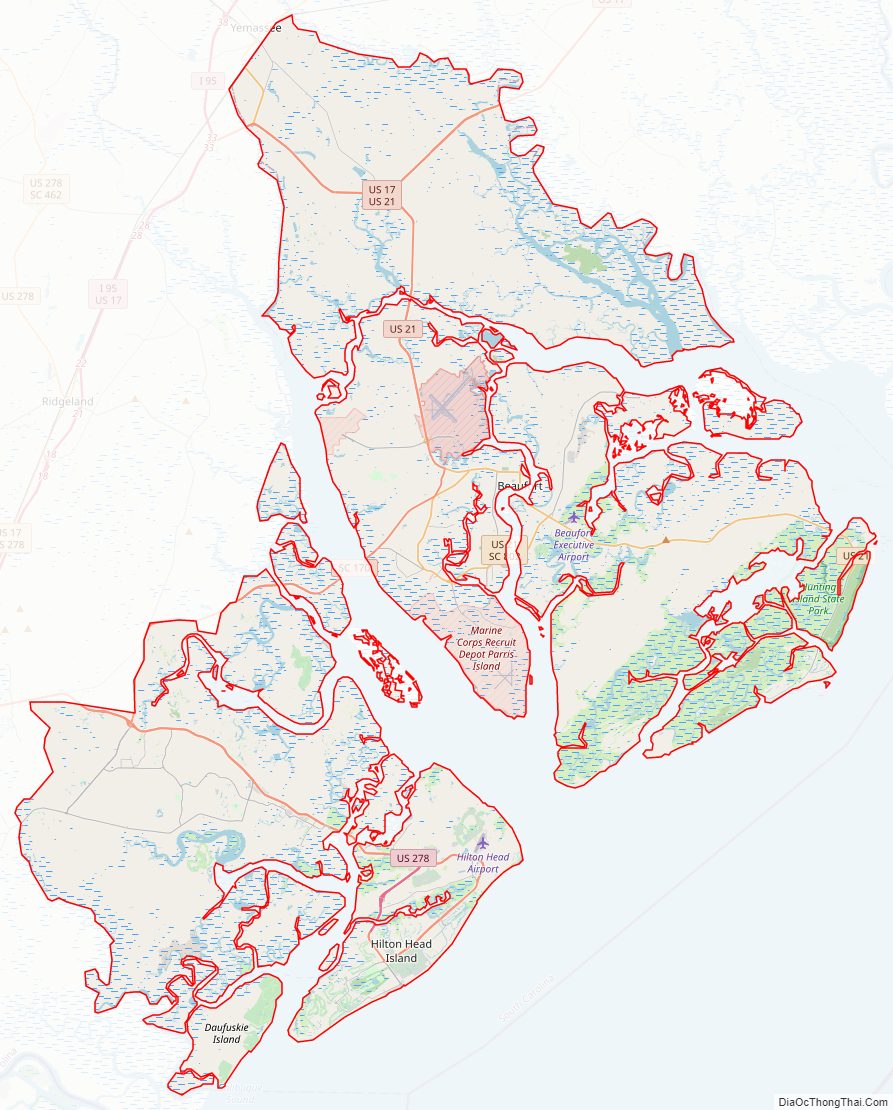
Beaufort County Road Map
Geography
According to the U.S. Census Bureau, the county has a total area of 923 square miles (2,390 km), of which 576 square miles (1,490 km) is land and 347 square miles (900 km) (38%) is water.
National protected areas
- Ashepoo-Combahee-Edisto (ACE) Basin National Estuarine Research Reserve (part)
- Ernest F. Hollings ACE Basin National Wildlife Refuge (part)
- Pinckney Island National Wildlife Refuge
State and local protected areas/sites
- Auldbrass Plantation
- Charlesfort – Santa Elena Historic Site
- Coffin Point Plantation
- Coligny Beach Park
- Hunting Island State Park
- Old Sheldon Church Ruins
- Sea Pines Forest Preserve
- Spanish Moss Trail
- Stony Creek Bridge
- Victoria Bluff Heritage Preserve/Wildlife Management Area
- Widgeon Point Preserve
Major water bodies
- Atlantic Ocean
- Colleton River
- Edisto River
- Harbor River
- Intracoastal Waterway
- May River
- Salkehatchie River
Adjacent counties
- Colleton County – north
- Jasper County – west
- Hampton County – northwest
Major highways
- US 17
- US 17 Alt.
- US 21
- US 21 Bus.
- US 278
- US 278 Bus.
- SC 46
- SC 116
- SC 128
- SC 170
- SC 802
Major infrastructure
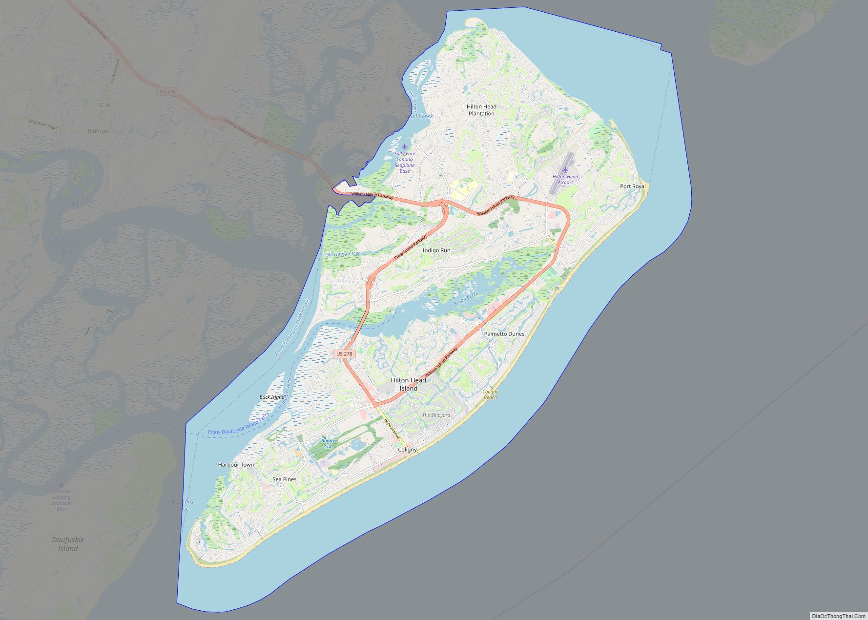
- Hilton Head Island Airport
- Marine Corps Air Station Beaufort
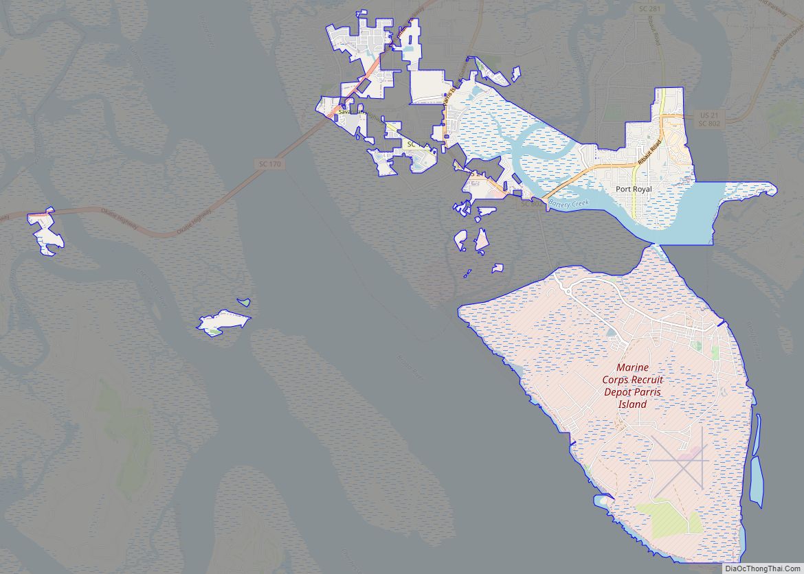
- Marine Corps Recruit Depot Parris Island
Beaufort County Topographic Map
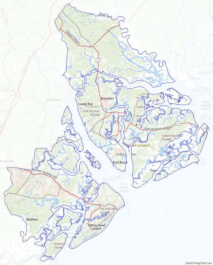
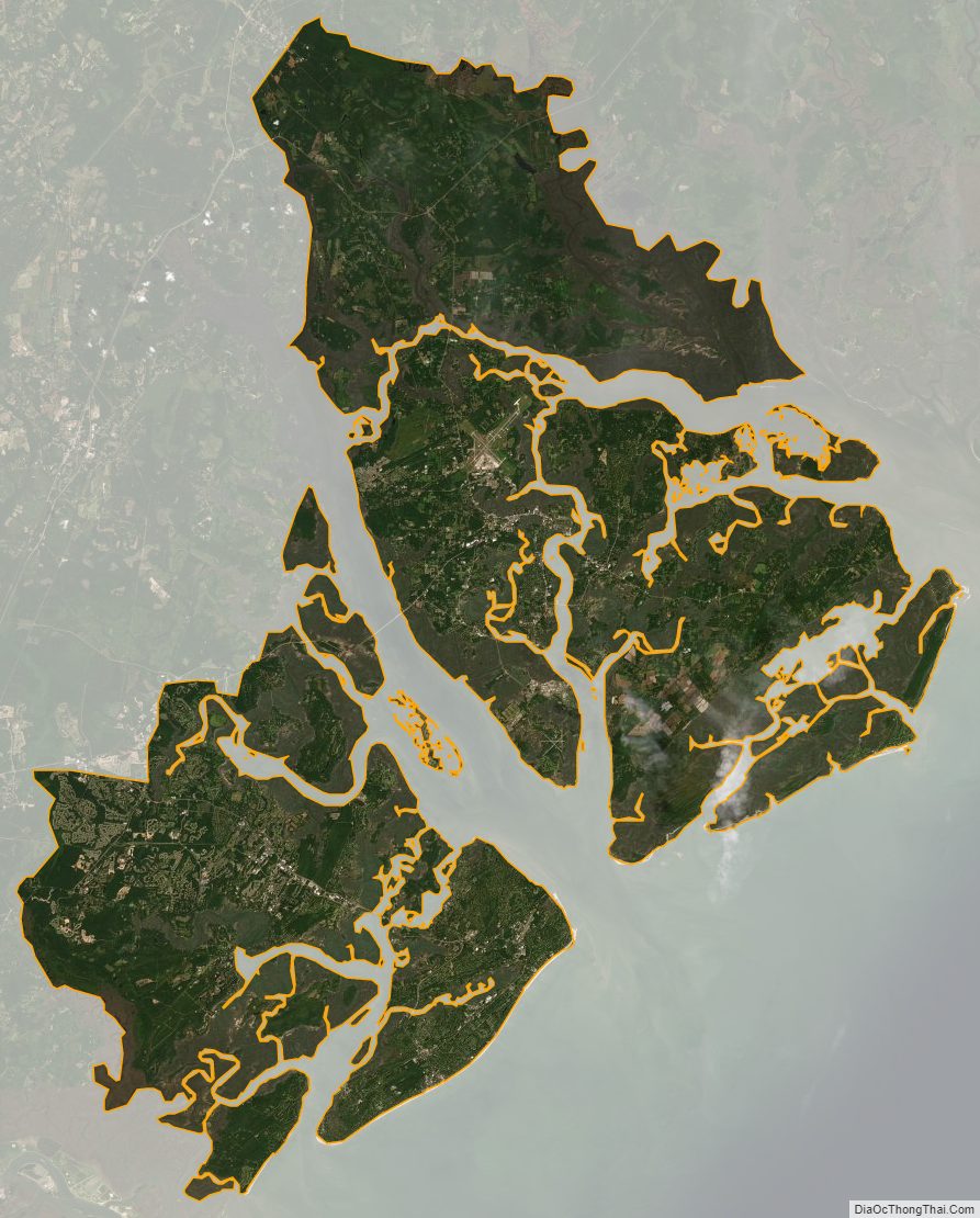
Beaufort County Satellite Map
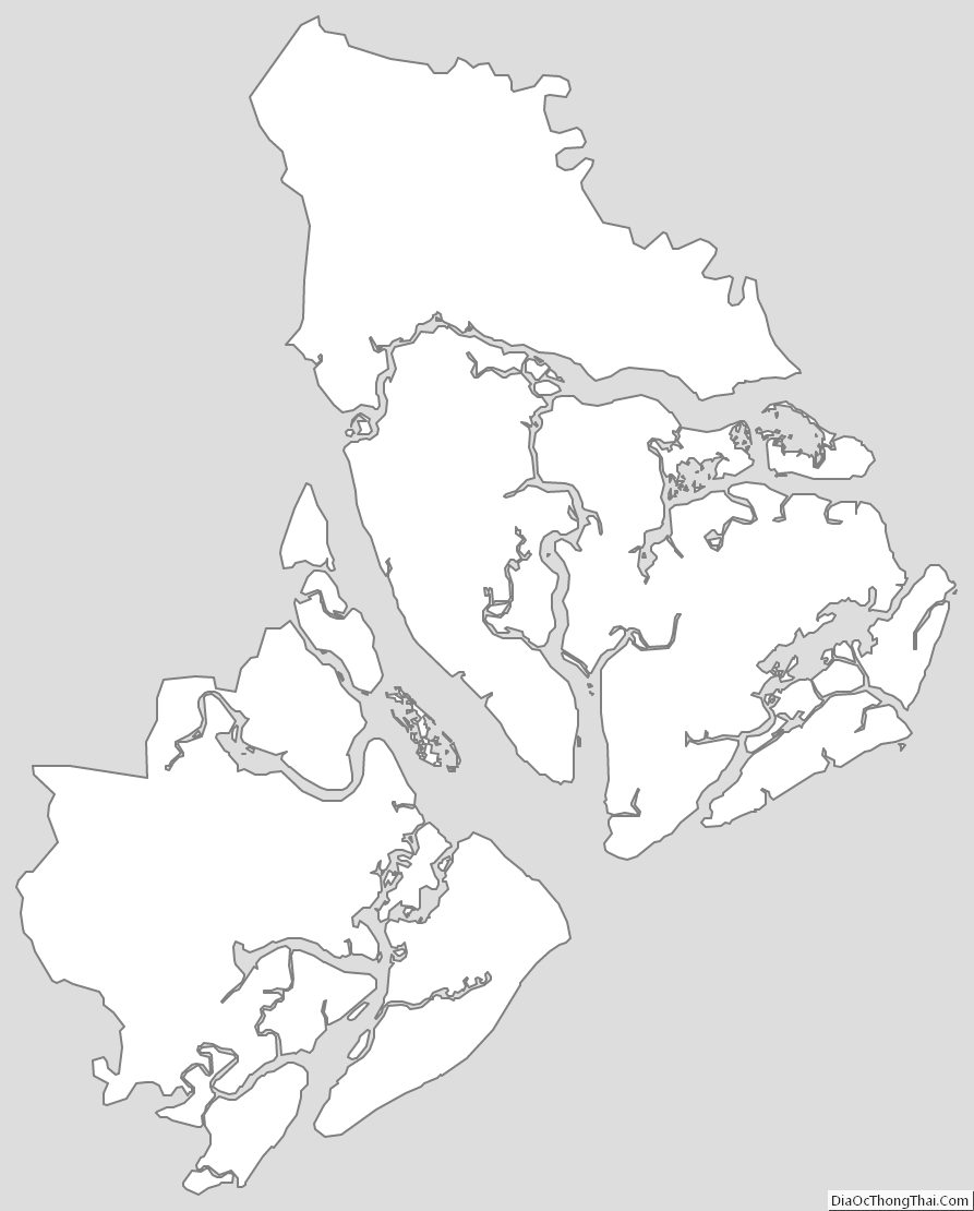
Beaufort County Outline Map