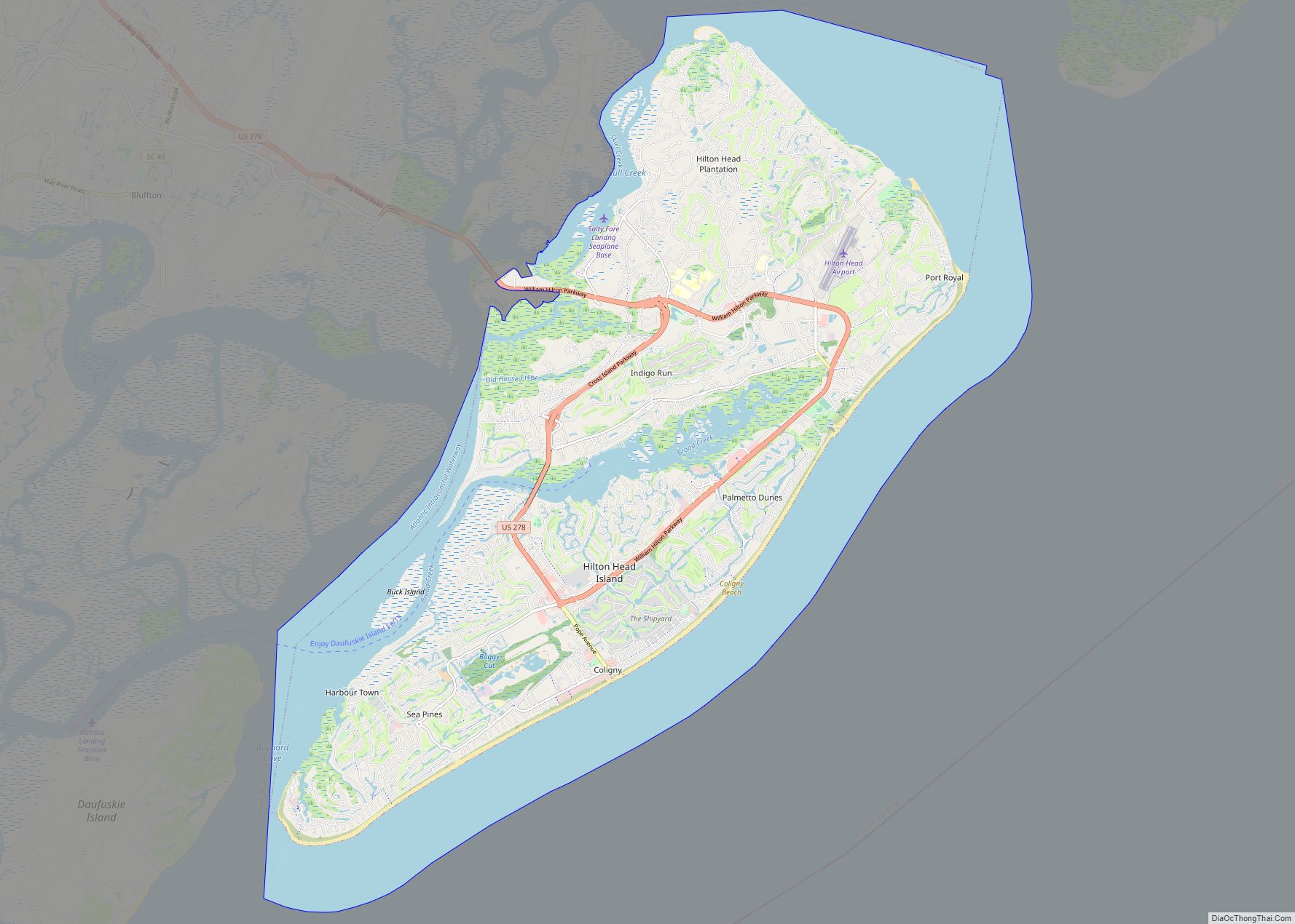
Bluffton is a town in southern Beaufort County, South Carolina, United States. The population as of the 2020 census was 27,716, an increase of over 120% since 2010, making it one of the fastest growing municipalities in South Carolina. Bluffton is the fifth largest municipality in South Carolina by land area. It is primarily located around U.S. Route 278, between Hilton Head Island and Interstate 95. The Lowcountry town’s original one square mile area, now known as Old Town, is situated on a bluff along the May River. The town is a primary town within the Hilton Head Island–Bluffton Metropolitan Area.
After the Tariff of 1842, Bluffton became a hotbed of separatist sentiment, which in turn led to a protest against federal taxes called the Bluffton Movement in 1844. Even though the movement quickly died out, it somewhat contributed to the secession movement that led to South Carolina being the first state to leave the Union. In the Antebellum Period, Bluffton became a popular location for wealthy merchants and plantation owners. During the Civil War, two thirds of the town was destroyed by fire during the Union’s Bluffton Expedition on June 4, 1863.
| Name: | Bluffton town |
|---|---|
| LSAD Code: | 43 |
| LSAD Description: | town (suffix) |
| State: | South Carolina |
| County: | Beaufort County |
| Incorporated: | 1852 |
| Elevation: | 20 ft (6 m) |
| Land Area: | 51.97 sq mi (134.60 km²) |
| Water Area: | 2.23 sq mi (5.77 km²) |
| Population Density: | 533.33/sq mi (205.92/km²) |
| ZIP code: | 29909-29910 |
| Area code: | 843, 854 |
| FIPS code: | 4507210 |
| GNISfeature ID: | 1220833 |
| Website: | www.townofbluffton.sc.gov |
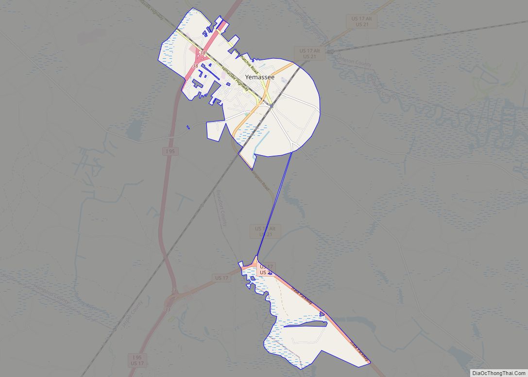
Online Interactive Map
Click on ![]() to view map in "full screen" mode.
to view map in "full screen" mode.
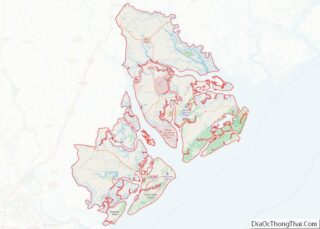
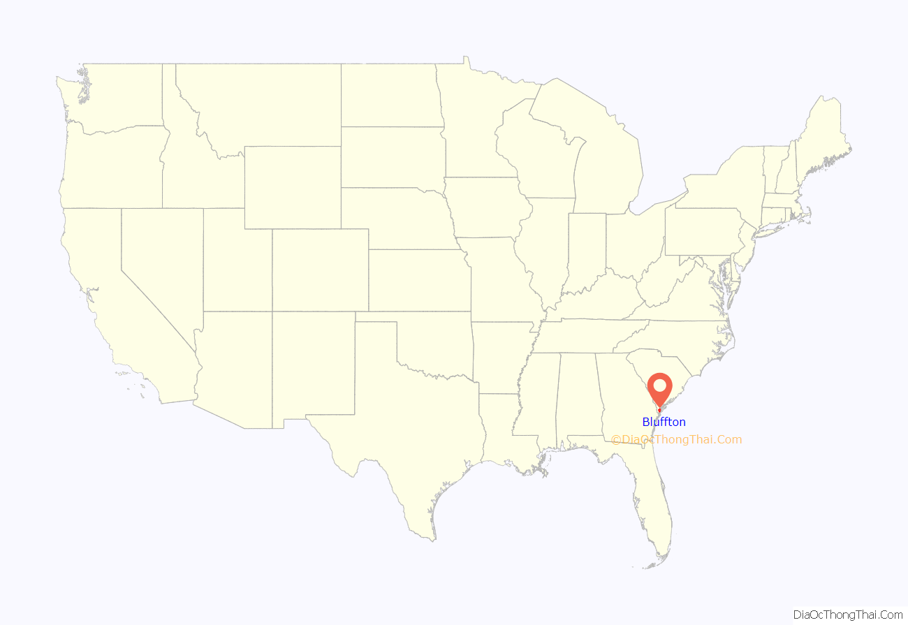
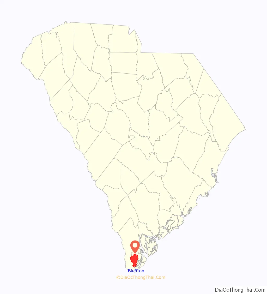
Bluffton location map. Where is Bluffton town?
History
Colonial era (1670–1776)
During the 17th and the 18th centuries, the area comprising southern Beaufort County was known as Granville County of St. Luke’s Parish. The Yamasee people were invited to settle in the area by Lord Cardoss, leader of the nearby Scottish settlement in Beaufort. The Yamasee established ten towns with over 1,200 inhabitants in the area. In 1715, the Yamasee War broke out, and after several years of fighting, the Yamasee migrated to Florida, opening the “Indian Lands” to European settlement. In 1718, the Lords Proprietors carved the area into several new baronies, including the Devil’s Elbow Barony that contained the future town of Bluffton. The first titled owner of the land was the Barbadian planter Sir John Colleton. Following the departure of the Yamasee people, colonists began building plantations in the Bluffton area in 1728. The Colletons prospered by growing cotton, corn and indigo.
American Revolution (1776–1785)
Before his death in 1776, Sir John Colleton (grandson of the original owner) developed plantations near Victoria Bluff – Foot Point areas and later disposed of much of his barony, much of it bought by the Rose and Kirk families. These plantations were destroyed by the British under General Prévost in 1779. During the 18th century, much of the land south of the May River (now known as Palmetto Bluff) was covered with rice fields. Rice became a lucrative crop and a part of lowcountry culture until the early 20th century when it was disrupted by a series of devastating storms.
Antebellum era (1785–1861)
The town of Bluffton was eventually built on two adjoining parcels in the Devil’s Elbow Barony purchased by Benjamin Walls and James Kirk. The first homes were constructed during the early 1800s by area plantation owners seeking the high ground and cool river breezes as an escape from the unhealthy conditions present on Lowcountry rice and cotton plantations. Easy access by water provided more incentive for expansion, and the many tidal coves afforded excellent locations for residences. The community was originally known as “Kirk’s Landing” or “Kirk’s Bluff” as shown in Mill’s Atlas of 1825. The first streets were formally laid out during the 1830s and the name of Bluffton decided upon in the early 1840s as a compromise between the Kirk and Pope families.
The first South Carolina secession movement began under what is now known as the Secession Oak tree, led by Robert Barnwell Rhett on July 31, 1844. In the 1850s, a steamboat landing was built at the end of Calhoun Street, and Bluffton became the commercial center of southern Beaufort County as a stopover for travelers between Savannah and Beaufort. In 1852, the town was officially incorporated by an act of the South Carolina General Assembly and comprised approximately one square mile. The iconic Church of the Cross was designed by architect Edward Brickell White to seat up to 600 parishioners at a cost of $5,000, and construction began in 1854. On July 17, 1857, the first services were held at the Church of the Cross.
Civil War (1861–1865)
After a Union victory at the Battle of Port Royal on November 7, 1861, Confederate Brigadier-General Thomas F. Drayton directed the evacuation of rebel forces from Hilton Head Island to the Bluffton mainland. Occupying Port Royal Harbor, the Union’s South Atlantic Blockading Squadron could then be monitored from rebel lookouts dispersed from Bluffton’s substantial picket headquarters. Bluffton’s location resulted in it being the only strategic position on the East Coast at which the Confederates could gather direct intelligence on the Union squadron. That was conducting crucial blockade operations along the southern coastline. In late May 1863, Major-General David Hunter, Commander of the Department of the South, ordered the destruction of Bluffton by fire. The Union “Expedition against Bluffton” was carried out on June 4, 1863, destroying approximately two thirds of the town’s estimated 60 structures. Only the town’s two churches and fifteen residences remained standing after the attack. Eight antebellum homes and two churches still exist in Old Town and highlight the town’s nationally popular registered historic district.
Postbellum era (1865–1945)
Rebuilding came slowly, as few local landowners could still afford the luxury of a summer home in Bluffton. The town did not experience a true rebuilding until the 1880s, when it emerged as a commercial center for Beaufort County.
Contemporary era (1945–present)
Bluffton remained a commercial center until Coastal Highway (US 17) and the bridge at Port Wentworth over the Savannah River were completed, which made riverboat trade and travel less attractive. The Great Depression began shortly thereafter and brought the closure of the town’s prosperity and commercial importance. The popularity of Bluffton as a vacation spot remained even after its loss of commercial stature. The development of Hilton Head Island, nearby Sun City and the related development in the 1990s caused a resurgence of commercial activity in the town. In 1996, Bluffton was designated a National Historic District with 46 contributing buildings and two contributing sites. In 1998, the Heyward House opened to the public by the Bluffton Historical Preservation Society. In 1999, the Heyward House was part of the Save America’s Treasures program. The Heyward House became the town’s welcome center in 2000, and the Old Town Bluffton historic district was established through zoning regulations and architectural standards. In 2005, Bluffton was recognized as a Preserve America Community, a federal program that encourages community efforts to preserve the nation’s cultural and historical assets.
Altamaha Town, Bluffton Historic District, Church of the Cross, and Rose Hill Plantation House are listed on the National Register of Historic Places.
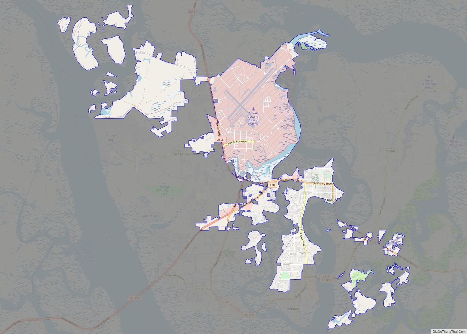
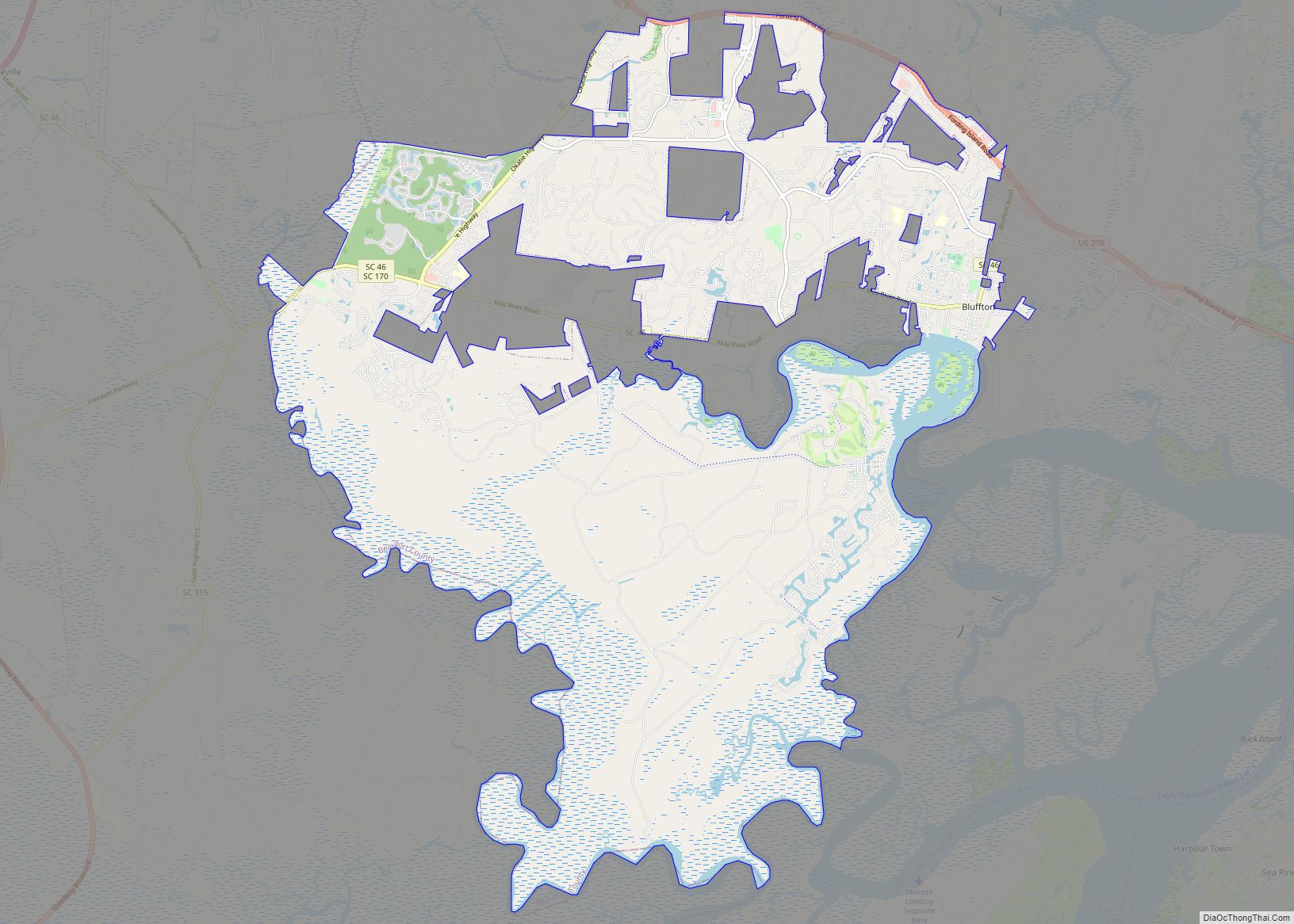
Bluffton Road Map
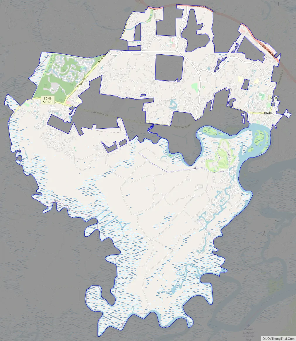
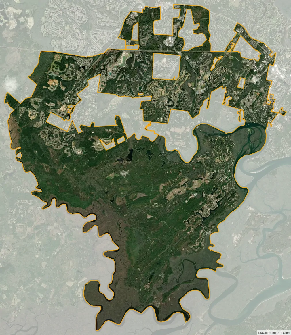
Bluffton city Satellite Map
Geography
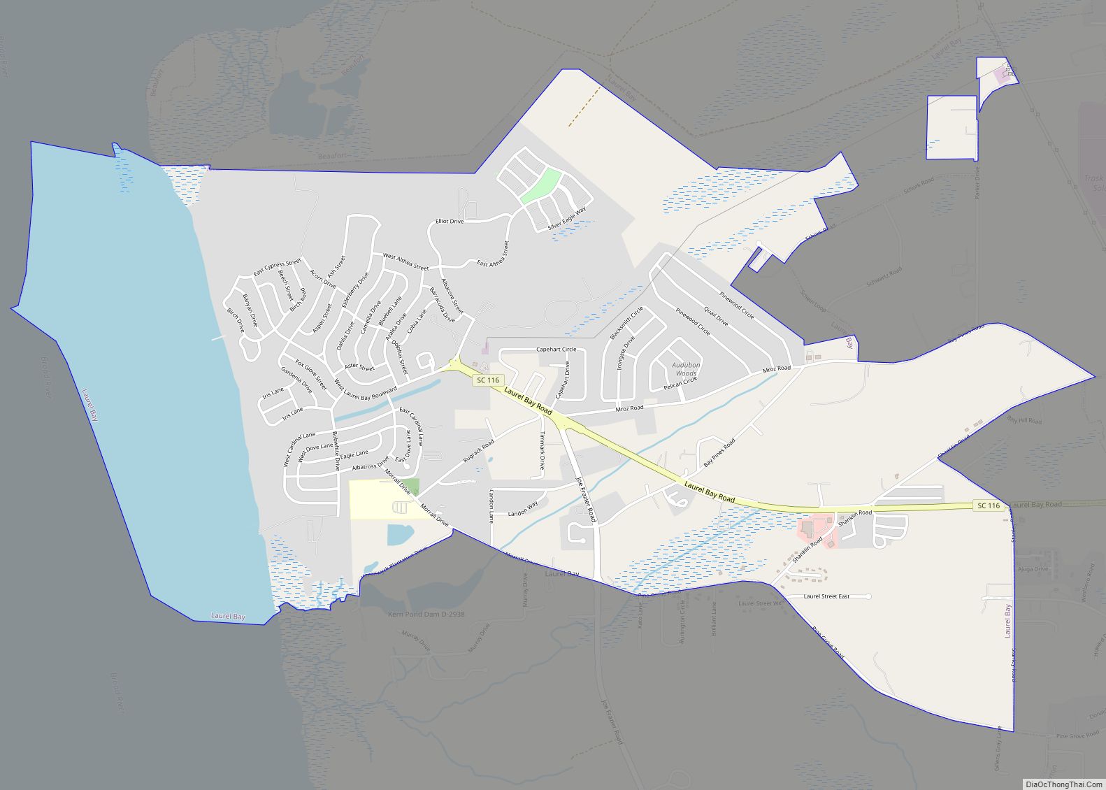
Bluffton was once mostly wetlands, many of which were drained possibly during the antebellum era. Agriculture and pine timber harvesting contributed to the landscape still present today. The town proper consists of five primary areas. The historic district of Old Town, on the northern bluff of the May River; Palmetto Bluff, located on the southern side of the May River; Jones Estate, situated along the New River; Buckwalter, located on the northwest side of town; and Shultz Tract, north of Old Town. The May River winds through the center of town. The New River forms the southwest boundary of the town.
Topography
The town of Bluffton has a total area of 54 square miles (141 km), of which 52.2 square miles (135.3 km) is land and 2.2 square miles (5.7 km) is water. Bluffton is the fifth largest municipality in South Carolina by land area. The municipal boundary contains many large “doughnut holes” of unincorporated territory due to South Carolina’s strict annexation laws. Most of Bluffton was undeveloped land until the housing boom of the early 2000s, which led to explosive growth in Bluffton’s area. Many of Bluffton’s planned unit developments were built during this time. As of 2012 many of these developments remain only partially complete due to the economic downturn.
Climate
Bluffton has a humid subtropical climate (Köppen Cfa), with very mild winters, hot, humid summers, and significant rainfall all year long. August is the wettest month; almost half of the annual rainfall occurs during the summer months in the form of thundershowers. Fall remains relatively warm through November. Winter is short and mild, and is characterized by occasional rain. Snow flurries rarely occur. The highest temperature recorded was 107 °F (42 °C), in 1986, and the lowest temperature recorded was 4 °F (−16 °C) on January 21, 1985. Hurricanes are a major threat to the area during the summer and early fall but there has not been a major hurricane event in Bluffton since the Category 3 Sea Islands Hurricane in 1893.
See also
Map of South Carolina State and its subdivision:- Abbeville
- Aiken
- Allendale
- Anderson
- Bamberg
- Barnwell
- Beaufort
- Berkeley
- Calhoun
- Charleston
- Cherokee
- Chester
- Chesterfield
- Clarendon
- Colleton
- Darlington
- Dillon
- Dorchester
- Edgefield
- Fairfield
- Florence
- Georgetown
- Greenville
- Greenwood
- Hampton
- Horry
- Jasper
- Kershaw
- Lancaster
- Laurens
- Lee
- Lexington
- Marion
- Marlboro
- McCormick
- Newberry
- Oconee
- Orangeburg
- Pickens
- Richland
- Saluda
- Spartanburg
- Sumter
- Union
- Williamsburg
- York
- Alabama
- Alaska
- Arizona
- Arkansas
- California
- Colorado
- Connecticut
- Delaware
- District of Columbia
- Florida
- Georgia
- Hawaii
- Idaho
- Illinois
- Indiana
- Iowa
- Kansas
- Kentucky
- Louisiana
- Maine
- Maryland
- Massachusetts
- Michigan
- Minnesota
- Mississippi
- Missouri
- Montana
- Nebraska
- Nevada
- New Hampshire
- New Jersey
- New Mexico
- New York
- North Carolina
- North Dakota
- Ohio
- Oklahoma
- Oregon
- Pennsylvania
- Rhode Island
- South Carolina
- South Dakota
- Tennessee
- Texas
- Utah
- Vermont
- Virginia
- Washington
- West Virginia
- Wisconsin
- Wyoming