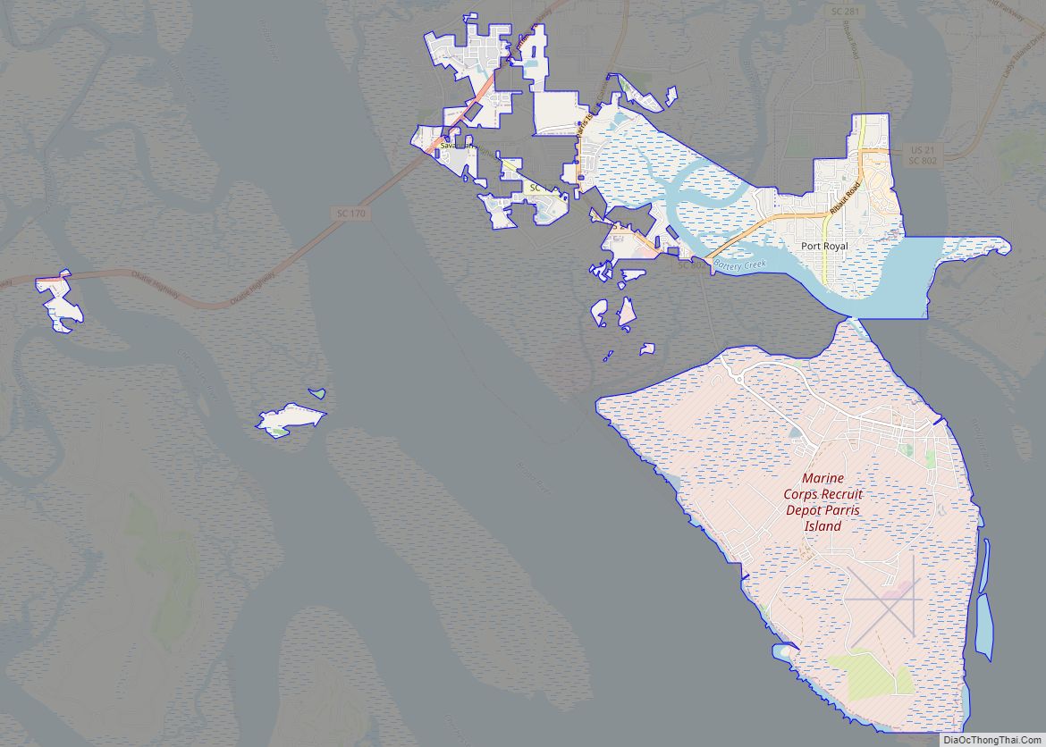
Port Royal is a town on Port Royal Island in Beaufort County, South Carolina, United States. The population was 14,220 at the 2020 census. It is part of the Hilton Head Island–Bluffton metropolitan area. Port Royal is home to Marine Corps Recruit Depot Parris Island and United States Naval Hospital Beaufort.
| Name: | Port Royal town |
|---|---|
| LSAD Code: | 43 |
| LSAD Description: | town (suffix) |
| State: | South Carolina |
| County: | Beaufort County |
| Elevation: | 23 ft (7 m) |
| Land Area: | 16.96 sq mi (43.94 km²) |
| Water Area: | 2.59 sq mi (6.70 km²) |
| Population Density: | 838.20/sq mi (323.63/km²) |
| ZIP code: | 29935 |
| Area code: | 843, 854 |
| FIPS code: | 4558030 |
| GNISfeature ID: | 1250223 |
| Website: | www.portroyal.org |
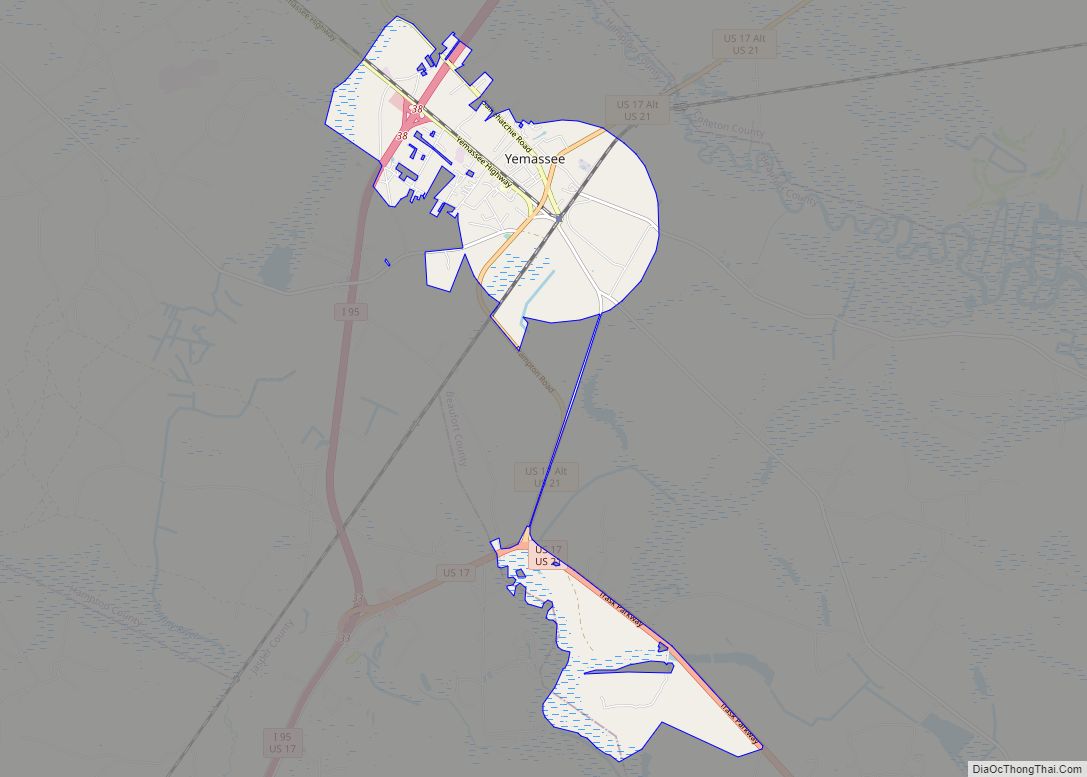
Online Interactive Map
Click on ![]() to view map in "full screen" mode.
to view map in "full screen" mode.
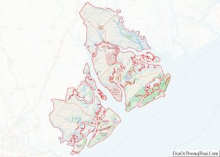
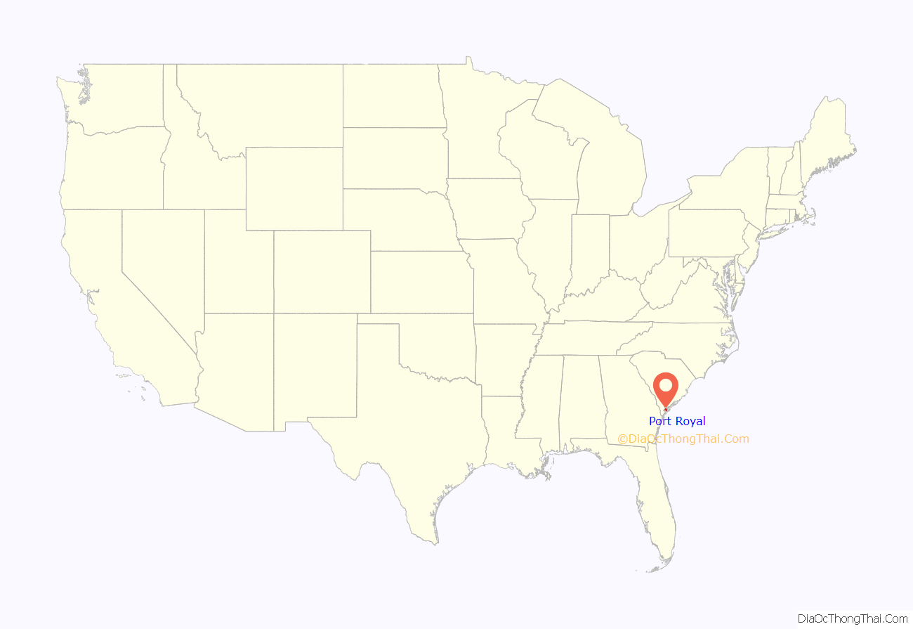
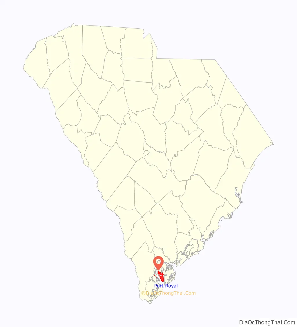
Port Royal location map. Where is Port Royal town?
History
Port Royal takes its name from the adjacent Port Royal Sound, which was explored and named by Frenchman Jean Ribault in 1562. Ribault founded the short-lived settlement of Charlesfort on Parris Island. The area later became the site of a Spanish and still later Scottish colony during the 17th century.
Port Royal was the site of the Naval Battle of Port Royal during the Civil War. Later during the war, it was the one of the sites of the Port Royal Experiment, which included most of the Sea Islands in Union hands. In 1863, the Emancipation Proclamation was first read at Christmas under the Proclamation tree in Port Royal.
Due to the benefits of a large and sheltered natural harbor, Port Royal was able to develop port facilities to support the growing phosphate mining activities after the Civil War. The Port Royal Railroad was completed from Port Royal to a junction with the main Charleston and Savannah Railway in Yemassee, thus establishing a land route for trade and commerce. Port Royal was the southeastern terminus of the Charleston and Western Carolina Railway, the railroad last had passenger trains to Port Royal in the mid-1950s. Development of a community around the previously isolated port site at the end of the Beaufort River and Battery Creek led to the platting of streets and town lots by development interests. A land rush ensued, and Port Royal was officially incorporated in 1874, 300 years after initial settlement efforts.
The Sea Islands Hurricane of 1893 destroyed much of the phosphate industry and stunted development, but the port continued to operate throughout the 20th century. The opening of Parris Island as a Marine Corps recruiting station brought some vitality back to the community, though rapid residential growth did not occur until the later decades of the 20th century. The port’s vitality however began to decline as the State of South Carolina began to focus on dredging Charleston’s harbor and expanding port facilities further up the coast. In an effort to save costs, the State Ports Authority closed the port facility in Port Royal in 2004. Efforts to redevelop have been ongoing but been hampered by the Great Recession. Due to annexation, including Parris Island, the population of Port Royal rose from 3,950 in 2000 to 10,678 in 2010, a 170% increase.
The Camp Saxton Site, Fort Frederick Heritage Preserve, Hasell Point Site, Little Barnwell Island, F.W. Scheper Store, and Union Church of Port Royal are listed on the National Register of Historic Places.
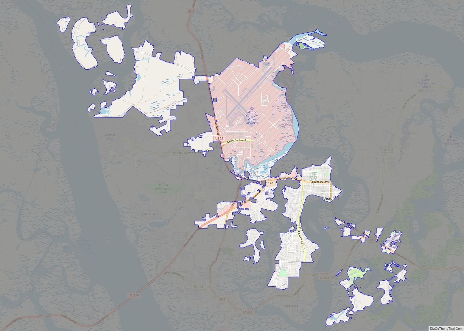
Port Royal Road Map

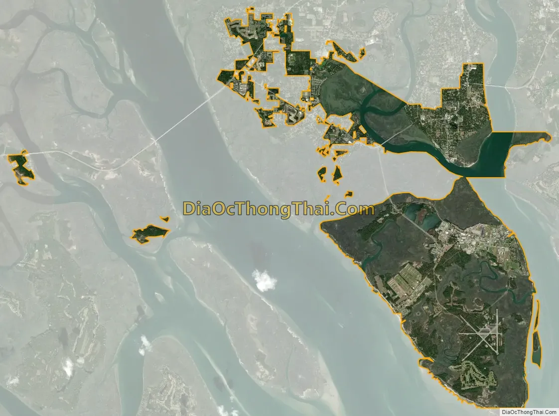
Port Royal city Satellite Map
Geography
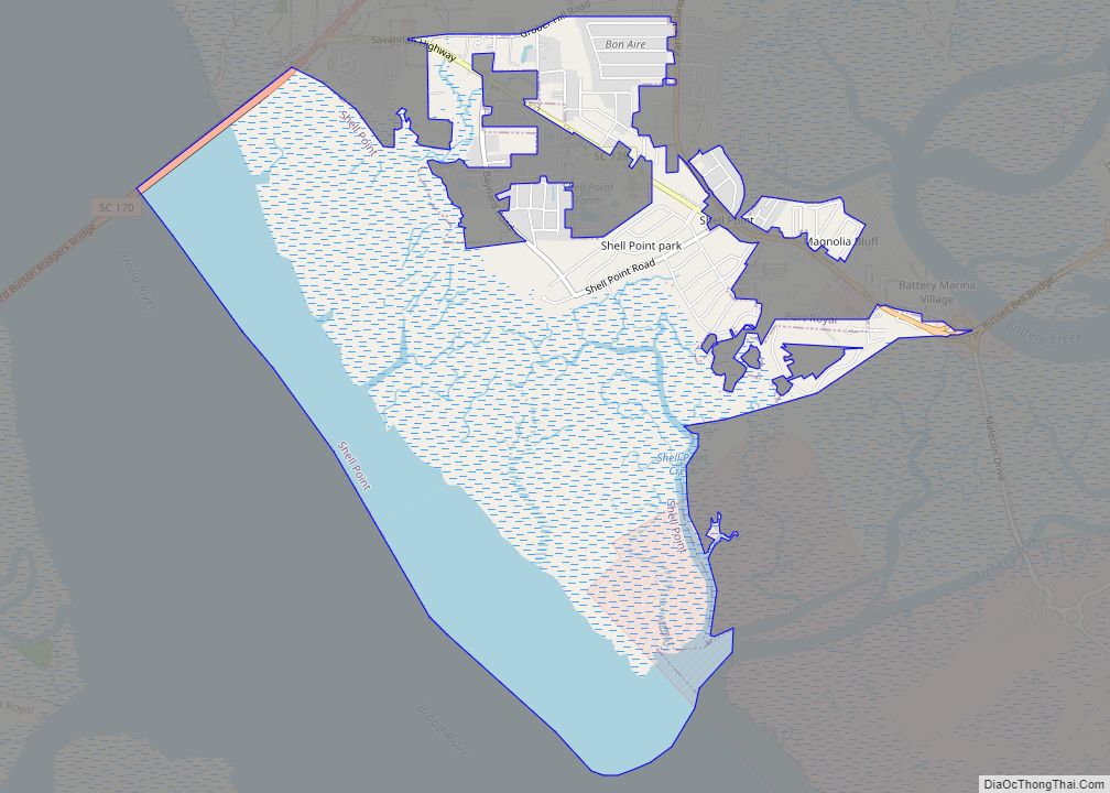
Port Royal has expanded in recent times by annexation of parcels of land on the west side of Battery Creek.
According to the United States Census Bureau, the town has a total area of 22.0 square miles (57.0 km), of which 19.0 square miles (49.1 km) is land and 3.1 square miles (7.9 km), or 13.92%, is water.
See also
Map of South Carolina State and its subdivision:- Abbeville
- Aiken
- Allendale
- Anderson
- Bamberg
- Barnwell
- Beaufort
- Berkeley
- Calhoun
- Charleston
- Cherokee
- Chester
- Chesterfield
- Clarendon
- Colleton
- Darlington
- Dillon
- Dorchester
- Edgefield
- Fairfield
- Florence
- Georgetown
- Greenville
- Greenwood
- Hampton
- Horry
- Jasper
- Kershaw
- Lancaster
- Laurens
- Lee
- Lexington
- Marion
- Marlboro
- McCormick
- Newberry
- Oconee
- Orangeburg
- Pickens
- Richland
- Saluda
- Spartanburg
- Sumter
- Union
- Williamsburg
- York
- Alabama
- Alaska
- Arizona
- Arkansas
- California
- Colorado
- Connecticut
- Delaware
- District of Columbia
- Florida
- Georgia
- Hawaii
- Idaho
- Illinois
- Indiana
- Iowa
- Kansas
- Kentucky
- Louisiana
- Maine
- Maryland
- Massachusetts
- Michigan
- Minnesota
- Mississippi
- Missouri
- Montana
- Nebraska
- Nevada
- New Hampshire
- New Jersey
- New Mexico
- New York
- North Carolina
- North Dakota
- Ohio
- Oklahoma
- Oregon
- Pennsylvania
- Rhode Island
- South Carolina
- South Dakota
- Tennessee
- Texas
- Utah
- Vermont
- Virginia
- Washington
- West Virginia
- Wisconsin
- Wyoming