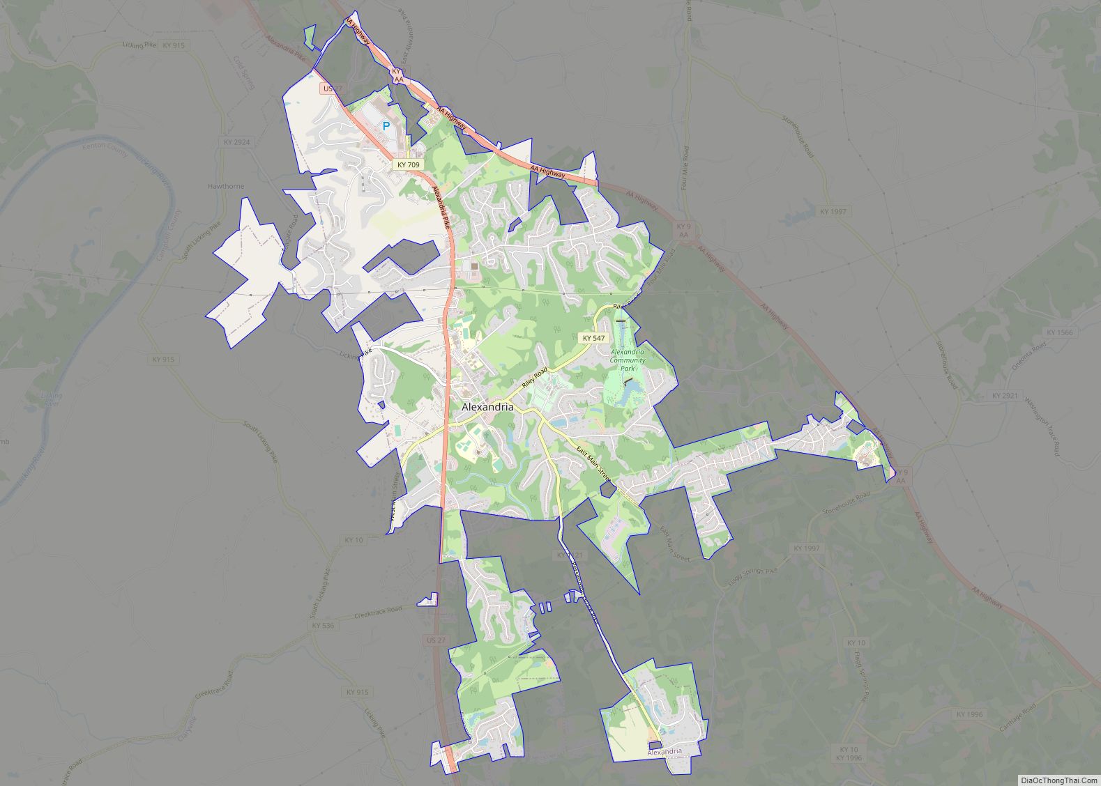
Campbell County is a county located in the northern part of the U.S. state of Kentucky. As of the 2020 census, the population was 93,076. Its county seats are Alexandria and Newport. The county was formed on December 17, 1794, from sections of Scott, Harrison, and Mason Counties and was named for Colonel John Campbell (1735–1799), a Revolutionary War soldier and Kentucky legislator. Campbell County, with Boone and Kenton Counties, is part of the Northern Kentucky metro community, and the Cincinnati-Middletown, OH-KY-IN Metropolitan Statistical Area.
| Name: | Campbell County |
|---|---|
| FIPS code: | 21-037 |
| State: | Kentucky |
| Founded: | December 17, 1794 |
| Named for: | John Campbell |
| Seat: | Alexandria and Newport |
| Largest city: | Fort Thomas |
| Total Area: | 159 sq mi (410 km²) |
| Land Area: | 151 sq mi (390 km²) |
| Total Population: | 93,076 |
| Population Density: | 590/sq mi (230/km²) |
| Time zone: | UTC−5 (Eastern) |
| Summer Time Zone (DST): | UTC−4 (EDT) |
| Website: | www.campbellcountyky.gov |
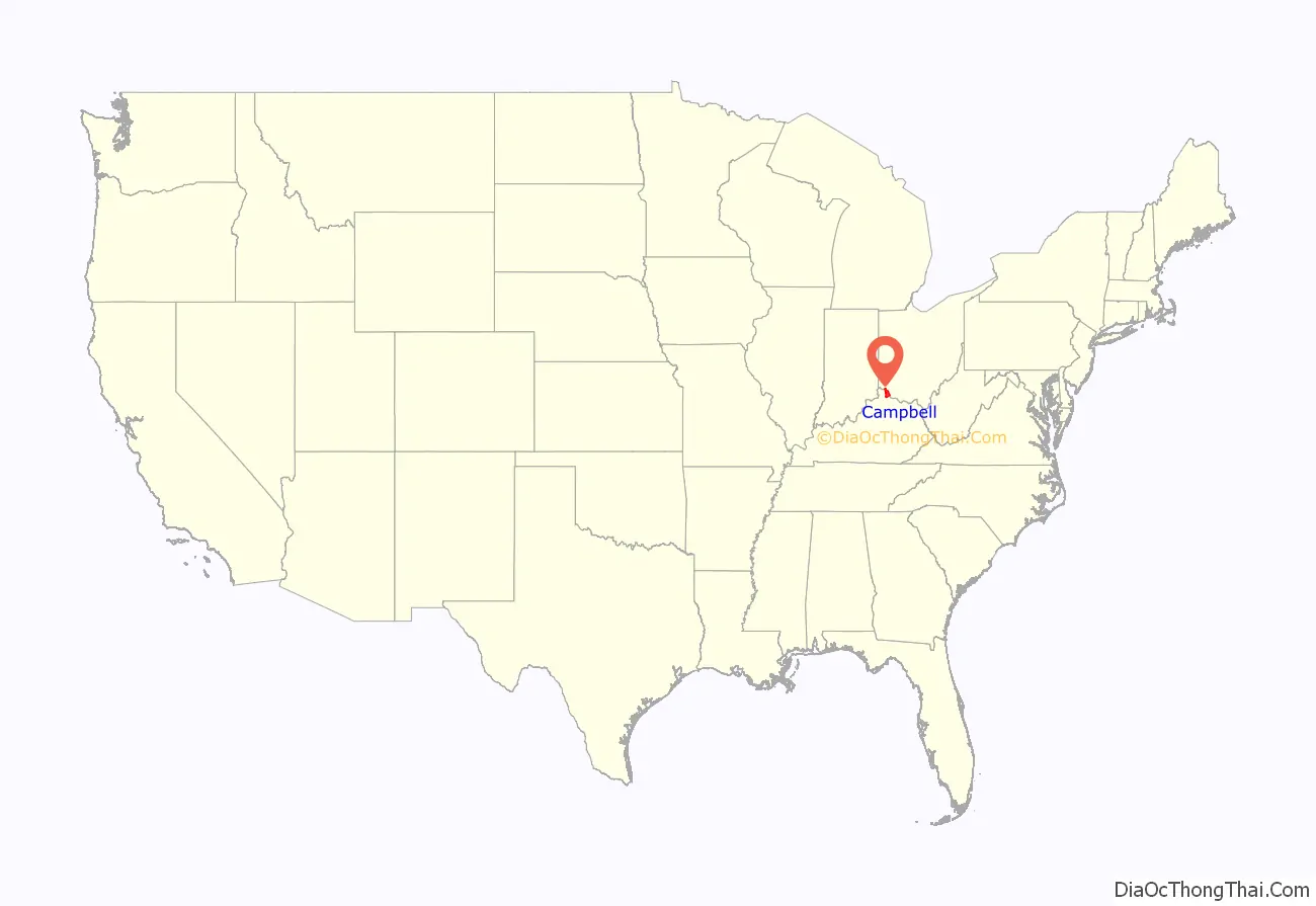
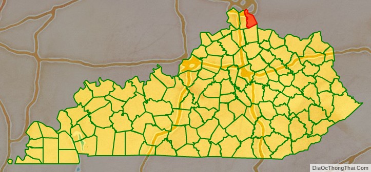
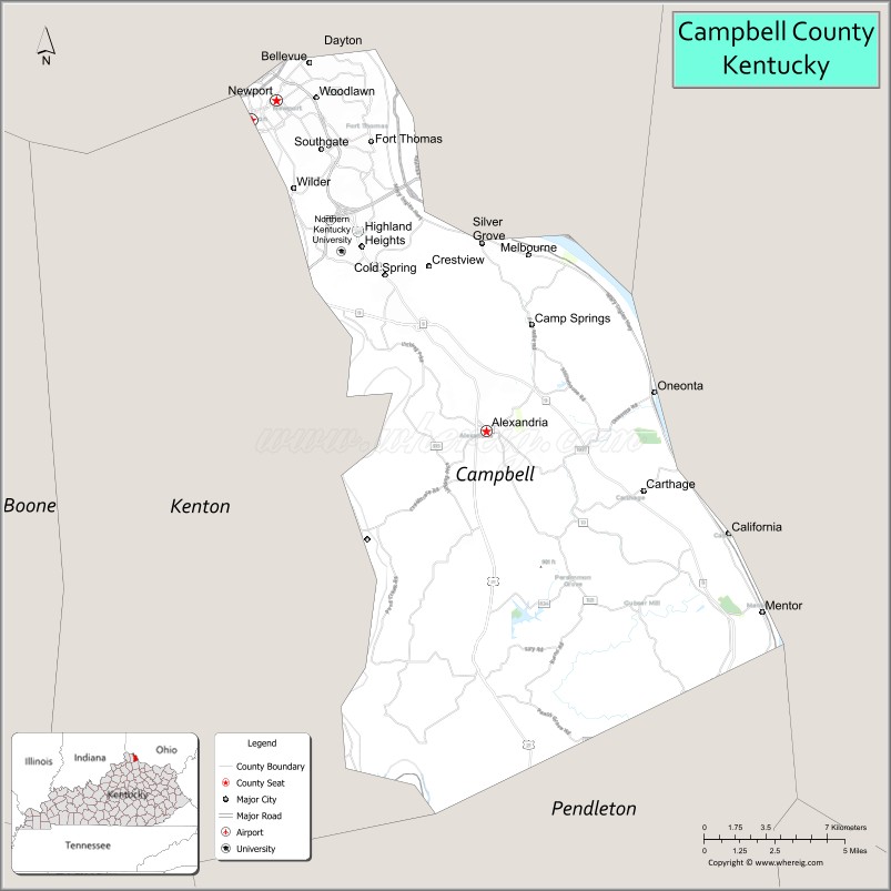
Campbell County location map. Where is Campbell County?
History
Campbell County was founded December 17, 1794, two years after the creation of the Commonwealth of Kentucky, becoming the state’s 19th county. Campbell County was carved out of Scott, Harrison and Mason counties. The original county included all of present Boone, Kenton, Pendleton, and most of Bracken and Grant counties. Campbell County is named in honor of John Campbell, an Irish immigrant who was a soldier, explorer, statesman and one of the drafters of the Kentucky Constitution.
The first courthouse, built of logs, was replaced in 1815 by a brick structure. The present courthouse dates from 1884.
County seat
Wilmington, a pioneer settlement, was the original county seat of Campbell County from 1794 until 1797. The original justices in the Campbell County Court were John Roberts, Thomas Kennedy, Samuel Bryan, John Cook, James Little, Robert Benham and John Bush. Newport was designated as the county seat until 1823, when it was moved to Visalia, at that time closer to the geographical center of the county. This was an unpopular action, however, as the overwhelming majority of residents lived in the north, along the Ohio River. The county court returned to Newport in 1824 and remained there until 1840.
In 1840, Kenton County was created, primarily out of a significant portion of Campbell. The Kentucky General Assembly forced the county to move its seat to Alexandria, closer to the center of the new, smaller Campbell County. In 1883, after years of lobbying, the General Assembly established a special provision to allow Newport to designate a Court House District separate from the offices in Alexandria.
The special Courthouse Commission legislation led to the misconception that the county was dual seated, but Alexandria remained the sole de jure county seat. It was not until November 24, 2010, that a court ruling granted Newport equal status as a county seat.
Campbell County Road Map
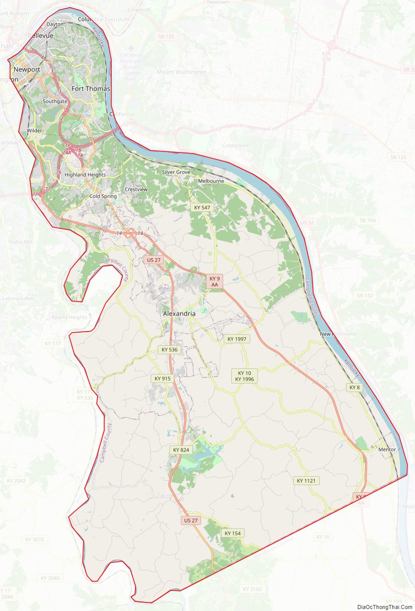
Geography
According to the United States Census Bureau, the county has a total area of 159 square miles (410 km), of which 151 square miles (390 km) is land and 8.1 square miles (21 km) (5.1%) is water. It is the fourth-smallest county in Kentucky by land area and fifth-smallest by total area. It lies along the Ohio and Licking Rivers.
Adjacent counties
- Hamilton County, Ohio (north)
- Clermont County, Ohio (east)
- Pendleton County (south)
- Kenton County (west)
Major highways
- I-275
- I-471
- US 27
- KY 8
- KY 9
- KY 10
- KY 154
- KY 536
- KY 547
- KY 824
- KY 915
- KY 1120
- KY 1121
- KY 1566
- KY 1632
- KY 1936
- KY 1996
- KY 1997
- KY 1998
- KY 2345
- KY 2376
- KY 2828
- KY 2921
- KY 2924
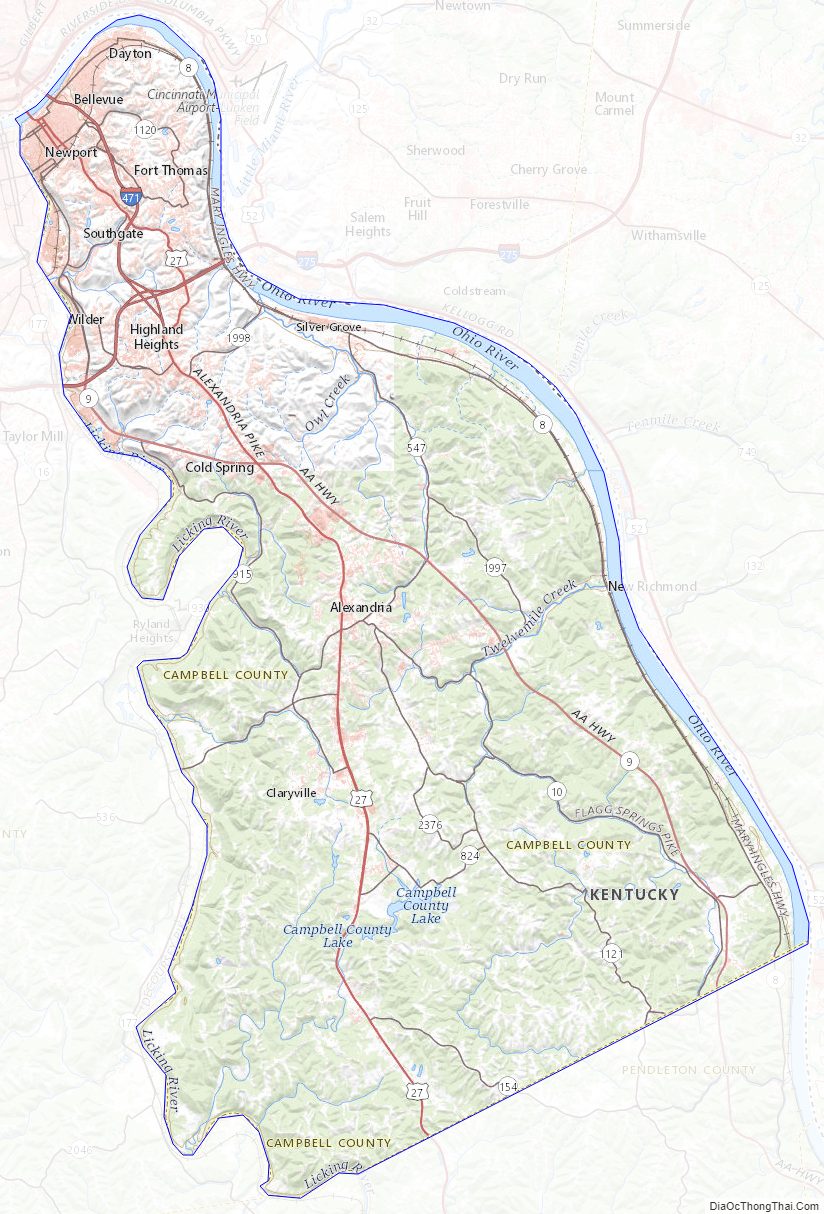
Campbell County Topographic Map
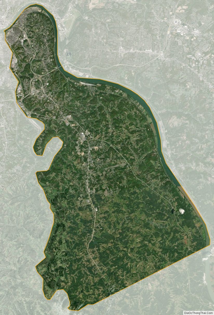
Campbell County Satellite Map
Campbell County Outline Map