Pendleton County is a county located in the U.S. state of Kentucky. As of the 2020 census, the population was 14,644. Its county seat is Falmouth. The county was founded December 13, 1798. Pendleton County is included in the Cincinnati-Middletown, OH-KY-IN Metropolitan Statistical Area.
| Name: | Pendleton County |
|---|---|
| FIPS code: | 21-191 |
| State: | Kentucky |
| Founded: | 1798 |
| Named for: | Edmund Pendleton |
| Seat: | Falmouth |
| Largest city: | Falmouth |
| Total Area: | 282 sq mi (730 km²) |
| Land Area: | 277 sq mi (720 km²) |
| Total Population: | 14,644 |
| Population Density: | 52/sq mi (20/km²) |
| Time zone: | UTC−5 (Eastern) |
| Summer Time Zone (DST): | UTC−4 (EDT) |
| Website: | pendletoncounty.ky.gov |
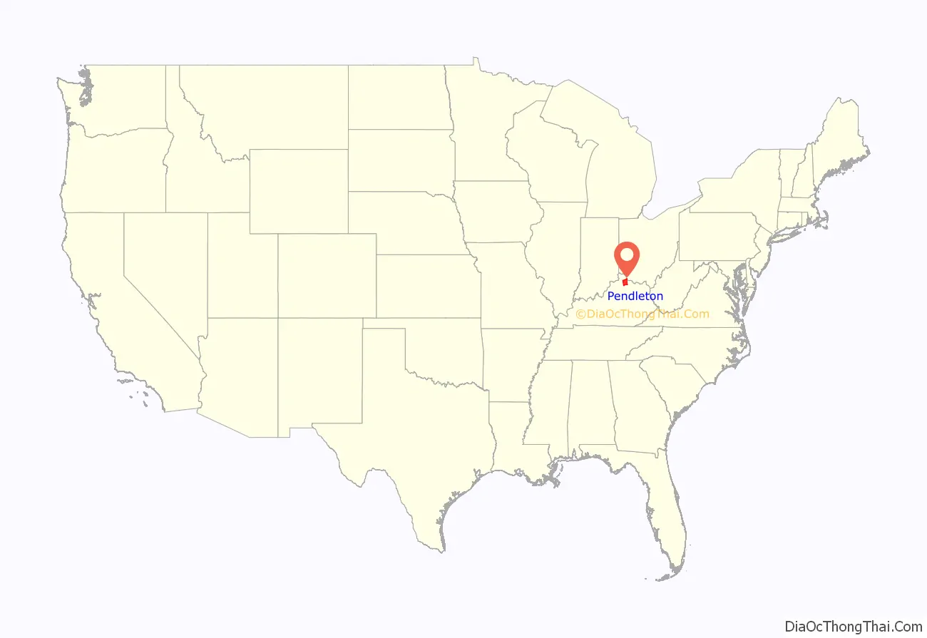
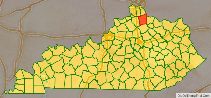
Pendleton County location map. Where is Pendleton County?
History
Pendleton County was created from parts of Campbell and Bracken counties in 1798. The county was named after Edmund Pendleton, a longtime member of the Virginia House of Burgesses, the Continental Congress and chief justice of Virginia.
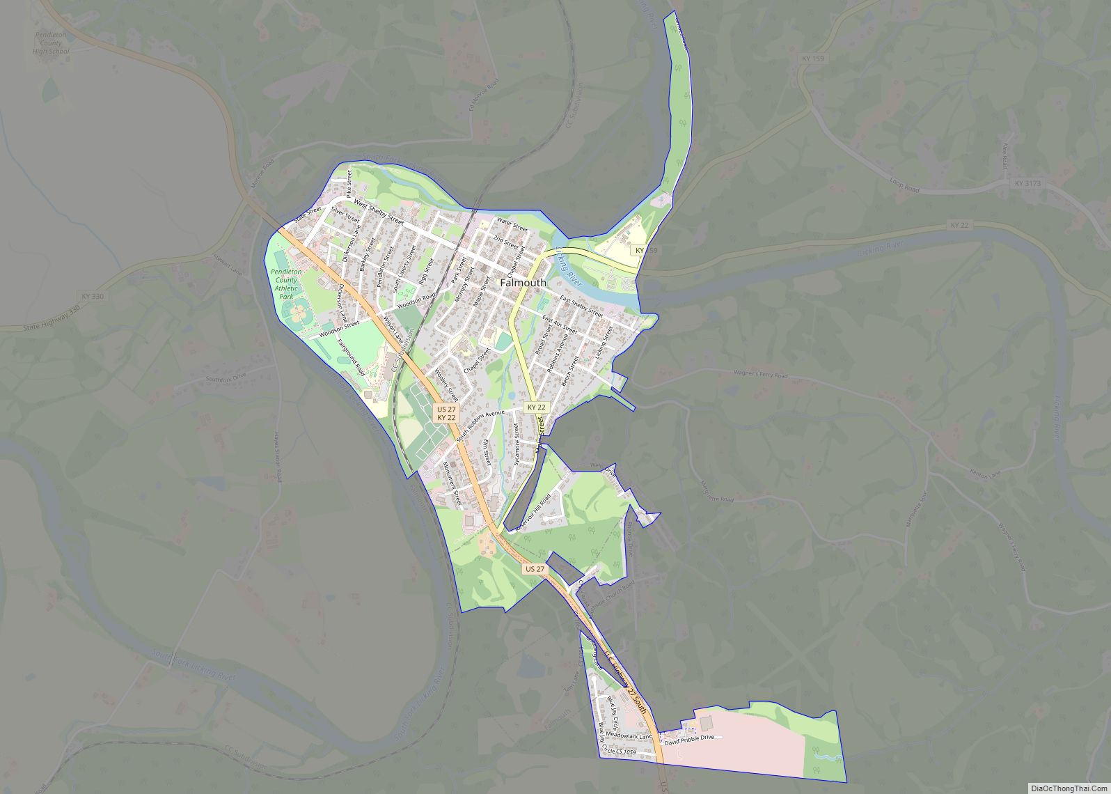
Falmouth, the future county seat, began as a settlement called Forks of Licking, c. 1776.
Falmouth was chartered in 1793. Its name originated from the Virginians who settled there from Falmouth, Virginia. It was also in 1793 that one of the first sawmills in Kentucky was built in Falmouth. Falmouth was designated the county seat in 1799. The county courthouse was erected in 1848.
During the American Civil War, the county sent men to both armies. A Union Army recruiting camp was established in Falmouth in September 1861. Two Confederate recruiters were captured and executed by the Union Army in the Peach Grove area of northern Pendleton County. In July 1862, a number of county citizens were rounded up by Union troops during a crackdown against suspected Confederate sympathizers. In June 1863, a number of women were arrested at Demossville because they were believed to be potential spies dangerous to the Federal government. Falmouth was the site of a small skirmish on September 18, 1862, between twenty-eight Confederates and eleven Home Guardsmen.
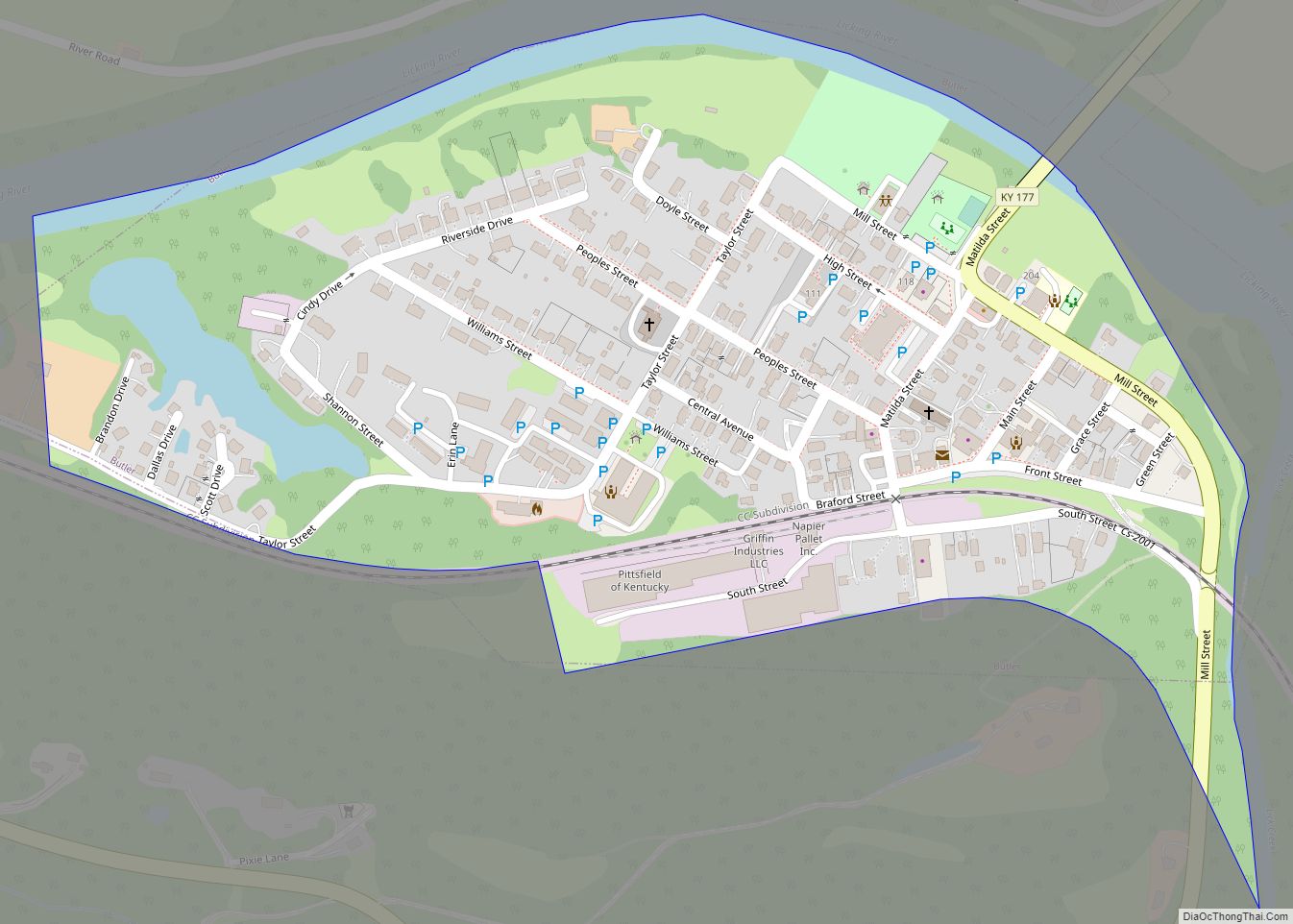
The city of Butler was established c. 1852 when the Kentucky Central Railroad was built through the area. The city was named for William O. Butler, U.S. congressman from the area, when it was incorporated on February 1, 1868.
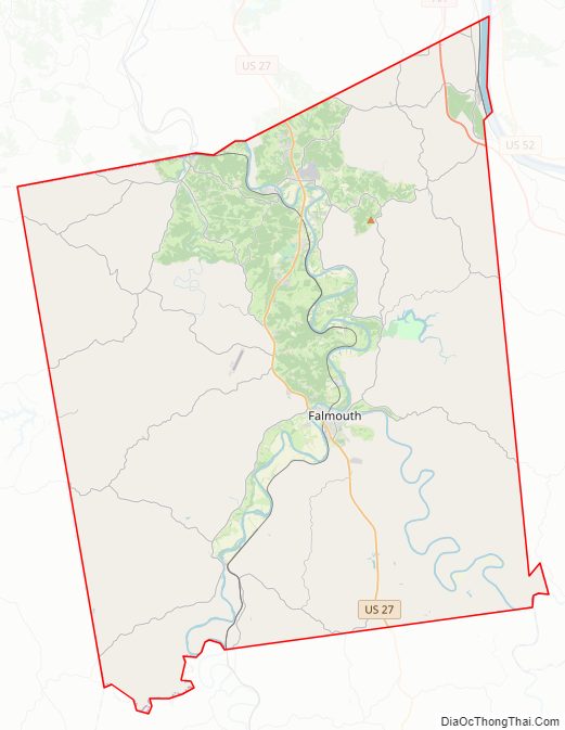
Pendleton County Road Map
Geography
According to the United States Census Bureau, the county has a total area of 282 square miles (730 km), of which 277 square miles (720 km) is land and 4.8 square miles (12 km) (1.7%) is water. The county’s northeastern border with Ohio is formed by the Ohio River.
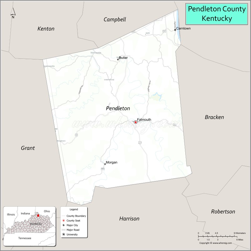
Adjacent counties
- Kenton County (northwest)
- Campbell County (north)
- Clermont County, Ohio (northeast)
- Bracken County (east)
- Harrison County (south)
- Grant County (west)
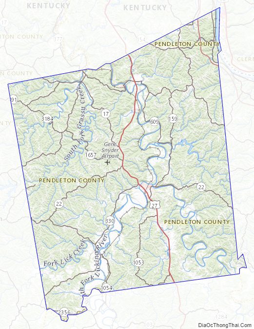
Pendleton County Topographic Map
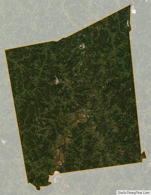
Pendleton County Satellite Map
Pendleton County Outline Map