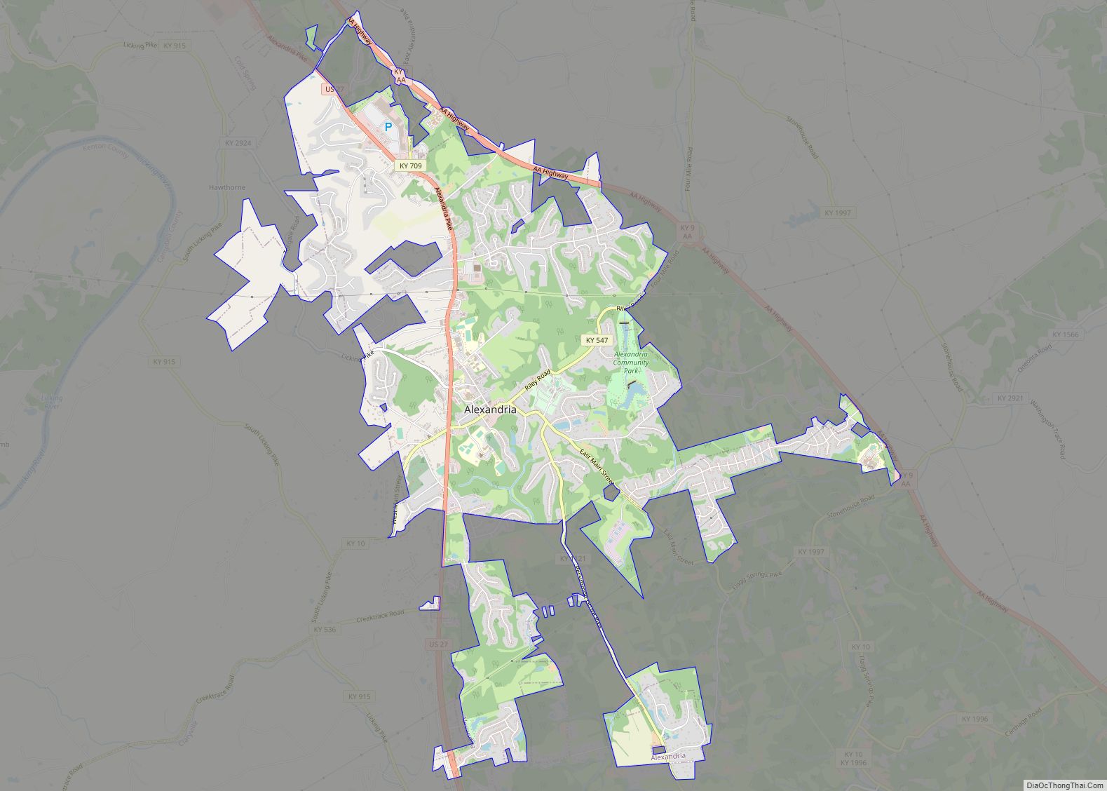
Alexandria is a home rule-class city in Campbell County, Kentucky, in the United States. Along with Newport, it is one of the dual seats of the county. The population was 10,341 at the 2020 census.
| Name: | Alexandria city |
|---|---|
| LSAD Code: | 25 |
| LSAD Description: | city (suffix) |
| State: | Kentucky |
| County: | Campbell County |
| Elevation: | 883 ft (269 m) |
| Total Area: | 6.96 sq mi (18.02 km²) |
| Land Area: | 6.93 sq mi (17.94 km²) |
| Water Area: | 0.03 sq mi (0.08 km²) |
| Total Population: | 10,341 |
| Population Density: | 1,493.07/sq mi (576.45/km²) |
| ZIP code: | 41001 |
| Area code: | 859 |
| FIPS code: | 2100802 |
| GNISfeature ID: | 0485831 |
| Website: | alexandriaky.org |
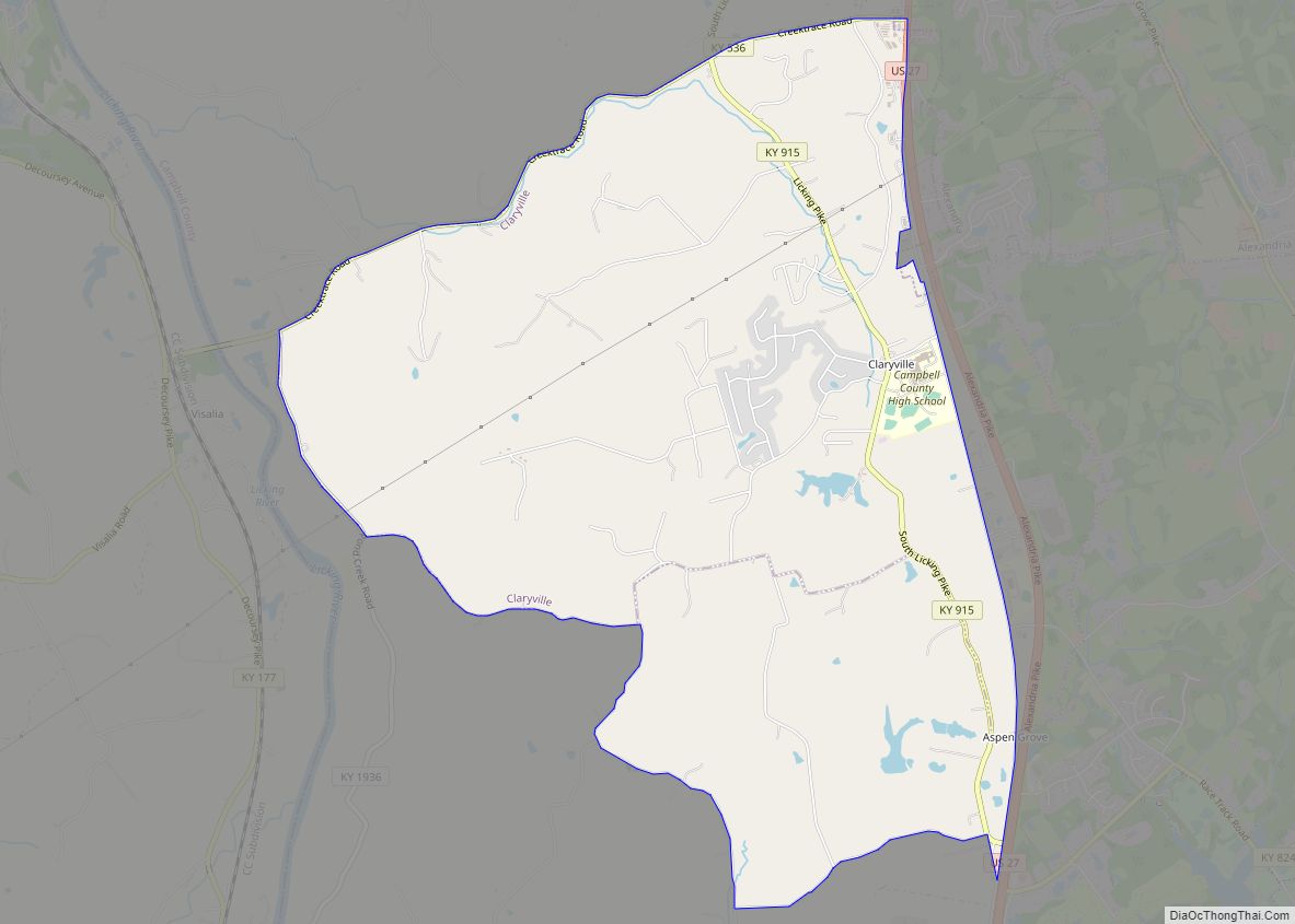
Online Interactive Map
Click on ![]() to view map in "full screen" mode.
to view map in "full screen" mode.
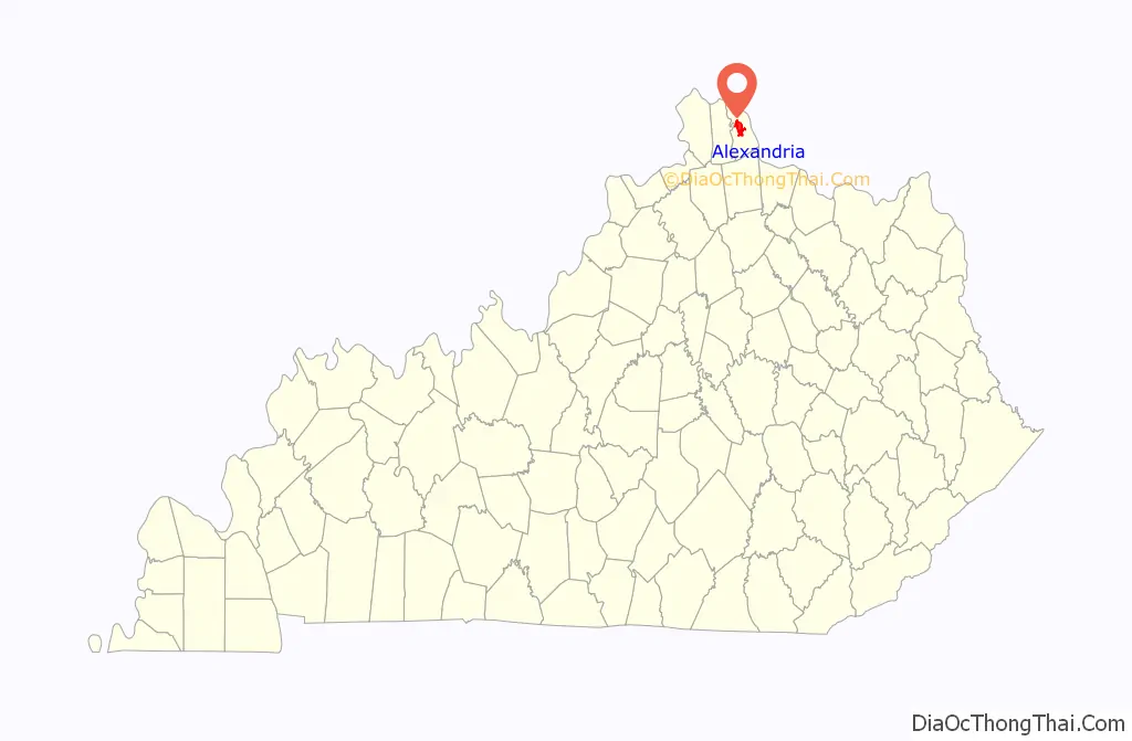
Alexandria location map. Where is Alexandria city?

History
It is believed that the area that is now Alexandria was first settled by Frank Spilman and his family c. 1793. The Spilman family was from King George County, Virginia, and they may have named their settlement after Alexandria, Virginia. The family had begun developing and selling lots in the settlement by 1819, the year the first post office was established. On February 22, 1834, Alexandria was formally established by an act of the state assembly.
When the Kentucky General Assembly formed Kenton County from part of Campbell County in 1840, they moved Campbell’s county seat from Newport to Alexandria, which was closer to the center of the redrawn county. The citizens of Alexandria quickly constructed a county courthouse but, because the majority of the county’s population lived in Newport, the move was not a popular one and it took a court order and a visit from the sheriff to get the county clerk to move.
The city of Alexandria was formally incorporated by act of the state assembly in 1856.
In 1883, Newport successfully lobbied for its own Court House District, allowing it to retain a Court House Commission with taxing authority and various county offices in addition to those maintained at Alexandria. A new courthouse was established in Newport in 1884, and the county’s fiscal court and judicial offices operated out of this while other administrative offices remained in Alexandria. Nonetheless, the county was not dual seated until 2010.
Pro wrestler B. J. Whitmer resides in Alexandria.
Alexandria Road Map
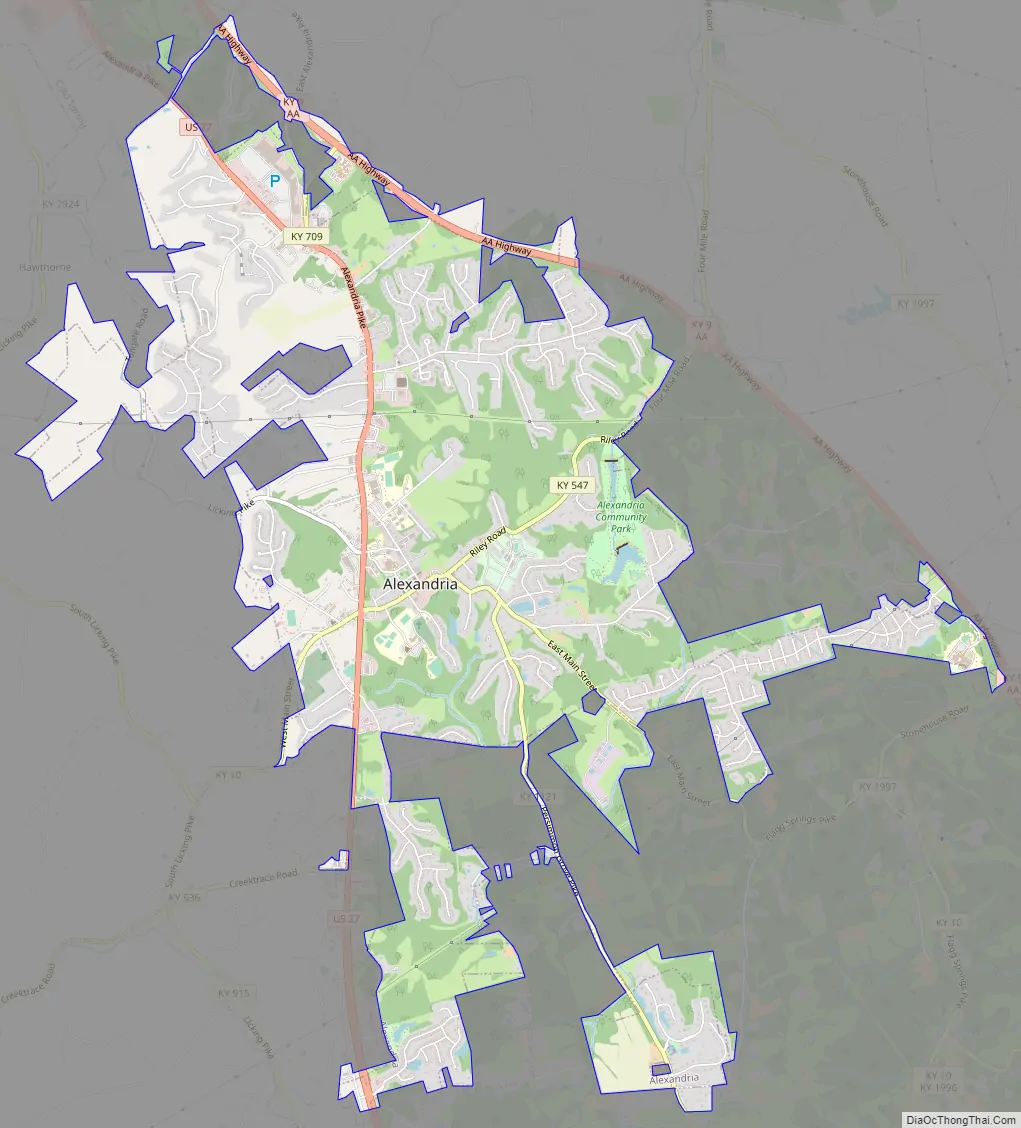
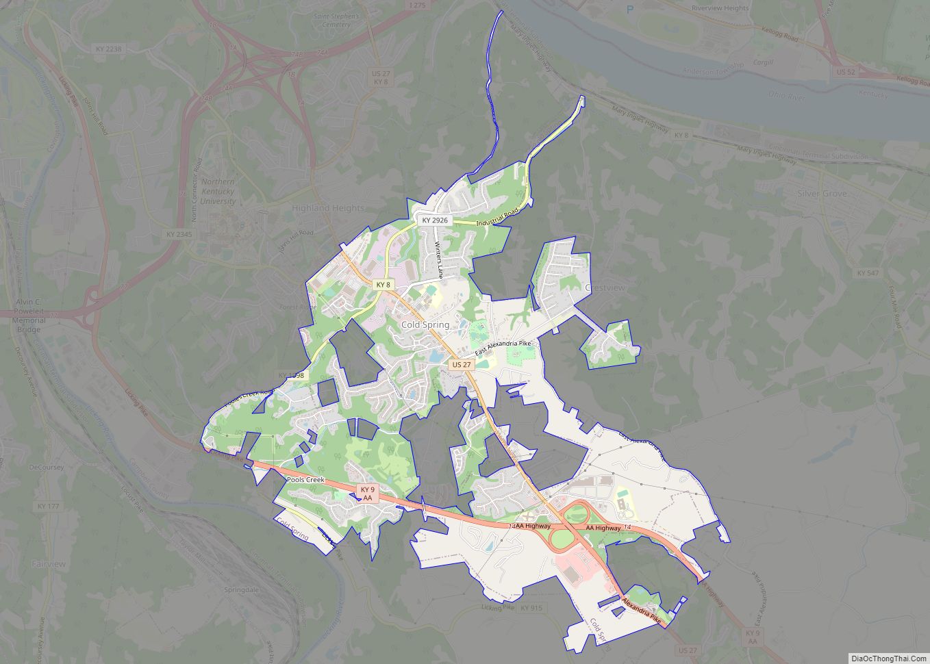
Alexandria city Satellite Map

Geography
Alexandria is located near the geographic center of Campbell County at 38°57′32″N 84°23′21″W / 38.95889°N 84.38917°W / 38.95889; -84.38917 (38.958947, −84.389290).
According to the United States Census Bureau, the city has a total area of 6.9 square miles (18.0 km), of which 6.9 square miles (17.9 km) is land and 0.04 square miles (0.1 km), or 0.05%, is water. The city is 14 miles (23 km) south of Cincinnati, Ohio, on U.S. Route 27. Kentucky Route 9, a four-lane limited access highway, follows the northeastern boundary of Alexandria and leads 47 miles (76 km) southeast to Maysville.
See also
Map of Kentucky State and its subdivision:- Adair
- Allen
- Anderson
- Ballard
- Barren
- Bath
- Bell
- Boone
- Bourbon
- Boyd
- Boyle
- Bracken
- Breathitt
- Breckinridge
- Bullitt
- Butler
- Caldwell
- Calloway
- Campbell
- Carlisle
- Carroll
- Carter
- Casey
- Christian
- Clark
- Clay
- Clinton
- Crittenden
- Cumberland
- Daviess
- Edmonson
- Elliott
- Estill
- Fayette
- Fleming
- Floyd
- Franklin
- Fulton
- Gallatin
- Garrard
- Grant
- Graves
- Grayson
- Green
- Greenup
- Hancock
- Hardin
- Harlan
- Harrison
- Hart
- Henderson
- Henry
- Hickman
- Hopkins
- Jackson
- Jefferson
- Jessamine
- Johnson
- Kenton
- Knott
- Knox
- Larue
- Laurel
- Lawrence
- Lee
- Leslie
- Letcher
- Lewis
- Lincoln
- Livingston
- Logan
- Lyon
- Madison
- Magoffin
- Marion
- Marshall
- Martin
- Mason
- McCracken
- McCreary
- McLean
- Meade
- Menifee
- Mercer
- Metcalfe
- Monroe
- Montgomery
- Morgan
- Muhlenberg
- Nelson
- Nicholas
- Ohio
- Oldham
- Owen
- Owsley
- Pendleton
- Perry
- Pike
- Powell
- Pulaski
- Robertson
- Rockcastle
- Rowan
- Russell
- Scott
- Shelby
- Simpson
- Spencer
- Taylor
- Todd
- Trigg
- Trimble
- Union
- Warren
- Washington
- Wayne
- Webster
- Whitley
- Wolfe
- Woodford
- Alabama
- Alaska
- Arizona
- Arkansas
- California
- Colorado
- Connecticut
- Delaware
- District of Columbia
- Florida
- Georgia
- Hawaii
- Idaho
- Illinois
- Indiana
- Iowa
- Kansas
- Kentucky
- Louisiana
- Maine
- Maryland
- Massachusetts
- Michigan
- Minnesota
- Mississippi
- Missouri
- Montana
- Nebraska
- Nevada
- New Hampshire
- New Jersey
- New Mexico
- New York
- North Carolina
- North Dakota
- Ohio
- Oklahoma
- Oregon
- Pennsylvania
- Rhode Island
- South Carolina
- South Dakota
- Tennessee
- Texas
- Utah
- Vermont
- Virginia
- Washington
- West Virginia
- Wisconsin
- Wyoming