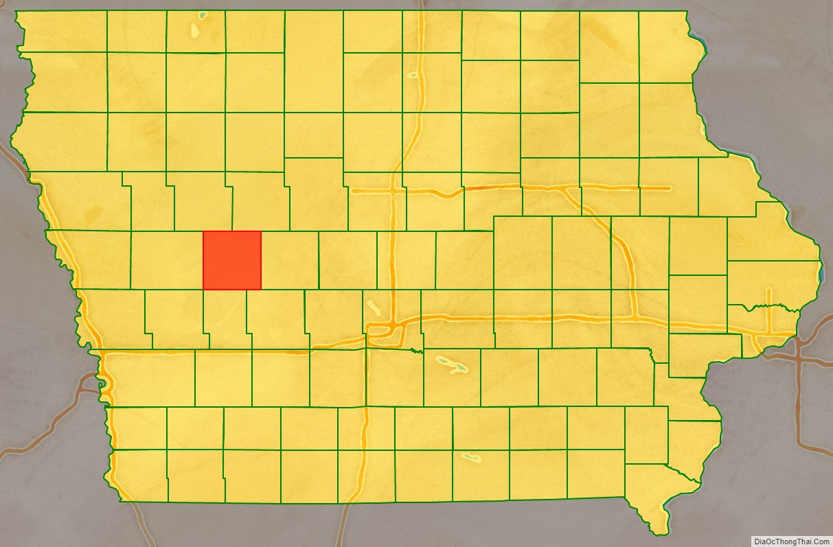
Carroll County is a county located in the U.S. state of Iowa. As of the 2020 census, the population was 20,760. Its county seat is Carroll. The county is named in honor of Charles Carroll of Carrollton, signer of the Declaration of Independence.
| Name: | Carroll County |
|---|---|
| FIPS code: | 19-027 |
| State: | Iowa |
| Founded: | 1851 |
| Named for: | Charles Carroll of Carrollton |
| Seat: | Carroll |
| Largest city: | Carroll |
| Total Area: | 570 sq mi (1,500 km²) |
| Land Area: | 569 sq mi (1,470 km²) |
| Total Population: | 20,760 |
| Population Density: | 36/sq mi (14/km²) |
| Time zone: | UTC−6 (Central) |
| Summer Time Zone (DST): | UTC−5 (CDT) |
| Website: | www.carrollcountyiowa.gov |
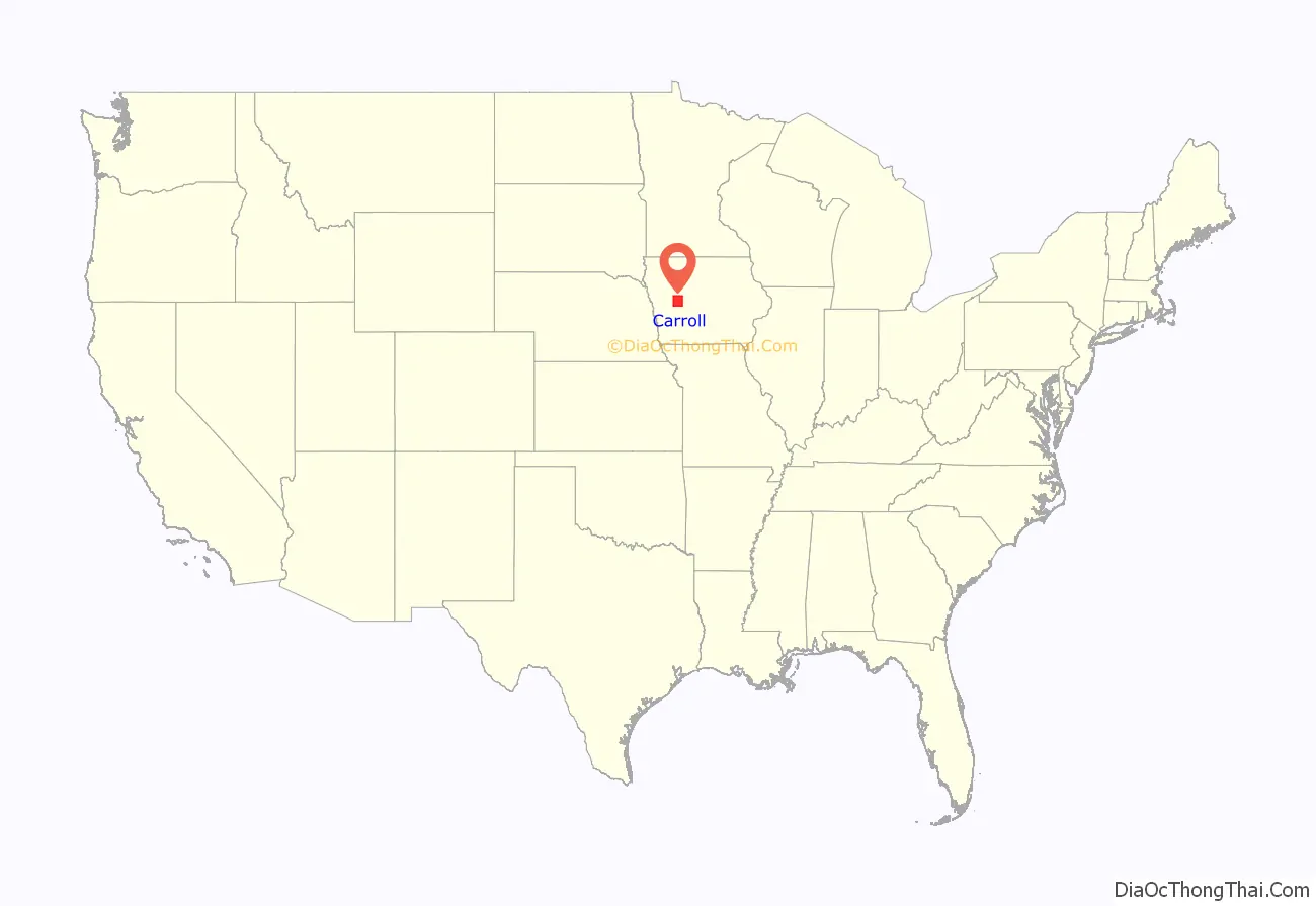
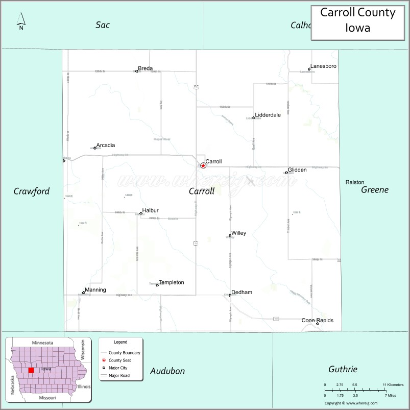
Carroll County location map. Where is Carroll County?
History
Carroll County was formed on January 15, 1851, from sections of Pottawattamie County. It was named after Charles Carroll of Carrollton, Maryland, the only Roman Catholic and longest-living signer of the Declaration of Independence. In 1855, the county government was established in Carrollton and in 1858, the first courthouse was built. In 1869, the seat was moved to Carroll City (today Carroll) which was centrally located and connected to the Chicago and North Western Transportation Company. The courthouse was destroyed in 1886 by fire. The present courthouse was erected in 1965. However the courthouse is set to go under construction in the near future.
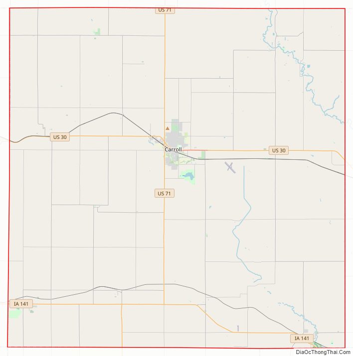
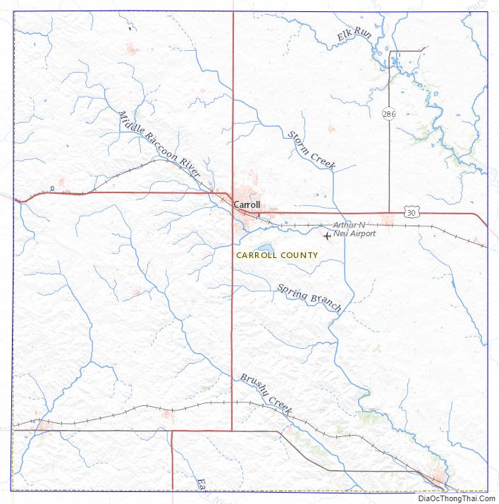
Carroll County Road Map
Geography
According to the U.S. Census Bureau, the county has a total area of 570 square miles (1,500 km), of which 569 square miles (1,470 km) is land and 0.8 square miles (2.1 km) (0.1%) is water.
Major highways
- U.S. Highway 30
- U.S. Highway 71
- Iowa Highway 141
Adjacent counties
- Sac County (northwest)
- Calhoun County (northeast)
- Greene County (east)
- Guthrie County (southeast)
- Audubon County (south)
- Crawford County (west)
Carroll County Topographic Map
Carroll County Satellite Map

Carroll County Outline Map