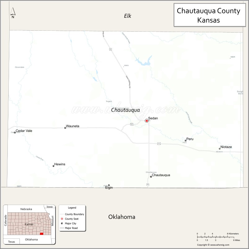
Chautauqua County (county code CQ) is a county located in Southeast Kansas, United States. As of the 2020 census, the county population was 3,379. Its county seat and most populous city is Sedan. Chautauqua County is named for Chautauqua County, New York, the birthplace of Edward Jaquins, a Kansas politician who was instrumental in getting the county established.
| Name: | Chautauqua County |
|---|---|
| FIPS code: | 20-019 |
| State: | Kansas |
| Founded: | March 25, 1875 |
| Named for: | Chautauqua County, New York |
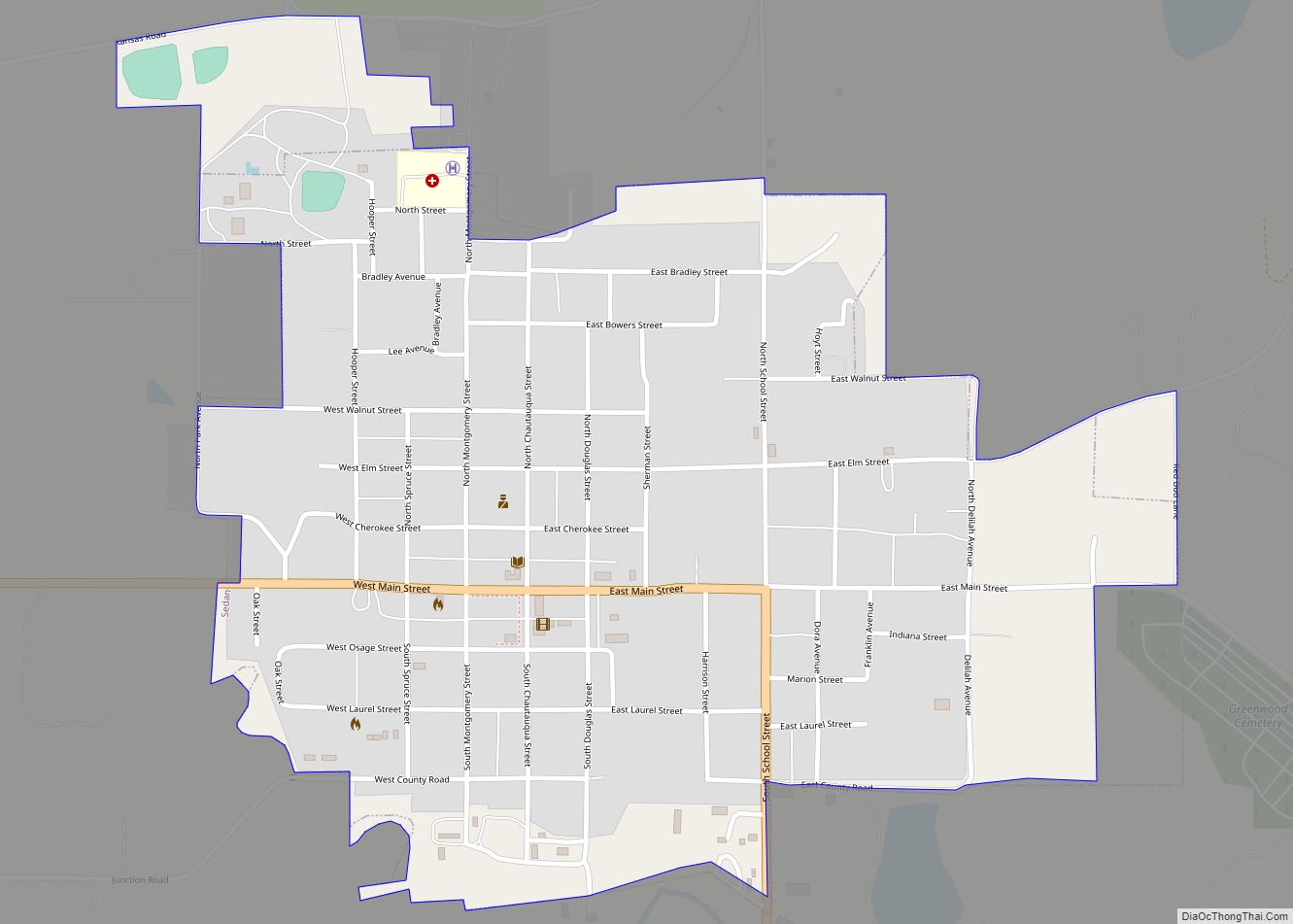
| Seat: | Sedan |
| Largest city: | Sedan |
| Total Area: | 645 sq mi (1,670 km²) |
| Land Area: | 639 sq mi (1,660 km²) |
| Total Population: | 3,379 |
| Population Density: | 5.3/sq mi (2.0/km²) |
| Time zone: | UTC−6 (Central) |
| Summer Time Zone (DST): | UTC−5 (CDT) |
| Website: | chautauquacountyks.com |
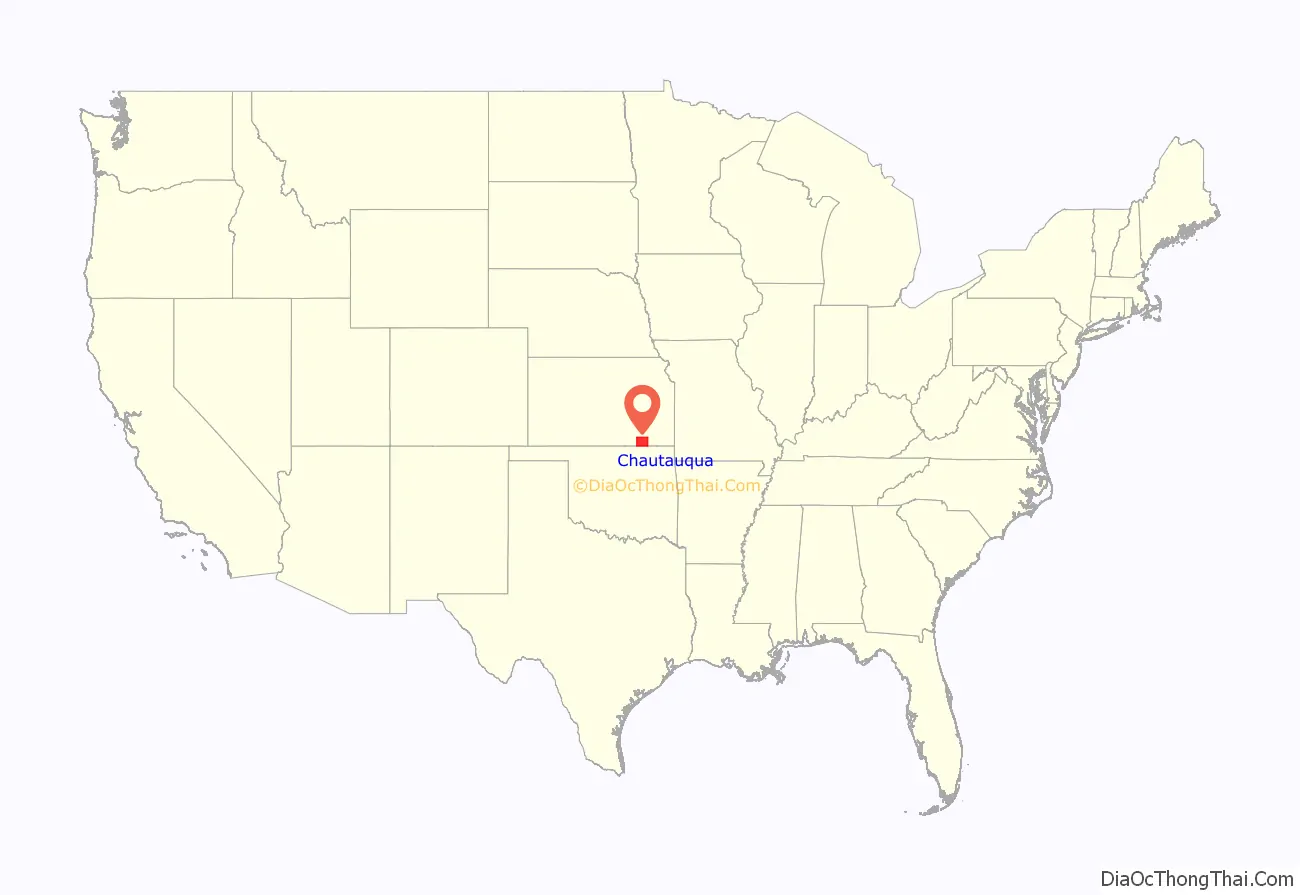
Chautauqua County location map. Where is Chautauqua County?
History
Early history
For many millennia, the Great Plains of North America was inhabited by nomadic Native Americans. The name is non-native, but is derived from the now-extinct Native Erie language, spoken near the Great Lakes. From the 16th century to 18th century, the Kingdom of France claimed ownership of large parts of North America. In 1762, after the French and Indian War, France secretly ceded New France to Spain, per the Treaty of Fontainebleau.
19th century
In 1802, Spain returned most of the land to France, but keeping title to about 7,500 square miles. In 1803, most of the land for modern day Kansas was acquired by the United States from France as part of the 828,000 square mile Louisiana Purchase for 2.83 cents per acre.
In 1854, the Kansas Territory was organized, then in 1861 Kansas became the 34th U.S. state. Chautauqua County was created by an act of the Kansas legislature on June 1, 1875, by the division of Howard County into Elk County (the northern half) and Chautauqua County (the southern half). At the time of its creation, the county’s population was about 7,400.
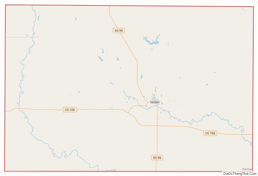
Chautauqua County Road Map
Geography
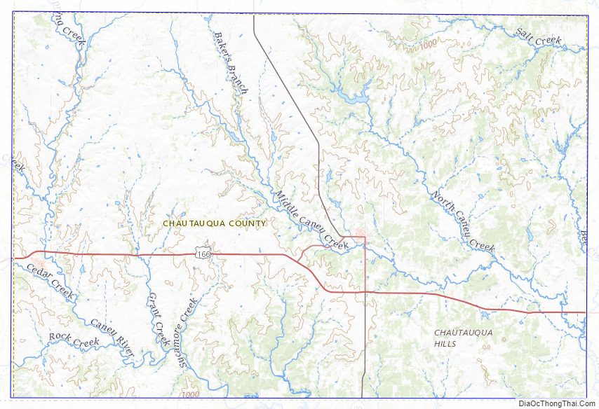
According to the U.S. Census Bureau, the county has a total area of 645 square miles (1,670 km), of which 639 square miles (1,660 km) is land and 5.9 square miles (15 km) (0.9%) is water.
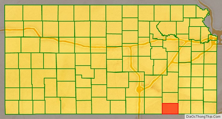
Adjacent counties
- Elk County (north)
- Montgomery County (east)
- Washington County, Oklahoma (southeast)
- Osage County, Oklahoma (south)
- Cowley County (west)
Major highways
Sources: National Atlas, U.S. Census Bureau
- U.S. Route 166
- Kansas Highway 38
- Kansas Highway 99
Chautauqua County Topographic Map
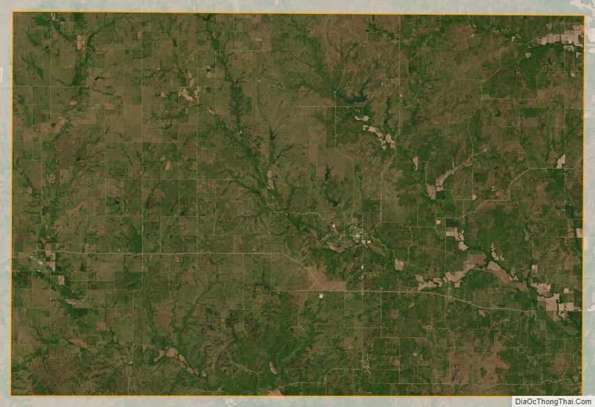
Chautauqua County Satellite Map
Chautauqua County Outline Map