Crawford County is a county located in the U.S. state of Iowa. As of the 2020 census, the population was 16,525. Its county seat is Denison. The county was named for William Harris Crawford, U.S. senator from Georgia and United States Secretary of the Treasury.
| Name: | Crawford County |
|---|---|
| FIPS code: | 19-047 |
| State: | Iowa |
| Founded: | 1851/1855 |
| Named for: | William Harris Crawford |
| Seat: | Denison |
| Largest city: | Denison |
| Total Area: | 715 sq mi (1,850 km²) |
| Land Area: | 714 sq mi (1,850 km²) |
| Total Population: | 16,525 |
| Population Density: | 23/sq mi (8.9/km²) |
| Time zone: | UTC−6 (Central) |
| Summer Time Zone (DST): | UTC−5 (CDT) |
| Website: | www.crawfordcounty.iowa.gov |
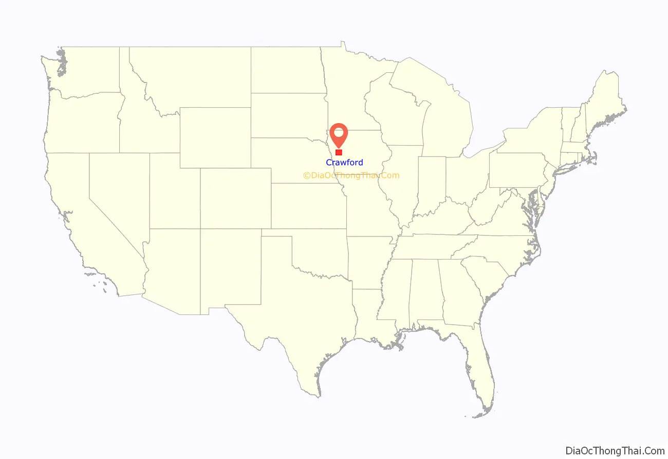
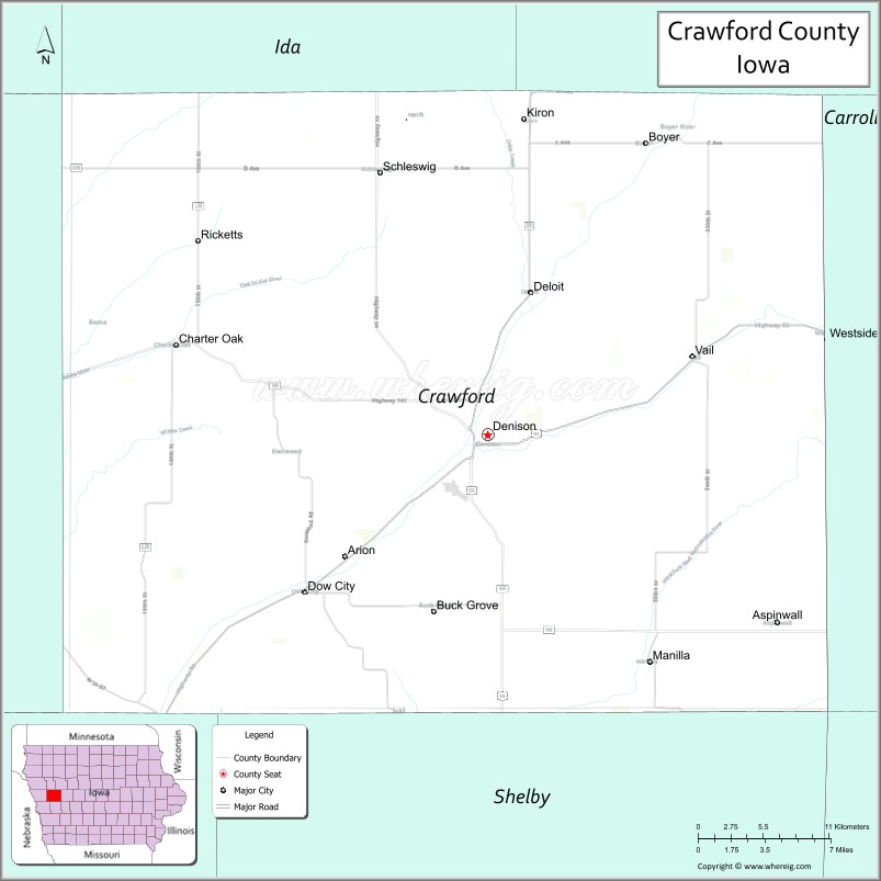
Crawford County location map. Where is Crawford County?
History
In January 1851, the Iowa Legislature authorized the creation of 50 additional counties in the state. Due to its lack of inhabitants, the designated Crawford County area was attached to Shelby County for purposes of revenue, taxation, and judicial matters.
In 1855 there were sufficient settlers, who petitioned for separation from Shelby. This was granted, and a county governing structure was established. The county as then designated did not include its present western townships.
In 1865, four eastern townships of Monona County were separated from that county and incorporated into Crawford County’s boundary.
After several adjustments and reorganizations, the present arrangement of Crawford County townships was completed in June 1872.
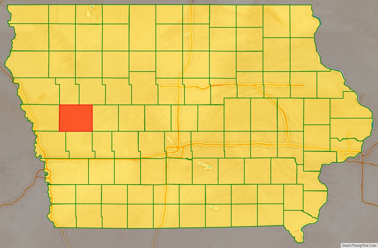
Crawford County Road Map
Geography
According to the US Census Bureau, the county has a total area of 715 square miles (1,850 km), of which 714 square miles (1,850 km) is land and 0.8 square miles (2.1 km) (0.1%) is water.
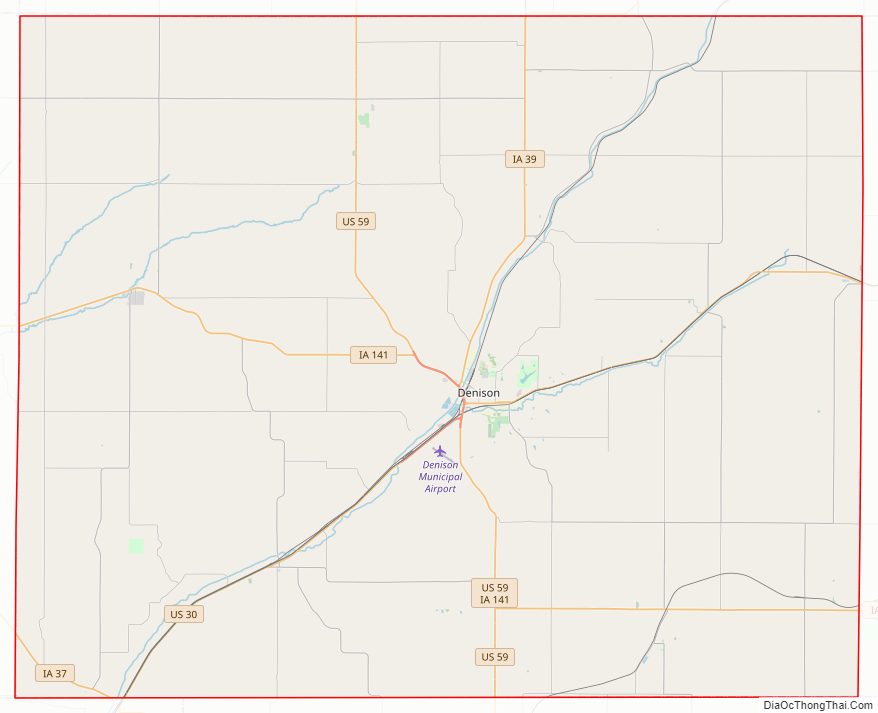
Major highways
- U.S. Highway 30 – runs ENE across bottom of county. Enters at Dunlap, exits to Carroll County at Westside.
- U.S. Highway 59 – runs generally north–south through center of county, passing Schleswig and Denison. Its exit into Shelby County is five miles east of its entry from Ida County.
- Iowa Highway 37 – cuts the SW corner of county, running SE from Monona County to Harrison County.
- Iowa Highway 39 – runs north and ENE from Denison to Kiron, then into Ida and Sac Counties.
- Iowa Highway 141 – enters SE part of county at Aspinwall, runs west to intersection with US Highway 59, two miles above the county’s south line.
Adjacent counties
- Ida County − north
- Sac County − northeast
- Carroll County − east
- Audubon County − southeast
- Shelby County − south
- Harrison County − southwest
- Monona County − west
- Woodbury County − northwest
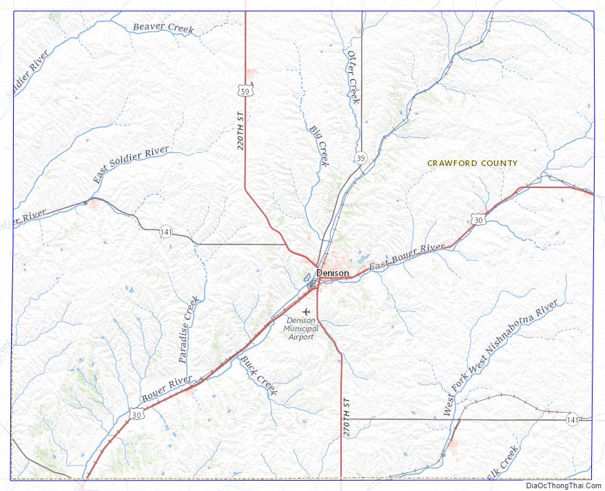
Crawford County Topographic Map
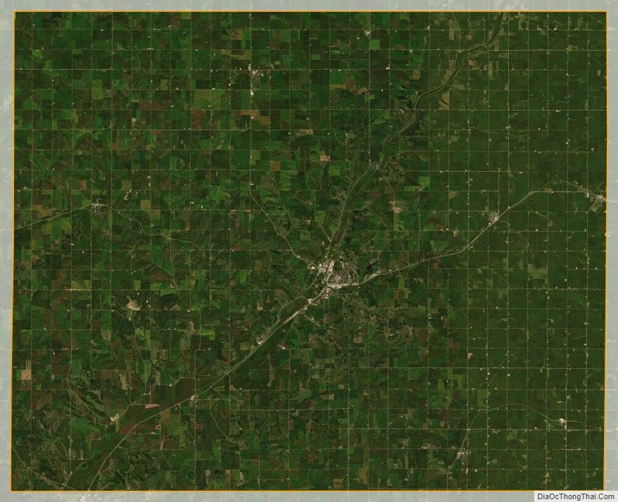
Crawford County Satellite Map
Crawford County Outline Map