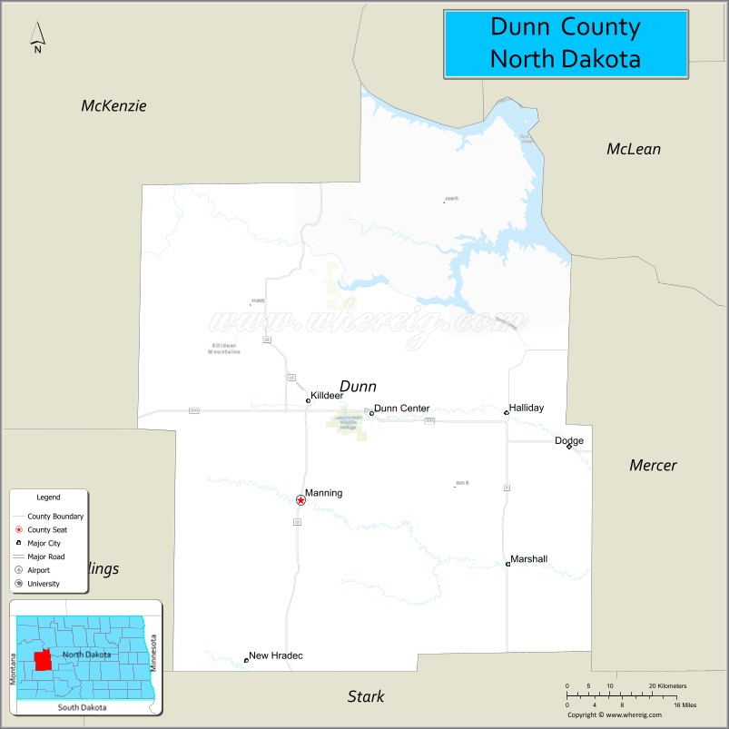
Dunn County is a county in the U.S. state of North Dakota. As of the 2020 census, the population was 4,095. Its county seat is Manning.
| Name: | Dunn County |
|---|---|
| FIPS code: | 38-025 |
| State: | North Dakota |
| Founded: | 1883 |
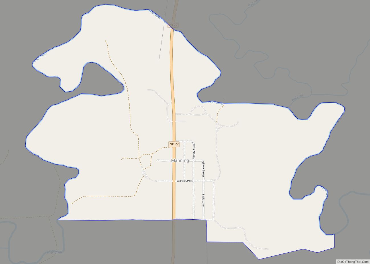
| Seat: | Manning |
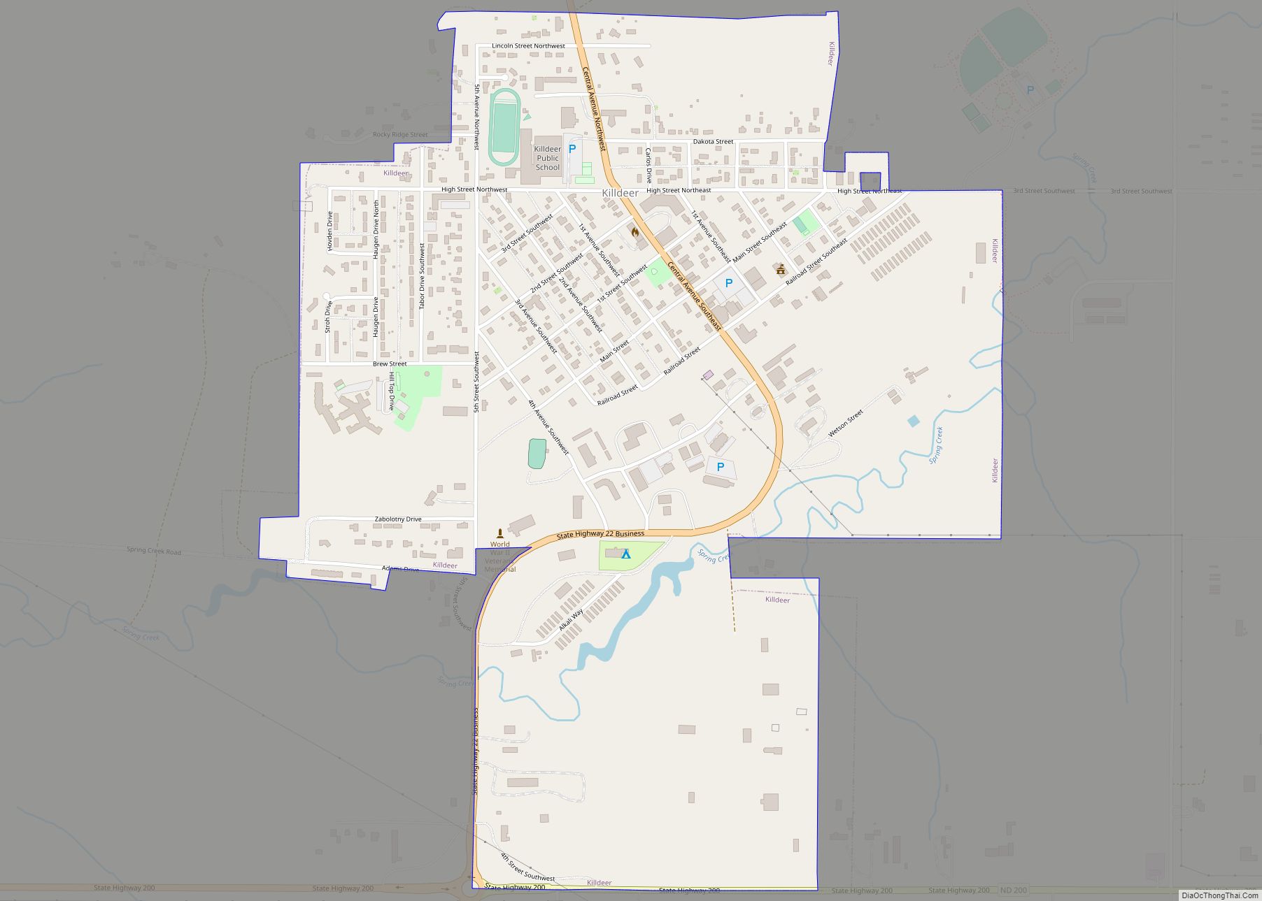
| Largest city: | Killdeer |
| Total Area: | 2,082 sq mi (5,390 km²) |
| Land Area: | 2,008 sq mi (5,200 km²) |
| Total Population: | 4,095 |
| Population Density: | 2.0/sq mi (0.76/km²) |
| Website: | www.dunncountynd.org |
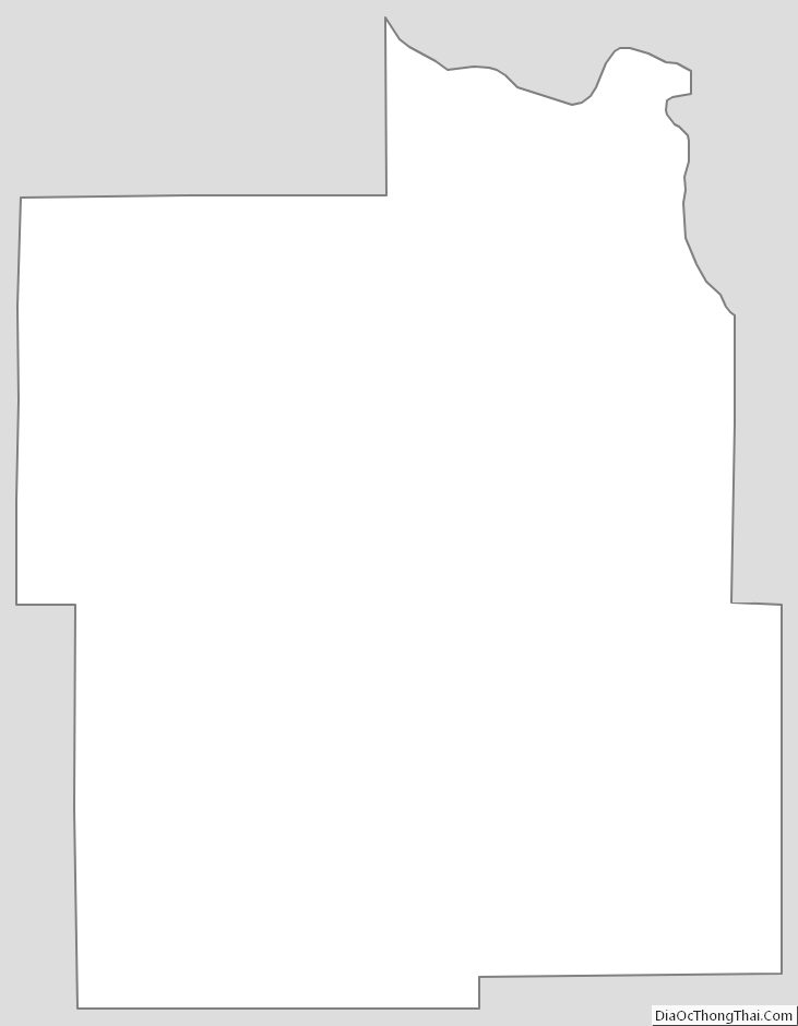
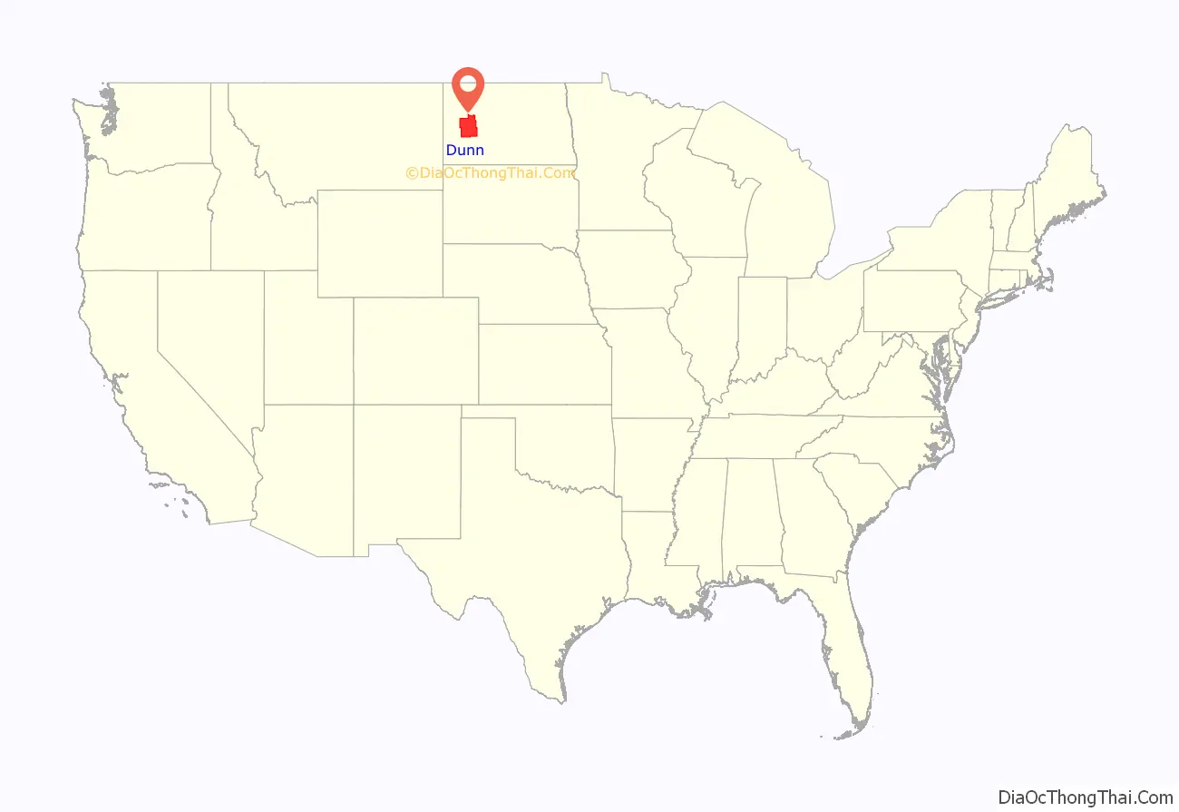
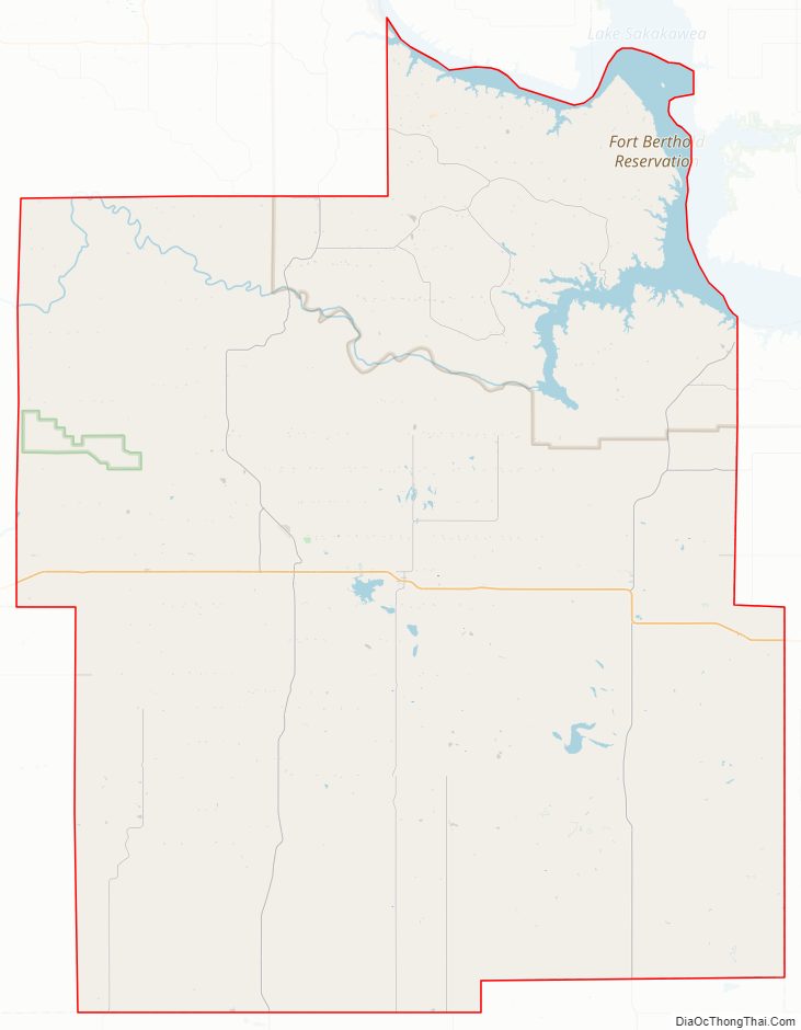
Dunn County location map. Where is Dunn County?
History
On March 9, 1883, the Dakota Territory legislature authorized the creation of a new county, using territory partitioned from Howard County (which is now extinct). The county organization was not effected at that time, but the county was not attached to another county for judicial purposes.
The county boundaries were altered in 1883, and on November 3, 1896, the legislature ordered Dunn dissolved, with its territory assigned to Stark County. However, the state supreme court overturned the legislature’s act on May 24, 1901; in effect re-creating Dunn County. The county was still not assigned to another county. This was resolved on March 10, 1903, when the county was assigned to Stark County for judicial purposes.
On March 13, 1903, the legislature again voted to dissolve Dunn County, but again (during the 1905 session) the state supreme court voided the act. Dunn County continued to be attached to Stark County. However, on January 18, 1908, the county organization was effected, and Dunn became a standalone county. In the process, Dunn gained a tract of previously unattached land from Stark County, enlarging its boundary. The configuration thus created has remained to the present. The county was named for John Piatt Dunn, who opened the first drugstore in North Dakota, and who was a civic and commercial leader during the early history of Bismarck.
Dunn County Road Map
Geography
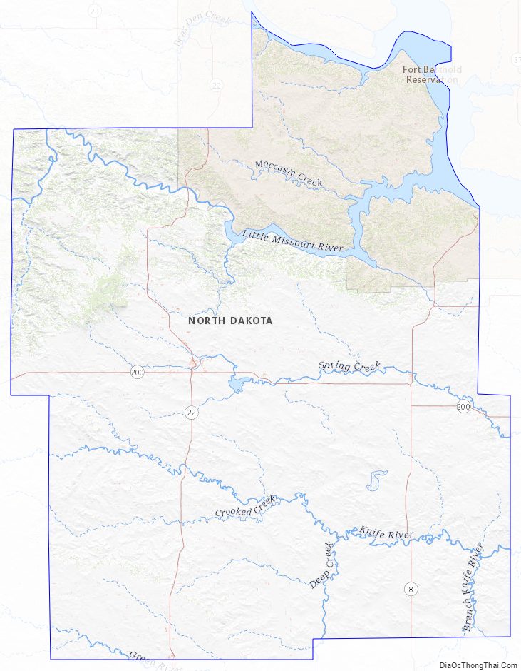
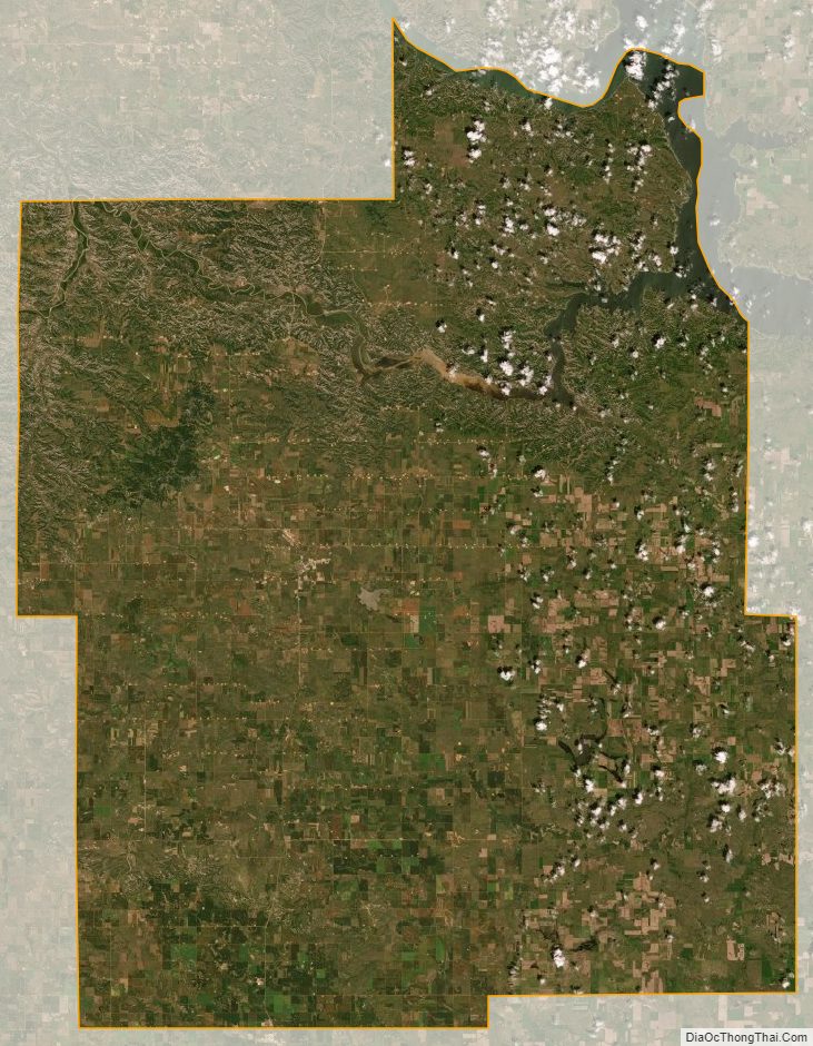
The Missouri River flows southeasterly along the northeastern boundary of Dunn County, and the Little Missouri River flows eastward across the center part of the county, to its confluence with the Missouri in the northeastern part of the county. The county terrain consists of semi-arid rolling hills, which are etched in the north and east by gullies and drainages to the river valleys. The terrain slopes to the east and north; its highest point is a hill at the southwestern corner, at 2,625′ (800m) ASL. The county has a total area of 2,082 square miles (5,390 km), of which 2,008 square miles (5,200 km) is land and 74 square miles (190 km) (3.5%) is water. It is the fifth-largest county in North Dakota by total area.
Dunn County is somewhat unusual among western North Dakota counties. Like other counties in the region, it has both prairie and badlands areas. Located in the northwest part of the county are the Killdeer Mountains, which are more accurately described as hills. These hills help create a mini-ecosystem on the southern edge of the Little Missouri badlands, which has a greater abundance of aspen forests and wildlife than is typically found in southwestern North Dakota. The Killdeer Mountains’ highest point, and the highest point in Dunn County, is 3281 feet above sea level.
The northwest corner of the county, northwest of the Killdeer Mountains, features many square miles of bur oak forest, mainly on the north-facing slopes of the hills. Bur oak and quaking aspen, though native to North Dakota, are sparse in western North Dakota, with Dunn County being a notable exception.
Major highways
- North Dakota Highway 8
- North Dakota Highway 22
- North Dakota Highway 200
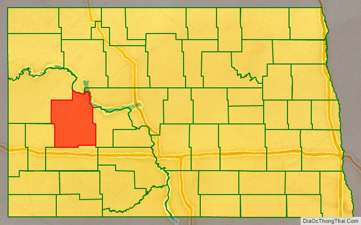
Adjacent counties
- Mountrail County – north
- McLean County – northeast
- Mercer County – east
- Stark County – south
- Billings County – southwest
- McKenzie County – northwest
Protected areas
- Lake Ilo National Wildlife Refuge
- Little Missouri Public Use Area
- Kildeer Mountain State Game Preserve
- Badlands Trail Rides
- Little Mountain State Park
Lakes
- Moffet Slough
Dunn County Topographic Map
Dunn County Satellite Map
Dunn County Outline Map