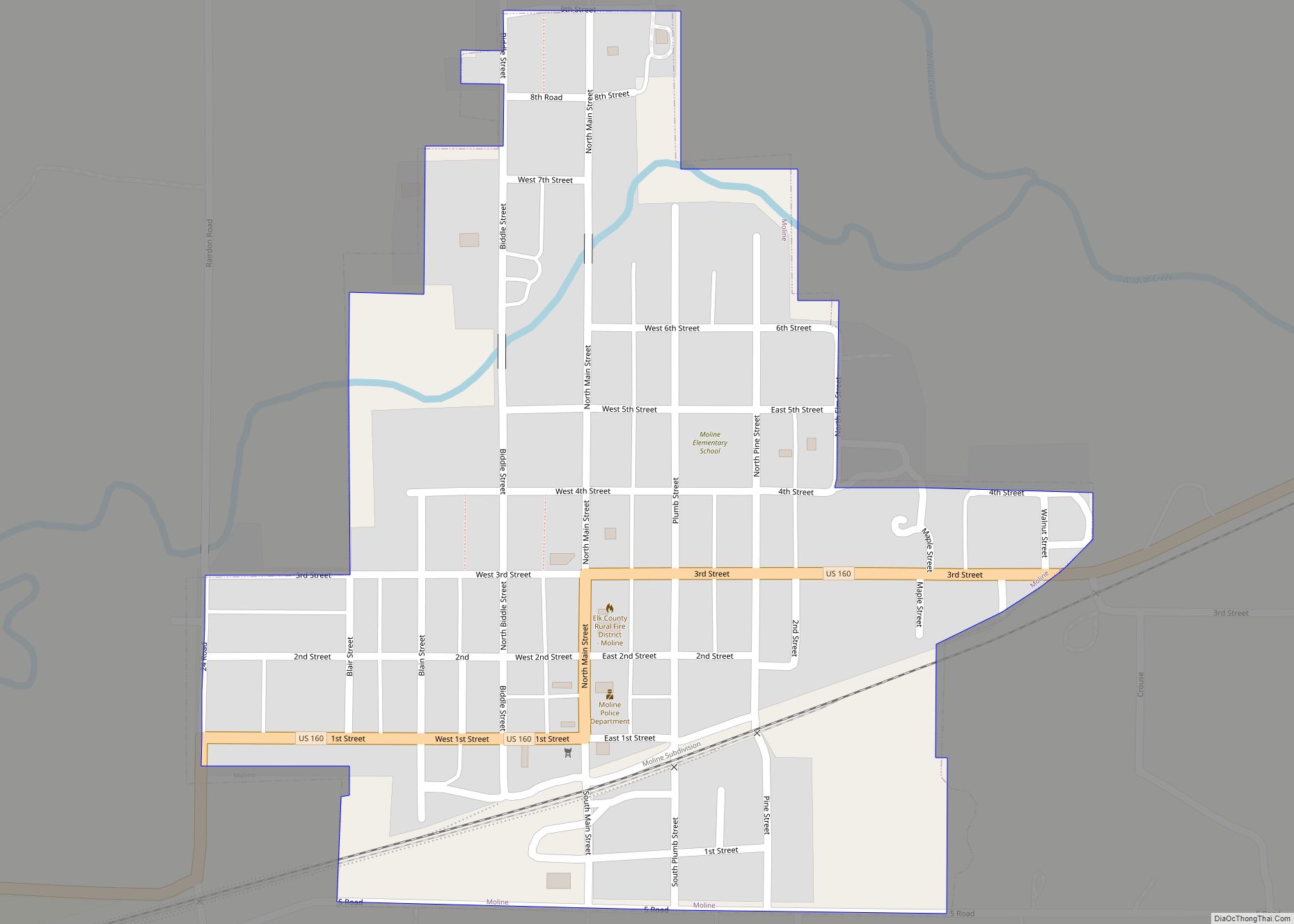
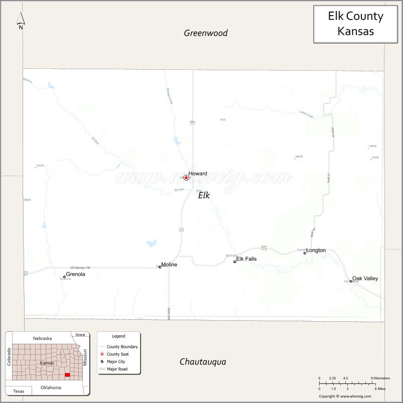
Elk County (county code EK) is a county located in the U.S. state of Kansas. As of the 2020 census, the county population was 2,483. Its county seat and most populous city is Howard.
| Name: | Elk County |
|---|---|
| FIPS code: | 20-049 |
| State: | Kansas |
| Founded: | March 25, 1875 |
| Named for: | Elk River |
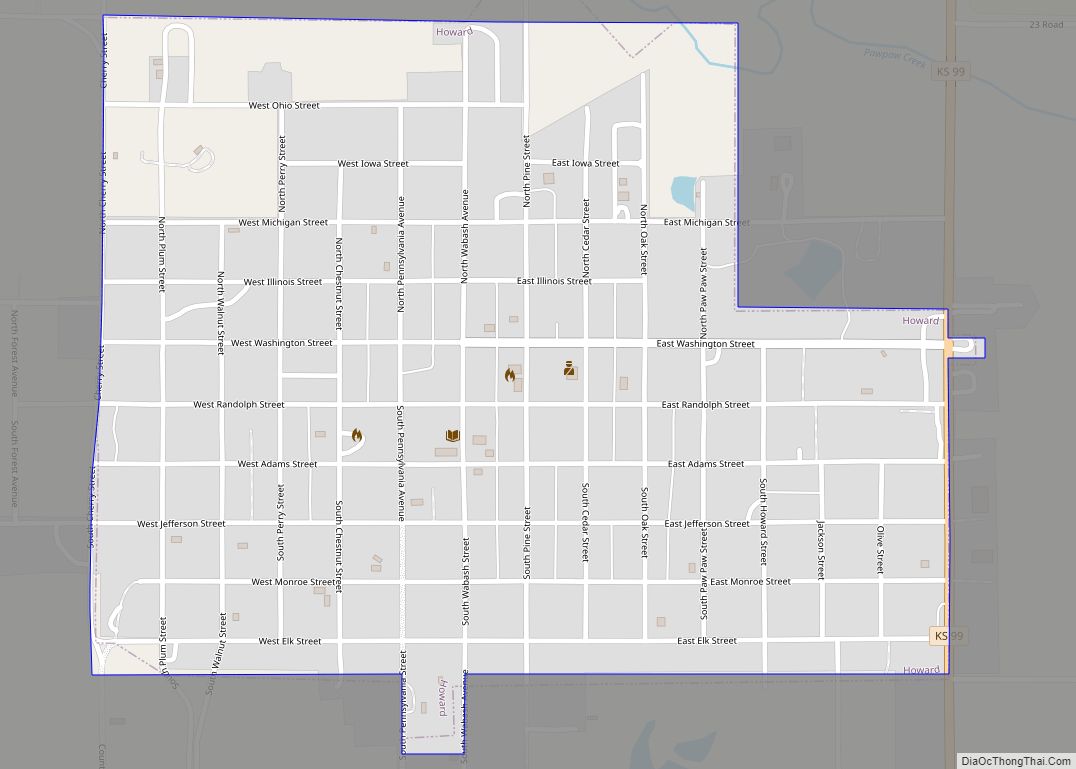
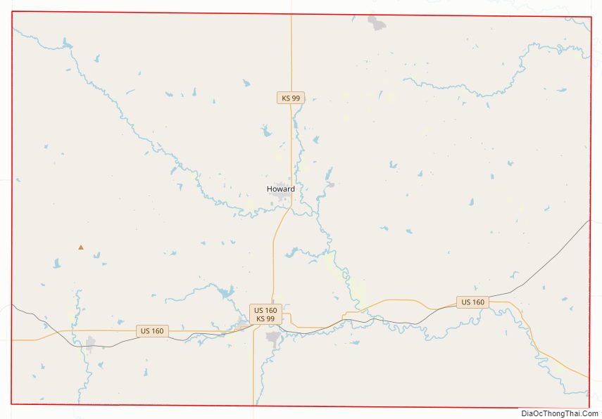
| Seat: | Howard |
| Largest city: | Howard |
| Total Area: | 650 sq mi (1,700 km²) |
| Land Area: | 644 sq mi (1,670 km²) |
| Total Population: | 2,483 |
| Population Density: | 3.9/sq mi (1.5/km²) |
| Time zone: | UTC−6 (Central) |
| Summer Time Zone (DST): | UTC−5 (CDT) |
| Website: | elkcountyks.org |
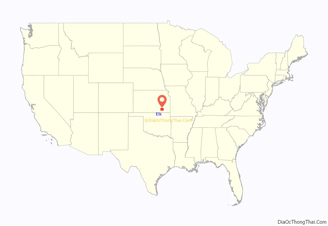
Elk County location map. Where is Elk County?
History
Early history
For many millennia, the Great Plains of North America was inhabited by nomadic Native Americans. From the 16th century to 18th century, the Kingdom of France claimed ownership of large parts of North America. In 1762, after the French and Indian War, France secretly ceded New France to Spain, per the Treaty of Fontainebleau.
19th century
In 1802, Spain returned most of the land to France, but keeping title to about 7,500 square miles. In 1803, most of the land for modern day Kansas was acquired by the United States from France as part of the 828,000 square mile Louisiana Purchase for 2.83 cents per acre.
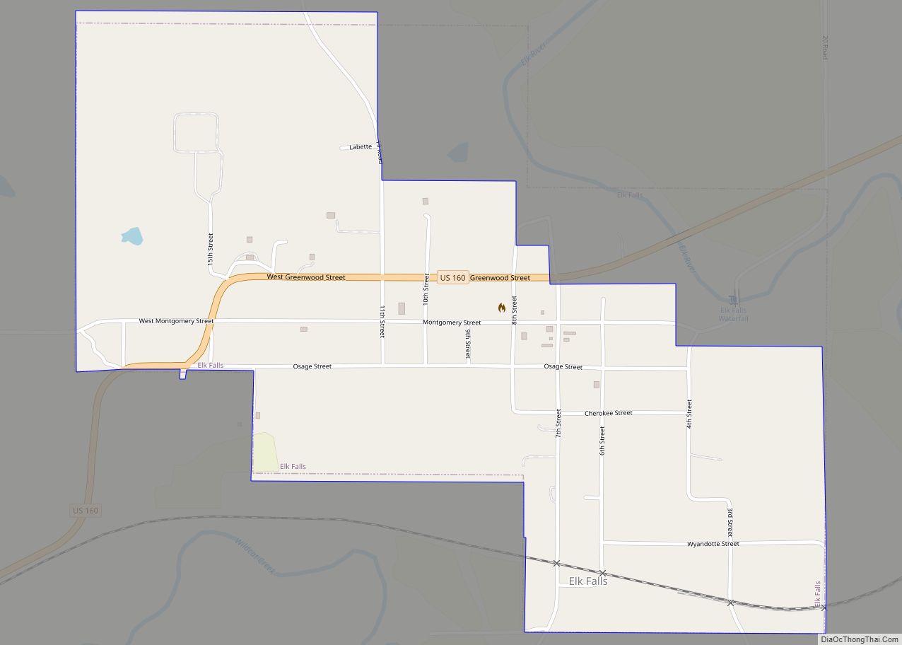
In 1854, after first serving as an area to relocate Native American tribes from the east, the United States organized Kansas Territory. In 1861, Kansas was admitted as the 34th U.S. state. The area that today is Elk County was, for a brief period, reserved to the Osage Indians as hunting grounds for buffalo and other game. In 1867, when Howard County was formed, it encompassed both present day Elk and Chautauqua counties. Disputes over county seats caused a division. In 1875, Elk County was established, named for the Elk River.
The first railroad in Elk County was built in 1879. It connected cattle ranches and farms to eastern markets.
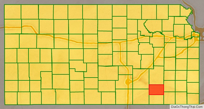
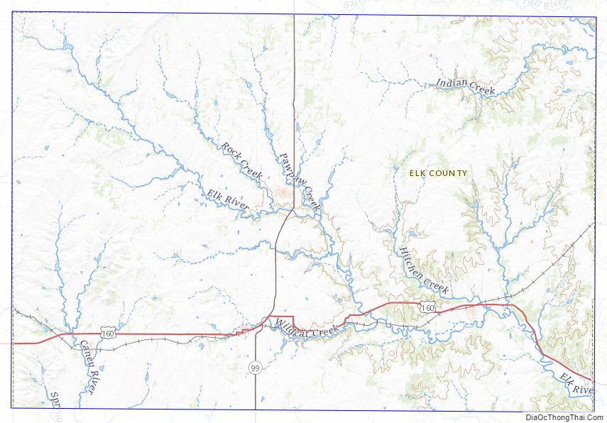
Elk County Road Map
Geography
According to the U.S. Census Bureau, the county has a total area of 650 square miles (1,700 km), of which 644 square miles (1,670 km) is land and 6.2 square miles (16 km) (1.0%) is water.
Adjacent counties
- Greenwood County (north)
- Wilson County (east)
- Montgomery County (southeast)
- Chautauqua County (south)
- Cowley County (southwest)
- Butler County (northwest)
Elk County Topographic Map
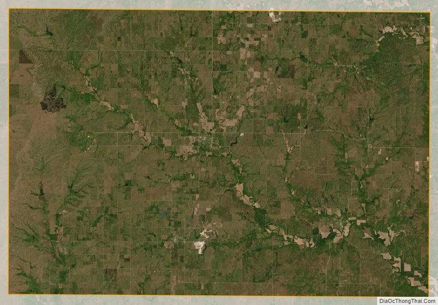
Elk County Satellite Map
Elk County Outline Map