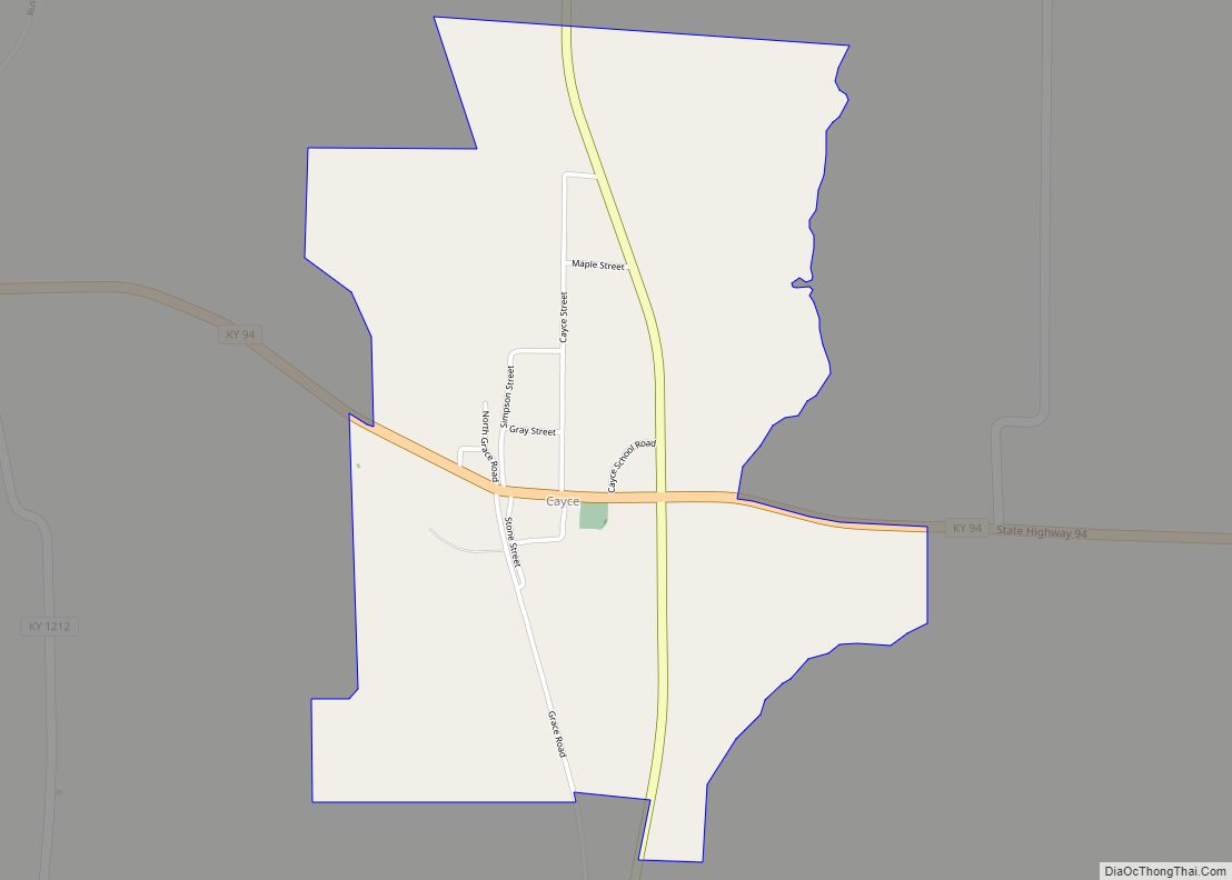
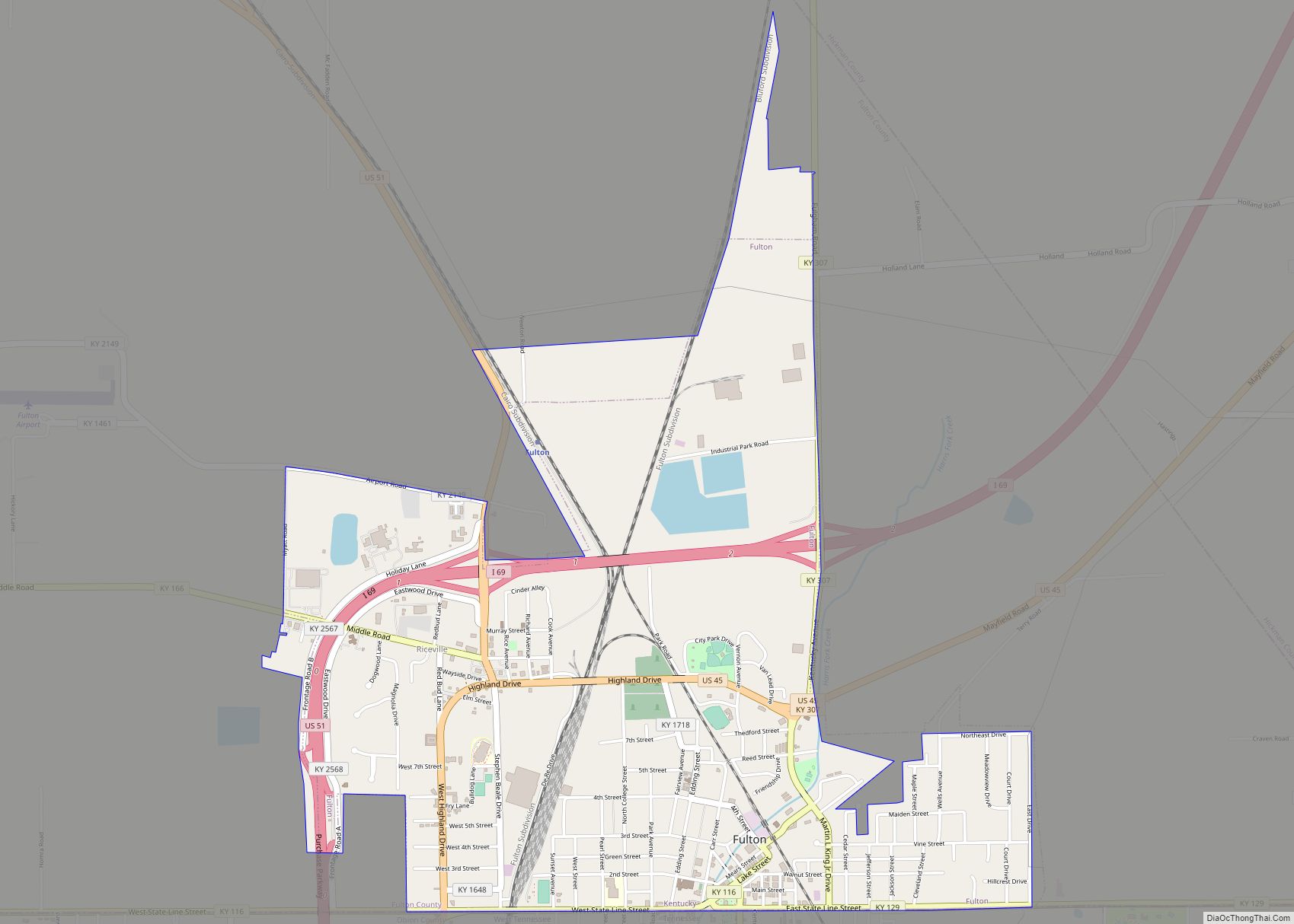
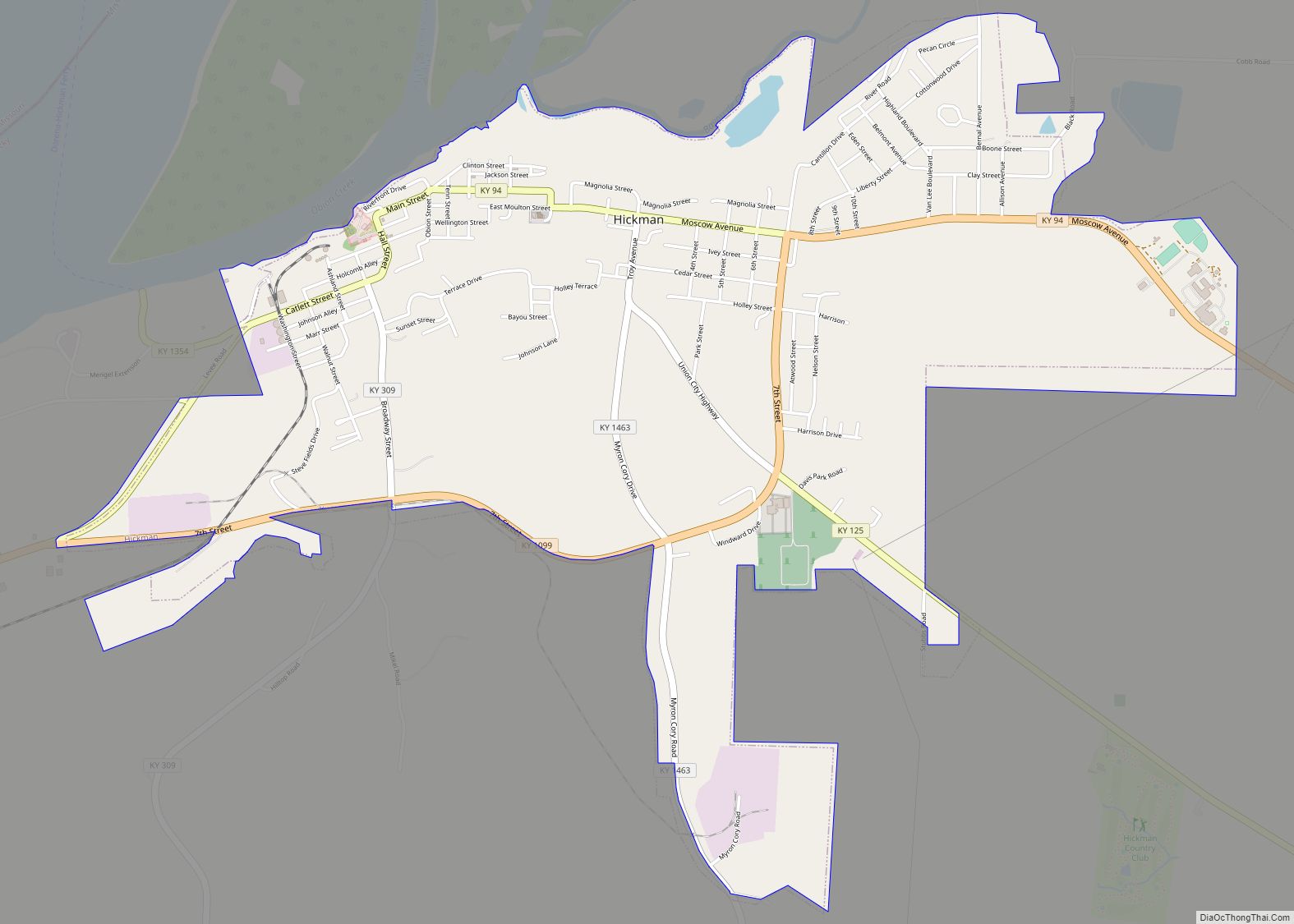
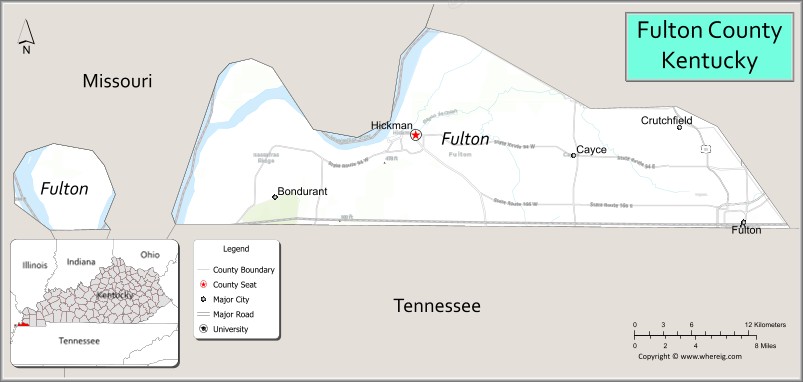
Fulton County is the westernmost county in the U.S. state of Kentucky, with the Mississippi River forming its western boundary. As of the 2020 census, the population was 6,515. Its county seat is Hickman and its largest city is Fulton. The county was formed in 1845 from Hickman County, Kentucky and named for Robert Fulton, the inventor of the steamboat.
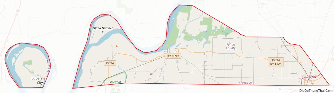
Allied with Tennessee by trade and culture, white Fulton County residents were largely pro-Confederate during the American Civil War. Forces from both armies passed through the county during different periods of the conflict. Because of imprecise early surveying of Kentucky’s southern border, Fulton County is divided into two non-contiguous parts. An exclave on the peninsula in the Kentucky Bend of the Mississippi River can be reached only by road through Tennessee.
| Name: | Fulton County |
|---|---|
| FIPS code: | 21-075 |
| State: | Kentucky |
| Founded: | 1845 |
| Named for: | Robert Fulton |
| Seat: | Hickman |
| Largest city: | Fulton |
| Total Area: | 231 sq mi (600 km²) |
| Land Area: | 206 sq mi (530 km²) |
| Total Population: | 6,515 |
| Population Density: | 28/sq mi (11/km²) |
| Time zone: | UTC−6 (Central) |
| Summer Time Zone (DST): | UTC−5 (CDT) |
| Website: | www.fultoncounty.ky.gov |
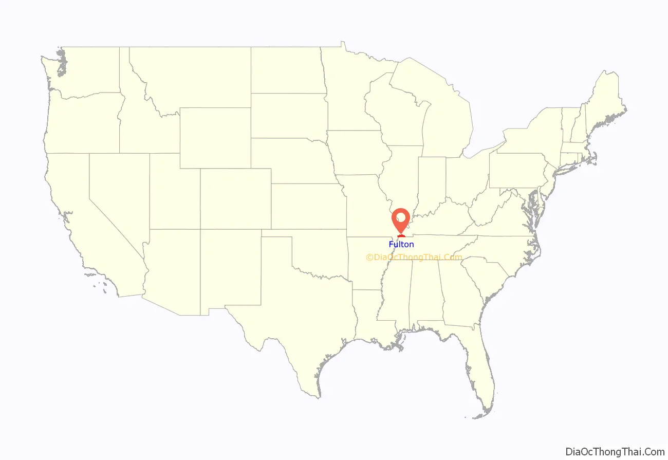
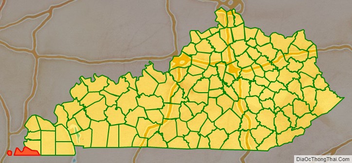
Fulton County location map. Where is Fulton County?
History
The rural county was not organized until 1845, from a portion of Hickman County. It was named for Robert Fulton, inventor of the steamboat. Hickman, Kentucky was designated as the county seat. The county was developed for agriculture, which was originally dependent on slave labor. Area farmers had ties to Tennessee planters, and shipped produce down the Mississippi River, which formed the county’s western border. They supported the Confederacy, while Kentucky maintained official neutrality as a Border State.
During the post-Reconstruction period, there was considerable racial violence by whites against blacks in Fulton County; they exercised terrorism to re-establish and maintain white supremacy. Whites lynched 20 African Americans here from 1877 to 1950; most were killed around the turn of the 20th century. This was by far the highest total of any county in the state, more than ten times the total in many other counties. Five men were lynched from 1883 to 1917, for alleged rape, assault, barn burning, and robbery and murder.
After the Civil War, some African Americans became landowners in the county. A notably egregious lynching was that on October 3, 1908, in Hickman of David Walker and his entire family by 50 Night Riders. This may have been part of anarchic violence that was directed at blacks arising from the “Reelfoot Lake Uprising”, but it also appeared that whites coveted Walker’s land. Walker and his wife, an infant in arms, and three children were shot multiple times; the eldest son burned to death in their farmhouse; seven in total were killed on the night of October 3, 1908 in Hickman. Walker owned a 21 1/2 acre farm; his white neighbor took it over after the killings, and later sold it to another white man. One of the latter’s descendants continues to own the rural land.
On December 16, 1918, Private Charles Lewis, a veteran of World War I, was lynched at Tyler Station. Private Lewis was accused of robbery and while he was held in the local jail, a group of masked men forced their way into the jail, smashed the locks with a sledgehammer, then took him outside and hanged him from a tree.
Fulton County Road Map
Geography
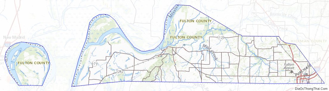
According to the U.S. Census Bureau, the county has a total area of 231 square miles (600 km), of which 206 square miles (530 km) is land and 25 square miles (65 km) (11%) is water.
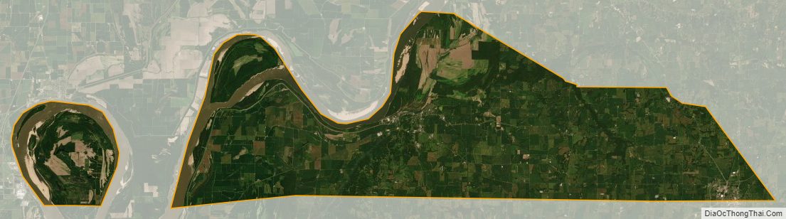
About 11 square miles (28 km) of the county is separated in a peninsula from the rest of the state by an oxbow of the Mississippi River, known as the Kentucky Bend or New Madrid Bend, after the city in Missouri on the north side of the river. Travelers going there have to pass into Tennessee by road (there is no bridge from Missouri) and then go north to reach the Kentucky Bend exclave. The lowest point in the state of Kentucky is located on the Mississippi River in Kentucky Bend in Fulton County, where it flows past Kentucky and between Tennessee and Missouri. It is expected that over time, the river will cut across the short neck of the peninsula, cutting it off entirely from Kentucky, with land gradually filling in behind it to connect it to Missouri.
Adjacent counties
- Mississippi County, Missouri (northwest)
- Hickman County (northeast)
- Obion County, Tennessee (south)
- Lake County, Tennessee (southwest)
- New Madrid County, Missouri (west)
National protected area
- Reelfoot National Wildlife Refuge (part)
Major highways
- US 45
- US 51
- KY 58
- KY 94
- KY 116
- KY 123
- KY 125
- KY 166
- KY 239
- KY 307
- KY 781
- KY 924
- KY 1529
Fulton County Topographic Map
Fulton County Satellite Map
Fulton County Outline Map