Hickman is a city in and the county seat of Fulton County, Kentucky, United States. Located on the Mississippi River, the city had a population of 2,365 at the 2020 U.S. census and is classified as a home rule-class city. Hickman is part of the Union City micropolitan area.
| Name: | Hickman city |
|---|---|
| LSAD Code: | 25 |
| LSAD Description: | city (suffix) |
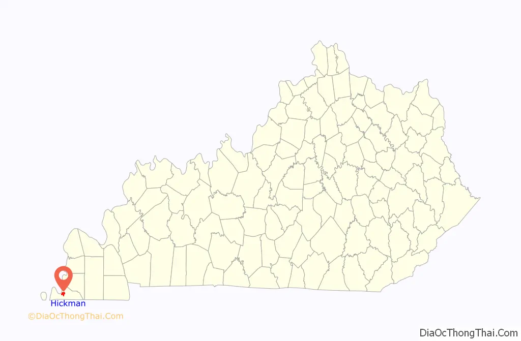
| State: | Kentucky |
| County: | Fulton County |
| Elevation: | 469 ft (143 m) |
| Total Area: | 3.58 sq mi (9.27 km²) |
| Land Area: | 3.55 sq mi (9.19 km²) |
| Water Area: | 0.03 sq mi (0.08 km²) |
| Total Population: | 2,365 |
| Population Density: | 666.38/sq mi (257.28/km²) |
| ZIP code: | 42050 |
| Area code: | 270 & 364 |
| FIPS code: | 2136298 |
| GNISfeature ID: | 0494109 |
| Website: | hickman.cityof.org |
Online Interactive Map
Click on ![]() to view map in "full screen" mode.
to view map in "full screen" mode.
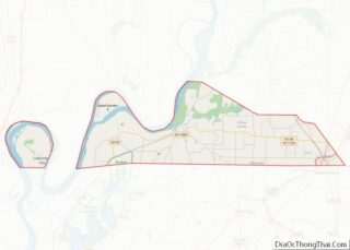
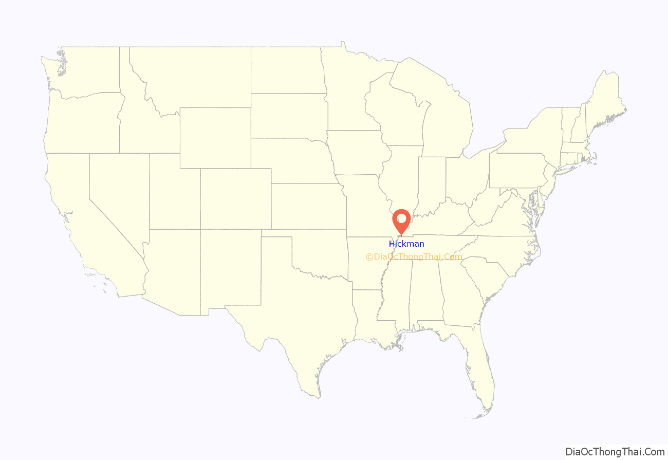
Hickman location map. Where is Hickman city?
History
This area was long occupied by various cultures of indigenous peoples. European-American settlement of this area did not begin until decades after the American Revolutionary War. James Mills built the first cabin on the site in 1819. The community of Mills Point was large enough to receive a post office in 1830. Around 1834, G. Marr purchased much of the surrounding area and laid out more streets.
The community was renamed Hickman in 1837 after the maiden name of Marr’s wife. The city was formally incorporated by the state assembly on February 18, 1841. In 1845, it became the county seat.
David Walker, his wife, and their four children were lynched in Hickman in 1908 after Mr. Walker was accused of using inappropriate language with a white woman.
Two floods devastated Hickman, the first in 1912 and the second in 1913. The flood of 1912 began when a levee located near Hickman broke. Within a few hours the water had risen to the roofs of houses. The flood of 1913 began when a levee near West Hickman broke on April 4. Baseball pitcher Rube Waddell was among the many who helped save the city during both floods. Waddell came down with pneumonia after each flood; he died of tuberculosis.
Registered historic sites
Thomas Chapel C.M.E. Church is an historic African-American church on Moscow Avenue in Hickman, part of the Colored Methodist Episcopal Church formed by freedmen after the American Civil War. Freedmen set up their own denomination in order to be independent of white supervision in the Methodist Church, South, which had split away from northern congregations at the outbreak of war. (In 1954 the CME changed its name to Christian Methodist Episcopal Church.) The church in Hickman was built in 1895. It was added to the National Register of Historic Places in 1979.
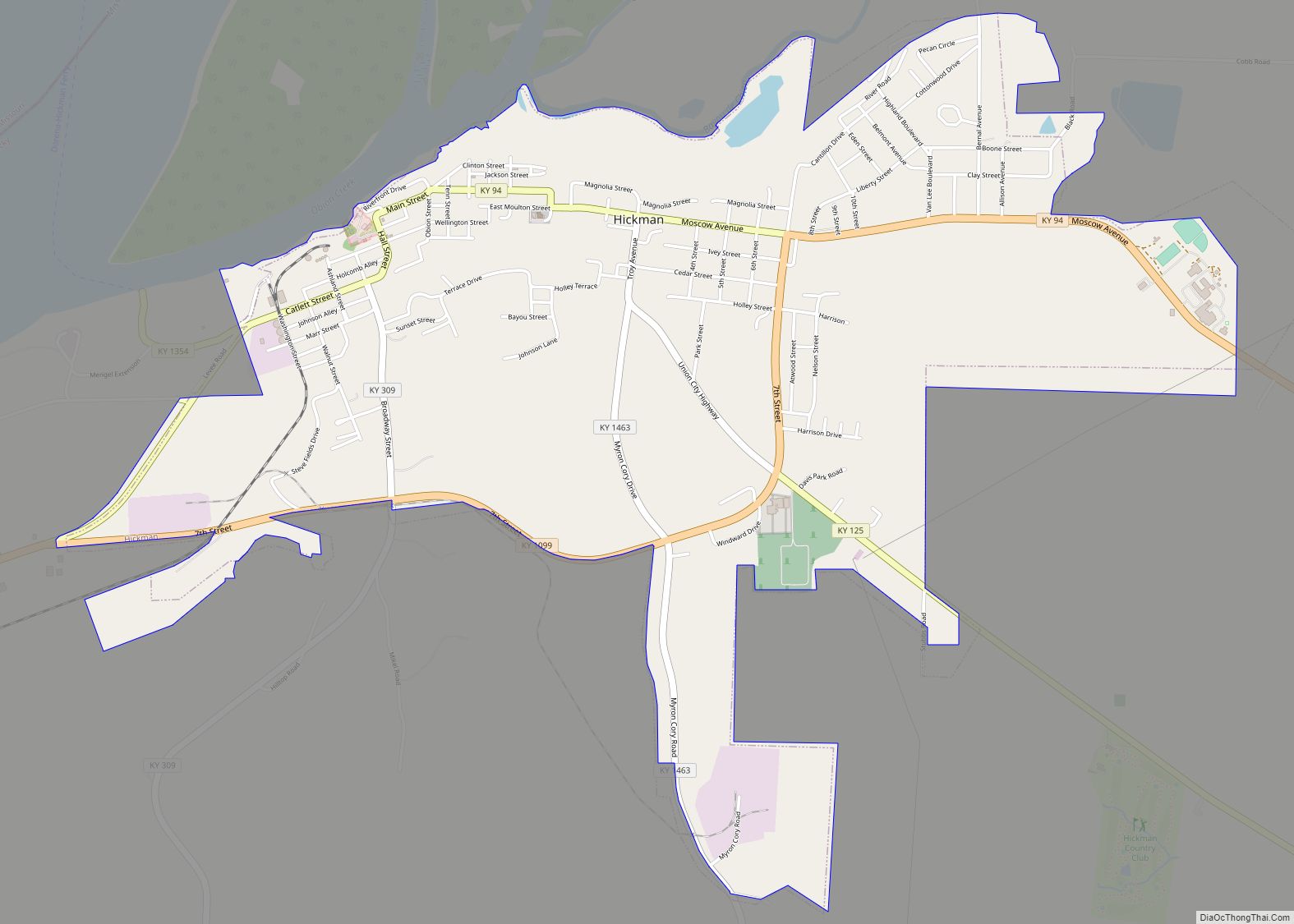
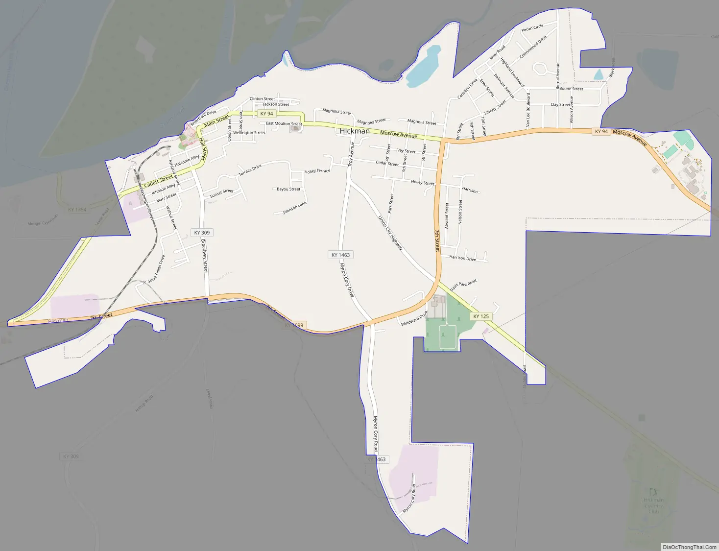
Hickman Road Map
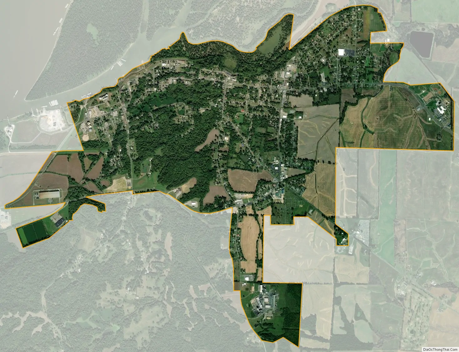
Hickman city Satellite Map
Geography
According to the United States Census Bureau, the city has a total area of 3.6 square miles (9.3 km), of which 3.6 square miles (9.3 km) is land and 0.28% is water.
Climate
The climate in this area is characterized by hot, humid summers and generally mild to cool winters. According to the Köppen Climate Classification system, Hickman has a humid subtropical climate, abbreviated “Cfa” on climate maps.
See also
Map of Kentucky State and its subdivision:- Adair
- Allen
- Anderson
- Ballard
- Barren
- Bath
- Bell
- Boone
- Bourbon
- Boyd
- Boyle
- Bracken
- Breathitt
- Breckinridge
- Bullitt
- Butler
- Caldwell
- Calloway
- Campbell
- Carlisle
- Carroll
- Carter
- Casey
- Christian
- Clark
- Clay
- Clinton
- Crittenden
- Cumberland
- Daviess
- Edmonson
- Elliott
- Estill
- Fayette
- Fleming
- Floyd
- Franklin
- Fulton
- Gallatin
- Garrard
- Grant
- Graves
- Grayson
- Green
- Greenup
- Hancock
- Hardin
- Harlan
- Harrison
- Hart
- Henderson
- Henry
- Hickman
- Hopkins
- Jackson
- Jefferson
- Jessamine
- Johnson
- Kenton
- Knott
- Knox
- Larue
- Laurel
- Lawrence
- Lee
- Leslie
- Letcher
- Lewis
- Lincoln
- Livingston
- Logan
- Lyon
- Madison
- Magoffin
- Marion
- Marshall
- Martin
- Mason
- McCracken
- McCreary
- McLean
- Meade
- Menifee
- Mercer
- Metcalfe
- Monroe
- Montgomery
- Morgan
- Muhlenberg
- Nelson
- Nicholas
- Ohio
- Oldham
- Owen
- Owsley
- Pendleton
- Perry
- Pike
- Powell
- Pulaski
- Robertson
- Rockcastle
- Rowan
- Russell
- Scott
- Shelby
- Simpson
- Spencer
- Taylor
- Todd
- Trigg
- Trimble
- Union
- Warren
- Washington
- Wayne
- Webster
- Whitley
- Wolfe
- Woodford
- Alabama
- Alaska
- Arizona
- Arkansas
- California
- Colorado
- Connecticut
- Delaware
- District of Columbia
- Florida
- Georgia
- Hawaii
- Idaho
- Illinois
- Indiana
- Iowa
- Kansas
- Kentucky
- Louisiana
- Maine
- Maryland
- Massachusetts
- Michigan
- Minnesota
- Mississippi
- Missouri
- Montana
- Nebraska
- Nevada
- New Hampshire
- New Jersey
- New Mexico
- New York
- North Carolina
- North Dakota
- Ohio
- Oklahoma
- Oregon
- Pennsylvania
- Rhode Island
- South Carolina
- South Dakota
- Tennessee
- Texas
- Utah
- Vermont
- Virginia
- Washington
- West Virginia
- Wisconsin
- Wyoming