Missouri is a state in the Midwestern region of the United States. Ranking 21st in land area, it is bordered by eight states (tied for the most with Tennessee): Iowa to the north, Illinois, Kentucky and Tennessee to the east, Arkansas to the south and Oklahoma, Kansas and Nebraska to the west. In the south are the Ozarks, a forested highland, providing timber, minerals, and recreation. The Missouri River, after which the state is named, flows through the center into the Mississippi River, which makes up the eastern border. With more than six million residents, it is the 19th-most populous state of the country. The largest urban areas are St. Louis, Kansas City, Springfield and Columbia; the capital is Jefferson City.
Humans have inhabited what is now Missouri for at least 12,000 years. The Mississippian culture, which emerged at least in the ninth century, built cities and mounds before declining in the 14th century. When European explorers arrived in the 17th century, they encountered the Osage and Missouria nations. The French incorporated the territory into Louisiana, founding Ste. Genevieve in 1735 and St. Louis in 1764. After a brief period of Spanish rule, the United States acquired Missouri as part of the Louisiana Purchase in 1803. Americans from the Upland South, including enslaved African Americans, rushed into the new Missouri Territory. Missouri was admitted as a slave state as part of the Missouri Compromise of 1820. Many from Virginia, Kentucky and Tennessee settled in the Boonslick area of Mid-Missouri. Soon after, heavy German immigration formed the Missouri Rhineland.
Missouri played a central role in the westward expansion of the United States, as memorialized by the Gateway Arch. The Pony Express, Oregon Trail, Santa Fe Trail and California Trail all began in Missouri. As a border state, Missouri’s role in the American Civil War was complex, and it was subject to rival governments, raids, and guerilla warfare. After the war, both Greater St. Louis and the Kansas City metropolitan area became centers of industrialization and business. Today the state is divided into 114 counties and the independent city of St. Louis.
Missouri’s culture blends elements of the Midwestern and Southern United States. It is the birthplace of the musical genres ragtime, Kansas City jazz and St. Louis blues. The well-known Kansas City-style barbecue, and the lesser-known St. Louis-style barbecue, can be found across the state and beyond. Missouri is a major center of beer brewing and has some of the most permissive alcohol laws in the U.S. It is home to Anheuser-Busch, the world’s largest beer producer, and produces an eponymous wine produced in the Missouri Rhineland and Ozarks. Outside the state’s major cities, popular tourist destinations include the Lake of the Ozarks, Table Rock Lake and Branson.
Well-known Missourians include Chuck Berry, Sheryl Crow, Walt Disney, Edwin Hubble, Nelly, Brad Pitt, Harry S. Truman, and Mark Twain. Some of the largest companies based in the state include Cerner, Express Scripts, Monsanto, Emerson Electric, Edward Jones, H&R Block, Wells Fargo Advisors, Centene Corporation, and O’Reilly Auto Parts. Well-known universities in Missouri include the University of Missouri, Saint Louis University, Washington University in St. Louis. Missouri has been called the “Mother of the West” and the “Cave State”, but its most famous nickname is the “Show Me State”.
| Before statehood: | Missouri Territory |
|---|---|
| Admitted to the Union: | August 10, 1821 (24th) |
| Capital: | Jefferson City |
| Largest city: | Kansas City |
| Largest metro and urban areas: | Greater St. Louis |
| Elevation: | 800 ft (244 m) |
| Total Area: | 69,715 sq mi (180,560 km) |
| Area Rank: | 21st |
| Total Population: | 6,160,281 |
| Population Rank: | 19th |
| Population Density: | 88.2/sq mi (34.1/km) |
| Population Density Rank: | 30th |
| Median Household Income: | $53,578 |
| Income Rank: | 38th |
| Demonym(s): | Missourian |
| USPS abbreviation: | MO |
| ISO 3166 code: | US-MO |
| Website: | www.mo.gov |
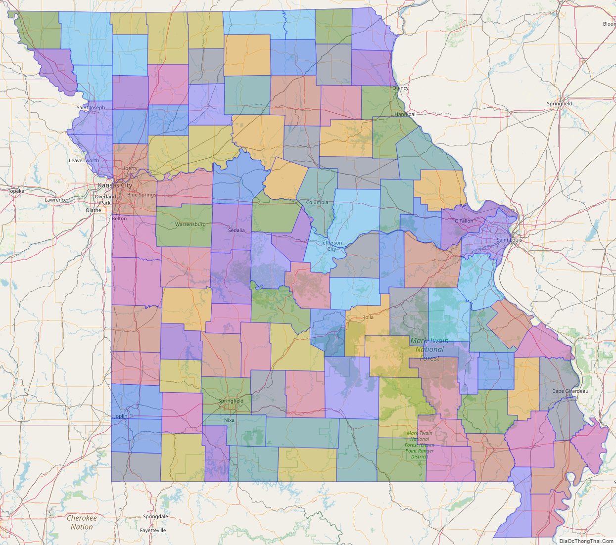
Online Interactive Map
Click on ![]() to view map in "full screen" mode.
to view map in "full screen" mode.
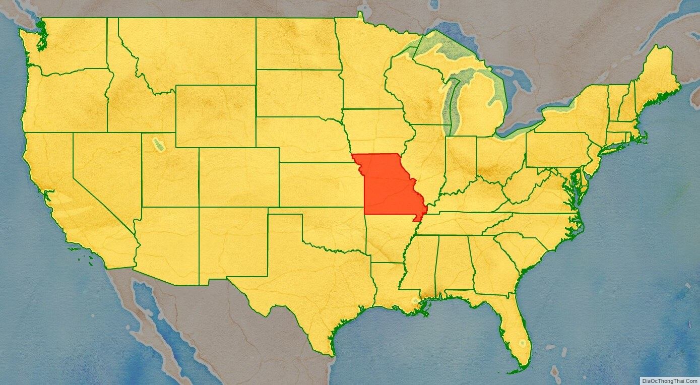
Missouri location map. Where is Missouri state?
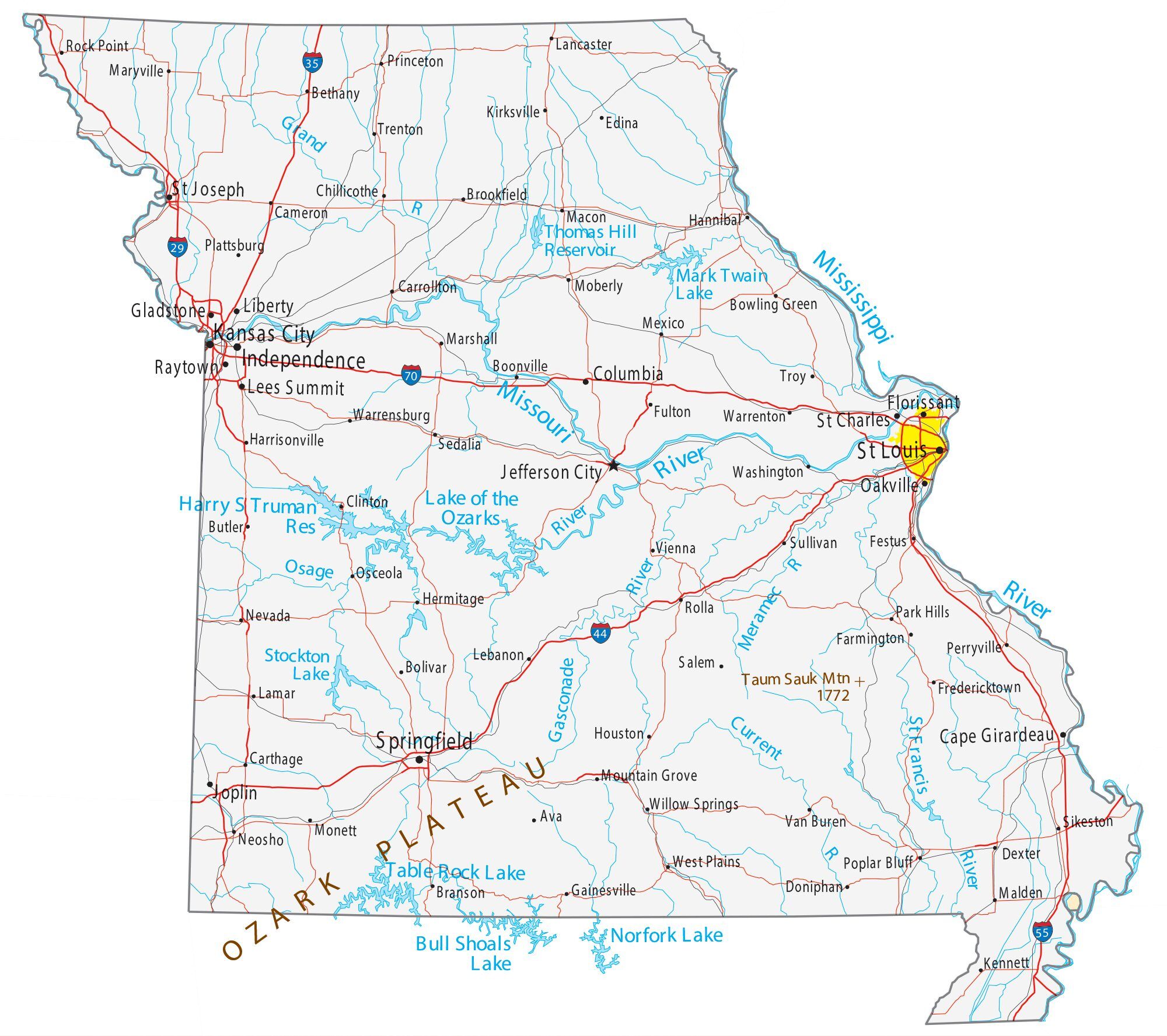
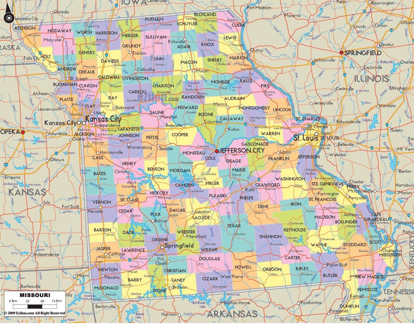
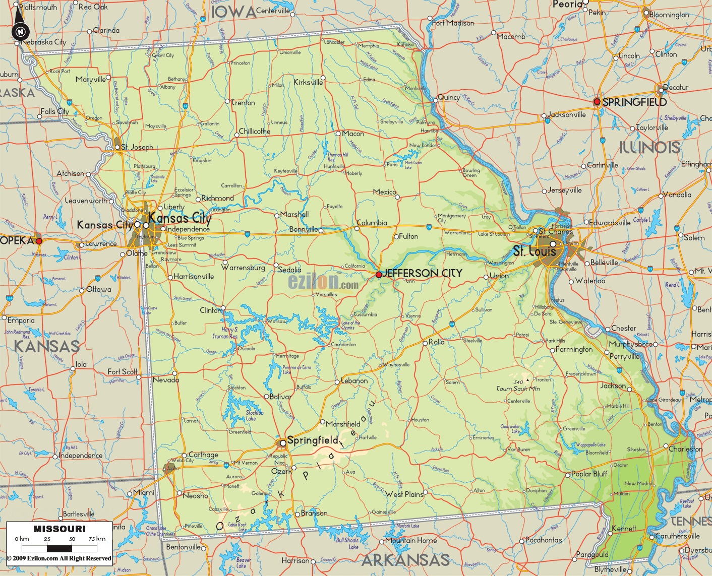
Missouri Road Map
Missouri Map – Roads & Cities
Missouri Street Map
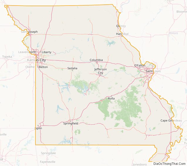
Missouri State Map – Places and Landmarks
Missouri Political Map
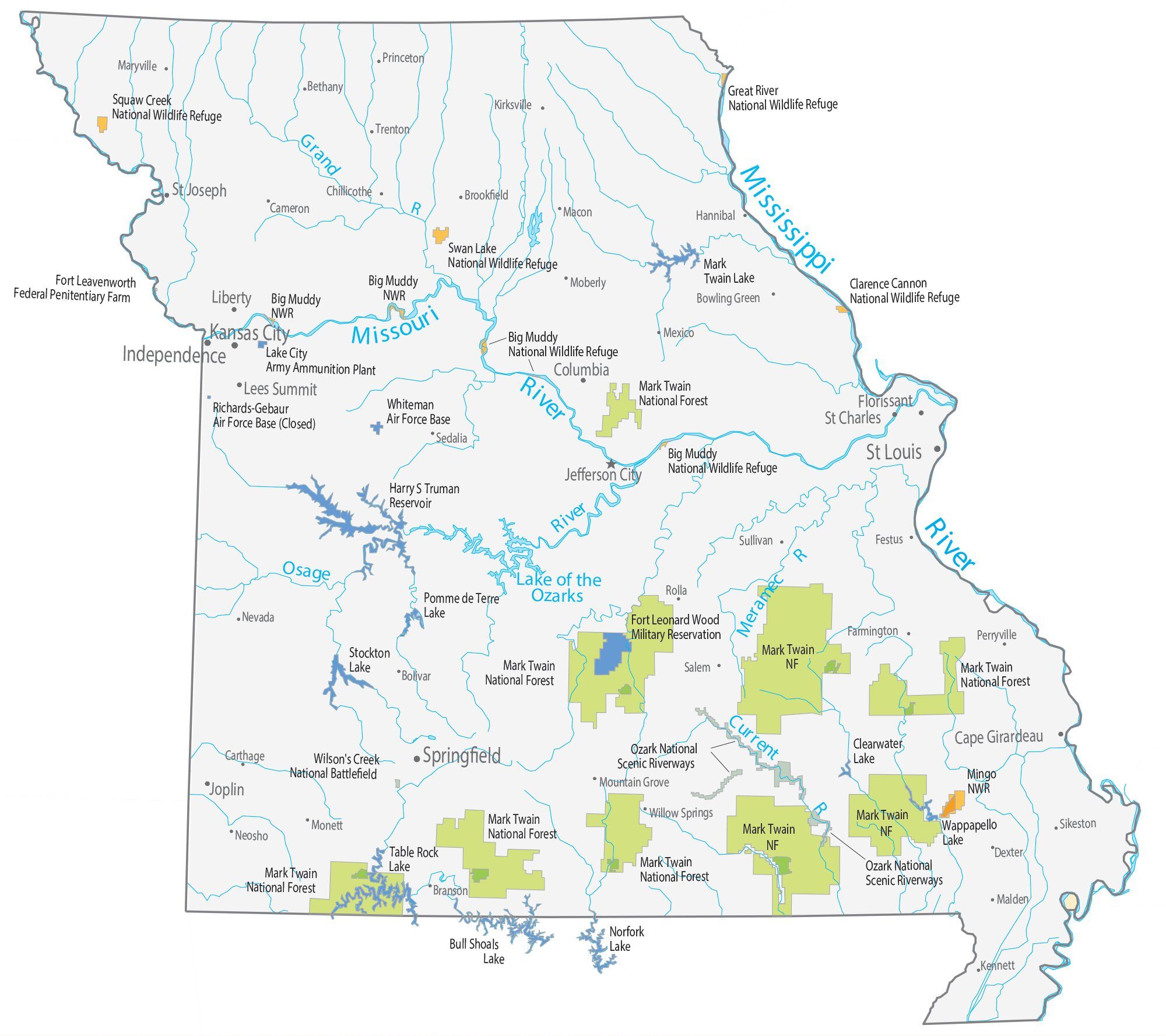
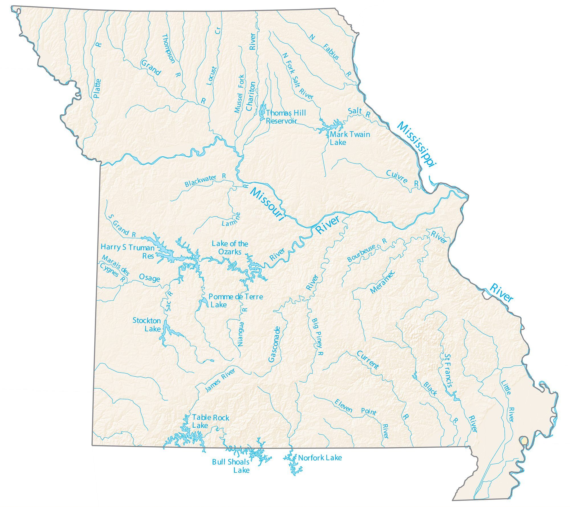
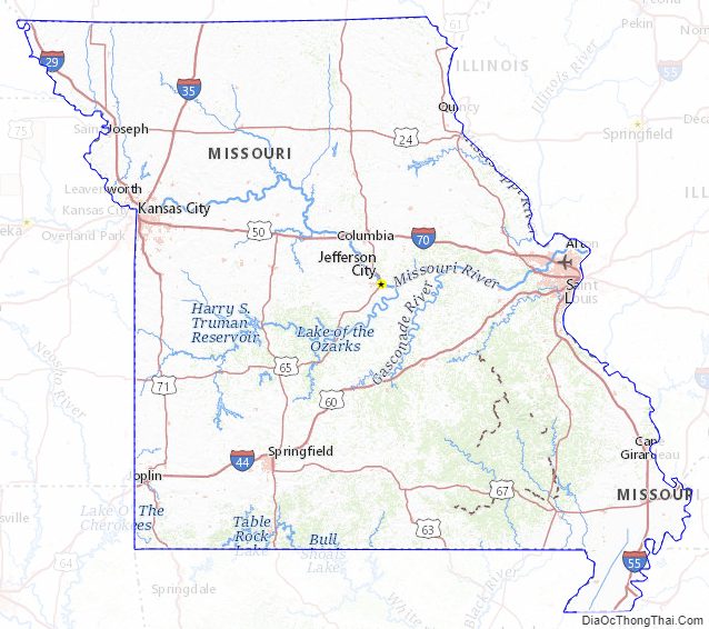
Missouri Lakes and Rivers Map
Geography
Missouri borders eight different states, a figure equaled only by its neighbor, Tennessee. Missouri is bounded by Iowa on the north; by Illinois, Kentucky, and Tennessee across the Mississippi River on the east; on the south by Arkansas; and by Oklahoma, Kansas, and Nebraska (the last across the Missouri River) on the west. Whereas the northern and southern boundaries are straight lines, the Missouri Bootheel extends south between the St. Francis and the Mississippi rivers. The two largest rivers are the Mississippi (which defines the eastern boundary of the state) and the Missouri River (which flows from west to east through the state), essentially connecting the two largest metros of Kansas City and St. Louis.
Although today it is usually considered part of the Midwest, Missouri was historically seen by many as a border state, chiefly because of the settlement of migrants from the South and its status as a slave state before the Civil War, balanced by the influence of St. Louis. The counties that made up “Little Dixie” were those along the Missouri River in the center of the state, settled by Southern migrants who held the greatest concentration of slaves.
In 2005, Missouri received 16,695,000 visitors to its national parks and other recreational areas totaling 101,000 acres (410 km), giving it $7.41 million in annual revenues, 26.6% of its operating expenditures.
Topography
North of, and in some cases just south of, the Missouri River lie the Northern Plains that stretch into Iowa, Nebraska, and Kansas. Here, rolling hills remain from the glaciation that once extended from the Canadian Shield to the Missouri River. Missouri has many large river bluffs along the Mississippi, Missouri, and Meramec Rivers. Southern Missouri rises to the Ozark Mountains, a dissected plateau surrounding the Precambrian igneous St. Francois Mountains. This region also hosts karst topography characterized by high limestone content with the formation of sinkholes and caves.
The southeastern part of the state is known as the Missouri Bootheel region, which is part of the Mississippi Alluvial Plain or Mississippi embayment. This region is the lowest, flattest, warmest, and wettest part of the state. It is also among the poorest, as the economy there is mostly agricultural. It is also the most fertile, with cotton and rice crops predominant. The Bootheel was the epicenter of the four New Madrid Earthquakes of 1811 and 1812.
Climate
Missouri generally has a humid continental climate with cool, sometimes cold, winters and hot, humid, and wet summers. In the southern part of the state, particularly in the Bootheel, the climate becomes humid subtropical. Located in the interior United States, Missouri often experiences extreme temperatures. Without high mountains or oceans nearby to moderate temperature, its climate is alternately influenced by air from the cold Arctic and the hot and humid Gulf of Mexico. Missouri’s highest recorded temperature is 118 °F (48 °C) at Warsaw and Union on July 14, 1954, while the lowest recorded temperature is −40 °F (−40 °C) also at Warsaw on February 13, 1905.
Located in Tornado Alley, Missouri also receives extreme weather in the form of severe thunderstorms and tornadoes. On May 22, 2011, a massive EF-5 tornado killed 158 people and destroyed roughly one-third of the city of Joplin. The tornado caused an estimated $1–3 billion in damages, killed 159 people and injured more than a thousand. It was the first EF5 to hit the state since 1957 and the deadliest in the U.S. since 1947, making it the seventh deadliest tornado in American history and 27th deadliest in the world. St. Louis and its suburbs also have a history of experiencing particularly severe tornadoes, the most recent one of note being an EF4 that damaged Lambert-St. Louis International Airport on April 22, 2011. One of the worst tornadoes in American history struck St. Louis on May 27, 1896, killing at least 255 people and causing $10 million in damage (equivalent to $3.9 billion in 2009 or $4.93 billion in today’s dollars).
Wildlife
Missouri is home to diverse flora and fauna, including several endemic species. There is a large amount of fresh water present due to the Mississippi River, Missouri River, Table Rock Lake and Lake of the Ozarks, with numerous smaller tributary rivers, streams, and lakes. North of the Missouri River, the state is primarily rolling hills of the Great Plains, whereas south of the Missouri River, the state is dominated by the Oak-Hickory Central U.S. hardwood forest.
Forests
Recreational and commercial uses of public forests, including grazing, logging, and mining, increased after World War II. Fishermen, hikers, campers, and others started lobbying to protect forest areas with a “wilderness character.” During the 1930s and 1940s Aldo Leopold, Arthur Carhart and Bob Marshall developed a “wilderness” policy for the Forest Service. Their efforts bore fruit with the Wilderness Act of 1964, which designated wilderness areas “where the earth and its community of life are untrammeled by men, where man himself is a visitor and does not remain.” This included second growth public forests like the Mark Twain National Forest.
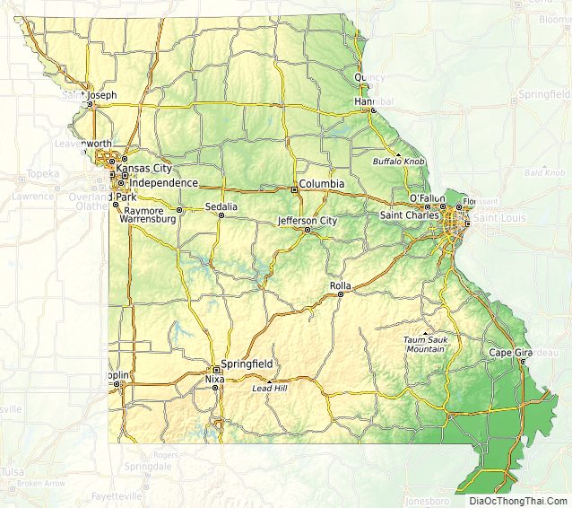
Missouri Physical Map
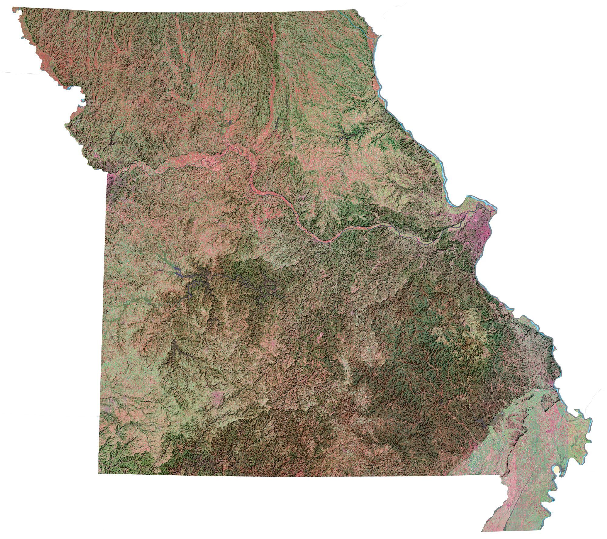
Missouri Topographic Map
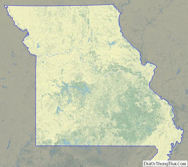
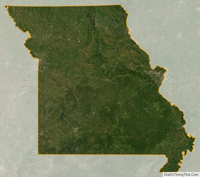
Missouri Satellite Map
Others printable maps
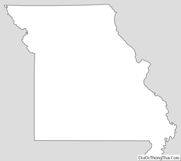
Missouri Outline Map
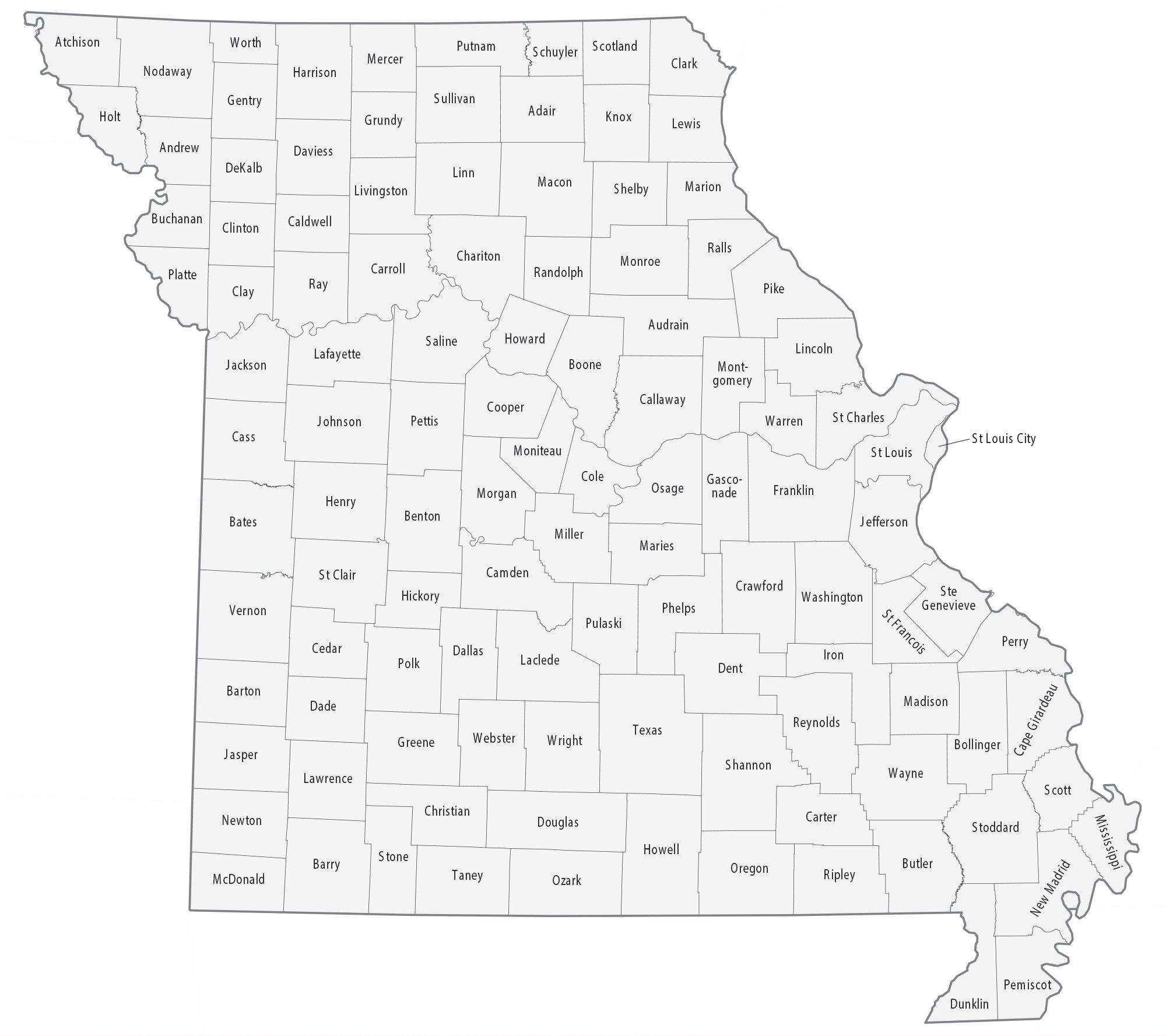
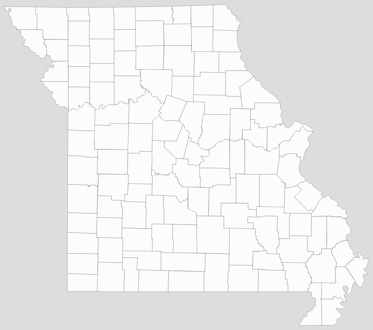
Blank Missouri County Map
See also
Map of Missouri State and its subdivision:- Adair
- Andrew
- Atchison
- Audrain
- Barry
- Barton
- Bates
- Benton
- Bollinger
- Boone
- Buchanan
- Butler
- Caldwell
- Callaway
- Camden
- Cape Girardeau
- Carroll
- Carter
- Cass
- Cedar
- Chariton
- Christian
- Clark
- Clay
- Clinton
- Cole
- Cooper
- Crawford
- Dade
- Dallas
- Daviess
- De Kalb
- Dent
- Douglas
- Dunklin
- Franklin
- Gasconade
- Gentry
- Greene
- Grundy
- Harrison
- Henry
- Hickory
- Holt
- Howard
- Howell
- Iron
- Jackson
- Jasper
- Jefferson
- Johnson
- Knox
- Laclede
- Lafayette
- Lawrence
- Lewis
- Lincoln
- Linn
- Livingston
- Macon
- Madison
- Maries
- Marion
- McDonald
- Mercer
- Miller
- Mississippi
- Moniteau
- Monroe
- Montgomery
- Morgan
- New Madrid
- Newton
- Nodaway
- Oregon
- Osage
- Ozark
- Pemiscot
- Perry
- Pettis
- Phelps
- Pike
- Platte
- Polk
- Pulaski
- Putnam
- Ralls
- Randolph
- Ray
- Reynolds
- Ripley
- Saint Charles
- Saint Clair
- Saint Francois
- Saint Louis
- Sainte Genevieve
- Saline
- Schuyler
- Scotland
- Scott
- Shannon
- Shelby
- Stoddard
- Stone
- Sullivan
- Taney
- Texas
- Vernon
- Warren
- Washington
- Wayne
- Webster
- Worth
- Wright
- Alabama
- Alaska
- Arizona
- Arkansas
- California
- Colorado
- Connecticut
- Delaware
- District of Columbia
- Florida
- Georgia
- Hawaii
- Idaho
- Illinois
- Indiana
- Iowa
- Kansas
- Kentucky
- Louisiana
- Maine
- Maryland
- Massachusetts
- Michigan
- Minnesota
- Mississippi
- Missouri
- Montana
- Nebraska
- Nevada
- New Hampshire
- New Jersey
- New Mexico
- New York
- North Carolina
- North Dakota
- Ohio
- Oklahoma
- Oregon
- Pennsylvania
- Rhode Island
- South Carolina
- South Dakota
- Tennessee
- Texas
- Utah
- Vermont
- Virginia
- Washington
- West Virginia
- Wisconsin
- Wyoming


