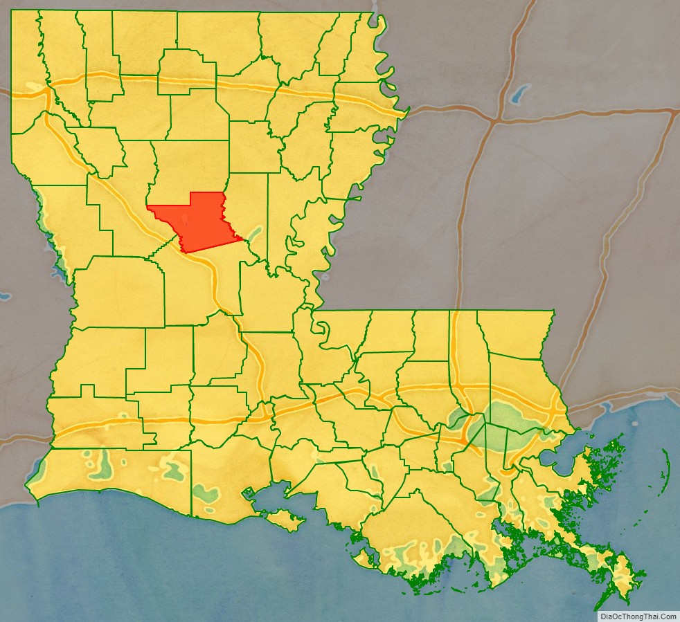
| Name: | Grant Parish |
|---|---|
| FIPS code: | 22-043 |
| State: | Louisiana |
| Founded: | 1869 |
| Named for: | Ulysses S. Grant |
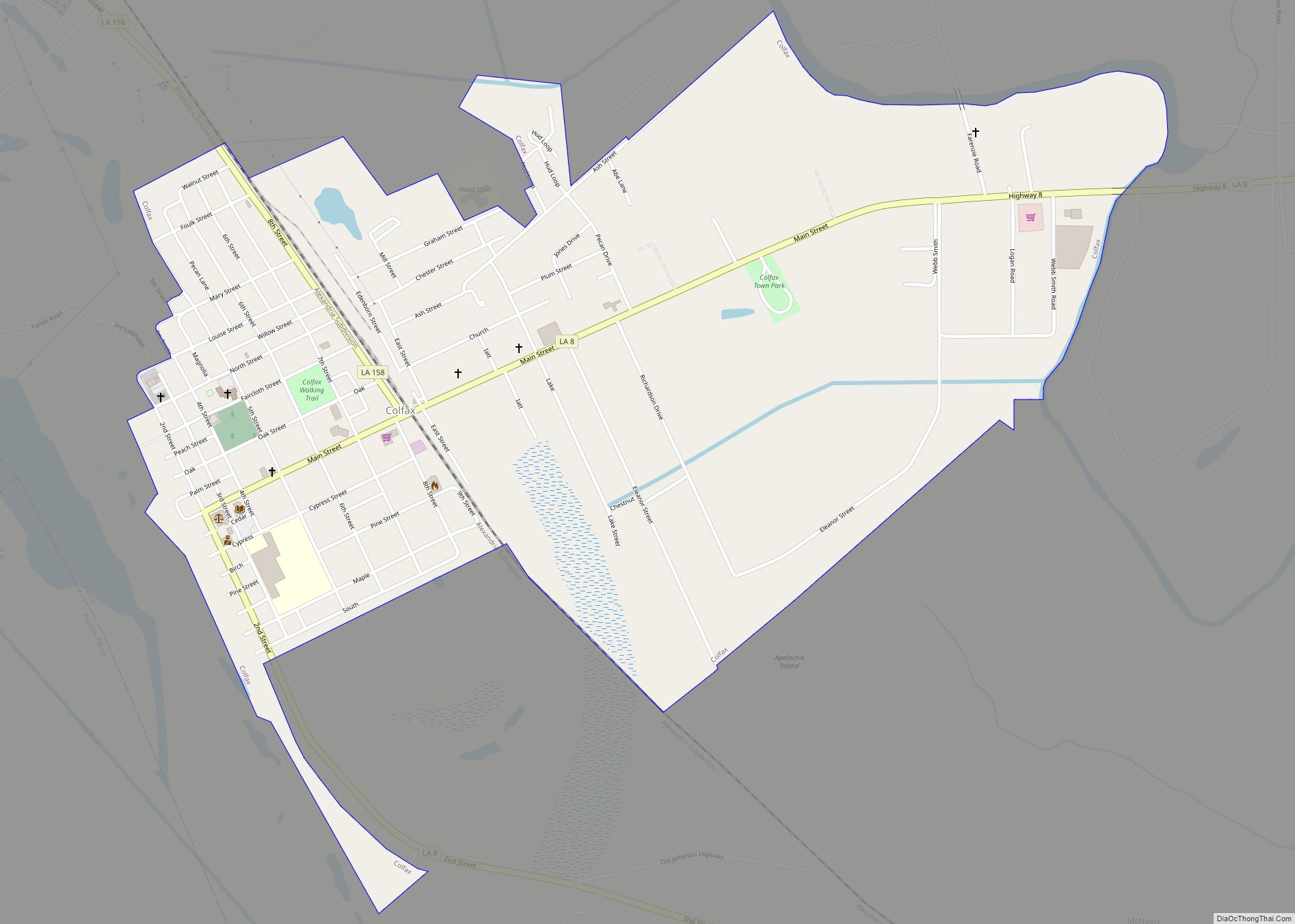
| Seat: | Colfax |
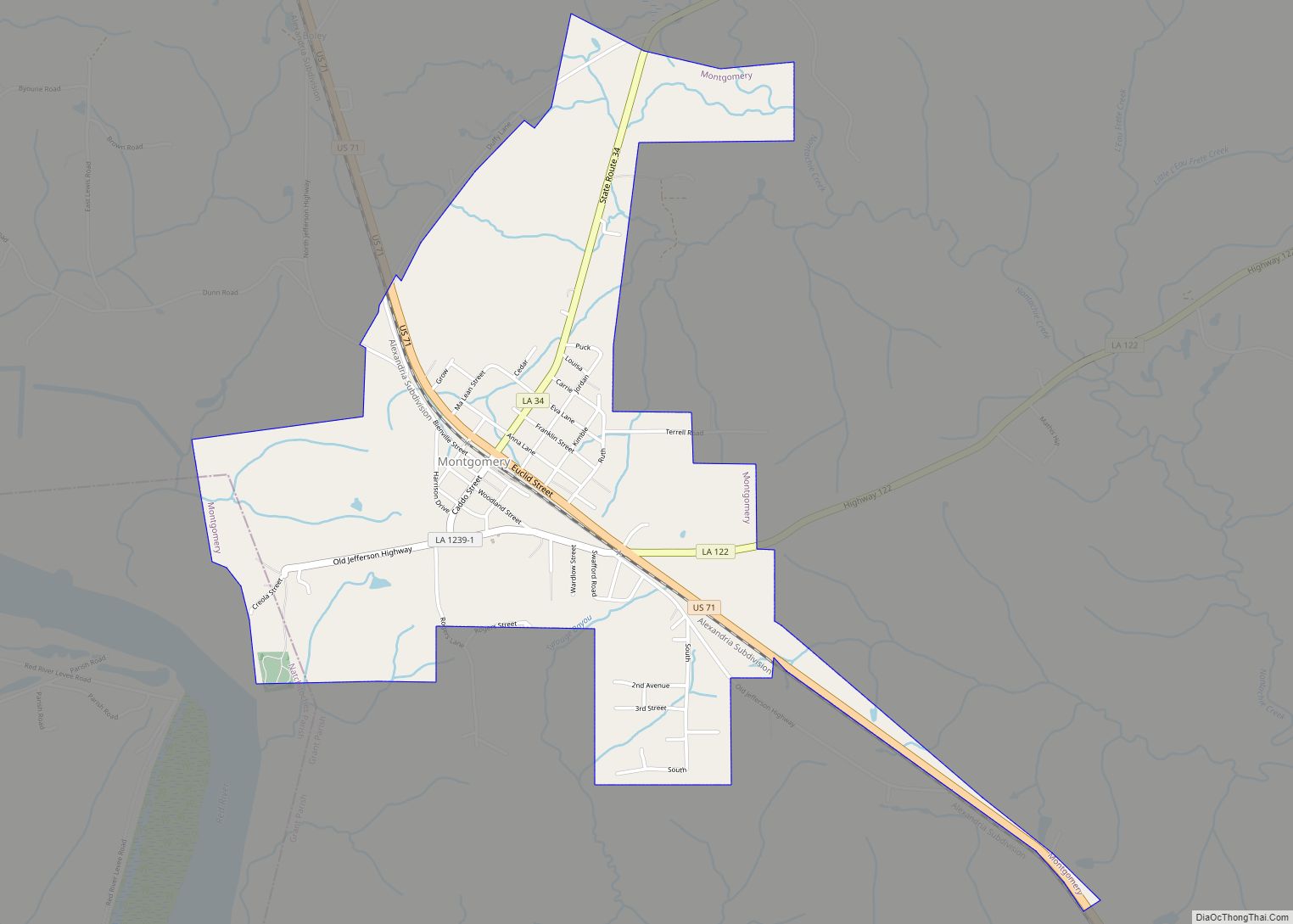
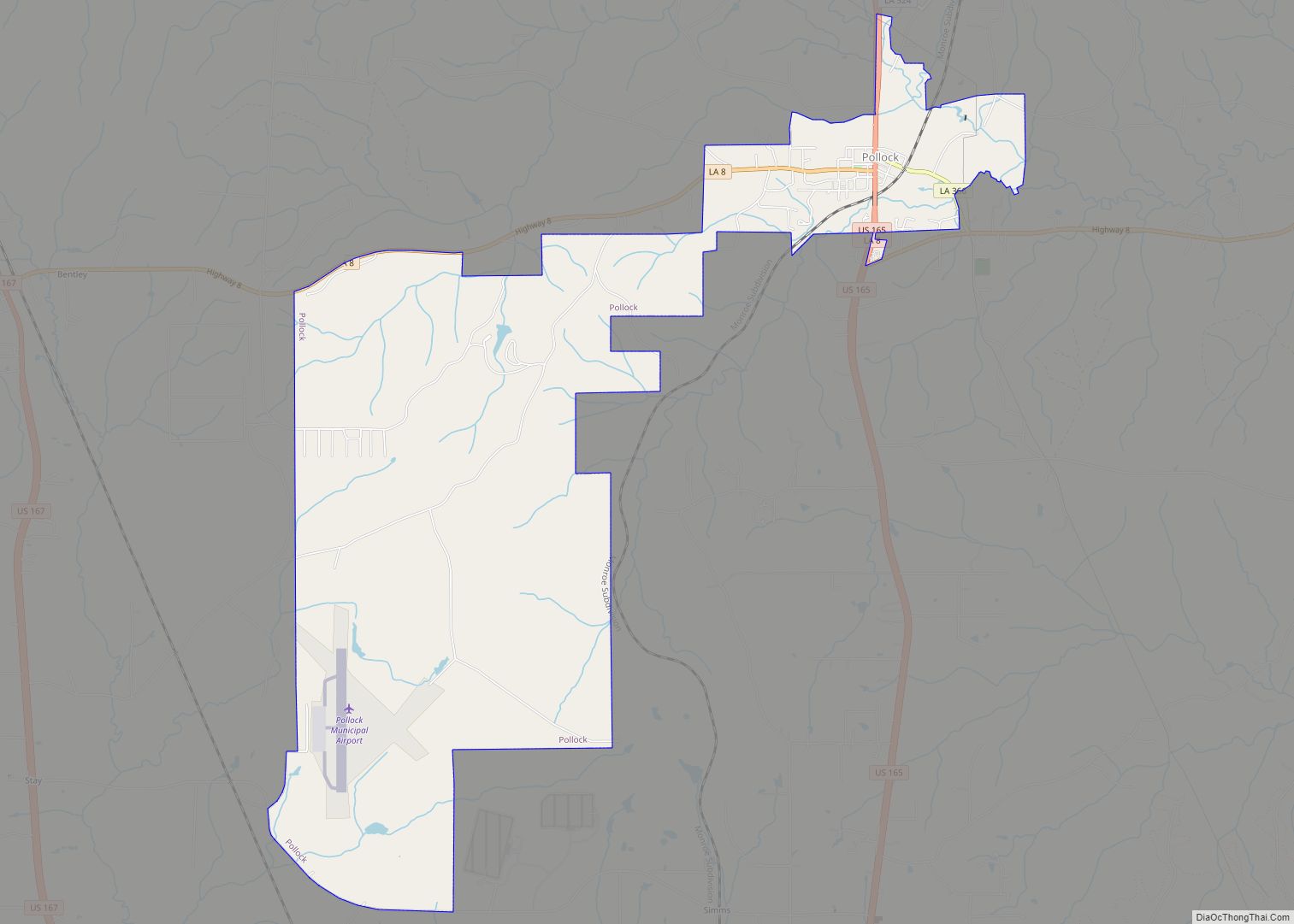
| Largest town: | Montgomery (area) Colfax (population) |
| Total Area: | 1,720 km² (665 sq mi) |
| Land Area: | 1,670 km² (643 sq mi) |
| Total Population: | 22,169 |
| Population Density: | 13/km² (33/sq mi) |
| Time zone: | UTC-6 (CST) |
| Summer Time Zone (DST): | UTC-5 (CDT) |
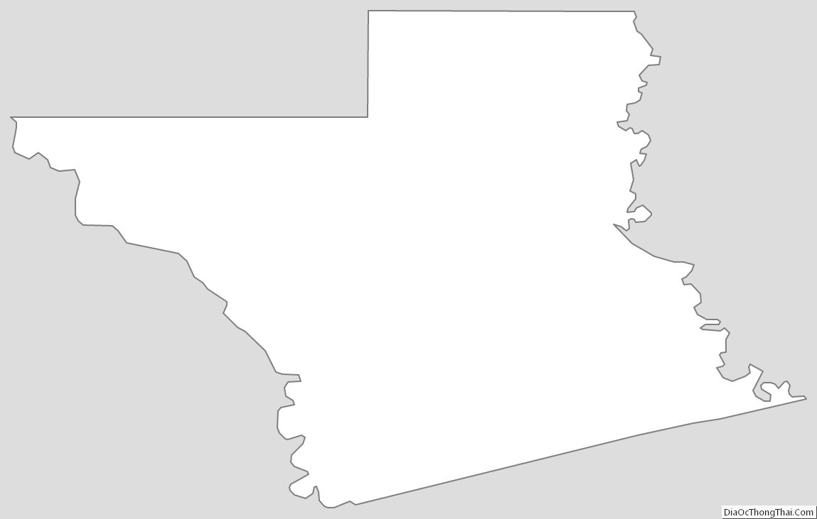
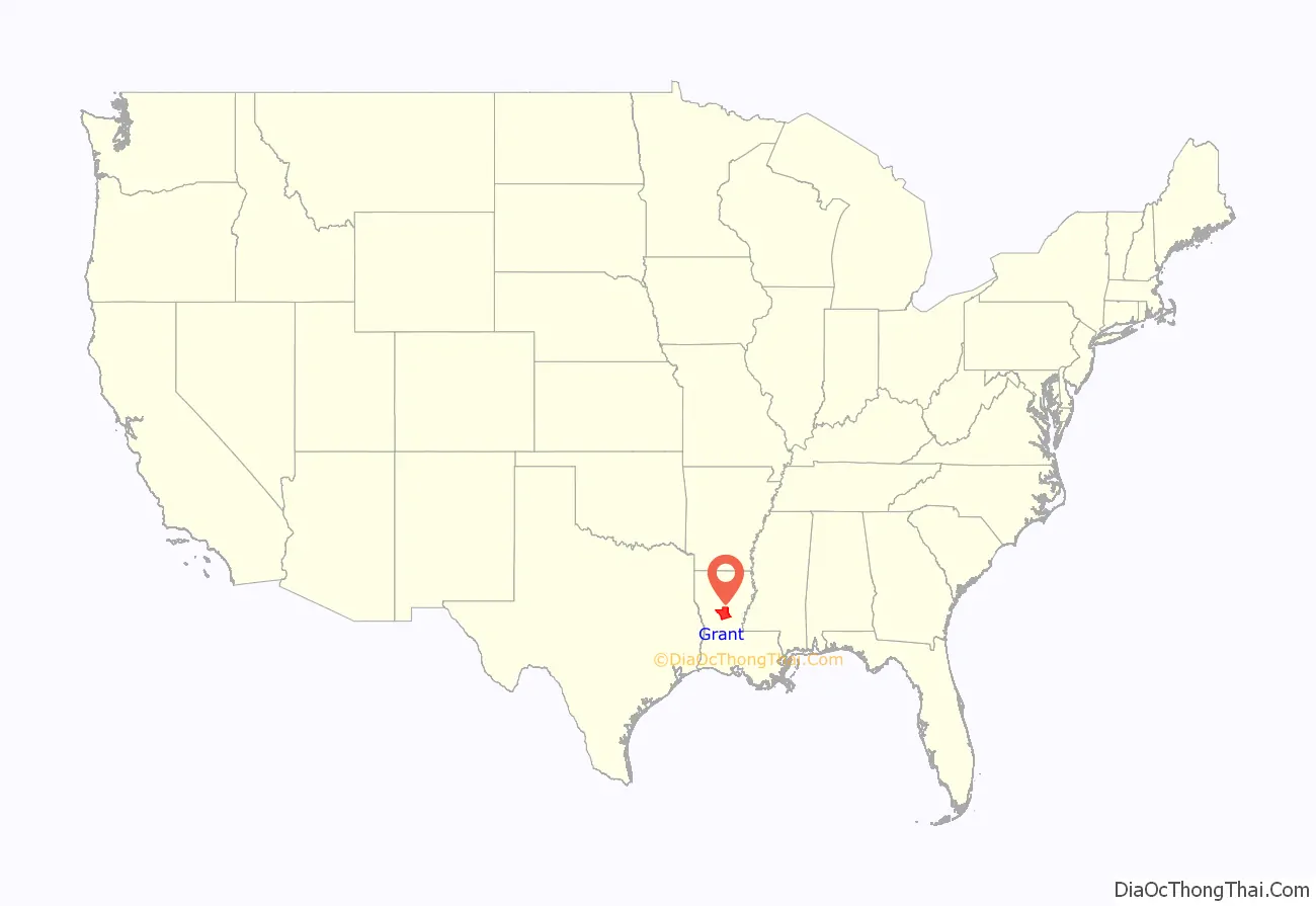
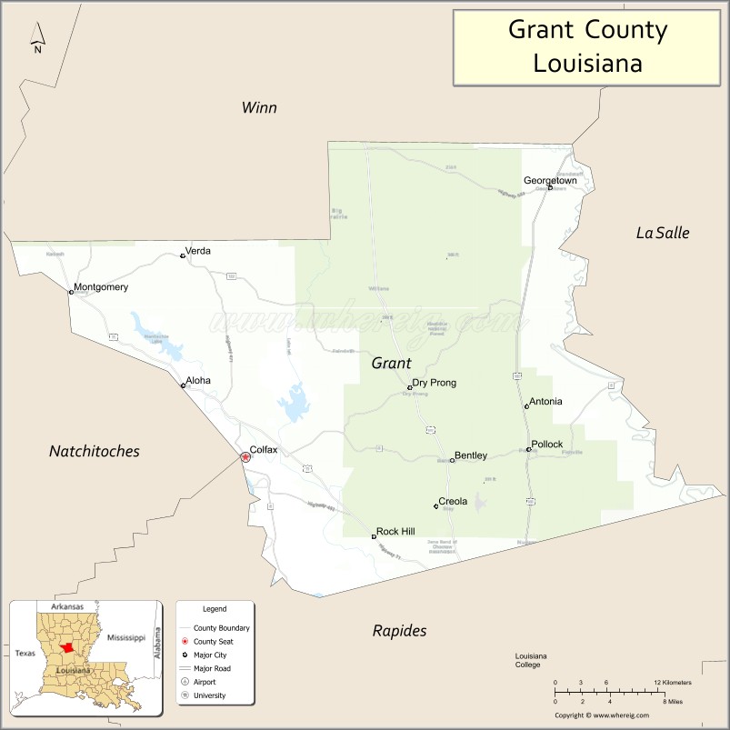
Grant Parish location map. Where is Grant Parish?
History
Grant Parish was originally a part of the more populous Rapides Parish to the south. Prior to the American Civil War, the center of activity focused upon “Calhoun’s Landing,” named for the cotton and sugar planter Meredith Calhoun, a native of South Carolina. Calhoun also published the former National Democrat newspaper in what became Colfax, designated as the seat of government of the new parish.
Grant was one of several new parishes created by the Reconstruction legislature in an attempt to build the Republican Party in the state. Founded in 1869, it had a slight majority of freedmen, many of whom had worked on cotton plantations in the area. It was named for U.S. President Ulysses S. Grant. The parish seat of Colfax was named for Grant’s first vice president, Schuyler M. Colfax (whose name is pronounced COAL-facks) of Indiana. However, the town of Colfax is pronounced CAHL-facks. The parish came into existence on March 4, 1869, which also was the day of President Grant’s first inauguration. The parish encompassed both cotton plantations and pinewoods. It was one of several areas along the Red River that had considerable violence during Reconstruction, as whites tried to maintain social control.
The gubernatorial election of 1872 was disputed in the state, and both the Democrats and Republicans certified their slates of local officers. Two inaugurations were held. The election was finally settled in favor of the Republican candidates, but the decision was disputed in certain areas. As social tensions rose, Republican officials took their places at the courthouse in Colfax. They were defended by freedmen and state militia (mostly made up of freedmen), who feared a Democratic Party takeover of the parish. Amid widespread rumors, whites organized a militia and advanced on the courthouse on Easter Sunday, 1873. In the ensuing violence, three whites and 120-150 blacks were killed, including 50 that night who were held as prisoners. Leading late 20th-century historians renamed the Colfax Riot, the original state designation, as the Colfax Massacre. The total number of freedmen deaths were never established because some of the bodies were thrown into the river and woods.
The white militia was led by Christopher Columbus Nash, a Confederate officer who had been a prisoner of war at Johnson’s Island in Ohio. It consisted of veterans from Grant and neighboring parishes. The following year, Nash gathered many of the white militia members as the basis of the first chapter of the White League. Other chapters quickly grew up across the state. The White League’s organized violence in support of the Democratic Party included widespread intimidation of black voters. The League was integral to white Democrats’ regaining power in the state by 1876. Soon after, they effectively disfranchised most blacks, a situation that persisted until after federal enforcement of Civil Rights-era legislation of the mid-1960s.
Politics
Today Grant Parish is majority white and votes strongly Republican. Mitt Romney polled 7,082 votes (81.7 percent) in his 2012 race against the Democrat U.S. President Barack H. Obama, who trailed with 1,422 votes (16.4 percent). In 2008, U.S. Senator John McCain of Arizona swept the parish, with 6,907 votes (80.7 percent) to Obama’s 1,474 (17.2 percent).
In 1992, George Herbert Walker Bush carried Grant Parish but was unsuccessful in his bid for reelection. He polled 3,214 votes (40.8 percent) to Democratic Governor Bill Clinton of Arkansas’s 3,122 (39.6 percent). This son of the South carried numerous other Republican-leaning jurisdictions. Ross Perot, who later founded the Reform Party, polled 1,174 (14.9 percent). In 1996, Republican Robert J. Dole narrowly won in Grant Parish over U.S. President Bill Clinton, a son of the South, with 3,117 votes (42.8 percent) to 2,980 (40.9 percent). Ross Perot polled another 1,055 (14.5 percent).
The last Democrat to win in Grant Parish at the presidential level was former Governor Jimmy Carter of Georgia in his 1976 defeat of U.S. President Gerald R. Ford, Jr., who had Bob Dole as his vice-presidential partner.
Republican nominee Donald Trump was a runaway winner in Grant Parish in 2016 over Democrat Hillary Rodham Clinton: 7,408 (84 percent) to 1,181 (13 percent).
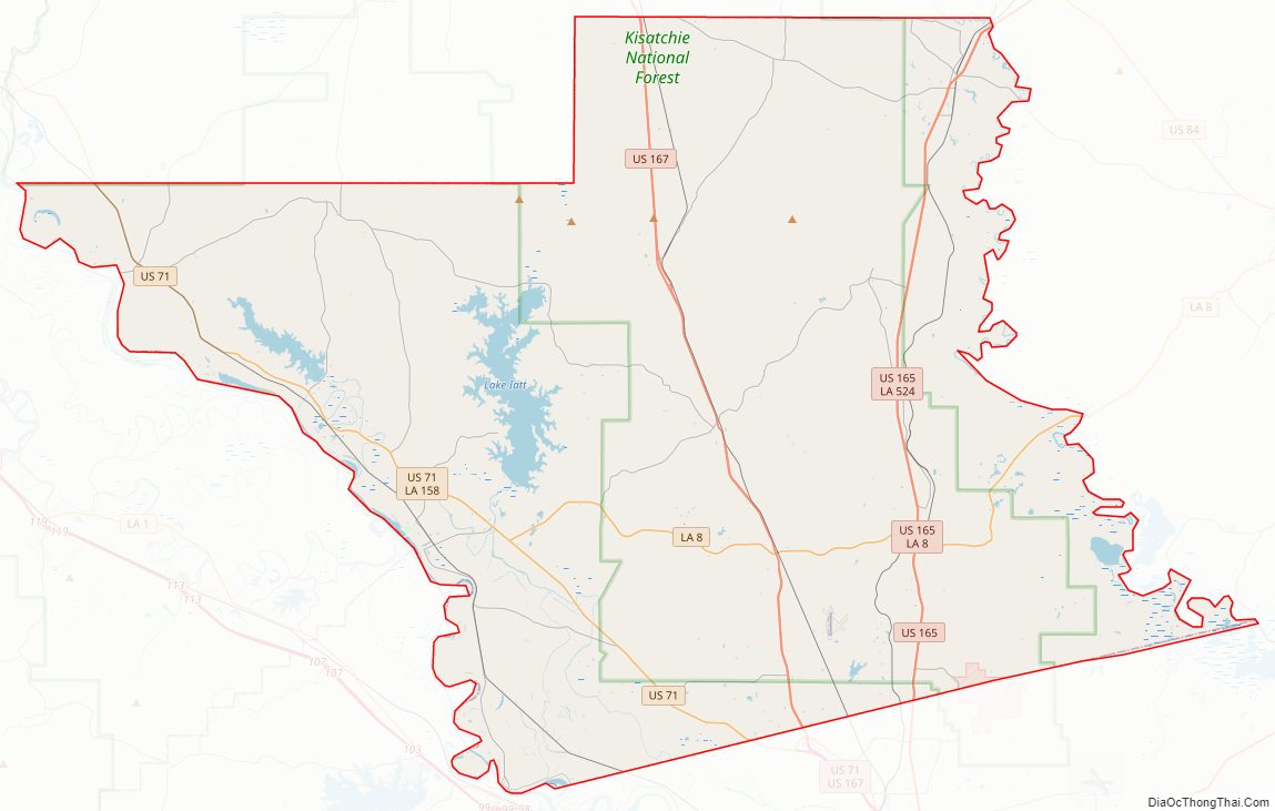
Grant Parish Road Map
Geography
According to the U.S. Census Bureau, the parish has a total area of 665 square miles (1,720 km), of which 643 square miles (1,670 km) is land and 22 square miles (57 km) (3.3%) is water.
Major highways
- U.S. Highway 71
- U.S. Highway 165
- U.S. Highway 167
- Louisiana Highway 8
- Louisiana Highway 34
- Louisiana Highway 122
- Louisiana Highway 123
- Louisiana Highway 471
- Louisiana Highway 500
Adjacent parishes
- Winn Parish (north)
- La Salle Parish (east)
- Rapides Parish (south)
- Natchitoches Parish (west)
National protected area
- Kisatchie National Forest (part)
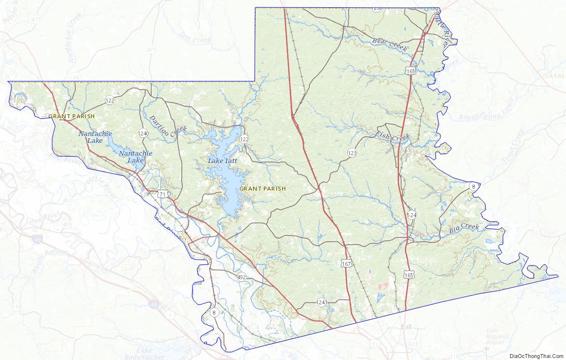
Grant Parish Topographic Map
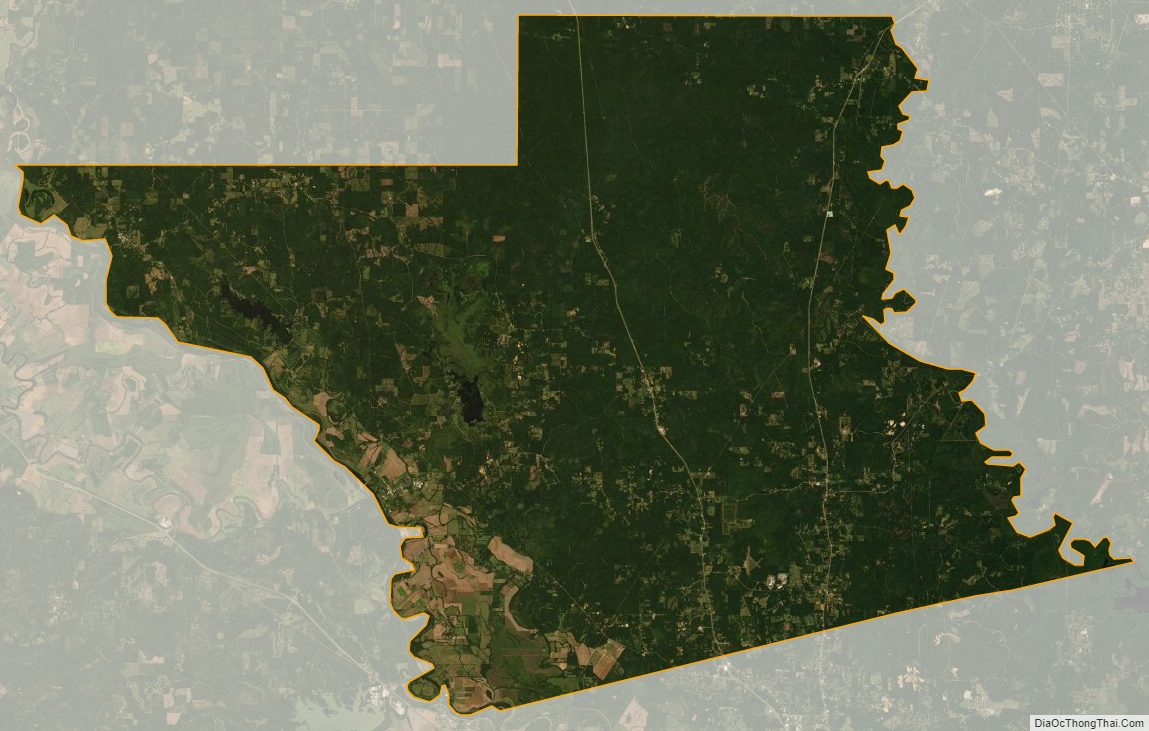
Grant Parish Satellite Map
Grant Parish Outline Map