Hubbard County is a county in the northwestern part of the U.S. state of Minnesota. As of the 2020 census, the population was 21,344. Its county seat is Park Rapids.
Part of the Leech Lake Indian Reservation is in the county.
| Name: | Hubbard County |
|---|---|
| FIPS code: | 27-057 |
| State: | Minnesota |
| Founded: | February 26, 1883 |
| Named for: | Lucius Frederick Hubbard |
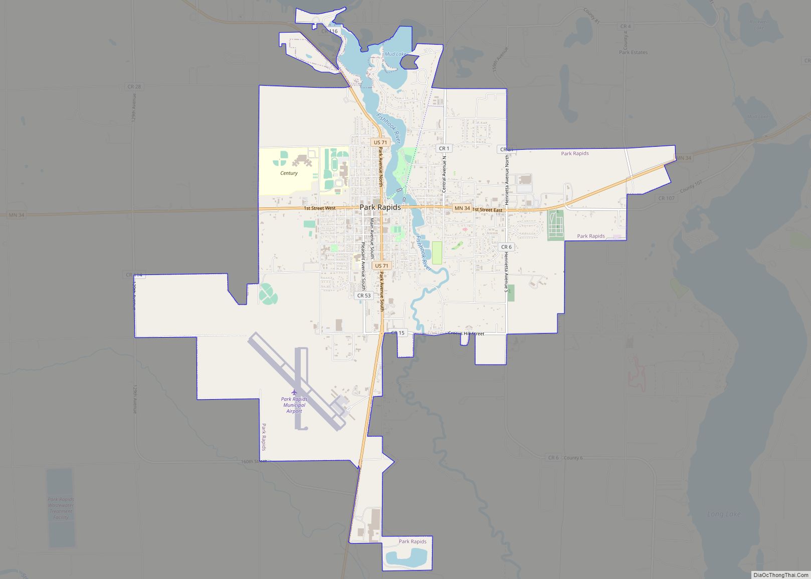
| Seat: | Park Rapids |
| Largest city: | Park Rapids |
| Total Area: | 999.39 sq mi (2,588.4 km²) |
| Land Area: | 922.46 sq mi (2,389.2 km²) |
| Total Population: | 21,344 |
| Population Density: | 23.1/sq mi (8/km²) |
| Time zone: | UTC−6 (Central) |
| Summer Time Zone (DST): | UTC−5 (CDT) |
| Website: | www.co.hubbard.mn.us |
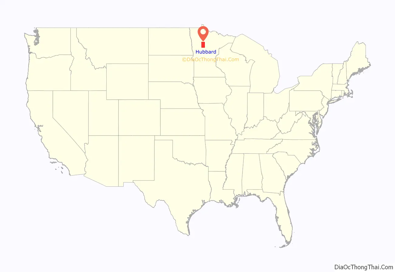
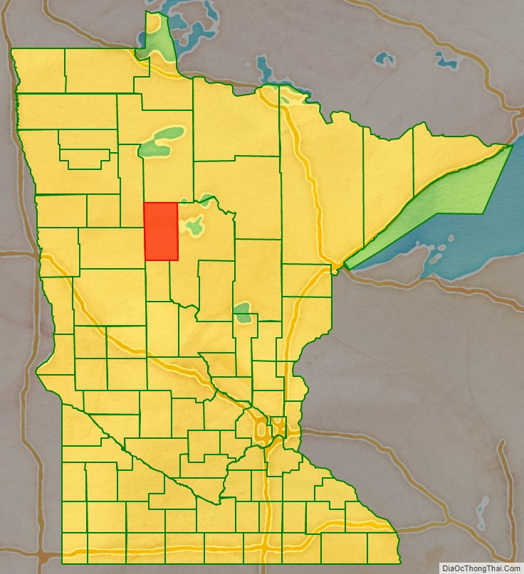
Hubbard County location map. Where is Hubbard County?
History
The county was created on February 26, 1883, with territory partitioned from Cass County. It was named for Lucius Frederick Hubbard, a prominent Territory editor, Civil War participant, and businessman who was governor of Minnesota from 1882 to 1887. The county’s boundaries have remained unchanged since its creation.
The new county’s courthouse was destroyed by fire around 1890, but the public records were salvaged.
Hubbard County Road Map
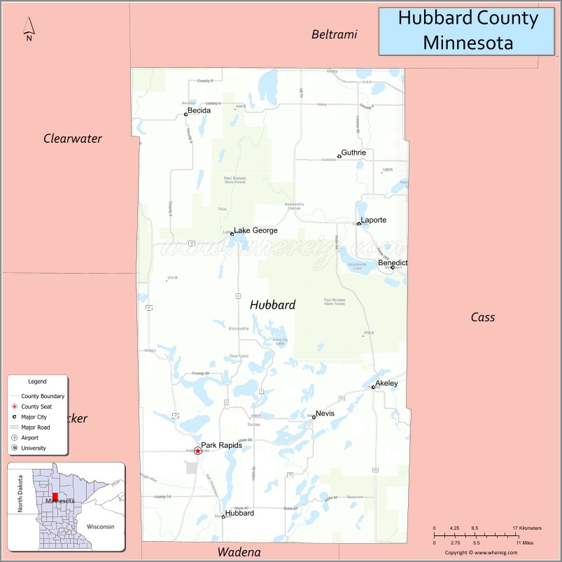
Geography
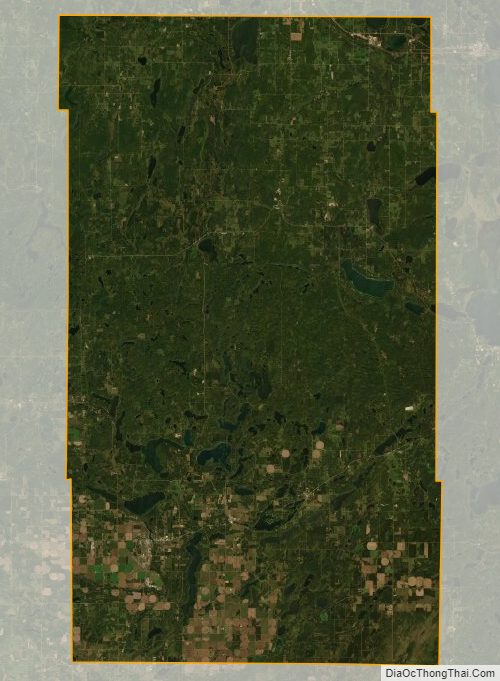
The county’s terrain is hilly, largely wooded, and dotted with lakes and ponds. It generally slopes to the east, with the northern part sloping to the north and the southern part sloping to the south. Its highest point is near the lower middle of its western border, at 1,549′ (472m) ASL. The county has an area of 1,000 square miles (2,600 km), of which 926 square miles (2,400 km) is land and 74 square miles (190 km) (7.4%) is water. There may be such a high point on the border but the accepted high point for this county is the Thorpe Lookout at 1844 feet which is why the forest service maintains a tower there the US Geodetic Survey agrees.47.0962°N, -94.8539° W
Major highways
- U.S. Highway 2
- U.S. Highway 71
- Minnesota State Highway 34
- Minnesota State Highway 64
- Minnesota State Highway 87
- Minnesota State Highway 113
- Minnesota State Highway 200
- Minnesota State Highway 226
Adjacent counties
- Beltrami County – north
- Cass County – east
- Wadena County – south
- Becker County – southwest
- Clearwater County – northwest
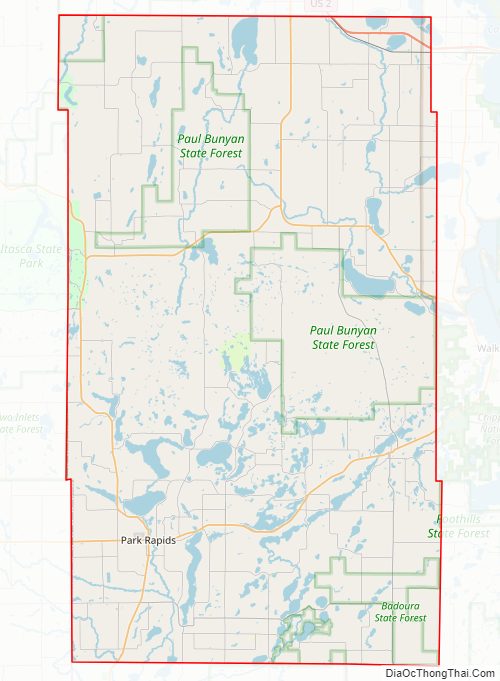
Protected areas
- Badoura Jack Pine Woodland Scientific and Natural Area
- Huntersville State Forest (part)
- Itasca State Park (part)
- Mississippi Headwaters (part)
- Paul Bunyan State Forest (part)
Hubbard County Topographic Map
Hubbard County Satellite Map
Hubbard County Outline Map