Park Rapids is a city in and the county seat of Hubbard County, Minnesota, United States. It is near Itasca State Park, the source of the Mississippi River, as well as the beginning of the Heartland State Trail. The city was founded in 1890 near the Fish Hook River rapids and is along U.S. Highway 71 and Minnesota State Highway 34. The population was 4,142 at the 2020 census.
| Name: | Park Rapids city |
|---|---|
| LSAD Code: | 25 |
| LSAD Description: | city (suffix) |
| State: | Minnesota |
| County: | Hubbard County |
| Founded: | 1882 |
| Elevation: | 1,440 ft (439 m) |
| Total Area: | 7.67 sq mi (19.85 km²) |
| Land Area: | 7.39 sq mi (19.14 km²) |
| Water Area: | 0.28 sq mi (0.72 km²) |
| Total Population: | 4,142 |
| Population Density: | 560.56/sq mi (216.45/km²) |
| ZIP code: | 56470 |
| Area code: | 218 |
| FIPS code: | 2749768 |
| GNISfeature ID: | 0649151 |
| Website: | ci.park-rapids.mn.us |
Online Interactive Map
Click on ![]() to view map in "full screen" mode.
to view map in "full screen" mode.
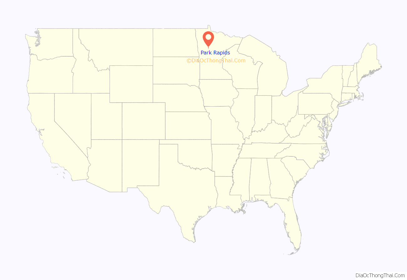
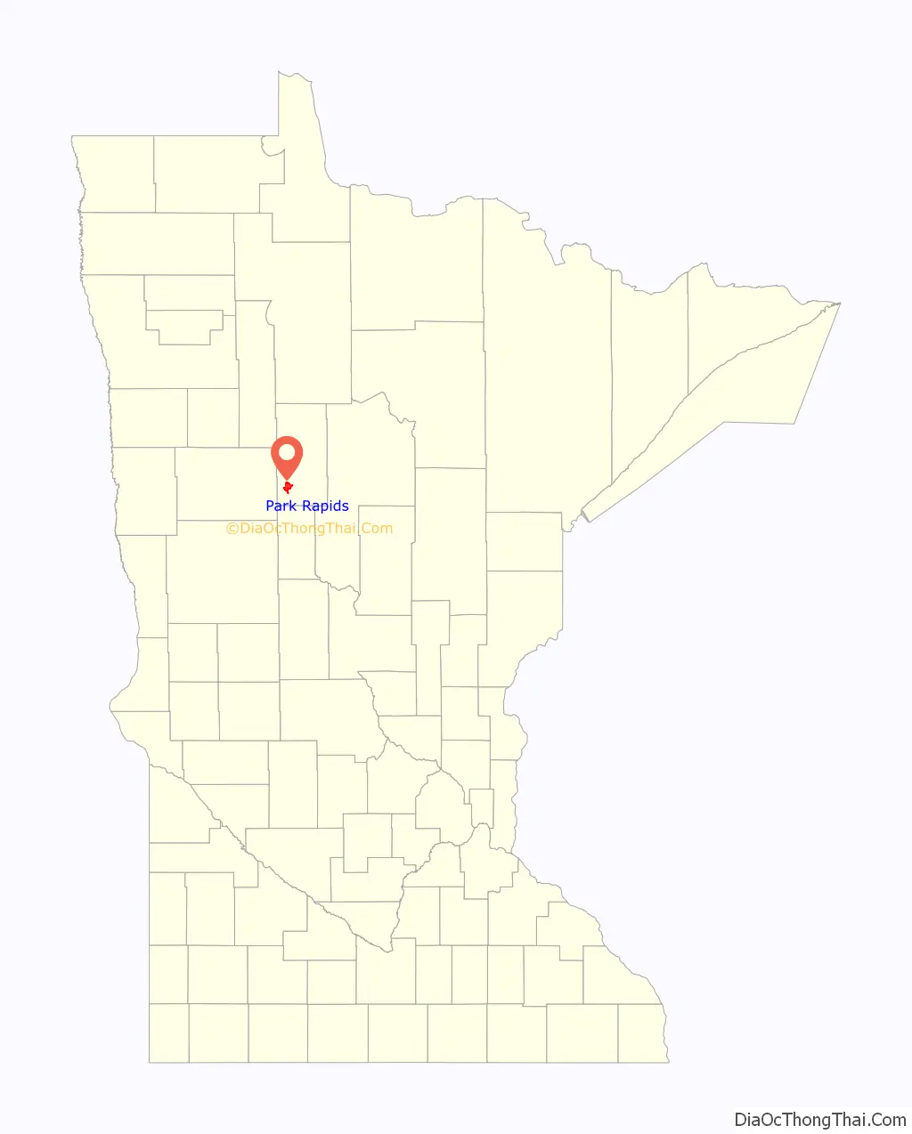
Park Rapids location map. Where is Park Rapids city?
History
Park Rapids became a city in 1882, and was named by Frank C. Rice after the park groves and prairies beside the Fish Hook River rapids. These rapids have since been dammed.
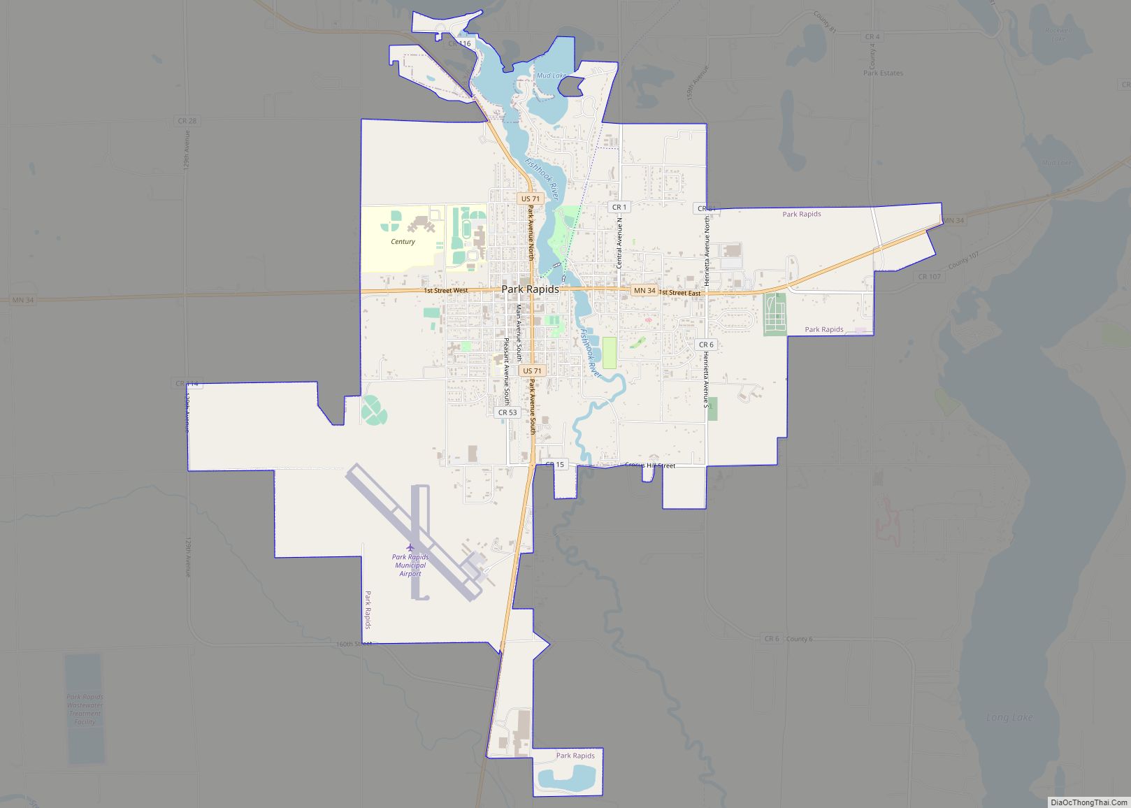
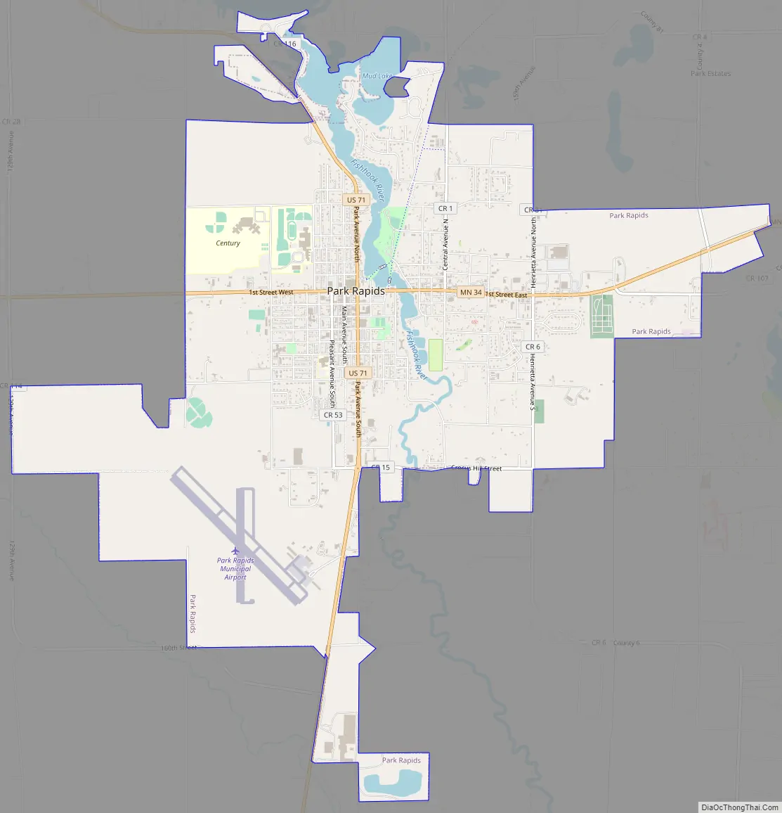
Park Rapids Road Map
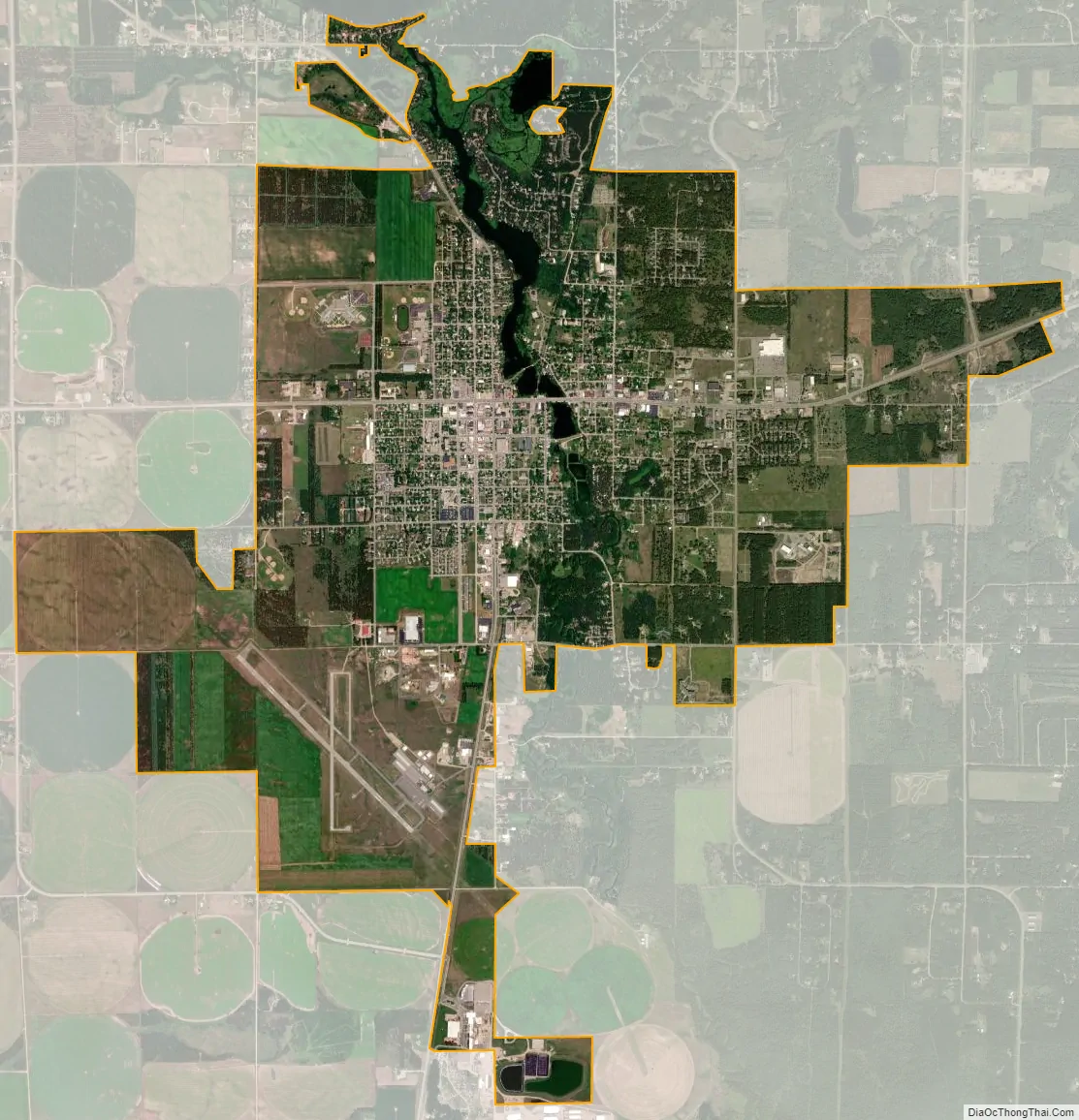
Park Rapids city Satellite Map
Geography
According to the United States Census Bureau, the city has an area of 6.81 square miles (17.64 km), of which 6.59 square miles (17.07 km) is land and 0.22 square miles (0.57 km) is water. The Fish Hook River flows through the city, which is surrounded by three lakes: Fish Hook, Long, and Potato.
See also
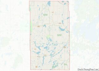
Map of Minnesota State and its subdivision:- Aitkin
- Anoka
- Becker
- Beltrami
- Benton
- Big Stone
- Blue Earth
- Brown
- Carlton
- Carver
- Cass
- Chippewa
- Chisago
- Clay
- Clearwater
- Cook
- Cottonwood
- Crow Wing
- Dakota
- Dodge
- Douglas
- Faribault
- Fillmore
- Freeborn
- Goodhue
- Grant
- Hennepin
- Houston
- Hubbard
- Isanti
- Itasca
- Jackson
- Kanabec
- Kandiyohi
- Kittson
- Koochiching
- Lac qui Parle
- Lake
- Lake of the Woods
- Lake Superior
- Le Sueur
- Lincoln
- Lyon
- Mahnomen
- Marshall
- Martin
- McLeod
- Meeker
- Mille Lacs
- Morrison
- Mower
- Murray
- Nicollet
- Nobles
- Norman
- Olmsted
- Otter Tail
- Pennington
- Pine
- Pipestone
- Polk
- Pope
- Ramsey
- Red Lake
- Redwood
- Renville
- Rice
- Rock
- Roseau
- Saint Louis
- Scott
- Sherburne
- Sibley
- Stearns
- Steele
- Stevens
- Swift
- Todd
- Traverse
- Wabasha
- Wadena
- Waseca
- Washington
- Watonwan
- Wilkin
- Winona
- Wright
- Yellow Medicine
- Alabama
- Alaska
- Arizona
- Arkansas
- California
- Colorado
- Connecticut
- Delaware
- District of Columbia
- Florida
- Georgia
- Hawaii
- Idaho
- Illinois
- Indiana
- Iowa
- Kansas
- Kentucky
- Louisiana
- Maine
- Maryland
- Massachusetts
- Michigan
- Minnesota
- Mississippi
- Missouri
- Montana
- Nebraska
- Nevada
- New Hampshire
- New Jersey
- New Mexico
- New York
- North Carolina
- North Dakota
- Ohio
- Oklahoma
- Oregon
- Pennsylvania
- Rhode Island
- South Carolina
- South Dakota
- Tennessee
- Texas
- Utah
- Vermont
- Virginia
- Washington
- West Virginia
- Wisconsin
- Wyoming