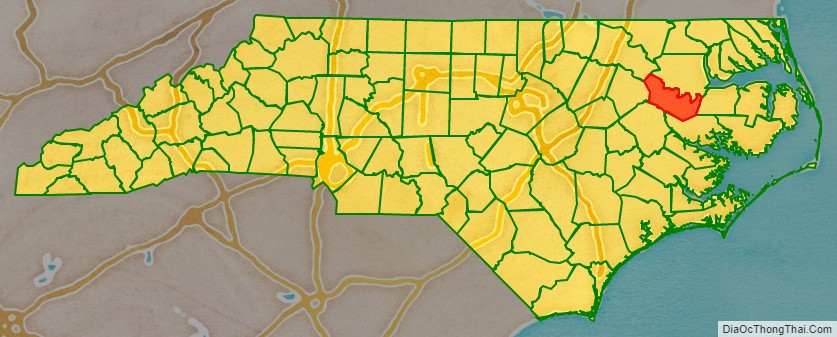
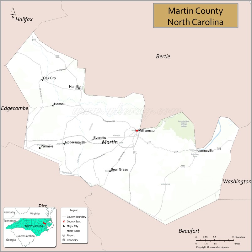
Martin County is a county located in the U.S. state of North Carolina. As of the 2020 census, the population was 22,031. Its county seat is Williamston.
| Name: | Martin County |
|---|---|
| FIPS code: | 37-117 |
| State: | North Carolina |
| Founded: | March 14, 1774 |
| Named for: | Josiah Martin |
| Seat: | Williamston |
| Largest town: | Williamston |
| Total Area: | 462 sq mi (1,200 km²) |
| Land Area: | 461 sq mi (1,190 km²) |
| Total Population: | 22,031 |
| Population Density: | 47.2/sq mi (18.2/km²) |
| Time zone: | UTC−5 (Eastern) |
| Summer Time Zone (DST): | UTC−4 (EDT) |
| Website: | www.martincountyncgov.com |
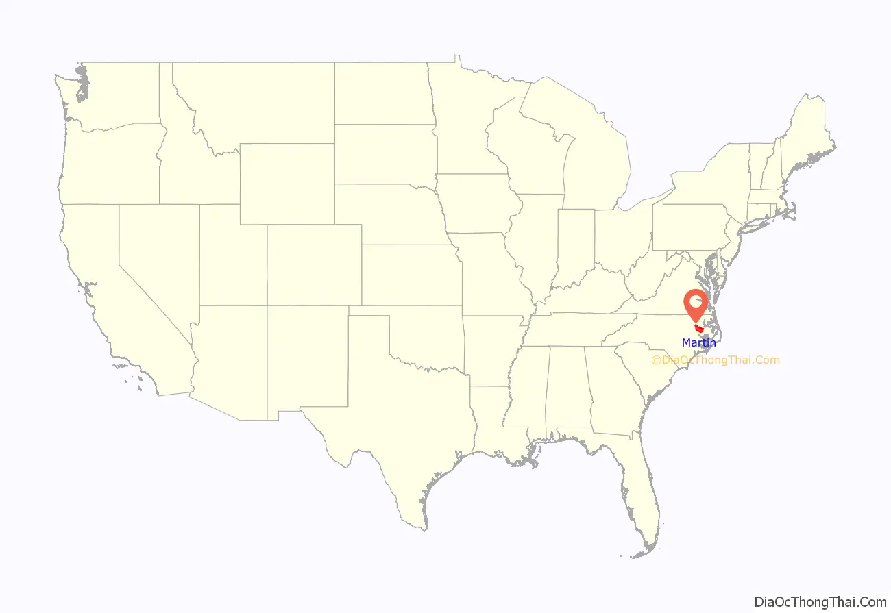
Martin County location map. Where is Martin County?
History
The county was formed in 1774 from the southeastern part of Halifax County and the western part of Tyrrell County. It was named for Josiah Martin, the last royal governor of North Carolina (1771–75). Whereas Dobbs County and Tryon County, named for Martin’s predecessors Arthur Dobbs and William Tryon, were abolished after American independence, Martin County was neither abolished nor renamed, a fact which has been attributed to the popularity of Alexander Martin, twice governor of the state (1782–84, 1789–92).
The Martin County Courthouse was listed on the National Register of Historic Places in 1979.
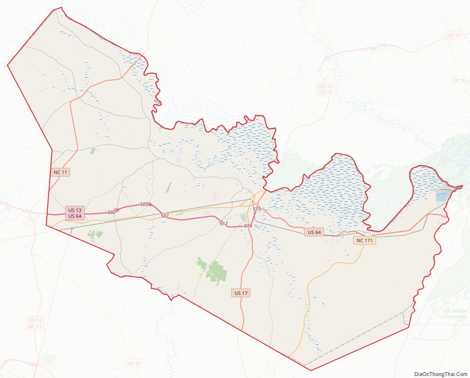
Martin County Road Map
Geography
According to the U.S. Census Bureau, the county has a total area of 462 square miles (1,200 km), of which 461 square miles (1,190 km) is land and 0.3 square miles (0.78 km) (0.06%) is water.
State and local protected areas/sites
- Fort Branch Confederate Earthen Fort Civil War Site
- Foxtale Hunting Preserve
- Lower Roanoke River Wetlands Game Land
- Jamesville Wildlife Preserve
Major water bodies
- Conoho Creek
- Etheridge Creek
- Gardiners Creek
- Hardison Mill Creek
- Long Creek
- Roanoke River
- Smithwick Creek
- Tranters Creek
- Welch Creek
Adjacent counties
- Bertie County – northeast
- Washington County – east
- Beaufort County – southeast
- Pitt County – southwest
- Edgecombe County – west
- Halifax County – northwest
Major highways
- Future I-87 (Concurrency with US 17 and US 64)
- US 13
- US 17
- US 64
- US 64 Alt.
- US 64 Bus.
- NC 11
- NC 42
- NC 111
- NC 125
- NC 142
- NC 171
- NC 903
Major infrastructure
- Marin County Airport
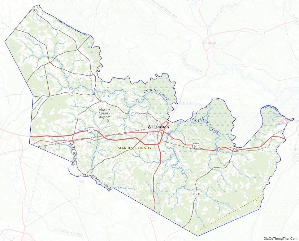
Martin County Topographic Map
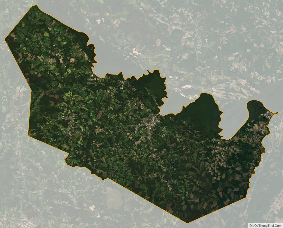
Martin County Satellite Map
Martin County Outline Map