Williamston is a town and the county seat of Martin County, North Carolina, United States. The population was 5,511 at the 2010 census. It is located in North Carolina’s Inner Banks region. The closest major city is Greenville, approximately 28 mi to the southwest.
| Name: | Williamston town |
|---|---|
| LSAD Code: | 43 |
| LSAD Description: | town (suffix) |
| State: | North Carolina |
| County: | Martin County |
| Elevation: | 69 ft (21 m) |
| Total Area: | 4.51 sq mi (11.68 km²) |
| Land Area: | 4.51 sq mi (11.68 km²) |
| Water Area: | 0.00 sq mi (0.00 km²) |
| Total Population: | 5,248 |
| Population Density: | 1,163.38/sq mi (449.14/km²) |
| ZIP code: | 27892 |
| Area code: | 252 |
| FIPS code: | 3774220 |
| GNISfeature ID: | 1023261 |
| Website: | www.townofwilliamston.com |
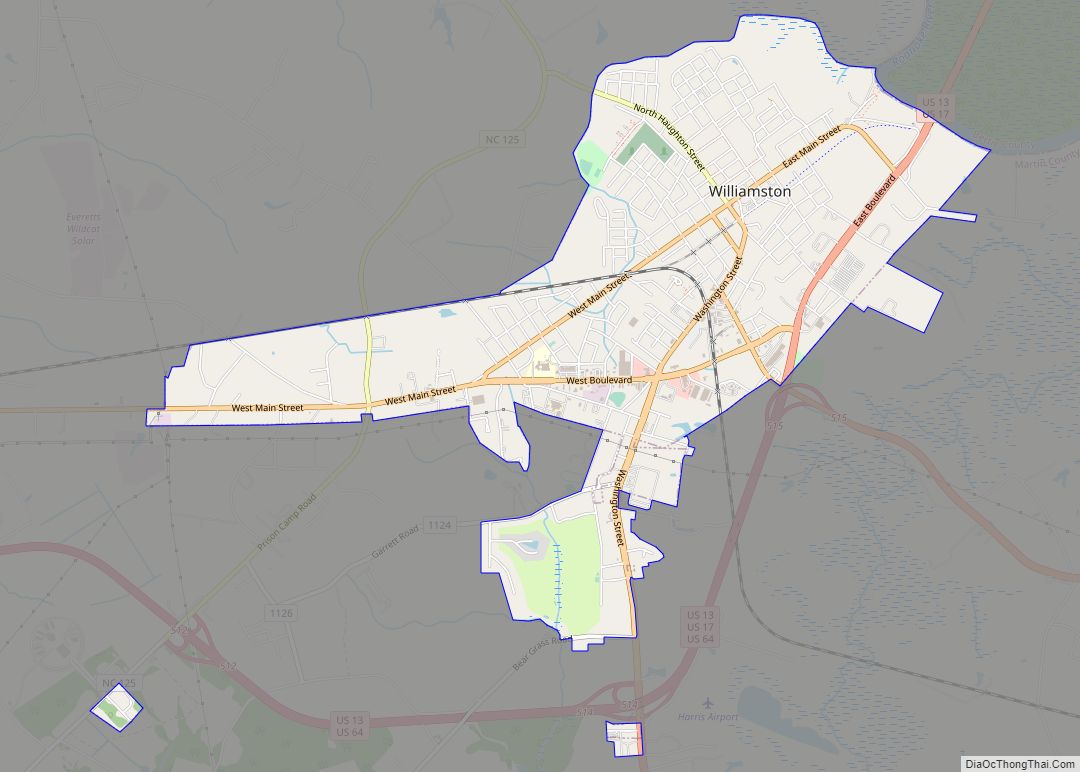
Online Interactive Map
Click on ![]() to view map in "full screen" mode.
to view map in "full screen" mode.
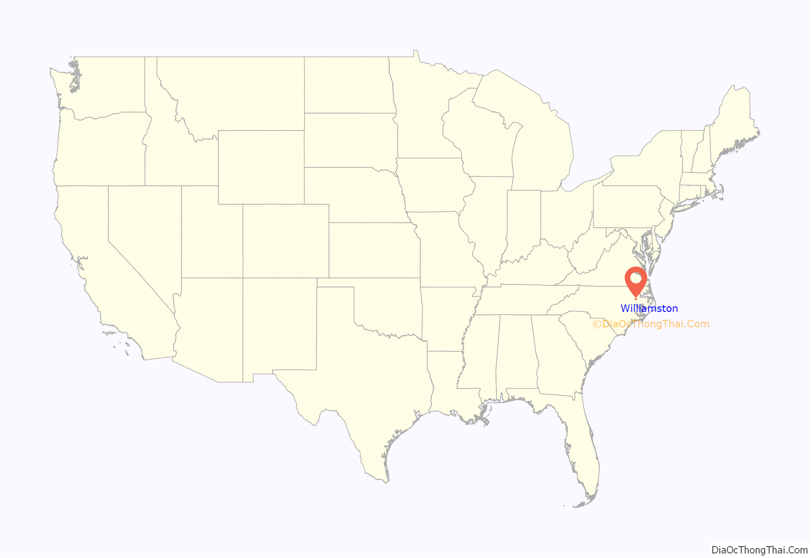
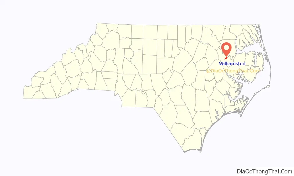
Williamston location map. Where is Williamston town?
History
Williamston was founded in 1779, and named after William Williams, a local military commander.
Williamston was the focus of activity in the civil rights movement. Beginning in June 1963, civil rights activists protested at City Hall for 29 consecutive days led by Golden Frinks.
The Ku Klux Klan was very active in this part of the state during this time, including a well-documented rally in Williamston on October 5, 1963, attended by mostly local residents but with several carloads of attendees traveling over 150 miles to attend.
Williamston Road Map
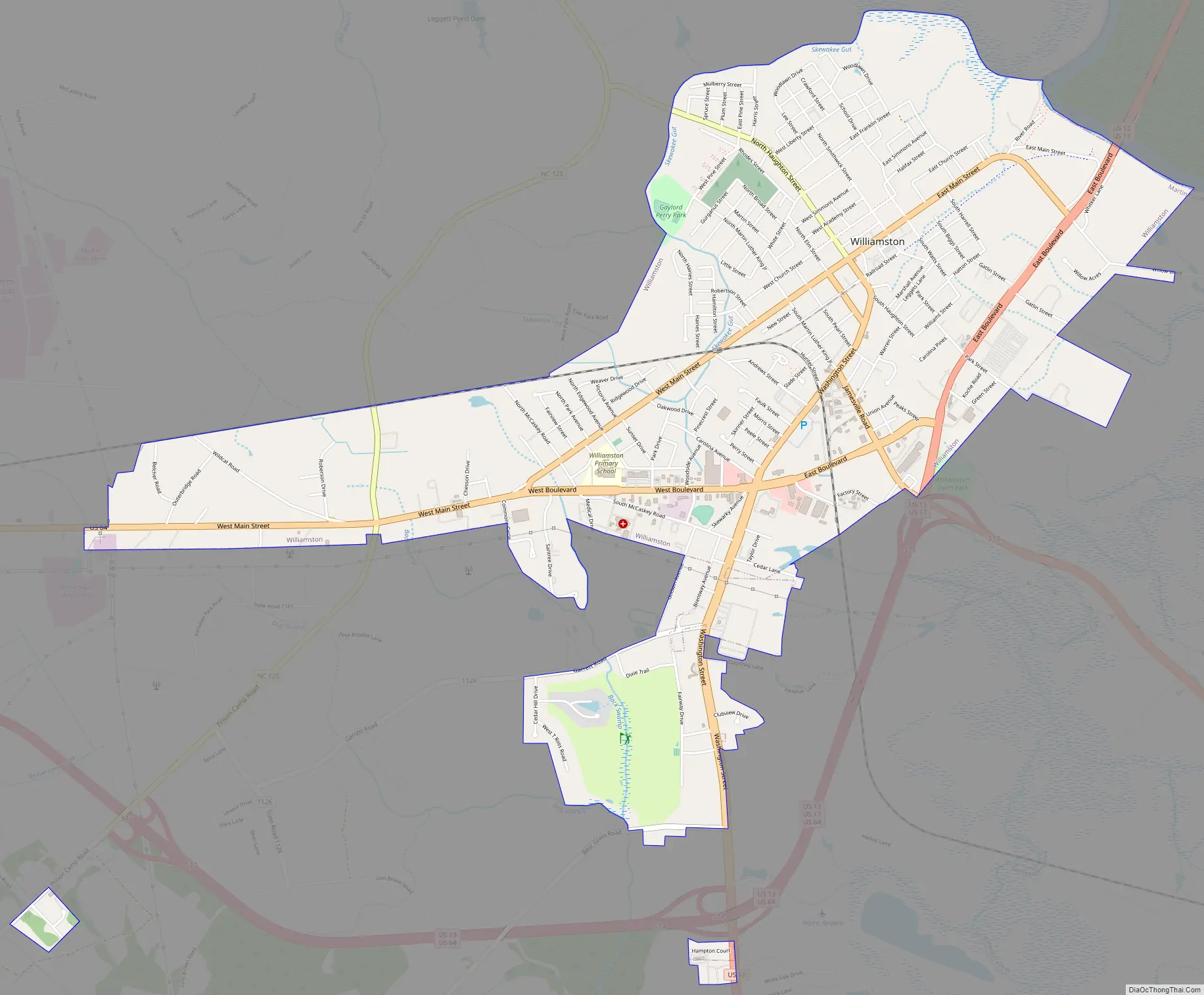
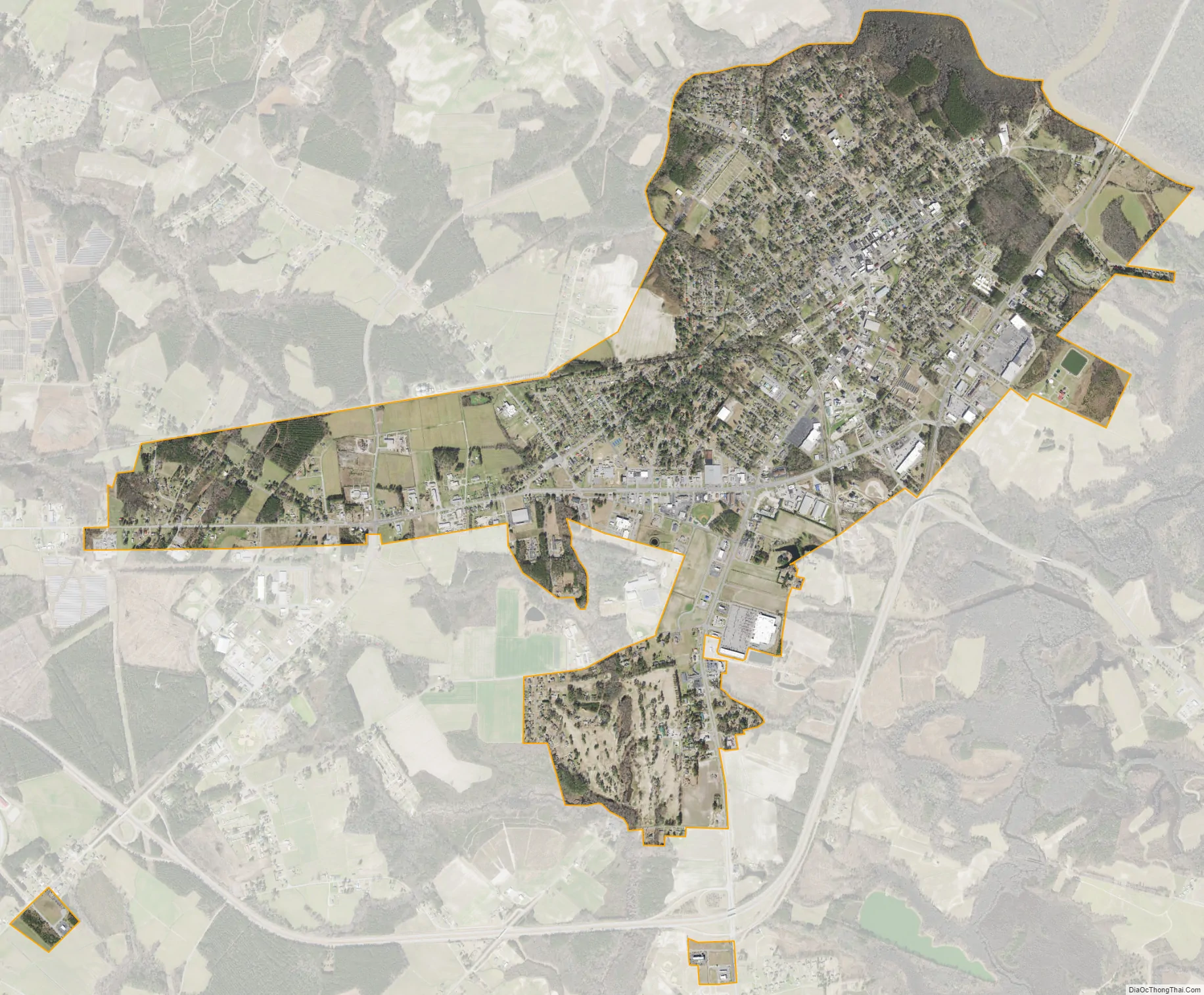
Williamston city Satellite Map
Geography
According to the United States Census Bureau, the town has a total area of 3.7 square miles (9.6 km), all land. Williamston is on the Roanoke River.
Some major highways are US 13, US 17 and US 64.
See also
Map of North Carolina State and its subdivision:- Alamance
- Alexander
- Alleghany
- Anson
- Ashe
- Avery
- Beaufort
- Bertie
- Bladen
- Brunswick
- Buncombe
- Burke
- Cabarrus
- Caldwell
- Camden
- Carteret
- Caswell
- Catawba
- Chatham
- Cherokee
- Chowan
- Clay
- Cleveland
- Columbus
- Craven
- Cumberland
- Currituck
- Dare
- Davidson
- Davie
- Duplin
- Durham
- Edgecombe
- Forsyth
- Franklin
- Gaston
- Gates
- Graham
- Granville
- Greene
- Guilford
- Halifax
- Harnett
- Haywood
- Henderson
- Hertford
- Hoke
- Hyde
- Iredell
- Jackson
- Johnston
- Jones
- Lee
- Lenoir
- Lincoln
- Macon
- Madison
- Martin
- McDowell
- Mecklenburg
- Mitchell
- Montgomery
- Moore
- Nash
- New Hanover
- Northampton
- Onslow
- Orange
- Pamlico
- Pasquotank
- Pender
- Perquimans
- Person
- Pitt
- Polk
- Randolph
- Richmond
- Robeson
- Rockingham
- Rowan
- Rutherford
- Sampson
- Scotland
- Stanly
- Stokes
- Surry
- Swain
- Transylvania
- Tyrrell
- Union
- Vance
- Wake
- Warren
- Washington
- Watauga
- Wayne
- Wilkes
- Wilson
- Yadkin
- Yancey
- Alabama
- Alaska
- Arizona
- Arkansas
- California
- Colorado
- Connecticut
- Delaware
- District of Columbia
- Florida
- Georgia
- Hawaii
- Idaho
- Illinois
- Indiana
- Iowa
- Kansas
- Kentucky
- Louisiana
- Maine
- Maryland
- Massachusetts
- Michigan
- Minnesota
- Mississippi
- Missouri
- Montana
- Nebraska
- Nevada
- New Hampshire
- New Jersey
- New Mexico
- New York
- North Carolina
- North Dakota
- Ohio
- Oklahoma
- Oregon
- Pennsylvania
- Rhode Island
- South Carolina
- South Dakota
- Tennessee
- Texas
- Utah
- Vermont
- Virginia
- Washington
- West Virginia
- Wisconsin
- Wyoming