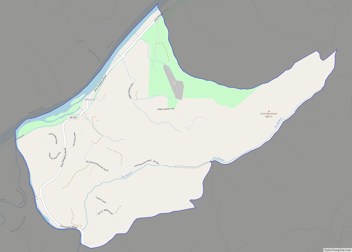
Pulaski County is a county located in the southwestern part of the U.S. state of Virginia. As of the 2020 census, the population was 33,800. Its county seat is Pulaski. Pulaski County is part of the Blacksburg–Christiansburg, VA Metropolitan Statistical Area.
| Name: | Pulaski County |
|---|---|
| FIPS code: | 51-155 |
| State: | Virginia |
| Founded: | 1839 |
| Named for: | Casimir Pulaski |
| Seat: | Pulaski |
| Largest town: | Pulaski |
| Total Area: | 330 sq mi (900 km²) |
| Land Area: | 320 sq mi (800 km²) |
| Total Population: | 33,800 |
| Population Density: | 100/sq mi (40/km²) |
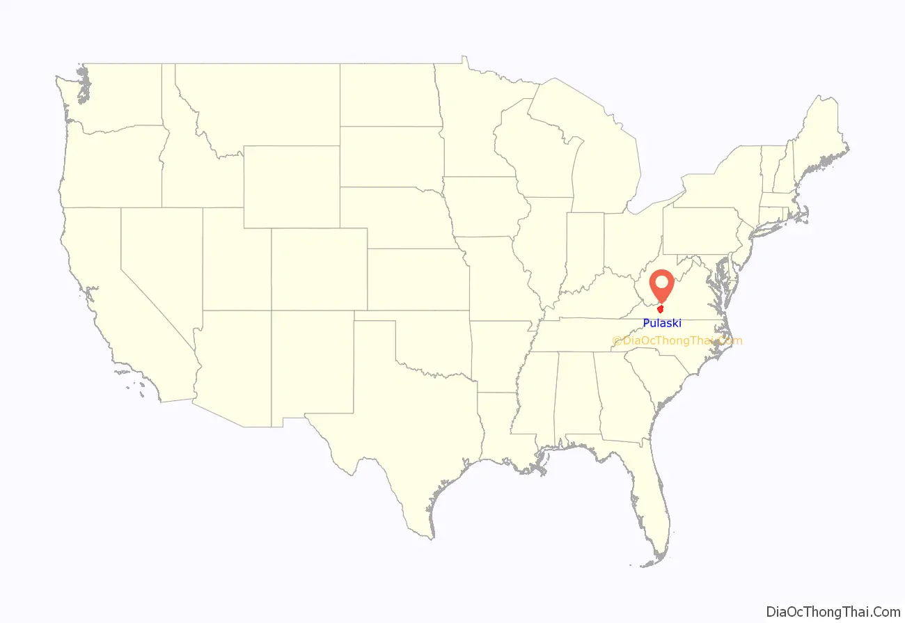
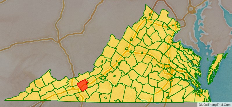
Pulaski County location map. Where is Pulaski County?
History
Pulaski County was formed on March 30, 1839, from parts of Montgomery and Wythe counties, becoming the 87th county of the Commonwealth of Virginia. It was named for Count Casimir Pulaski, an exiled Polish nobleman who fought during the American Revolution as part of George Washington’s army. He joined the army in 1777 and became a brigadier general and chief of cavalry in the Continental Army. He was fatally wounded at Savannah and died on October 11, 1779.
This area of the Blue Ridge has rolling hills and was settled by mostly small farmers, recent Scots-Irish and German immigrants and their descendants who migrated down the Shenandoah Valley from Pennsylvania in the mid to late-18th century. They pushed out or killed most Native Americans in the area. The new settlers were yeomen, who held fewer slaves than in the Tidewater area. Nonetheless, by 1840 about one-quarter of the population was made up of enslaved African Americans. The county had 3,739 persons, consisting of 2,768 free whites, and 971 blacks. Some 17 of the latter were free blacks.
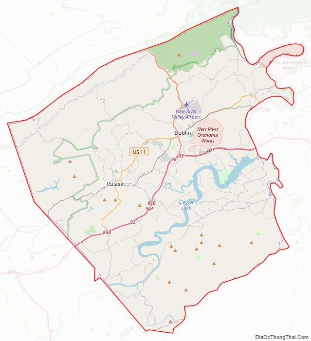
Pulaski County Road Map
Geography
According to the U.S. Census Bureau, the county has a total area of 330 square miles (850 km), of which 320 square miles (830 km) is land and 10 square miles (26 km) (3.0%) is water.
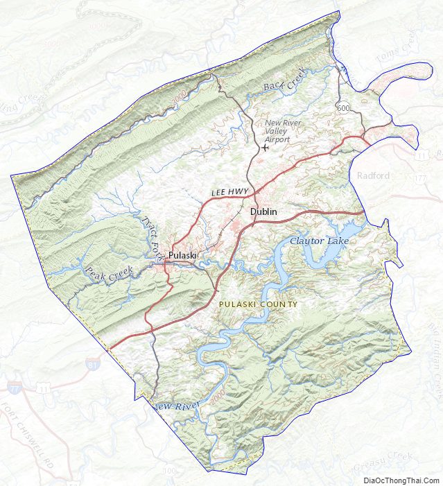
Pulaski County is the site of Claytor Lake State Park, which is located on Claytor Lake, a 4,500-acre (18 km), 21-mile (34 km) long man-made lake on the New River created for a hydroelectric project of Appalachian Power Company. Claytor Lake State Park, located on the north side of the lake, provides 497 acres of park with camping, cabins, picnic areas, and a swimming beach, as well as a marina. It is named for W. Graham Claytor, Sr. (1886–1971) of Roanoke, Virginia, a vice president of Appalachian Power who supervised construction of the dam and creation of the lake.
Pulaski County has several public boating sites including Harry DeHaven Park, in Allisonia on Rt.639, in Dublin on Rt. 660, and Gatewood Reservoir, a 162-acre water supply impoundment owned by the Town of Pulaski.
Adjacent counties / Independent city
- Bland County, Virginia – northwest
- Giles County, Virginia – north
- Montgomery County, Virginia – northeast
- Radford, Virginia – northeast
- Floyd County, Virginia – southeast
- Carroll County, Virginia – south
- Wythe County, Virginia – southwest
Law Enforcement
Pulaski County Sheriff is Michael W. Worrell, a law enforcement veteran with twenty plus years of service to the citizens of Pulaski County. He is a graduate of Pulaski County High School and Radford University.
National protected area
- Jefferson National Forest (part)
Major highways
- I-81
- US 11
- SR 99
- SR 100
- SR 114
Pulaski County Topographic Map
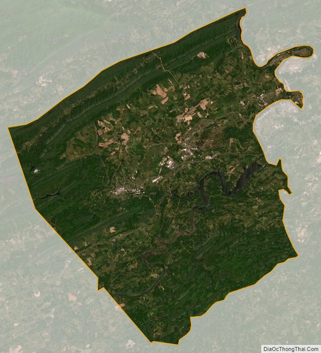
Pulaski County Satellite Map
Pulaski County Outline Map