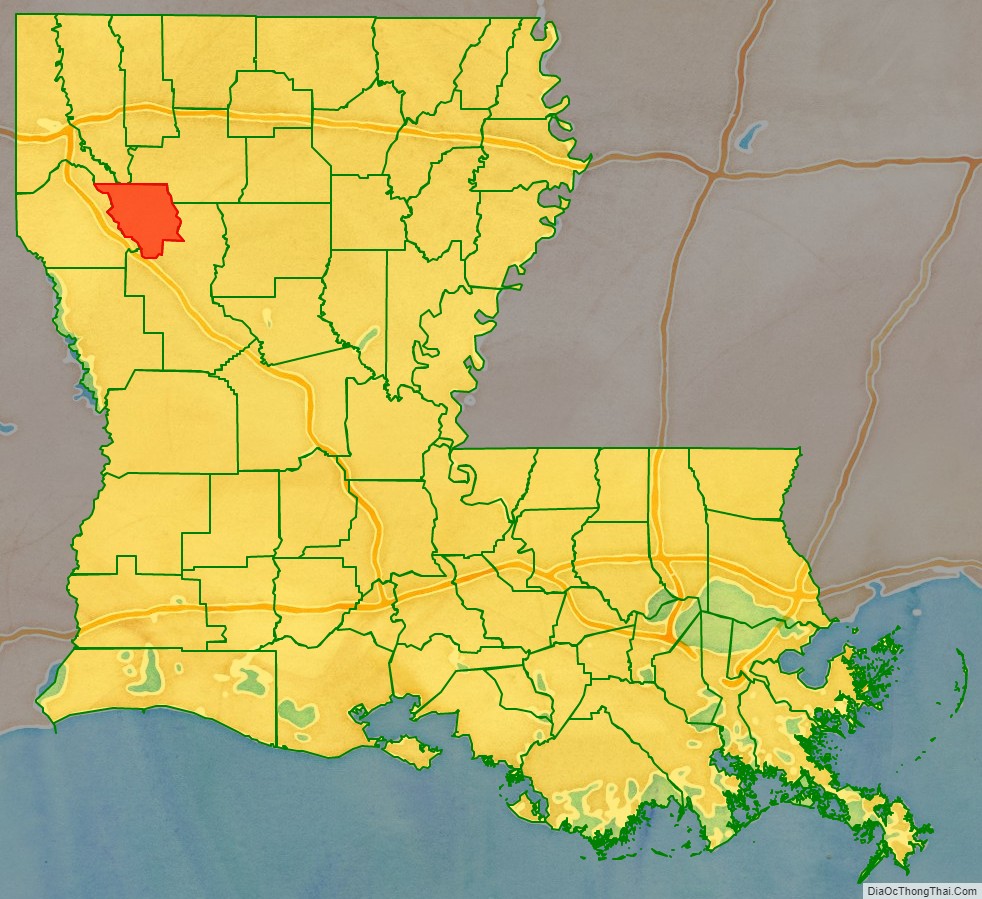
Red River Parish (French: Paroisse de la Rivière-Rouge) is a parish located in the U.S. state of Louisiana. As of the 2020 census, the population was 7,620, making it the fourth-least populous parish in Louisiana. Its seat is Coushatta. It is one of the newer parishes, created in 1871 by the state legislature from parts of Bienville, Bossier, Caddo, Desoto and Natchitoches Parishes under Reconstruction. The plantation economy was based on cotton cultivation, highly dependent on enslaved African labor before the American Civil War.
In 1880, the parish had a population with more than twice as many blacks as whites. They were essentially disenfranchised in 1898 under a new state constitution after the white Democrats regained power in the state in the late 1870s through paramilitary intimidation at the polls. Most of the former slaves worked as sharecroppers and laborers, cultivating cotton. Because of the mechanization of agriculture, many blacks left the parish during the mid-20th century Great Migration to seek better job opportunities elsewhere. By 2000, the parish population was 9,622, with a white majority, but Coushatta itself was still two thirds black.
| Name: | Red River Parish |
|---|---|
| FIPS code: | 22-081 |
| State: | Louisiana |
| Founded: | March 2, 1871 |
| Named for: | Red River |
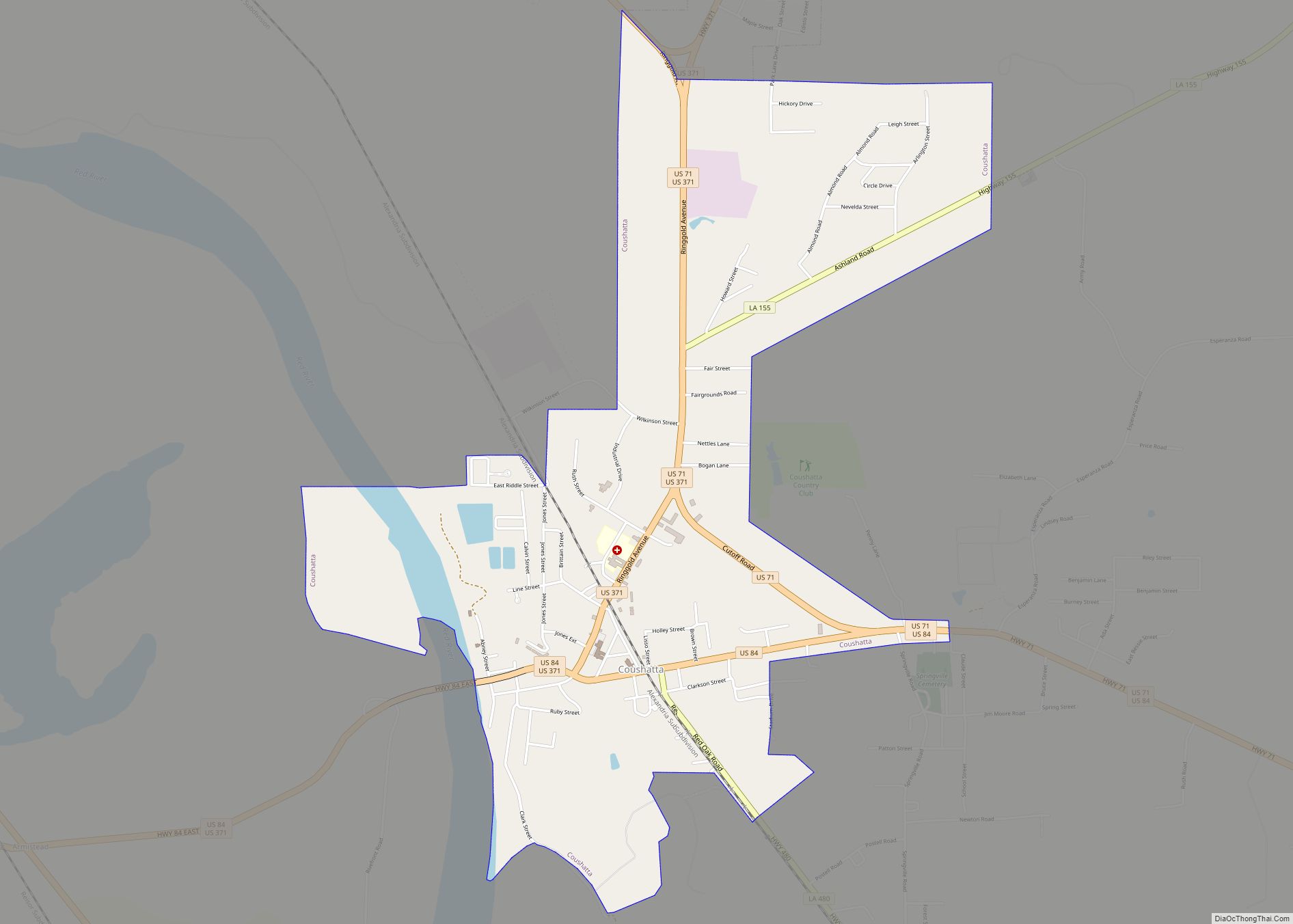
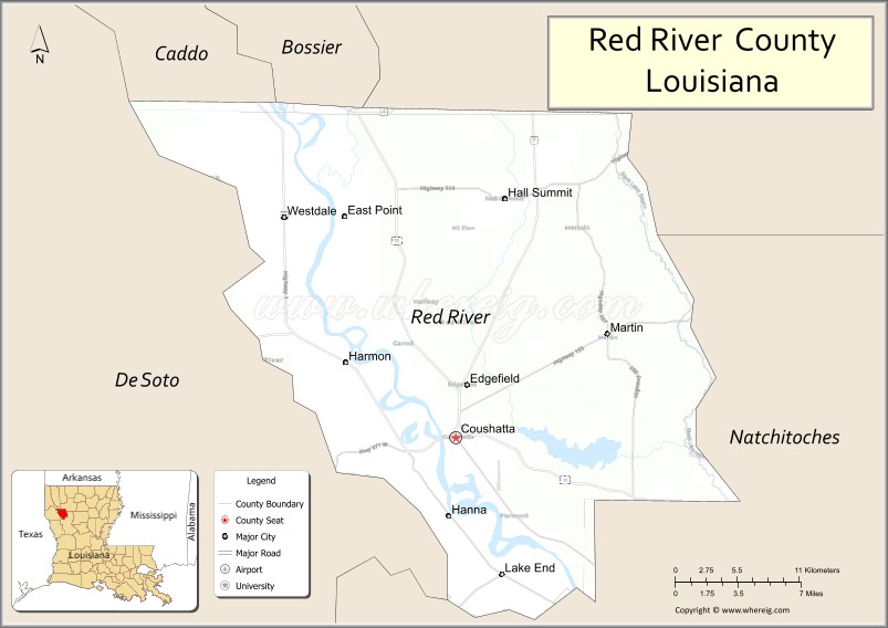
| Seat: | Coushatta |
| Total Area: | 1,040 km² (402 sq mi) |
| Land Area: | 1,010 km² (389 sq mi) |
| Total Population: | 7,620 |
| Population Density: | 23/km² (60/sq mi) |
| Time zone: | UTC-6 (CST) |
| Summer Time Zone (DST): | UTC-5 (CDT) |
| Website: | Red River Parish Police Jury |
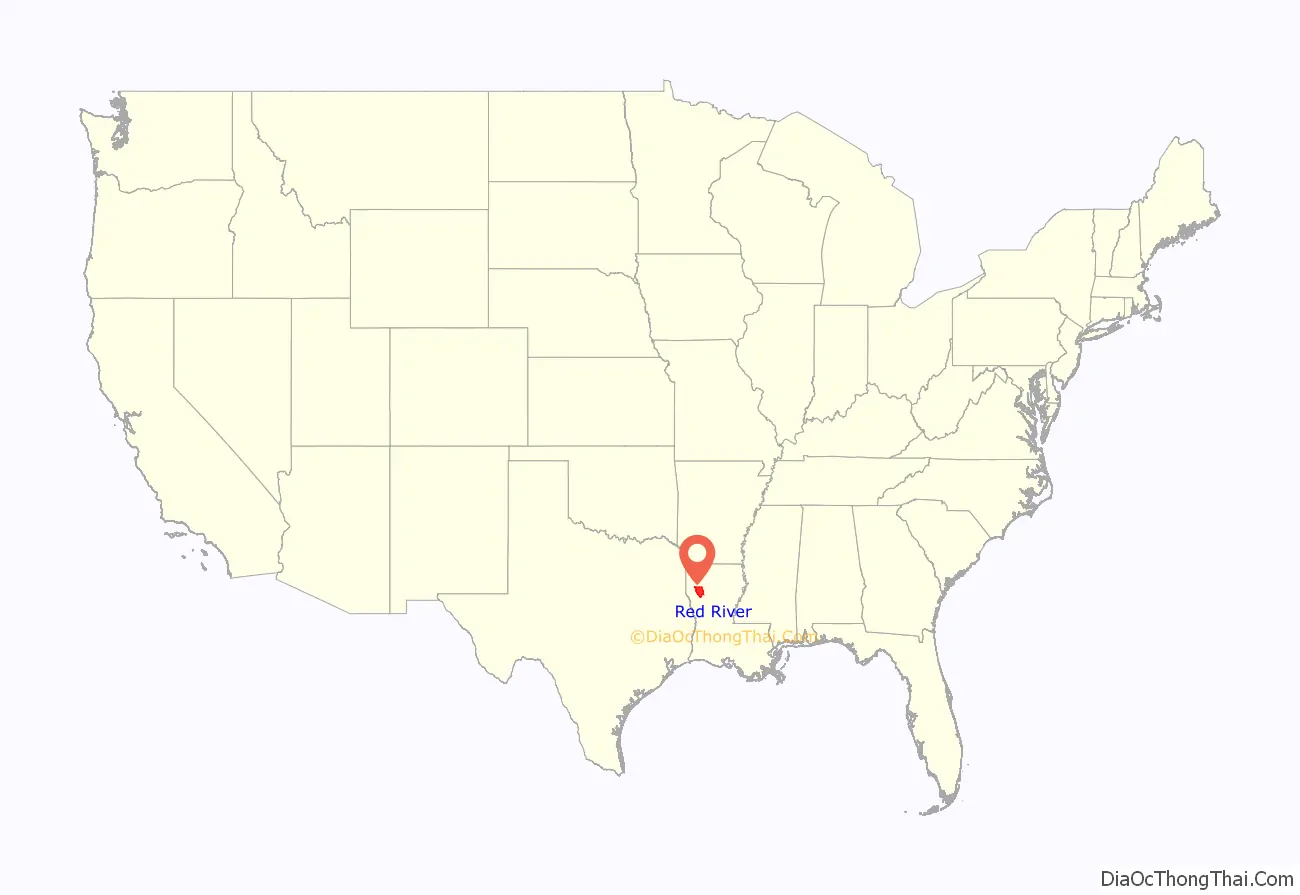
Red River Parish location map. Where is Red River Parish?
History
As in many other rural areas, Red River Parish and the Red River Valley were areas of white vigilante and paramilitary violence after the Civil War, as insurgents tried to regain power after the South’s defeat. The state legislature during Reconstruction created the parish in 1871, one of a number established to develop Republican Party strength.
Marshall H. Twitchell was a Union veteran who moved to the parish from Vermont and married a local woman. With the help of her family, he became a successful cotton planter and local leader. He was elected in 1870 as a Republican to the state legislature and filled four local offices with his brother and three brothers-in-law, the latter native to the parish. He won support from freedmen by appointing some to local offices and promoting education. The unpublished dissertation, Carpetbagger Extraordinary: Marshall Harvey Twitchell, 1840-1905 by the historian Jimmy G. Shoalmire studies Twitchell’s life within the context of the social unrest in Red River Parish at the time.
During the 1870s, there were regular outbreaks of violence in Louisiana, despite the presence of two thousand federal troops stationed there. The extended agricultural depression and poor economy of the late 19th century aggravated social tensions, as both freedmen and whites struggled to survive and to manage new labor arrangements.
The disputed gubernatorial election of 1872 increased political tensions in the state, especially as the outcome was unsettled for months. Both the Democratic Party and Republican candidates certified their own slates of local officers. Established in May 1874 from white militias, the White League was formed first in the Red River Valley in nearby Grant Parish. The organization grew increasingly well-organized in rural areas like Red River Parish. Soon White League chapters rose across the state. Operating openly, the White League used violence against officeholders, running some out of town and killing others, and suppressed election turnout among black and white Republicans.
In August 1874 the White League forced six white Republicans from office in Coushatta and ordered them to leave the state. Members assassinated them before they left Louisiana. Four of the men murdered were the brother and three brothers-in-law of state Senator Marshall Twitchell. The White League also killed five to twenty freedmen who had accompanied the Twitchell relatives and were witnesses to the vigilante acts.
Historians came to call the events the Coushatta Massacre. The murders contributed to Republican Governor William Pitt Kellogg’s request to President Grant for more Federal troops to help control the state. Ordinary Southerners wrote to President Grant at the White House describing the terrible conditions of violence and fear they lived under during these times.
With increased voter fraud, paramilitary violence against Republican blacks and whites, and intimidation at the polls preventing people from voting, white Democrats regained control of the state legislature in 1876. The population of the parish in 1880 was 8,573, of whom 2,506 were whites and 6,007 were blacks. In 1898 the state achieved disfranchisement of most blacks and many poor whites through a new constitution that created numerous barriers to voter registration.
20th century
To seek better opportunities and escape the oppression of segregation, underfunded education, and disfranchisement, thousands of African Americans left Red River and other rural parishes in the Great Migration north and west. As may be seen in the census table below, most left from 1940 to 1970, when the parish had steep population decreases. Regional agricultural problems contributed to outmigration, especially after increasing mechanization in the 1930s reduced the need for laborers. At this time many African Americans from Louisiana went to California, where the defense industry associated with World War II was growing and workers were needed.
Additional outmigration from the parish occurred as late as the 1980s, when African Americans from Louisiana migrated within the South to jobs in developing metropolitan areas of New South states.
Red River Parish has been a Democratic Party stronghold since the party reestablished dominance in 1876. As in other southern states, recent decades have brought a realignment in politics in Presidential elections, with the conservative white majority of the parish voting for Republican U.S. President George W. Bush in his 2004 reelection. The majority of the parish voters, however, has continued to support Democratic candidates at the state and local level.
Red River was one of only three parishes that did not vote for the Republican gubernatorial candidate, U.S. Representative Bobby Jindal in the October 20, 2007, jungle primary. The others were nearby Bienville and St. Bernard, located southeast of New Orleans.
Despite its Democratic heritage, Red River Parish is represented in the Louisiana State Senate by a Republican, Gerald Long, the only member of the Long dynasty not to have been elected to office as a Democrat. Long defeated the Democratic candidate, Thomas Taylor Townsend, in the 2007 nonpartisan blanket primary. Both candidates came from Natchitoches.
Louisiana was the last state to issue same-sex marriage licenses in 2015 after a landmark Supreme Court decision to allow same-sex marriage in all 50 U.S. states. Red River Parish was the final holdout of Louisiana’s 64 parishes when it continued to deny marriage licenses after 63 other parishes began doing so in late June 2015. Parish Clerk of Court Stuart Shaw was the only official besides Governor Bobby Jindal to continue to defy the Supreme Court’s ruling even after the Clerks of Court Association reversed their “wait and see” position.
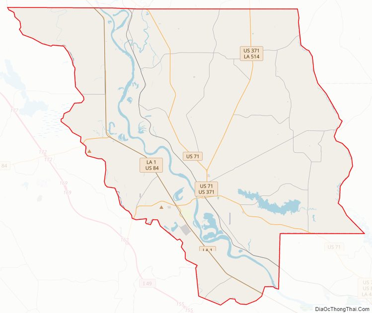
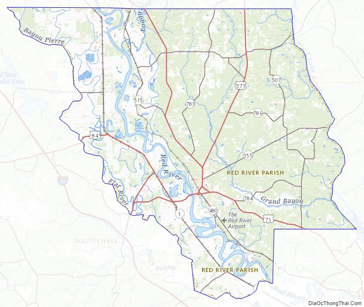
Red River Parish Road Map
Geography
According to the U.S. Census Bureau, the parish has a total area of 402 square miles (1,040 km), of which 389 square miles (1,010 km) is land and 13 square miles (34 km) (3.3%) is water.
Loggy Bayou flows south from Lake Bistineau, traverses Bienville Parish, and in Red River Parish joins the Red River.
Major highways
- U.S. Highway 71
- U.S. Highway 84
- U.S. Highway 371
- Louisiana Highway 1
- Louisiana Highway 174
- Louisiana Highway 480
Adjacent parishes
- Caddo Parish (northwest)
- Bossier Parish (north)
- Bienville Parish (northeast)
- Natchitoches Parish (southeast)
- De Soto Parish (west)
National protected area
- Red River National Wildlife Refuge (part)
Climate
According to the Köppen Climate Classification system, Red River Parish has a humid subtropical climate, abbreviated “Cfa” on climate maps. The hottest temperature recorded in Red River Parish was 108 °F (42.2 °C) on August 3, 1998, September 4, 2000, and August 19, 2011, while the coldest temperature recorded was 3 °F (−16.1 °C) on December 23, 1989.
Red River Parish Topographic Map
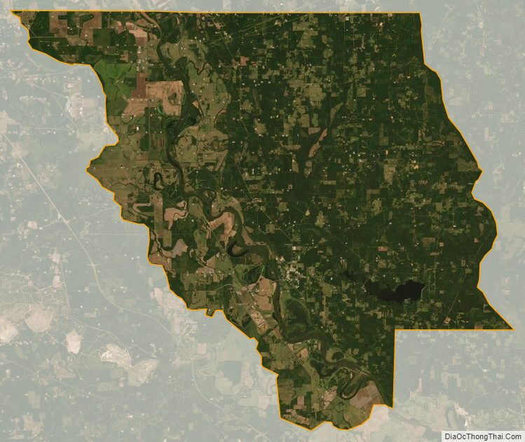
Red River Parish Satellite Map
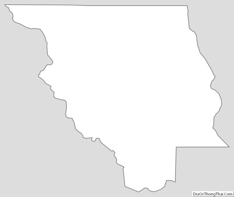
Red River Parish Outline Map