Natchitoches (/ˈnækətɪʃ/ NAK-ə-tish; French: Les Natchitoches) is a small city and the parish seat of Natchitoches Parish, Louisiana, United States. Established in 1714 by Louis Juchereau de St. Denis as part of French Louisiana, the community was named after the indigenous Natchitoches people.
The City of Natchitoches was incorporated on February 5, 1819, after Louisiana had become a state in 1812. It is the oldest permanent settlement in the land acquired by the Louisiana Purchase. Natchitoches is home to Northwestern State University. Its sister city is Nacogdoches, Texas.
| Name: | Natchitoches city |
|---|---|
| LSAD Code: | 25 |
| LSAD Description: | city (suffix) |
| State: | Louisiana |
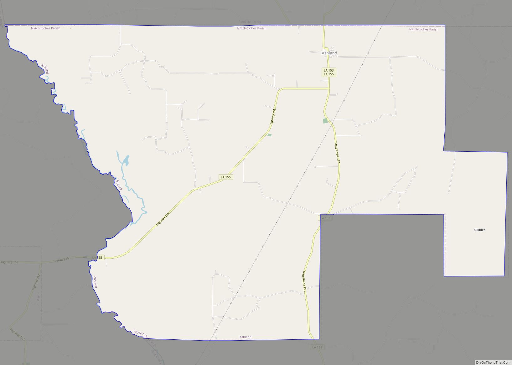
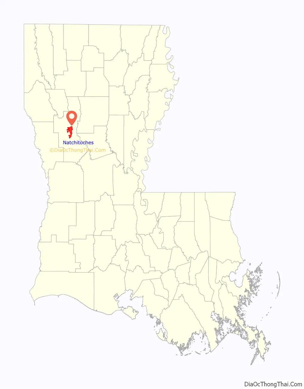
| County: | Natchitoches Parish |
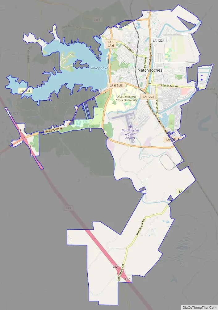
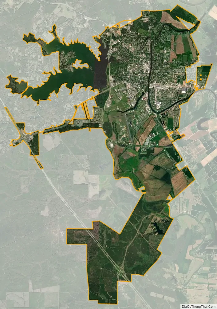
| Total Area: | 26.28 sq mi (68.07 km²) |
| Land Area: | 22.69 sq mi (58.77 km²) |
| Water Area: | 3.59 sq mi (9.31 km²) |
| Total Population: | 18,039 |
| Population Density: | 795.05/sq mi (306.97/km²) |
| ZIP code: | 71457 |
| Area code: | 318 |
| FIPS code: | 2253545 |
Online Interactive Map
Click on ![]() to view map in "full screen" mode.
to view map in "full screen" mode.
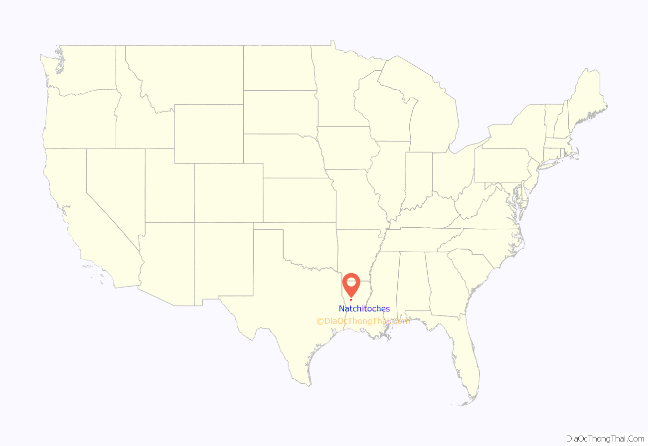
Natchitoches location map. Where is Natchitoches city?
History
Early years
Natchitoches was established in 1714 by Canadien explorer Louis Juchereau de St. Denis. It is the oldest permanent European settlement within the borders of the 1803 Louisiana Purchase. Natchitoches was founded as a French outpost on the Red River for trade with Spanish-controlled Mexico; French traders settled there as early as 1699. The post was established near a village of Natchitoches Indians, after whom the city was named. Early settlers were French Catholic immigrants and creoles (originally meaning those ethnic French born in the colony). French creoles acquired lands that were developed in the antebellum years as cotton-producing Magnolia Plantation and Oakland Plantation. Each has been preserved and is designated as a National Historic Landmark.
After the United States’ Louisiana Purchase of 1803, migration into the territory increased from the US. Natchitoches grew along with the population in the parish. Initially, the Americans were primarily of English and Scots-Irish ancestry and of Protestant faith. They developed several cotton plantations along the Red River. Numerous enslaved African Americans were brought to the area through the domestic slave trade to work the cotton, and provide all other skills on these plantations, generating the revenues for the wealthy planters before the Civil War.
The United States Government established a federal fur trade factory here in 1805. It was removed to Sulphur Fork, Arkansas in 1818.
In the 1820s and early 1830s, Natchitoches also served as a freight transfer point for cotton shipped from parts of east Texas. Cotton shippers used a land route crossing the Sabine River to Natchitoches, where the freight was transferred to boats, and floated down the Red River to New Orleans.
When the course of the Red River shifted, it bypassed Natchitoches and cut off its lucrative connection with the Mississippi River. A 33-mile (53 km) oxbow lake was left in the river’s previous location which became known as Cane River Lake.
Civil War
During the Civil War, Natchitoches was set on fire by Union soldiers who retreated through the town after their failed attempt to capture Shreveport. Confederate cavalry pursued the fleeing soldiers and arrived in time to help extinguish the flames before the town was destroyed. Alexandria was destroyed by Union troops in 1864, but both Union and Confederate troops were responsible for severely damaging plantations along the river during the war, including Magnolia and Oakland.
Radford Blunt published the Natchitoches Republican. He was also a candidate for the state legislature. William H. Tunnard edited the paper.
20th century
As the parish seat, Natchitoches suffered from the decline in agricultural population through the mid-20th century, and grew at a markedly lower rate after 1960. The mechanization of agriculture had reduced the number of workers needed, and many moved to cities for jobs. By the early 1970s, the town’s businesses were declining, along with many area farms, and buildings were boarded up.
In the mid-1970s, Mayor Bobby DeBlieux and other preservationists believed that attracting tourists to the area, based on its historic assets of nearly intact plantations and numerous historic buildings, could be a key to attracting visitors, reviving the town, and stimulating new businesses. Over the years, he worked with a variety of landowners and local people to gain support for designating a historic district in the city. He also supported making a national park out of the working area of Magnolia Plantation, which had many surviving outbuildings from the 19th century, and from Oakland Plantation, both downriver in the parish.
By the end of the 20th century, the mile-long French colonial area of downtown, which lies along Cane Lake, was designated as a National Historic District. Many buildings were adapted as antique shops, restaurants and souvenir emporiums. To accommodate tourists, the town had 32 bed-and-breakfast inns, the highest in the state. By 2018, that number had increased to 50.
The plantation country surrounds Cane River Lake. The markedly intact downriver Magnolia and Oakland plantations were designated as National Historic Landmarks, and are part of what has been developed as the Cane River Creole National Historical Park, which was authorized in 1994, with the support of US Senator J. Bennett Johnston. He was a cousin by marriage of Betty Hertzog, the last of the family to live in the great house at Magnolia.
Tours and interpretive programs at both sites continue to attract visitors, especially as they grapple with telling the difficult history of slavery and its aftermath at the plantations. They also cover the contributions of blacks and Creoles of color to the community.
Since the late 20th century, the 35-mile oxbow lake has served as the spring-break training location for numerous university crew teams, from universities such as the University of St. Thomas, Kansas State University, University of Kansas, Wichita State University, Murray State University, University of Central Oklahoma, and Washington University in St. Louis, as well as Northwestern State University. In the spring of 2018, LSU, Alabama, Texas and Georgia were also represented. Tourists interested in sports often visit in this period to watch the sports teams.
Over the years, the city and parish have improved conditions with a riverbank stabilization project and a water pump project to improve water levels in the lake. This directs water from Hampton Lake into Bayou Possiant, which feeds Cane River Lake.
In March 1965, nine children were among seventeen people killed in a natural gas pipeline explosion.
Natchitoches was the site of the 1973 plane crash that claimed the life of singer-songwriter Jim Croce. Croce had performed a concert on campus for Northwestern State University students at Prather Coliseum. He was killed less than an hour later in a plane headed to Sherman, Texas. The crash may have been a result of the pilot suffering a fatal heart attack.
Natchitoches Road Map
Natchitoches city Satellite Map
Geography
According to the United States Census Bureau, the city has a total area of 25.1 square miles (65 km), of which 21.6 square miles (56 km) are land and 3.6 square miles (9.3 km) (14.21%) are covered by water.
A 35-mi-long (56 km) lake was formed from a portion of the Red River when it changed course. It is now known as Cane River Lake. The municipal water supply comes from nearby Sibley Lake, a formerly drained wetland dammed in 1962, which also offers fishing and boating.
Geology
Soils in this area are a combination of leaf mold and red clays, sand, and sediments. The area is part of the Chestnut Salt Dome.
Cityscape
Though Natchitoches has few multistorey buildings, it has retained much of its historic European-style architecture listed on the National Register of Historic Places as the Natchitoches Historic District. The city is a mesh of wrought iron, stucco, and red brick. The city still has one of the original brick streets (Front Street), which the historical society protects from alterations. The city of Natchitoches recently completed a restoration project to repair the century-old brick street. During this process, workers removed each brick one by one, numbered it, cleaned it, and then replaced it after utilities, drainage, and the foundation were repaired beneath.
Climate
Weather-wise, Natchitoches lies in a boundary region that separates the plains of Texas from the consistently humid Gulf Coast. This gives summers both heat and humidity. Winters in Natchitoches are relatively mild, with measurable snowfall once every 5–10 years. Natchitoches averages 54.93 inches (1,395 mm) of rain per year. The city is in an area that frequently experiences severe thunderstorms, hail, damaging winds, and tornadoes.
See also
Map of Louisiana State and its subdivision:- Acadia
- Allen
- Ascension
- Assumption
- Avoyelles
- Beauregard
- Bienville
- Bossier
- Caddo
- Calcasieu
- Caldwell
- Cameron
- Catahoula
- Claiborne
- Concordia
- De Soto
- East Baton Rouge
- East Carroll
- East Feliciana
- Evangeline
- Franklin
- Grant
- Iberia
- Iberville
- Jackson
- Jefferson
- Jefferson Davis
- La Salle
- Lafayette
- Lafourche
- Lincoln
- Livingston
- Madison
- Morehouse
- Natchitoches
- Orleans
- Ouachita
- Plaquemines
- Pointe Coupee
- Rapides
- Red River
- Richland
- Sabine
- Saint Bernard
- Saint Charles
- Saint Helena
- Saint James
- Saint John the Baptist
- Saint Landry
- Saint Martin
- Saint Mary
- Saint Tammany
- Tangipahoa
- Tensas
- Terrebonne
- Union
- Vermilion
- Vernon
- Washington
- Webster
- West Baton Rouge
- West Carroll
- West Feliciana
- Winn
- Alabama
- Alaska
- Arizona
- Arkansas
- California
- Colorado
- Connecticut
- Delaware
- District of Columbia
- Florida
- Georgia
- Hawaii
- Idaho
- Illinois
- Indiana
- Iowa
- Kansas
- Kentucky
- Louisiana
- Maine
- Maryland
- Massachusetts
- Michigan
- Minnesota
- Mississippi
- Missouri
- Montana
- Nebraska
- Nevada
- New Hampshire
- New Jersey
- New Mexico
- New York
- North Carolina
- North Dakota
- Ohio
- Oklahoma
- Oregon
- Pennsylvania
- Rhode Island
- South Carolina
- South Dakota
- Tennessee
- Texas
- Utah
- Vermont
- Virginia
- Washington
- West Virginia
- Wisconsin
- Wyoming