Red Willow County is a county located in the U.S. state of Nebraska. As of the 2020 United States Census, the population was 10,702. Its county seat is McCook.
In the Nebraska license plate system, Red Willow County is represented by the prefix 48 (it had the forty-eighth-largest number of vehicles registered in the county when the license plate system was established in 1922).
| Name: | Red Willow County |
|---|---|
| FIPS code: | 31-145 |
| State: | Nebraska |
| Founded: | 1873 |
| Named for: | Red Willow Creek |
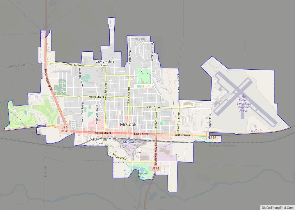
| Seat: | McCook |
| Largest city: | McCook |
| Total Area: | 718 sq mi (1,860 km²) |
| Land Area: | 717 sq mi (1,860 km²) |
| Total Population: | 10,702 |
| Population Density: | 15.0/sq mi (5.8/km²) |
| Time zone: | UTC−6 (Central) |
| Summer Time Zone (DST): | UTC−5 (CDT) |
| Website: | www.co.red-willow.ne.us |
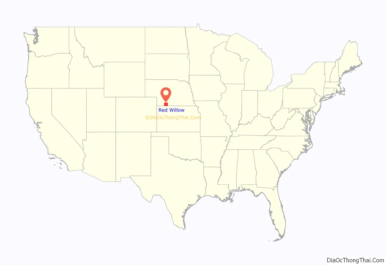
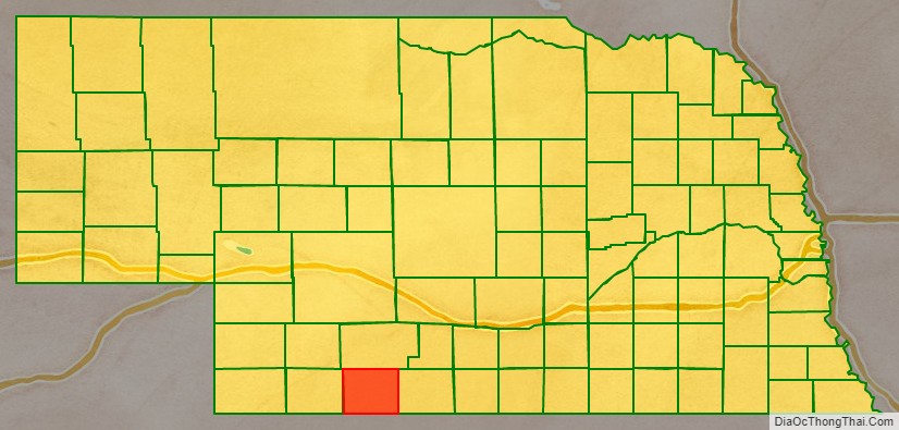
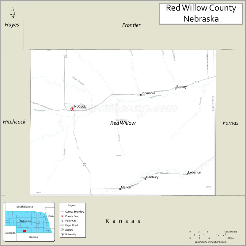
Red Willow County location map. Where is Red Willow County?
History
Red Willow County was formed in 1873. It was named for the Red Willow Creek. The name is reported to be a mistranslation of the Dakota Indian name Chanshasha Wakpala, which literally means Red Dogwood Creek. The Dakota referred to the creek thusly due to red dogwood shrubs that grew along the creek banks. Its stem and branches are deep red in color, and it is favored in basket making.
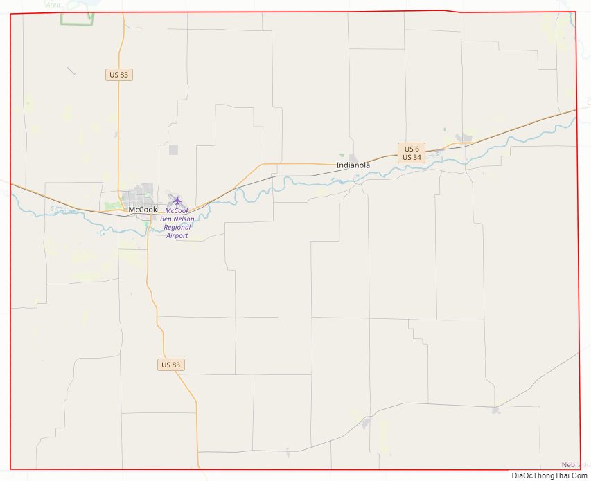
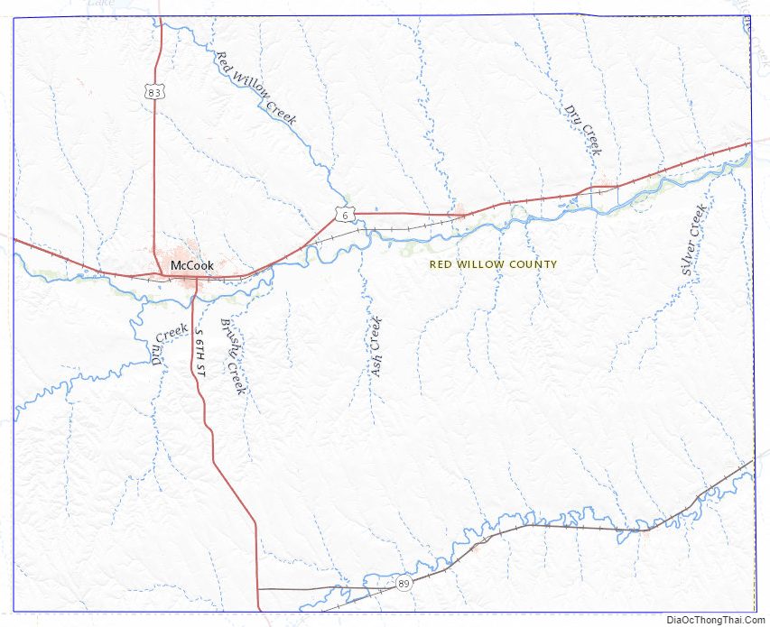
Red Willow County Road Map
Geography
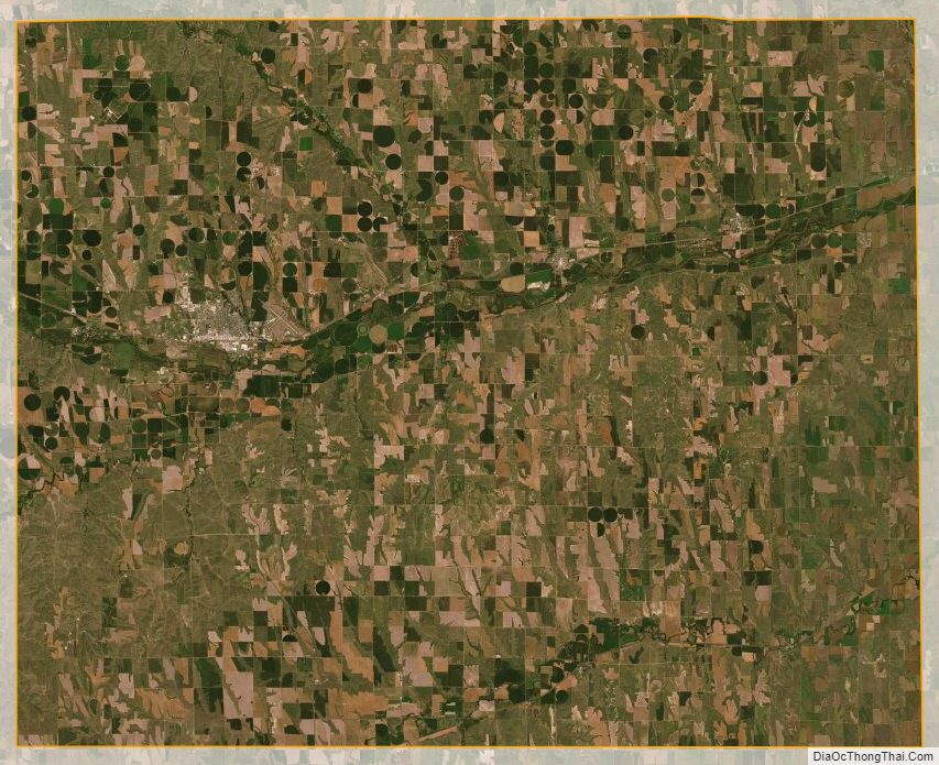
Red Willow County lies on the south line of Nebraska. The south boundary line of Red Willow County abuts the north boundary line of the state of Kansas. The Republican River runs easterly through the north-central part of the county. The county terrain consists of rolling hills, sloping to the east. The portions of the terrain in the drainage basins are used for agriculture. The county has a total area of 718 square miles (1,860 km), of which 717 square miles (1,860 km) is land and 1.0 square mile (2.6 km) (0.1%) is water.
Major highways
- U.S. Highway 6
- U.S. Highway 34
- U.S. Highway 83
- Nebraska Highway 89
Adjacent counties
- Furnas County – east
- Decatur County, Kansas – south
- Rawlins County, Kansas – southwest
- Hitchcock County – west
- Frontier County – north
Protected areas
- Red Willow Reservoir State Wildlife Management Area (part)
Red Willow County Topographic Map
Red Willow County Satellite Map
Red Willow County Outline Map