Rensselaer County /rɛnsəˈlɪər/ is a county in the U.S. state of New York. As of the 2020 census, the population was 161,130. Its county seat is Troy. The county is named in honor of the family of Kiliaen van Rensselaer, the original Dutch owner of the land in the area.
Rensselaer County is part of the Albany–Schenectady-Troy, NY Metropolitan Statistical Area.
| Name: | Rensselaer County |
|---|---|
| FIPS code: | 36-083 |
| State: | New York |
| Founded: | 1791 |
| Named for: | Kiliaen van Rensselaer |
| Seat: | Troy |
| Largest city: | Troy |
| Total Area: | 665 sq mi (1,720 km²) |
| Land Area: | 652 sq mi (1,690 km²) |
| Total Population: | 161,133 |
| Population Density: | 247.0/sq mi (95.4/km²) |
| Time zone: | UTC−5 (Eastern) |
| Summer Time Zone (DST): | UTC−4 (EDT) |
| Website: | www.rensco.com |
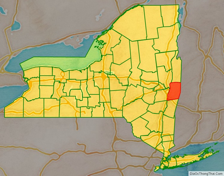
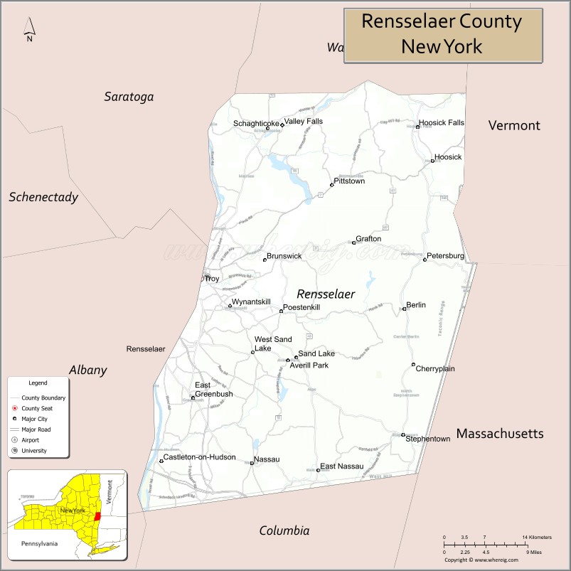
Rensselaer County location map. Where is Rensselaer County?

History
The area that is now Rensselaer County was inhabited by the Algonquian-speaking Mohican Indian tribe at the time of European encounter. Kiliaen van Rensselaer, a Dutch jeweler and merchant, purchased the area in 1630 and incorporated it in his patroonship Rensselaerswyck. (It was part of the Dutch colony New Netherland).
The land passed into English rule in 1664; the Dutch regained control in 1673, but the English took it back in 1674. Until 1776, the year of American independence, the county was under English or British control. The county was not organized as a legal entity until after the Revolution, in 1791, when it was created from an area that was originally part of the very large Albany County.
In 1807, in a county re-organization, the rural sections of Troy were set off as Towns, and the city was incorporated. The two towns created were Brunswick (named for Duke Friedrich Wilhelm of Braunschweig-Lüneburg) and Grafton (named for Henry FitzRoy, 5th Duke of Grafton). A third town, Philipstown, was set off in 1806. In 1808, it was renamed Nassau after the duke of that area.
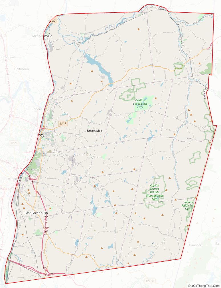
Rensselaer County Road Map
Geography
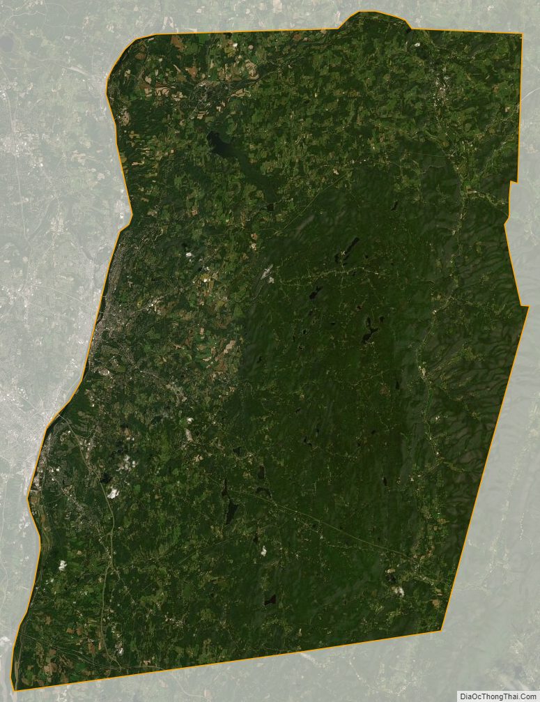
According to the U.S. Census Bureau, the county has a total area of 665 square miles (1,720 km), of which 652 square miles (1,690 km) is land and 13 square miles (34 km) (1.9%) is water.
Rensselaer County is in the eastern part of New York State. The eastern boundary of Rensselaer County runs along the New York–Vermont and New York–Massachusetts borders.
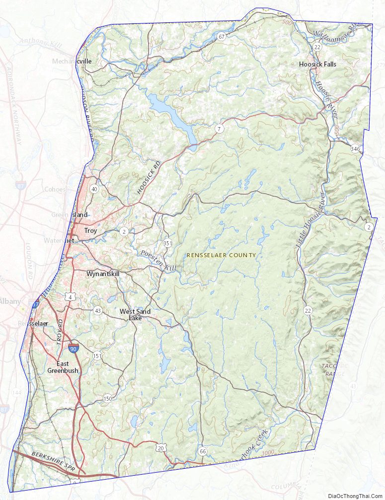
The terrain runs from level and flat near the Hudson and then rises into the Rensselaer Plateau around Poestenkill and Sand Lake, then to the Taconic Mountains along the Massachusetts state line.
The highest point is Berlin Mountain, 2,818 feet (859 m) above sea level, in the town of Berlin. The lowest point is 62 feet (19 m) above sea level at the Hudson River’s southernmost extent in the county.
The Hoosic River, a tributary of the Hudson River, is in the northern part of the county.
Depending on precise location within the county, road travel distance to New York City ranges between 132 miles (212 km) and 178 miles (286 km).
Rensselaer County Topographic Map
Rensselaer County Satellite Map
Rensselaer County Outline Map