Albany (/ˈɔːlbəni/ (listen) AWL-bən-ee) is the capital city of the U.S. state of New York and the seat of Albany County. It is located on the west bank of the Hudson River, about 10 miles (16 km) south of its confluence with the Mohawk River, and about 135 miles (220 km) north of New York City.
The city is known for its architecture, commerce, culture, institutions of higher education, and rich history. It is the economic and cultural core of the Capital District of the State of New York, which comprises the Albany–Schenectady–Troy Metropolitan Statistical Area, including the nearby cities and suburbs of Troy, Schenectady, and Saratoga Springs. With an estimated population of 1.1 million in 2013, the Capital District is the third most populous metropolitan region in the state. As of 2020, Albany’s population was 99,224.
The Hudson River area was originally inhabited by Algonquian-speaking Mohican (Mahican), who called it Pempotowwuthut-Muhhcanneuw. The area was settled by Dutch colonists who, in 1614, built Fort Nassau for fur trading and in 1624, built Fort Orange. In 1664, the English took over the Dutch settlements, renaming the city Albany in honor of the Duke of Albany, the future James II. The city was officially chartered in 1686 under English rule. It became the capital of New York in 1797 after the formation of the United States. Albany is one of the oldest surviving settlements of the original British thirteen colonies; no other city in the United States has been continuously chartered as long.
In the late 18th century and throughout most of the 19th, Albany was a center of trade and transportation. The city lies toward the north end of the navigable Hudson River. It was the original eastern terminus of the Erie Canal, connecting to the Great Lakes, and was home to some of the earliest railroads in the world. In the 1920s a powerful political machine controlled by the Democratic Party arose in Albany. In the latter part of the 20th century, Albany’s population shrank because of urban sprawl and suburbanization. In the 1990s, the New York State Legislature approved for the city a US$234 million building and renovation plan, which spurred redevelopment downtown. In the early 21st century, Albany’s high-technology industry grew, with great strides in nanotechnology.
| Name: | Albany city |
|---|---|
| LSAD Code: | 25 |
| LSAD Description: | city (suffix) |
| State: | New York |
| County: | Albany County |
| Incorporated: | 1686; 337 years ago (1686) |
| Elevation: | 148 ft (45 m) |
| Land Area: | 21.40 sq mi (55.44 km²) |
| Water Area: | 0.53 sq mi (1.38 km²) |
| Population Density: | 4,635.77/sq mi (1,789.90/km²) |
| FIPS code: | 3601000 |
| GNISfeature ID: | 977310 |
| Website: | albanyny.gov |
Online Interactive Map
Click on ![]() to view map in "full screen" mode.
to view map in "full screen" mode.
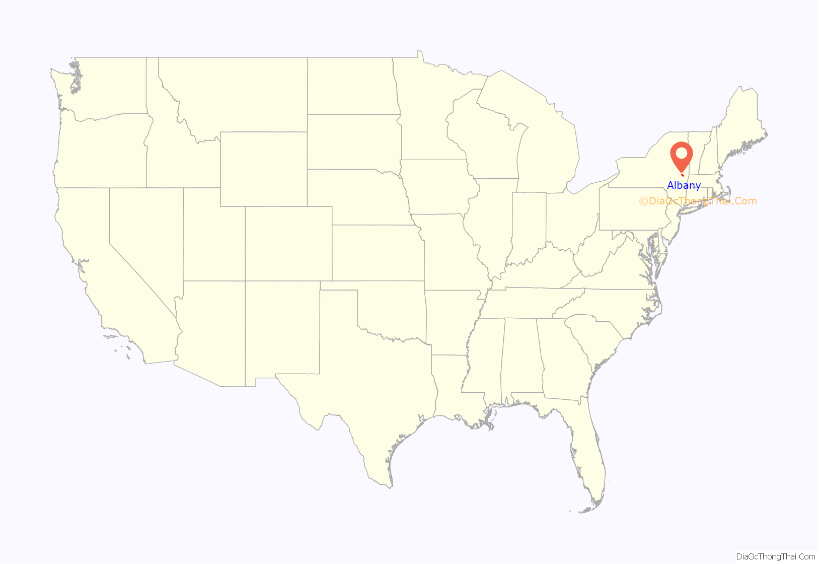
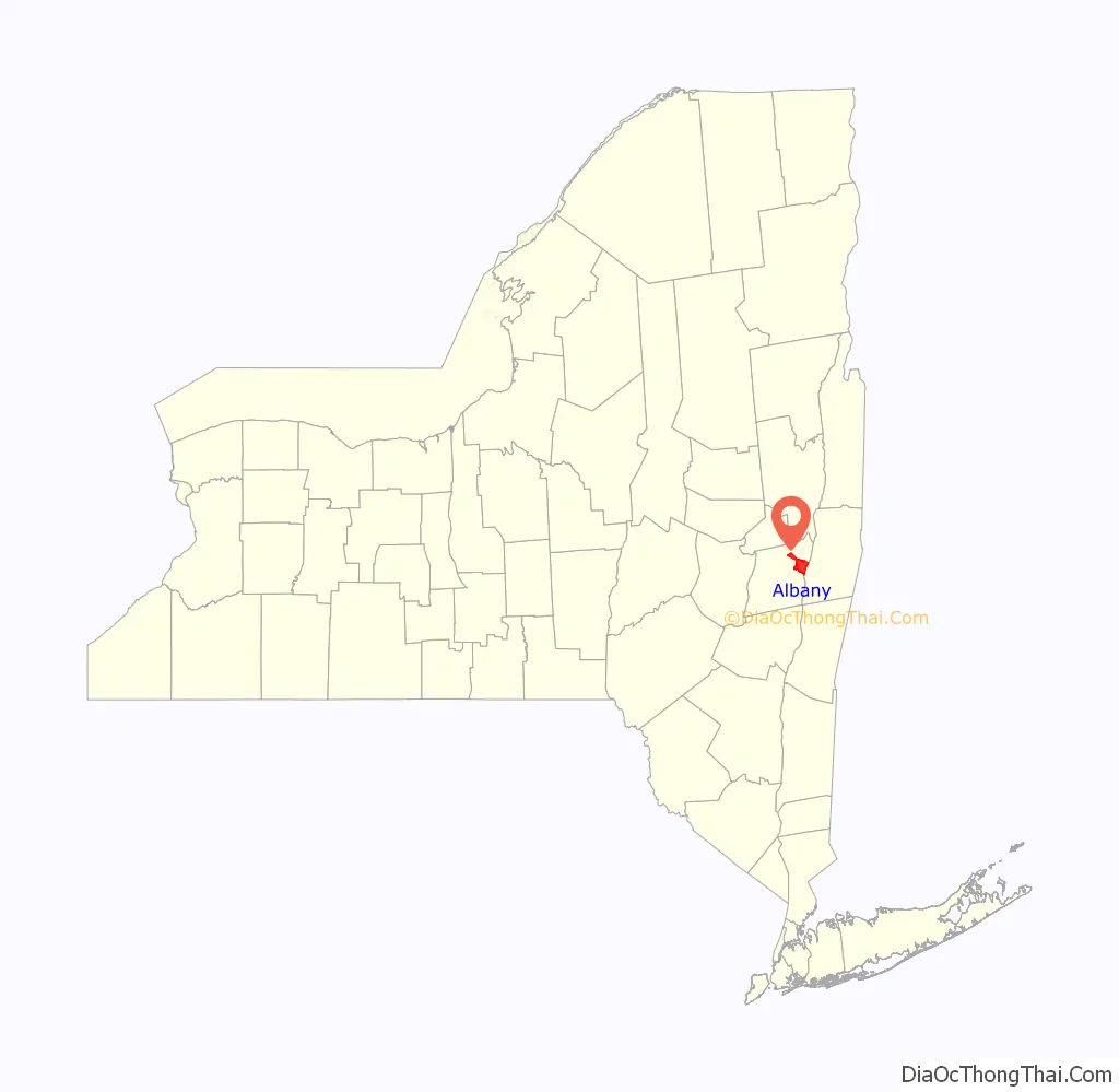
Albany location map. Where is Albany city?
History
Mohican, Mohawk, and Dutch before 1660
The Hudson River area was originally inhabited by Algonquian-speaking Mohican (Mahican), who called it Pempotowwuthut-Muhhcanneuw, meaning “the fireplace of the Mohican nation”. Based to the west along the Mohawk River, the Iroquoian-speaking Mohawk called it Sche-negh-ta-da, “through the pine woods”, referring to the path they took there. The Mohawk were one of the Five Nations of the Iroquois Confederacy.
According to Hendrick Aupaumut, the Mohicans came to the area from the north and the west. They settled along the Mahicannituck, which is now called the Hudson River, and called themselves the Muh-he-con-neok, the “People of the Waters That Are Never Still”. This name evolved to Mohicans.
The Mohawks were based in the Mohawk valley and noted for their fur trading and their access to trade between the Iroquois and other nations. The Mohawk became strong trading partners with the Dutch and English. It is likely that the Albany area was visited by European fur traders perhaps as early as 1540, but the extent and duration of those visits are unclear.
Permanent European claims began when Englishman Henry Hudson, exploring for the Dutch East India Company on the Half Moon (Dutch: Halve Maen), reached the area in 1609, claiming it for the United Netherlands. In 1614, Hendrick Christiaensen built Fort Nassau on Castle Island in the Hudson River. The fort acted as a fur-trading post and was the first documented European structure in present-day Albany. Commencement of the fur trade provoked hostility from the French colony in Canada and among the natives, all of whom vied to control the trade. In 1618, a flood ruined Fort Nassau, but the Dutch replaced it with Fort Orange on the mainland in 1624. Both forts were named in honor of the leading family of the Dutch Revolt, members of the House of Orange-Nassau. Fort Orange and the surrounding area were incorporated as the village of Beverwijck (English: Beaverwick or Beaver District) in 1652, and the city of Albany in 1686. In these early decades of trade, the Dutch, Mohican, and Mohawk developed relations that reflected differences among their three cultures.
British Occupation to 1800
Albany is one of the oldest surviving European settlements from the original Thirteen Colonies and the longest continuously chartered city in the United States. When New Netherland was captured by the English in 1664, the name was changed from Beverwijck to Albany in honor of the Duke of Albany (later James II). Duke of Albany was a Scottish title given since 1398, generally to a younger son of the King of Scots. The name is ultimately derived from Alba, the Gaelic name for Scotland. The Dutch briefly regained Albany in August 1673 and renamed the city Willemstadt; the English took permanent possession in 1674 with the Treaty of Westminster. On November 1, 1683, the Province of New York was split into counties, with Albany County being the largest. At that time the county included all of present New York State north of Dutchess and Ulster Counties in addition to present-day Bennington County, Vermont, theoretically stretching west to the Pacific Ocean; Albany became the county seat. Albany was formally chartered as a municipality by provincial Governor Thomas Dongan on July 22, 1686. The Dongan Charter was virtually identical in content to the charter awarded to the city of New York three months earlier. Dongan created Albany as a strip of land 1 mile (1.6 km) wide and 16 miles (26 km) long. Over the years Albany would lose much of the land to the west and annex land to the north and south. At this point, Albany had a population of about 500 people.
In 1754, representatives of seven British North American colonies met in the Stadt Huys, Albany’s city hall, for the Albany Congress; Benjamin Franklin of Pennsylvania presented the Albany Plan of Union there, which was the first formal proposal to unite the colonies. Although it was never adopted by Parliament, it was an important precursor to the United States Constitution. The same year, the French and Indian War, the fourth in a series of wars dating back to 1689, began. It ended in 1763 with French defeat, resolving a situation that had been a constant threat to Albany and held back its growth. In 1775, with the colonies in the midst of the Revolutionary War, the Stadt Huys became home to the Albany Committee of Correspondence (the political arm of the local revolutionary movement), which took over operation of Albany’s government and eventually expanded its power to control all of Albany County. Tories and prisoners of war were often jailed in the Stadt Huys alongside common criminals. In 1776, Albany native Philip Livingston signed the Declaration of Independence at Independence Hall in Philadelphia.
During and after the Revolutionary War, Albany County saw a great increase in real estate transactions. After Horatio Gates defeated John Burgoyne at Saratoga in 1777, the upper Hudson Valley was generally at peace as the war raged on elsewhere. Prosperity was soon seen all over Upstate New York. Migrants from Vermont and Connecticut began flowing in, noting the advantages of living on the Hudson and trading at Albany, while being only a few days’ sail from New York City. Albany reported a population of 3,498 in the first national census in 1790, an increase of almost 700% since its chartering.
On November 17, 1793, a large fire broke out, destroying 26 homes on Broadway, Maiden Lane, James Street, and State Street. The fire originated at a stable belonging to Leonard Gansevoort and was suspected to be arson set by enslaved people. Three were arrested and charged with arson: Pompey, a man enslaved by Matthew Visscher; Dinah, a 14-year-old girl enslaved by Volkert P. Douw; and Bet, a 12-year-old girl enslaved by Philip S. Van Rensselaer. On January 6, 1794, the three were tried and sentenced to death. For reasons unknown, Governor George Clinton issued a temporary stay of execution, but Dinah and Bet were executed by hanging on March 14, and Pompey on April 11, 1794.
In 1797, the state capital of New York was moved permanently to Albany. From statehood to this date, the Legislature had frequently moved the state capital between Albany, Kingston, Poughkeepsie, and the city of New York. Albany is the tenth-oldest state capital in the United States and the second-oldest city that is a state capital, after Santa Fe, New Mexico.
1800 to 1942
Albany has been a center of transportation for much of its history. In the late 18th and early 19th centuries, Albany saw development of the turnpike and by 1815, Albany was the turnpike center of the state. The development of Simeon De Witt’s gridded block system in 1794—which renamed streets that had originally honored British royalty with names of birds and mammals instead—was intersected by these major arterials coming out of Albany, cutting through the city at unexpected angles. The construction of the turnpike, in conjunction with canal and railroad systems, made Albany the hub of transportation for pioneers going to Buffalo and the Michigan Territory in the early and mid-19th century.
In 1807, Robert Fulton initiated a steamboat line from New York to Albany, the first successful enterprise of its kind anywhere in the world. By 1810, with 10,763 people, Albany was the tenth-largest urban place in the nation. The town and village north of Albany known as “the Colonie” was annexed in 1815. In 1825 the Erie Canal was completed, forming a continuous water route from the Great Lakes to New York City. Unlike the current Barge Canal, which ends at nearby Waterford, the original Erie Canal ended at Albany; Lock 1 was north of Colonie Street. The Canal emptied into a 32-acre (13 ha) man-made lagoon called the Albany Basin, which was Albany’s main port from 1825 until the Port of Albany-Rensselaer opened in 1932. In 1829, while working as a professor at the Albany Academy, Joseph Henry, widely regarded as “the foremost American scientist of the 19th century”, built the first electric motor. Three years later, he discovered electromagnetic self-induction (the SI unit for which is now the henry). He went on to be the first Secretary of the Smithsonian Institution. In the 1830 and 1840 censuses, Albany was ranked as the ninth-largest urban place in the nation; it dropped back to tenth in 1850. This was the last time the city was one of the top ten largest urban places in the nation.
Albany also has significant history with rail transport, as the location of two major regional railroad headquarters. The Delaware and Hudson Railway was headquartered in Albany at what is now the SUNY System Administration Building. In 1853, Erastus Corning, a noted industrialist and Albany’s mayor from 1834 to 1837, consolidated ten railroads stretching from Albany to Buffalo into the New York Central Railroad (NYCRR), headquartered in Albany until Cornelius Vanderbilt moved it to New York City in 1867. One of the ten companies that formed the NYCRR was the Mohawk and Hudson Railroad, which was the first railroad in the state and the first successful steam railroad running regularly scheduled service in the country.
While the key to Albany’s economic prosperity in the 19th century was transportation, industry and business also played a role. Largely thanks to the city’s Dutch and German roots, beer was one of its biggest commodities. Beverwyck Brewery, originally known as Quinn and Nolan (Nolan being mayor of Albany 1878–1883), was the last remaining brewer from that time when it closed in 1972. The city’s location at the east end of the Erie Canal gave it unparalleled access to both raw products and a captive customer base in the west. Albany was known for its publishing houses, and to some extent, still is. Albany was second only to Boston in the number of books produced for most of the 19th century. Iron foundries in both the north and south ends of the city attracted thousands of immigrants to the city for industrial jobs. To this day, one can see many intricate wrought-iron details that were constructed in those years on what are now historic buildings. The iron industry waned by the 1890s due to increased costs associated with a newly unionized workforce and the opening of mines in the Mesabi Range in Minnesota.
Albany’s other major exports during the 18th and 19th centuries were furs, wheat, meat, and lumber. By 1865, there were almost 4,000 saw mills in the Albany area and the Albany Lumber District was the largest lumber market in the nation. The city was also home to a number of banks. The Bank of Albany (1792–1861) was the second chartered bank in New York. The city was the original home of the Albank (founded in 1820 as the Albany Savings Bank), KeyBank (founded in 1825 as the Commercial Bank of Albany), and Norstar Bank (founded as the State Bank of Albany in 1803). American Express was founded in Albany in 1850 as an express mail business. In 1871, the northwestern portion of Albany—west from Magazine Street—was annexed to the neighboring town of Guilderland after the town of Watervliet refused annexation of the territory. In return for this loss, portions of Bethlehem and Watervliet were added to Albany. Part of the land annexed to Guilderland was ceded back to Albany in 1910, setting up the current western border.
The train carrying the body of slain President Abraham Lincoln came through Albany on the way to Illinois and some claim the ghostly image of that train remains.
Albany opened one of the first commercial airports in the world, and the first municipal airport in the United States, in 1908. Originally on a polo field on Loudon Road, it moved to Westerlo Island in 1909 and remained there until 1928. The Albany Municipal Airport—jointly owned by the city and county—was moved to its current location in Colonie in 1928. By 1916 Albany’s northern and southern borders reached their modern courses; Westerlo Island, to the south, became the second-to-last annexation, which occurred in 1926.
1942 to present day
Erastus Corning 2nd, arguably Albany’s most notable mayor (and great-grandson of the former mayor of the same name), was elected in 1941. Although he was one of the longest-serving mayors of any city in United States history (1942 until his death in 1983), one historian describes Corning’s tenure as “long on years, short on accomplishments,” citing Corning’s preference for maintaining the status quo as a factor that held back potential progress during his tenure. While Corning brought stability to the office of mayor, it is said even those who admire him greatly cannot come up with a sizable list of “major concrete Corning achievements.” Corning is given credit for saving—albeit somewhat unintentionally—much of Albany’s historic architecture.
During the 1950s and 1960s, a time when federal aid for urban renewal was plentiful, Albany did not have growth in its economy or infrastructure. It lost more than 20 percent of its population during the Corning years, as people moved to newer housing in the suburbs, followed by most of the downtown businesses moving there as well. While cities across the country grappled with similar issues, the problems were magnified in Albany: interference from the Democratic political machine hindered progress considerably. In 1960, the mayor sold the city’s stake in the airport to the county, citing budget issues. It was known from then on as Albany County Airport until a massive upgrade and modernization project between 1996 and 1998, when it was rebranded Albany International Airport.
Governor Nelson Rockefeller (1959–1973) (R) tried to stimulate the city with new monumental architecture and large, government-sponsored building projects; he drove construction of the Empire State Plaza, SUNY Albany’s uptown campus, and much of the W. Averell Harriman State Office Building Campus. Albany County Republican Chairman Joseph C. Frangella once quipped, “Governor Rockefeller was the best mayor Albany ever had.” Corning, although opposed to the project, was responsible for negotiating the payment plan for the Empire State Plaza. Rockefeller did not want to be limited by the Legislature’s power of the purse, so Corning devised a plan to have the county pay for the construction and have the state sign a lease-ownership agreement. The state paid off the bonds until 2004. It was Rockefeller’s only viable option, and he agreed. Due to the clout Corning gained from the situation, he gained inclusion of the State Museum, a convention center, and a restaurant, back in the plans—ideas which Rockefeller had originally vetoed. The county gained $35 million in fees and the city received $13 million for lost tax revenue. Having the state offices in the city enabled it to keep good jobs and retain middle-class residents.
Another major project of the 1960s and 1970s was the construction of Interstate 787 and the South Mall Arterial. Construction began in the early 1960s. A proposed Mid-Crosstown Arterial never came to fruition. One of the project’s main results was separating the city from the Hudson River. Historian Paul Grondahl has described Corning as shortsighted with respect to use of the waterfront, saying the mayor could have used his influence to change the location of I-787, which now cuts the city off from “its whole raison d’être” In 1967, the hamlet of Karlsfeld was the last annexation by the city, sourced from the Town of Bethlehem.
When Corning died in 1983, Thomas Whalen assumed the mayorship and was reelected twice. He encouraged redevelopment of historic structures and helped attract federal dollars earmarked for that purpose. What Corning had saved from destruction, Whalen refurbished for continued and new uses. The Mayor’s Office of Special Events was created in an effort to increase the number of festivals and artistic events in the city, including a year-long Dongan Charter tricentennial celebration in 1986. Whalen is credited for an “unparalleled cycle of commercial investment and development” in Albany due to his “aggressive business development programs”.
Prior to the recession of the 1990s, downtown Albany was home to four Fortune 500 companies. After the death of Corning and the retirement of Congressman Sam Stratton, the political environment changed. Long-term office holders became rare in the 1980s. Local media began following the drama surrounding county politics (specifically that of the newly created county executive position); the loss of Corning (and eventually the machine) led to a lack of interest in city politics. The election of Gerald Jennings was a surprise, and he served as mayor from 1994 until his retirement at the end of 2013. His tenure essentially ended the political machine that had been in place since the 1920s.
During the 1990s, the State Legislature approved the $234 million “Albany Plan”, “a building and renovation project [that] was the most ambitious building project to affect the area since the Rockefeller era.” Under the Albany Plan, renovation and new building projects were initiated around the downtown area. Many state workers were relocated from the Harriman State Office Campus to downtown, helping its retail businesses and vitality. The first decade of the 21st century saw a real possibility for a long-discussed and controversial Albany Convention Center; it opened in 2017 with the goal of making Albany a viable location for large events hosted by statewide organizations.
Albany remains an important location for business presence, given its role as de facto seat of Tech Valley and being home to the state capitol. Fortune 500 companies with offices in Albany include American Express, J.P. Morgan and Chase, Merrill Lynch, General Electric, Verizon, Goldman Sachs, International Paper, and Key Bank.
Albany won the All-America City Award in both 1991 and 2009.
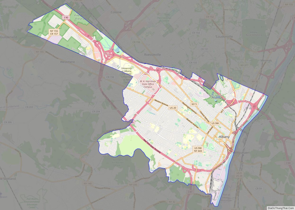
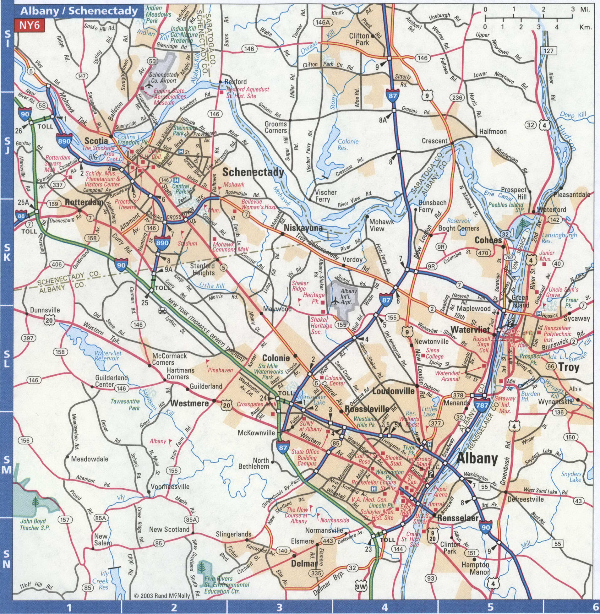
Albany Road Map
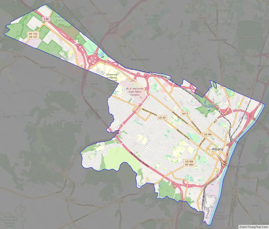
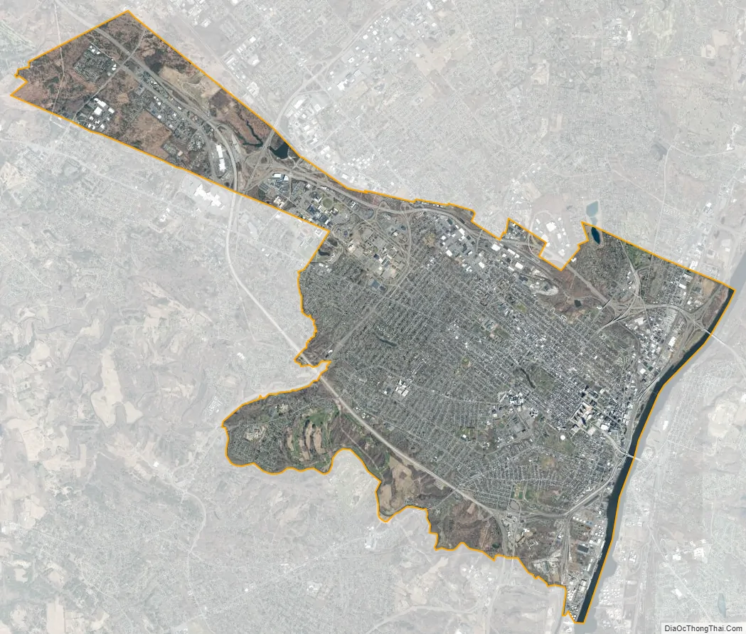
Albany city Satellite Map
Geography
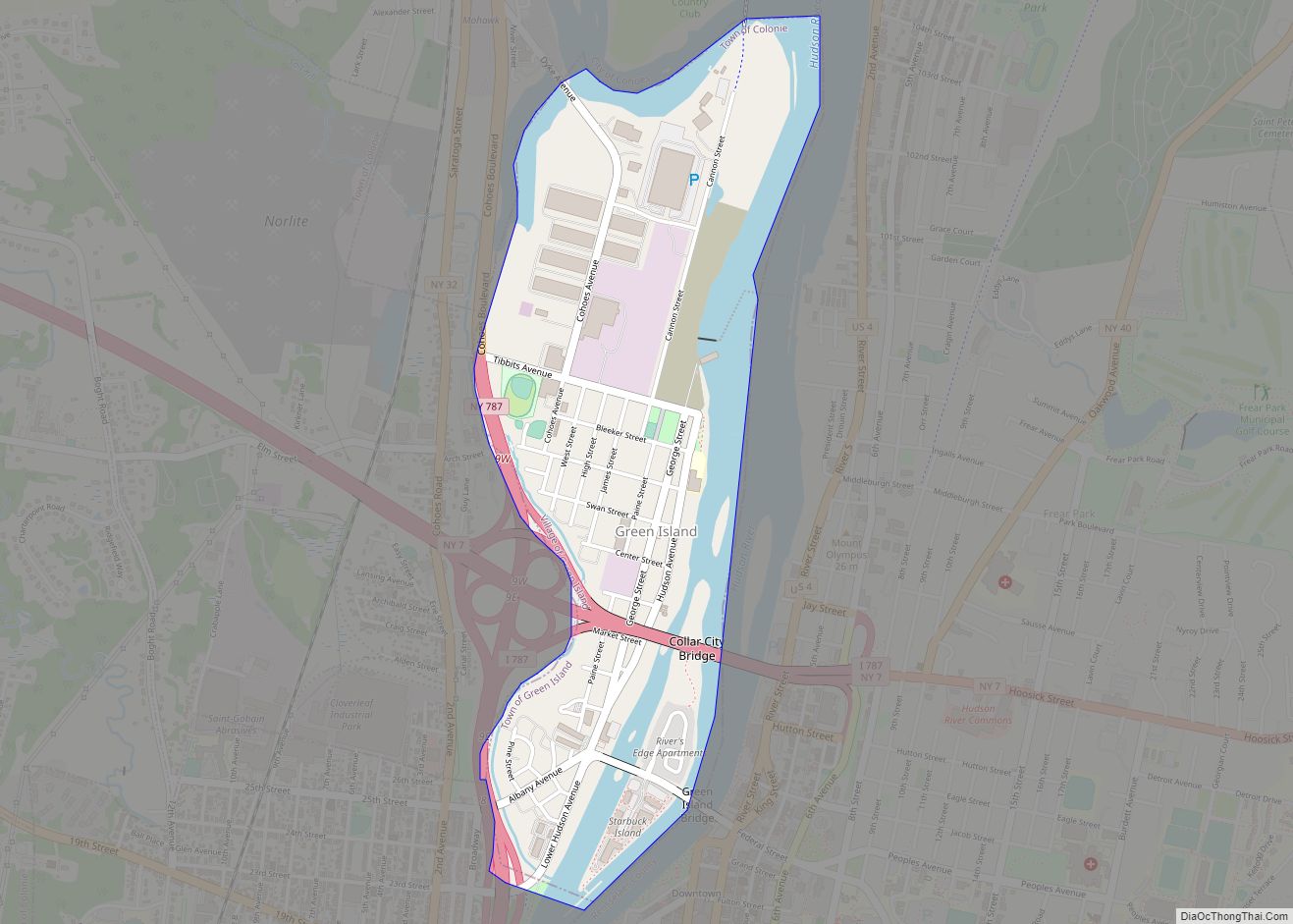
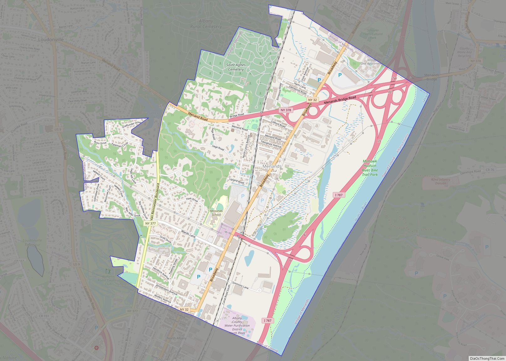
Albany is about 150 miles (240 km) north of New York City on the Hudson River. It has a total area of 21.8 square miles (56 km), of which 21.4 square miles (55 km) is land and 0.4 square miles (1.0 km) (1.8%) is water. The city is bordered on the north by the town of Colonie (along with the village of Menands), on the west by the town of Guilderland, and on the south by the town of Bethlehem. The former Foxes Creek, Beaver Kill, and Rutten Kill were diverted underground in the 19th century. There are four lakes within city limits: Buckingham Lake; Rensselaer Lake at the mouth of the Patroon Creek; Tivoli Lake, which was formed as a reservoir and once connected to the Patroon Creek; and Washington Park Lake, which was formed by damming the Beaver Kill.
The highest natural point in Albany is a USGS benchmark near the Loudonville Reservoir off Birch Hill Road, at 378 feet (115 m) above sea level. The lowest point is at the Hudson River—which is still technically an estuary at Albany and is affected by the Atlantic tide—at an average of 2 feet (0.61 m) above sea level at low tide and 4 feet (1.2 m) at high tide. The interior of Albany consists of rolling hills which were once part of the Albany Pine Bush, an area of pitch pine and scrub oak, and has arid, sandy soil that is a remnant of the ancient Lake Albany. Due to development, the Pine Bush has shrunk from an original 25,000 to 6,000 acres (10,100 to 2,400 ha) today. A preserve was set up by the State Legislature in 1988 and is on the city’s western edge, spilling into Guilderland and Colonie; it is the only sizable inland pine barrens sand dune ecosystem in the United States, and is home to many endangered species, including the Karner Blue butterfly.
Climate
Albany is in the humid continental climate zone (Köppen climate classification: Dfa), and features cold, snowy winters, and hot, humid summers; the city experiences four distinct seasons. Albany is in plant hardiness zone 6a near downtown and along the shore of the Hudson and 5b at its western end. Albany receives 40.7 inches (1,030 mm) of precipitation per year, with 138 days of at least 0.01 in (0.25 mm) of precipitation each year. Snowfall is significant, totaling 59.4 inches (151 cm) per season, but with less accumulation than the lake effect areas to the north and west, as it is farther from Lake Ontario. However, Albany is close enough to the Atlantic coast to receive heavy snow from Nor’easters and the city occasionally receives Alberta clippers. Winters can be very cold with fluctuating conditions; temperatures drop to 0 °F (−18 °C) or below on nine nights per annum. Summers in Albany can contain stretches of excessive heat and humidity, with temperatures of 90 °F (32 °C) or hotter on nine days per year. Record temperature extremes range from −28 °F (−33 °C), on January 19, 1971, to 104 °F (40 °C) on July 4, 1911.
Cityscape
The neighborhoods of Albany include Arbor Hill; Center Square, “[an] eclectic mix of residential and commercial [buildings], including bars, night clubs, restaurants, and stores”; Pine Hills; and the South End.
See also
Map of New York State and its subdivision:- Albany
- Allegany
- Bronx
- Broome
- Cattaraugus
- Cayuga
- Chautauqua
- Chemung
- Chenango
- Clinton
- Columbia
- Cortland
- Delaware
- Dutchess
- Erie
- Essex
- Franklin
- Fulton
- Genesee
- Greene
- Hamilton
- Herkimer
- Jefferson
- Kings
- Lake Ontario
- Lewis
- Livingston
- Madison
- Monroe
- Montgomery
- Nassau
- New York
- Niagara
- Oneida
- Onondaga
- Ontario
- Orange
- Orleans
- Oswego
- Otsego
- Putnam
- Queens
- Rensselaer
- Richmond
- Rockland
- Saint Lawrence
- Saratoga
- Schenectady
- Schoharie
- Schuyler
- Seneca
- Steuben
- Suffolk
- Sullivan
- Tioga
- Tompkins
- Ulster
- Warren
- Washington
- Wayne
- Westchester
- Wyoming
- Yates
- Alabama
- Alaska
- Arizona
- Arkansas
- California
- Colorado
- Connecticut
- Delaware
- District of Columbia
- Florida
- Georgia
- Hawaii
- Idaho
- Illinois
- Indiana
- Iowa
- Kansas
- Kentucky
- Louisiana
- Maine
- Maryland
- Massachusetts
- Michigan
- Minnesota
- Mississippi
- Missouri
- Montana
- Nebraska
- Nevada
- New Hampshire
- New Jersey
- New Mexico
- New York
- North Carolina
- North Dakota
- Ohio
- Oklahoma
- Oregon
- Pennsylvania
- Rhode Island
- South Carolina
- South Dakota
- Tennessee
- Texas
- Utah
- Vermont
- Virginia
- Washington
- West Virginia
- Wisconsin
- Wyoming