The Bronx (/brɒŋks/) is a borough of New York City, coextensive with Bronx County, in the state of New York. It is south of Westchester County; north and east of the New York City borough of Manhattan, across the Harlem River; and north of the New York City borough of Queens, across the East River. The Bronx has a land area of 42 square miles (109 km) and a population of 1,472,654 in the 2020 census. If each borough were ranked as a city, the Bronx would rank as the ninth-most-populous in the U.S. Of the five boroughs, it has the fourth-largest area, fourth-highest population, and third-highest population density. It is the only borough of New York City not primarily on an island. With a population that is 54.8% Hispanic as of 2020, it is the only majority-Hispanic county in the Northeastern United States and the fourth-most-populous nationwide.
The Bronx is divided by the Bronx River into a hillier section in the west, and a flatter eastern section. East and west street names are divided by Jerome Avenue. The West Bronx was annexed to New York City in 1874, and the areas east of the Bronx River in 1895. Bronx County was separated from New York County in 1914. About a quarter of the Bronx’s area is open space, including Woodlawn Cemetery, Van Cortlandt Park, Pelham Bay Park, the New York Botanical Garden, and the Bronx Zoo in the borough’s north and center. The Thain Family Forest at the New York Botanical Garden is thousands of years old; it is New York City’s largest remaining tract of the original forest that once covered the city. These open spaces are primarily on land reserved in the late 19th century as urban development progressed north and east from Manhattan.
The word “Bronx” originated with Faroese-born (or Swedish-born) Jonas Bronck, who established the first settlement in the area as part of the New Netherland colony in 1639. European settlers displaced the native Lenape after 1643. In the 19th and 20th centuries, the Bronx received many immigrant and migrant groups as it was transformed into an urban community, first from European countries, particularly Ireland, Germany, Italy, and Eastern Europe, and later from the Caribbean region, particularly Puerto Rico, Trinidad, Haiti, Guyana, Jamaica, Barbados, and the Dominican Republic), and immigrants from West Africa, particularly from Ghana and Nigeria), African American migrants from the Southern United States, Panamanians, Hondurans, and South Asians.
The Bronx contains the poorest congressional district in the United States, the 15th. There are, however, some upper-income, as well as middle-income neighborhoods such as Riverdale, Fieldston, Spuyten Duyvil, Schuylerville, Pelham Bay, Pelham Gardens, Morris Park, and Country Club. Parts of the Bronx saw a steep decline in population, livable housing, and quality of life starting from the mid-to-late 1960s, continuing throughout the 1970s and into the 1980s, ultimately culminating in a wave of arson in the late 1970s. The South Bronx, in particular, experienced severe urban decay. The borough began experiencing new population growth starting in the late 1990s and continuing to the present day.
| Name: | Bronx County |
|---|---|
| FIPS code: | 36-005 |
| State: | New York |
| Named for: | Jonas Bronck |
| Seat: | none (sui generis) |
| Total Area: | 57 sq mi (150 km²) |
| Land Area: | 42 sq mi (110 km²) |
| Total Population: | 1,472,654 |
| Population Density: | 34,917.7/sq mi (13,481.8/km²) |
| Time zone: | UTC−05:00 (Eastern) |
| Summer Time Zone (DST): | UTC−04:00 (EDT) |
| Website: | bronxboropres.nyc.gov |
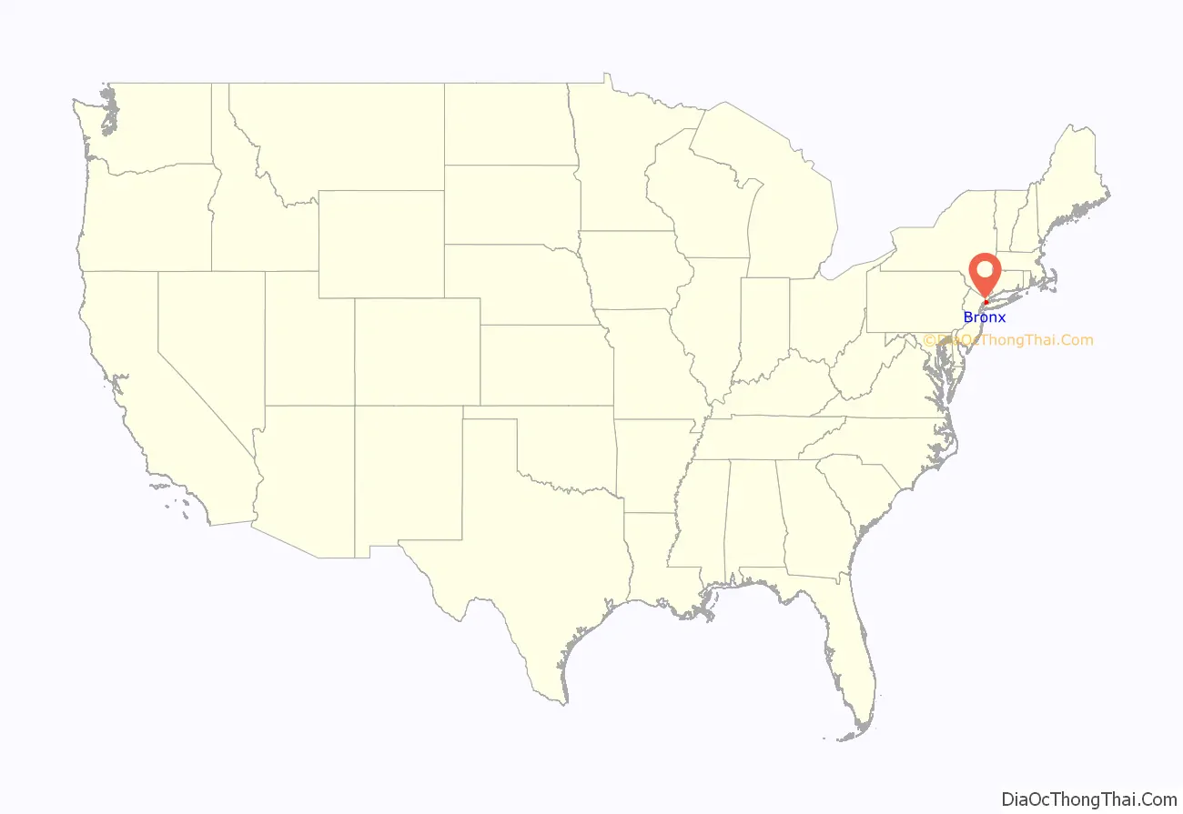
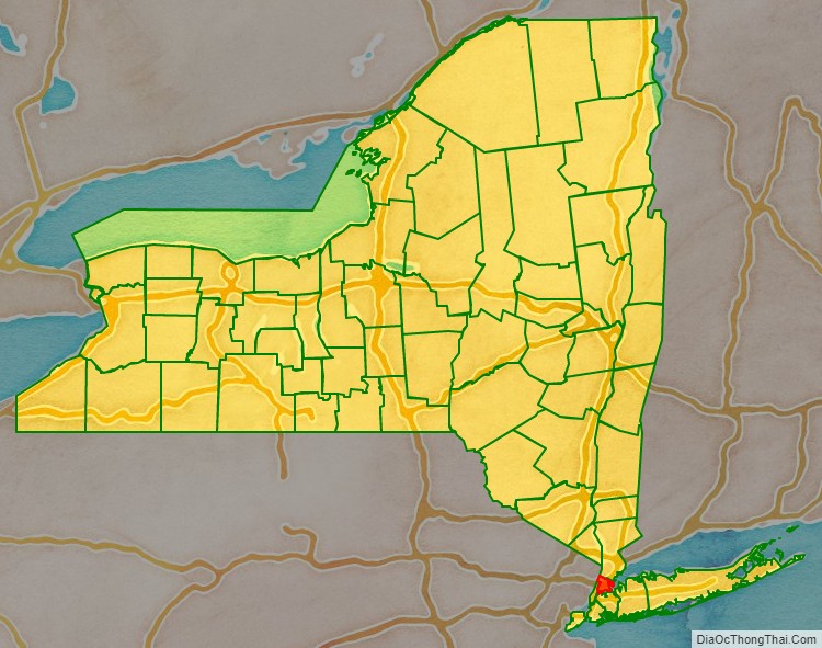
Bronx County location map. Where is Bronx County?
History
European colonization of the Bronx began in 1639. The Bronx was originally part of Westchester County, but it was ceded to New York County in two major parts (West Bronx, 1874 and East Bronx, 1895) before it became Bronx County. Originally, the area was part of the Lenape’s Lenapehoking territory inhabited by Siwanoy of the Wappinger Confederacy. Over time, European colonists converted the borough into farmlands.
Before 1914
The Bronx’s development is directly connected to its strategic location between New England and New York (Manhattan). Control over the bridges across the Harlem River plagued the period of British colonial rule. The King’s Bridge, built in 1693 where Broadway reached the Spuyten Duyvil Creek, was a possession of Frederick Philipse, lord of Philipse Manor. Local farmers on both sides of the creek resented the tolls, and in 1759, Jacobus Dyckman and Benjamin Palmer led them in building a free bridge across the Harlem River. After the American Revolutionary War, the King’s Bridge toll was abolished.
The territory now contained within Bronx County was originally part of Westchester County, one of the 12 original counties of the English Province of New York. The present Bronx County was contained in the town of Westchester and parts of the towns in Yonkers, Eastchester, and Pelham. In 1846, a new town was created by division of Westchester, called West Farms. The town of Morrisania was created, in turn, from West Farms in 1855. In 1873, the town of Kingsbridge was established within the former borders of the town of Yonkers, roughly corresponding to the modern Bronx neighborhoods of Kingsbridge, Riverdale, and Woodlawn Heights, and included Woodlawn Cemetery.
Among famous settlers in the Bronx during the 19th and early 20th centuries were author Willa Cather, tobacco merchant Pierre Lorillard, and inventor Jordan L. Mott, who established Mott Haven to house the workers at his iron works.
The consolidation of the Bronx into New York City proceeded in two stages. In 1873, the state legislature annexed Kingsbridge, West Farms, and Morrisania to New York, effective in 1874; the three towns were soon abolished in the process.
The whole territory east of the Bronx River was annexed to the city in 1895, three years before New York’s consolidation with Brooklyn, Queens, and Staten Island. This included the Town of Westchester (which had voted against consolidation in 1894) and parts of Eastchester and Pelham. The nautical community of City Island voted to join the city in 1896.
On January 1, 1898, the consolidated City of New York was born, including the Bronx as one of the five distinct boroughs (at the same time, the Bronx’s territory moved from Westchester County into New York County, which already included Manhattan and the rest of pre-1874 New York City).
On April 19, 1912, those parts of New York County which had been annexed from Westchester County in previous decades were newly constituted as Bronx County, the 62nd and last county to be created by the state, effective in 1914. Bronx County’s courts opened for business on January 2, 1914 (the same day that John P. Mitchel started work as Mayor of New York City). Marble Hill, Manhattan was now connected to the Bronx by filling in the former waterway, but it did not become part of the borough or county.
After 1914
The history of the Bronx during the 20th century may be divided into four periods: a boom period during 1900–1929, with a population growth by a factor of six from 200,000 in 1900 to 1.3 million in 1930. The Great Depression and post World War II years saw a slowing of growth leading into an eventual decline. The mid to late century were hard times, as the Bronx changed during 1950–1985 from a predominantly moderate-income to a predominantly lower-income area with high rates of violent crime and poverty in some areas. The Bronx has experienced an economic and developmental resurgence starting in the late 1980s that continues into today.
The Bronx was a mostly rural area for many generations, with small farms supplying the city markets. In the late 19th century, however, it grew into a railroad suburb. Faster transportation enabled rapid population growth in the late 19th century, involving the move from horse-drawn street cars to elevated railways and the subway system, which linked to Manhattan in 1904.
The South Bronx was a manufacturing center for many years and was noted as a center of piano manufacturing in the early part of the 20th century. In 1919, the Bronx was the site of 63 piano factories employing more than 5,000 workers.
At the end of World War I, the Bronx hosted the rather small 1918 World’s Fair at 177th Street and DeVoe Avenue.
The Bronx underwent rapid urban growth after World War I. Extensions of the New York City Subway contributed to the increase in population as thousands of immigrants came to the Bronx, resulting in a major boom in residential construction. Among these groups, many Irish Americans, Italian Americans, and especially Jewish Americans settled here. In addition, French, German, Polish, and other immigrants moved into the borough. As evidence of the change in population, by 1937, 592,185 Jews lived in the Bronx (43.9% of the borough’s population), while only 54,000 Jews lived in the borough in 2011. Many synagogues still stand in the Bronx, but most have been converted to other uses.
Bootleggers and gangs were active in the Bronx during Prohibition (1920–1933). Irish, Italian, Jewish, and Polish gangs smuggled in most of the illegal whiskey, and the oldest sections of the borough became poverty-stricken. Enright declared that speakeasies were home to “the vicious elements, bootleggers, gamblers and their friends in all walks of life” cooperating to “evade the law, escape punishment for their crimes, or to deter the police from doing their duty”.
Between 1930 and 1960, moderate and upper income Bronxites (predominantly non-Hispanic Whites) began to relocate from the borough’s southwestern neighborhoods. This migration has left a mostly poor African American and Hispanic (largely Puerto Rican) population in the West Bronx. One significant factor that shifted the racial and economic demographics was the construction of Co-op City, built to house middle-class residents in family-sized apartments. The high-rise complex played a significant role in draining middle-class residents from older tenement buildings in the borough’s southern and western fringes. Most predominantly non-Hispanic White communities today are in the eastern and northwestern sections of the borough.
From the mid-1960s to the early 1980s, the quality of life changed for some Bronx residents. Historians and social scientists have suggested many factors, including the theory that Robert Moses’ Cross Bronx Expressway destroyed existing residential neighborhoods and created instant slums, as put forward in Robert Caro’s biography The Power Broker. Another factor in the Bronx’s decline may have been the development of high-rise housing projects, particularly in the South Bronx. Yet another factor may have been a reduction in the real estate listings and property-related financial services offered in some areas of the Bronx, such as mortgage loans or insurance policies—a process known as redlining. Others have suggested a “planned shrinkage” of municipal services, such as fire-fighting. There was also much debate as to whether rent control laws had made it less profitable (or more costly) for landlords to maintain existing buildings with their existing tenants than to abandon or destroy those buildings.
In the 1970s, parts of the Bronx were plagued by a wave of arson. The burning of buildings was predominantly in the poorest communities, such as the South Bronx. One explanation of this event was that landlords decided to burn their low property-value buildings and take the insurance money, as it was easier for them to get insurance money than to try to refurbish a dilapidated building or sell a building in a severely distressed area. The Bronx became identified with a high rate of poverty and unemployment, which was mainly a persistent problem in the South Bronx. There were cases where tenants set fire to the building they lived in so they could qualify for emergency relocations by city social service agencies to better residences, sometimes being relocated to other parts of the city.
Out of 289 census tracts in the Bronx borough, 7 tracts lost more than 97% of their buildings to arson and abandonment between 1970 and 1980; another 44 tracts had more than 50% of their buildings meet the same fate. By the early 1980s, the Bronx was considered the most blighted urban area in the country, particularly the South Bronx which experienced a loss of 60% of the population and 40% of housing units. However, starting in the 1990s, many of the burned-out and run-down tenements were replaced by new housing units.
Revitalization
Since the late 1980s, significant development has occurred in the Bronx, first stimulated by the city’s “Ten-Year Housing Plan” and community members working to rebuild the social, economic and environmental infrastructure by creating affordable housing. Groups affiliated with churches in the South Bronx erected the Nehemiah Homes with about 1,000 units. The grass roots organization Nos Quedamos’ endeavor known as Melrose Commons began to rebuild areas in the South Bronx. The IRT White Plains Road Line (2 and 5 trains) began to show an increase in riders. Chains such as Marshalls, Staples, and Target opened stores in the Bronx. More bank branches opened in the Bronx as a whole (rising from 106 in 1997 to 149 in 2007), although not primarily in poor or minority neighborhoods, while the Bronx still has fewer branches per person than other boroughs.
In 1997, the Bronx was designated an All America City by the National Civic League, acknowledging its comeback from the decline of the mid-century. In 2006, The New York Times reported that “construction cranes have become the borough’s new visual metaphor, replacing the window decals of the 1980s in which pictures of potted plants and drawn curtains were placed in the windows of abandoned buildings.” The borough has experienced substantial new building construction since 2002. Between 2002 and June 2007, 33,687 new units of housing were built or were under way and $4.8 billion has been invested in new housing. In the first six months of 2007 alone total investment in new residential development was $965 million and 5,187 residential units were scheduled to be completed. Much of the new development is springing up in formerly vacant lots across the South Bronx.
In addition there came a revitalization of the existing housing market in areas such as Hunts Point, the Lower Concourse, and the neighborhoods surrounding the Third Avenue Bridge as people buy apartments and renovate them. Several boutique and chain hotels opened in the 2010s in the South Bronx.
New developments are underway. The Bronx General Post Office on the corner of the Grand Concourse and East 149th Street is being converted into a market place, boutiques, restaurants and office space with a USPS concession. The Kingsbridge Armory, often cited as the largest armory in the world, is scheduled for redevelopment as the Kingsbridge National Ice Center.
Under consideration for future development is the construction of a platform over the New York City Subway’s Concourse Yard adjacent to Lehman College. The construction would permit approximately 2,000,000 square feet (190,000 m) of development and would cost US$350–500 million.
Despite significant investment compared to the post war period, many exacerbated social problems remain including high rates of violent crime, substance abuse, overcrowding, and substandard housing conditions. The Bronx has the highest rate of poverty in New York City, and the greater South Bronx is the poorest area.
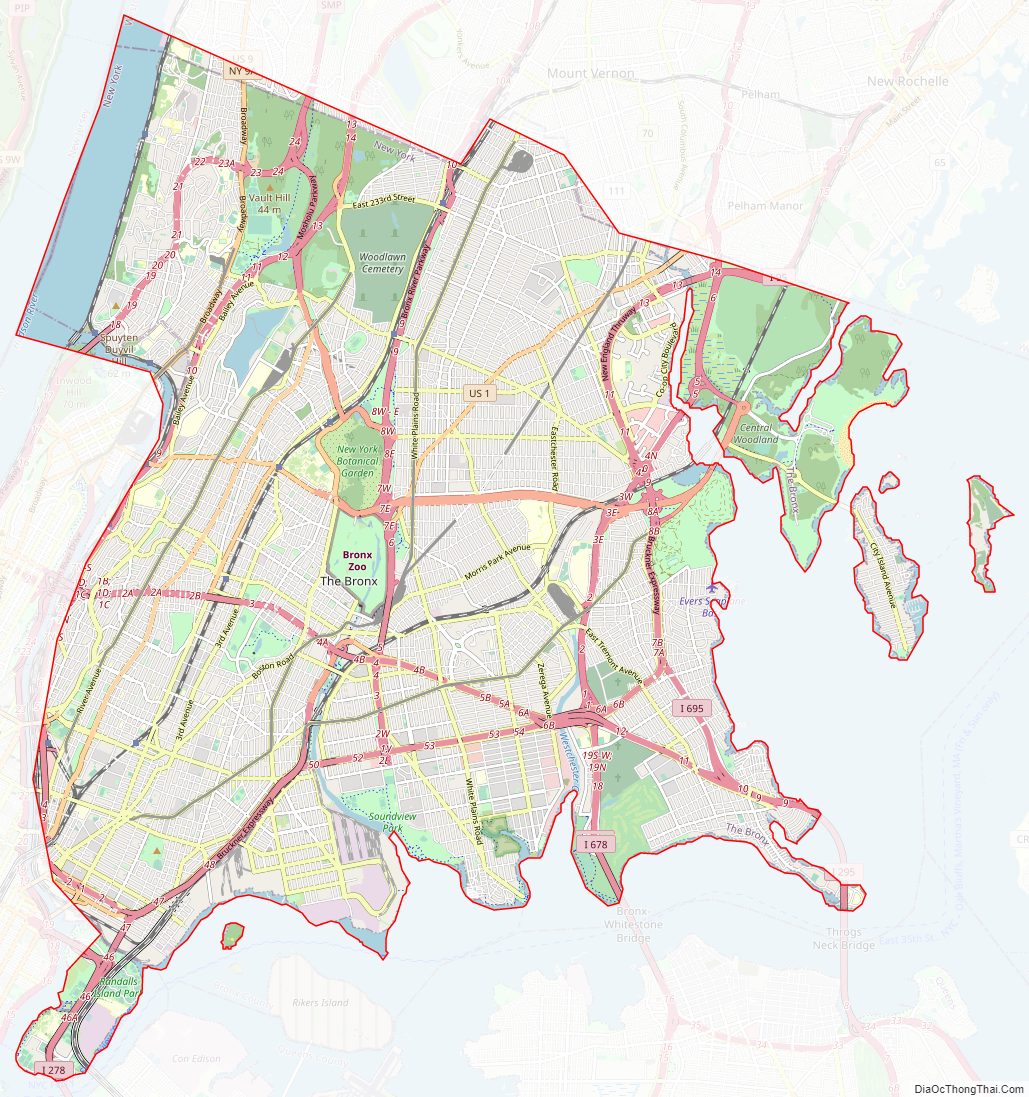
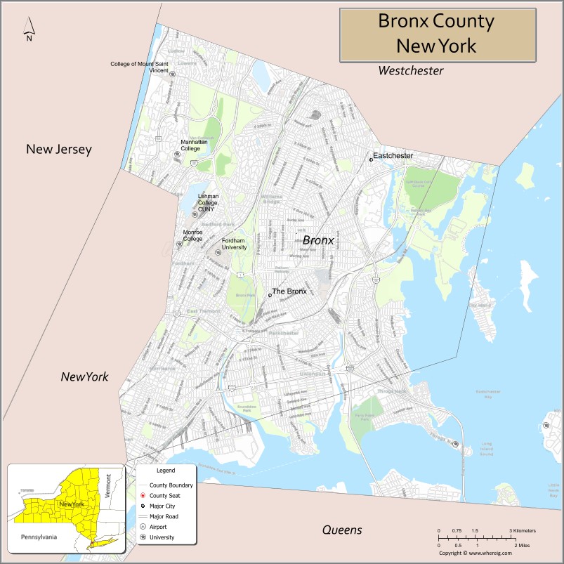
Bronx County Road Map
Geography
Location and physical features
According to the U.S. Census Bureau, Bronx County has a total area of 57 square miles (150 km), of which 42 square miles (110 km) is land and 15 square miles (39 km) (27%) is water.
The Bronx is New York City’s northernmost borough, New York State’s southernmost mainland county and the only part of New York City that is almost entirely on the North American mainland. Its bedrock is primarily Fordham gneiss, a high-grade heavily banded metamorphic rock containing significant amounts of pink feldspar. Marble Hill – politically part of Manhattan but now physically attached to the Bronx – is so-called because of the formation of Inwood marble there as well as in Inwood, Manhattan and parts of the Bronx and Westchester County.
The Hudson River separates the Bronx on the west from Alpine, Tenafly and Englewood Cliffs in Bergen County, New Jersey; the Harlem River separates it from the island of Manhattan to the southwest; the East River separates it from Queens to the southeast; and to the east, Long Island Sound separates it from Nassau County in western Long Island. Directly north of the Bronx are (from west to east) the adjoining Westchester County communities of Yonkers, Mount Vernon, Pelham Manor and New Rochelle. There is also a short southern land boundary with Marble Hill in the Borough of Manhattan, over the filled-in former course of the Spuyten Duyvil Creek; Marble Hill’s postal ZIP code, telephonic area codes and fire service, however, are shared with the Bronx and not Manhattan.
The Bronx River flows south from Westchester County through the borough, emptying into the East River; it is the only entirely freshwater river in New York City. A smaller river, the Hutchinson River (named after the religious leader Anne Hutchinson, killed along its banks in 1641), passes through the East Bronx and empties into Eastchester Bay.
The Bronx also includes several small islands in the East River and Long Island Sound, such as City Island and Hart Island. Rikers Island in the East River, home to the large jail complex for the entire city, is also part of the Bronx.
The Bronx’s highest elevation at 280 feet (85 m) is in the northwest corner, west of Van Cortlandt Park and in the Chapel Farm area near the Riverdale Country School. The opposite (southeastern) side of the Bronx has four large low peninsulas or “necks” of low-lying land that jut into the waters of the East River and were once salt marsh: Hunt’s Point, Clason’s Point, Screvin’s Neck and Throggs Neck. Further up the coastline, Rodman’s Neck lies between Pelham Bay Park in the northeast and City Island. The Bronx’s irregular shoreline extends for 75 square miles (194 km).
Parks and open space
Although Bronx County was the third most densely populated county in the United States as of 2006 (after Manhattan and Brooklyn), 7,000 acres (28 km) of the Bronx—about one fifth of the Bronx’s area, and one quarter of its land area—is given over to parkland. The vision of a system of major Bronx parks connected by park-like thoroughfares is usually attributed to John Mullaly.
Woodlawn Cemetery, one of the largest cemeteries in New York City, sits on the western bank of the Bronx River near Yonkers. It opened in 1863, in what was then the town of Yonkers, at the time a rural area.
The borough’s northern side includes the largest park in New York City—Pelham Bay Park, which includes Orchard Beach—and the third-largest, Van Cortlandt Park, which is west of Woodlawn Cemetery and borders Yonkers. Also in the northern Bronx, Wave Hill, the former estate of George W. Perkins—known for a historic house, gardens, changing site-specific art installations and concerts—overlooks the New Jersey Palisades from a promontory on the Hudson in Riverdale. Nearer the borough’s center, and along the Bronx River, is Bronx Park; its northern end houses the New York Botanical Gardens, which preserve the last patch of the original hemlock forest that once covered the county, and its southern end the Bronx Zoo, the largest urban zoological gardens in the United States. In 1904 the Chestnut Blight pathogen (Cryphonectria parasitica) was found for the first time outside of Asia, here, at the Bronx Zoo. Over the next 40 years it spread throughout eastern North America and killed back essentially every American Chestnut (Castanea dentata), causing ecological and economic devastation.
Just south of Van Cortlandt Park is the Jerome Park Reservoir, surrounded by 2 miles (3 km) of stone walls and bordering several small parks in the Bedford Park neighborhood; the reservoir was built in the 1890s on the site of the former Jerome Park Racetrack. Further south is Crotona Park, home to a 3.3-acre (1.3 ha) lake, 28 species of trees, and a large swimming pool. The land for these parks, and many others, was bought by New York City in 1888, while land was still open and inexpensive, in anticipation of future needs and future pressures for development.
Some of the acquired land was set aside for the Grand Concourse and Pelham Parkway, the first of a series of boulevards and parkways (thoroughfares lined with trees, vegetation and greenery). Later projects included the Bronx River Parkway, which developed a road while restoring the riverbank and reducing pollution, Mosholu Parkway and the Henry Hudson Parkway.
In 2006, a five-year, $220-million program of capital improvements and natural restoration in 70 Bronx parks was begun (financed by water and sewer revenues) as part of an agreement that allowed a water filtration plant under Mosholu Golf Course in Van Cortlandt Park. One major focus is on opening more of the Bronx River’s banks and restoring them to a natural state.
Neighborhoods
The number, locations, and boundaries of the Bronx’s neighborhoods (many of them sitting on the sites of 19th-century villages) have become unclear with time and successive waves of newcomers. In 2006, Manny Fernandez of The New York Times wrote,
Notable Bronx neighborhoods include the South Bronx; Little Italy on Arthur Avenue in the Belmont section; and Riverdale.
(Bronx Community Districts 9 [south central], 10 [east], 11 [east central] and 12 [north central] )
East of the Bronx River, the borough is relatively flat and includes four large low peninsulas, or ‘necks,’ of low-lying land which jut into the waters of the East River and were once saltmarsh: Hunts Point, Clason’s Point, Screvin’s Neck (Castle Hill Point) and Throgs Neck. The East Bronx has older tenement buildings, low income public housing complexes, and multifamily homes, as well as single family homes. It includes New York City’s largest park: Pelham Bay Park along the Westchester-Bronx border.
Neighborhoods include: Clason’s Point, Harding Park, Soundview, Castle Hill, Parkchester (Community District 9); Throggs Neck, Country Club, City Island, Pelham Bay, Edgewater Park, Co-op City (Community District 10); Westchester Square, Van Nest, Pelham Parkway, Morris Park (Community District 11); Williamsbridge, Eastchester, Baychester, Edenwald and Wakefield (Community District 12).
(Bronx Community District 10)
City Island is east of Pelham Bay Park in Long Island Sound and is known for its seafood restaurants and private waterfront homes. City Island’s single shopping street, City Island Avenue, is reminiscent of a small New England town. It is connected to Rodman’s Neck on the mainland by the City Island Bridge.
East of City Island is Hart Island, which is uninhabited and not open to the public. It once served as a prison and now houses New York City’s potter’s field for unclaimed bodies.
(Bronx Community Districts 1 to 8, progressing roughly from south to northwest)
The western parts of the Bronx are hillier and are dominated by a series of parallel ridges, running south to north. The West Bronx has older apartment buildings, low income public housing complexes, multifamily homes in its lower income areas as well as larger single family homes in more affluent areas such as Riverdale and Fieldston. It includes New York City’s third-largest park: Van Cortlandt Park along the Westchester-Bronx border. The Grand Concourse, a wide boulevard, runs through it, north to south.
(Bronx Community Districts 7 [between the Bronx and Harlem Rivers] and 8 [facing the Hudson River] – plus part of Board 12)
Neighborhoods include: Fordham-Bedford, Bedford Park, Norwood, Kingsbridge Heights (Community District 7), Kingsbridge, Riverdale (Community District 8), and Woodlawn Heights (Community District 12). (Marble Hill, Manhattan is now connected by land to the Bronx rather than Manhattan and is served by Bronx Community District 8.)
(Bronx Community Districts 1 to 6 plus part of CD 7—progressing northwards, CDs 2, 3 and 6 border the Bronx River from its mouth to Bronx Park, while 1, 4, 5 and 7 face Manhattan across the Harlem River)
Like other neighborhoods in New York City, the South Bronx has no official boundaries. The name has been used to represent poverty in the Bronx and is applied to progressively more northern places so that by the 2000s, Fordham Road was often used as a northern limit. The Bronx River more consistently forms an eastern boundary. The South Bronx has many high-density apartment buildings, low income public housing complexes, and multi-unit homes. The South Bronx is home to the Bronx County Courthouse, Borough Hall, and other government buildings, as well as Yankee Stadium. The Cross Bronx Expressway bisects it, east to west. The South Bronx has some of the poorest neighborhoods in the country, as well as very high crime areas.
Neighborhoods include: The Hub (a retail district at Third Avenue and East 149th Street), Port Morris, Mott Haven (Community District 1), Melrose (Community District 1 & Community District 3), Morrisania, East Morrisania [also known as Crotona Park East] (Community District 3), Hunts Point, Longwood (Community District 2), Highbridge, Concourse (Community District 4), West Farms, Belmont, East Tremont (Community District 6), Tremont, Morris Heights (Community District 5), University Heights. (Community District 5 & Community District 7).
Adjacent counties
The Bronx adjoins:
- Westchester County – north
- Nassau County, New York – southeast (across the East River)
- Queens County, New York (Queens) – south (across the East River)
- New York County, New York (Manhattan) – southwest
- Bergen County, New Jersey – west (across the Hudson River)