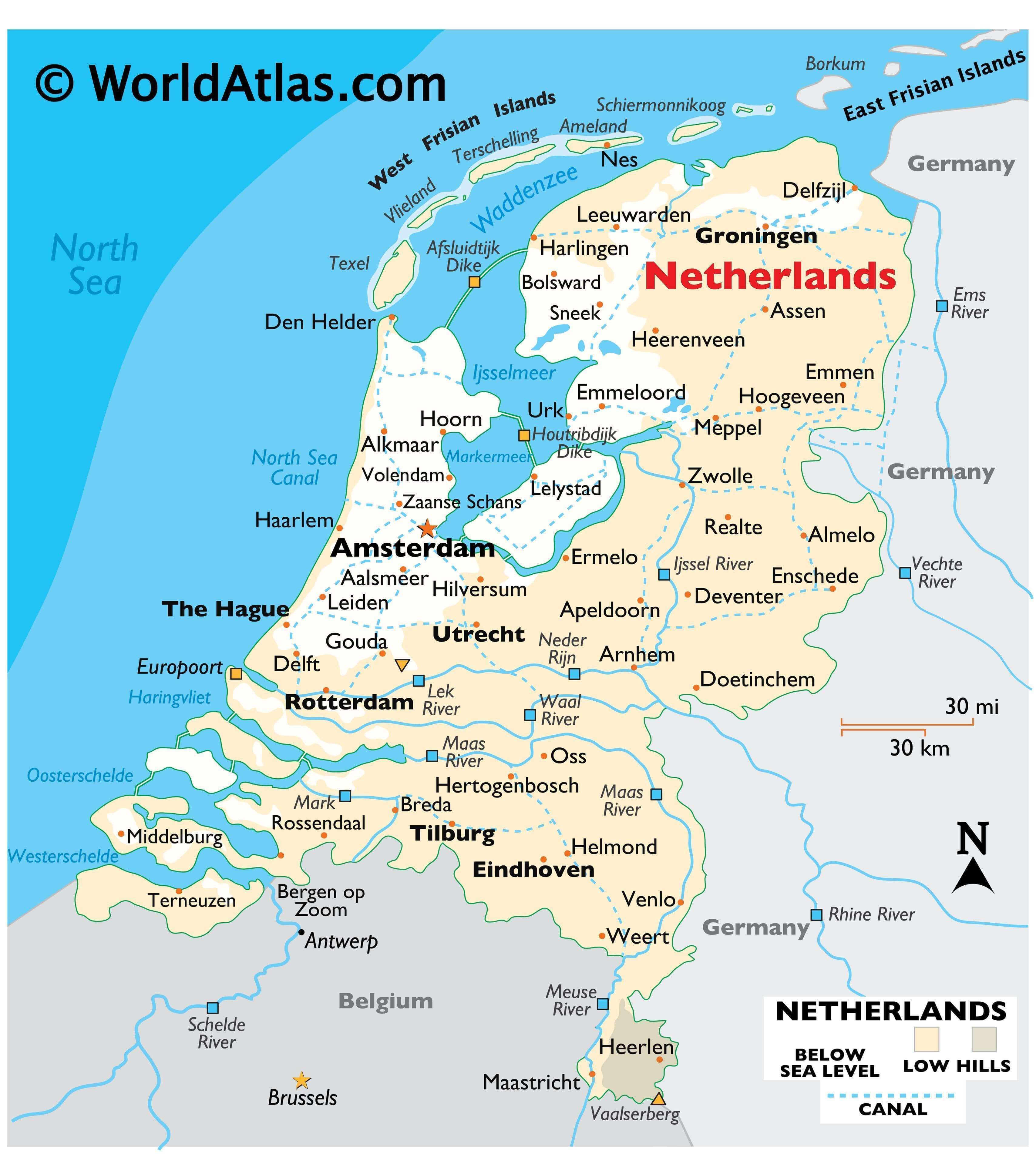
As observed on the physical map of the Netherlands, it is a very flat country with almost 25% of its land at, or below sea level. The country covers a total area of 41,865 sq. km.
Low rolling hills cover some of the central areas, and in the far south, the land rises into the foothills of the Ardennes Mountains. Vaalserberg, the country’s highest point is located there, rising to 322 m (1,053 ft). A yellow upright triangle marks its position on the map. It is found where the Netherlands meets Germany and Belgium.
Stretched along the northern coastline, the West Frisian Islands continue to the northeast, becoming the German East Frisian Islands. These barrier islands, separated from the mainland by the Waddenzee, provide a small level of protection from the North Sea.
The Netherlands is crossed by hundreds of miles of navigable canals. One of the most important is the North Sea Canal, as it enables ocean-going ships to reach the port of Amsterdam. Satellite picture here!
Water, water everywhere, as the central and southern Netherlands are positioned at the delta of four major rivers, including the Rijn, Mass, Scheldt and Waal.
The country’s largest lakes, Ijsselmeer and Markermeer are both manmade, created by dikes.
The lowest point in the country is ‘Nieuwekerk aan den Ijssel’ at 6,76 m below sea level. An inverted triangle marks its position on the map above.
| Flag: |  |
|---|---|
| Legal Name: | Kingdom of the Netherlands |
| Capital Value: | Amsterdam; note – The Hague is the seat of government |
| Official languages: | Dutch |
| Demonym(s): | Dutch |
| Government: | Unitary parliamentary constitutional monarchy |
| Legislature: | States General |
| Total Area: | 41,543 km² |
| Land Area: | 33,893 km² |
| Water Area: | 7,650 km² |
| Population: | 17,332,850 |
| Density: | 520/km (1,346.8/sq mi) (16th) |
| GDP: | $909.07 Billion |
| GDP Per Capita: | $52,447.83 |
| Currency Value: | Euros (EUR) |
| Driving side: | right |
| Calling code: | +31, +599 |
| Internet TLD: | .nl, .bq |
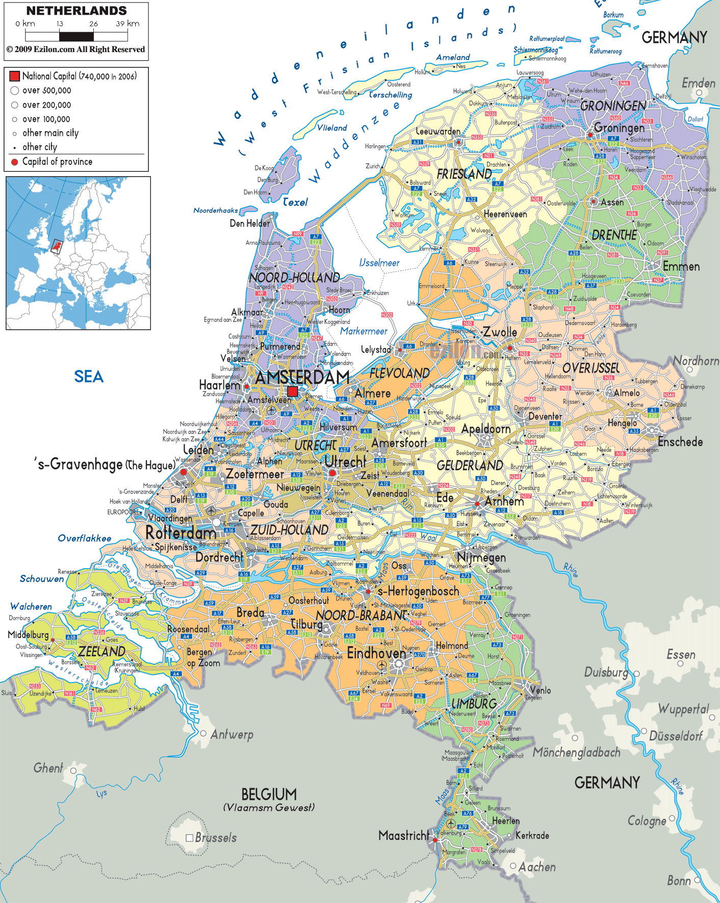
From the bustling streets of Amsterdam to the picturesque canals of Utrecht, take a virtual tour of the Netherlands with this interactive map. View its major cities, rivers, and highways, as well as its mostly low coastal plain and higher terrain in the southeast. Zoom in to get a closer look, or use the satellite and elevation map to explore the country’s physical features.
Online Interactive Political Map
Click on ![]() to view map in "full screen" mode.
to view map in "full screen" mode.
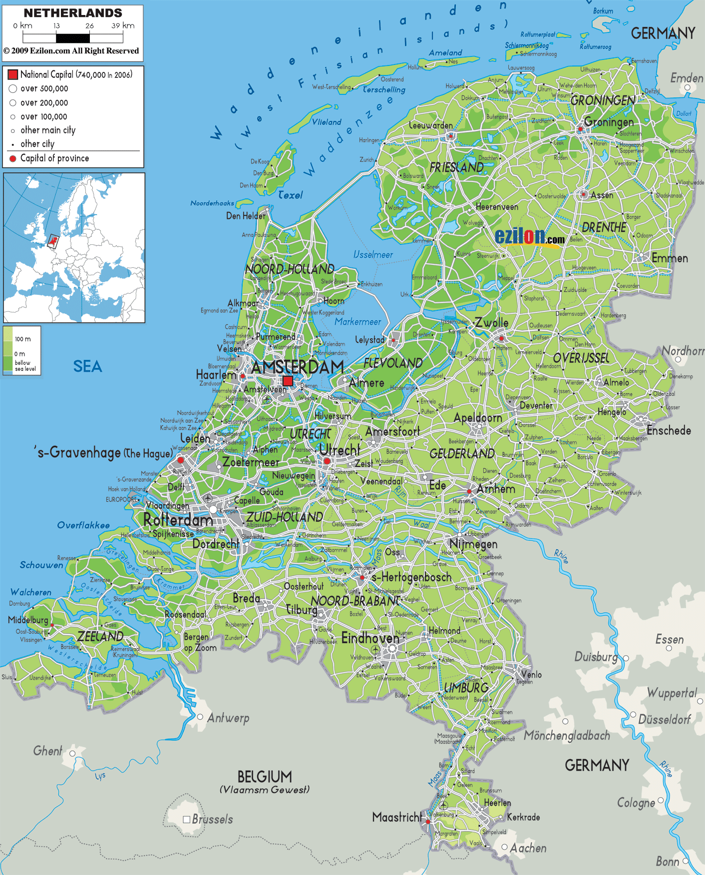
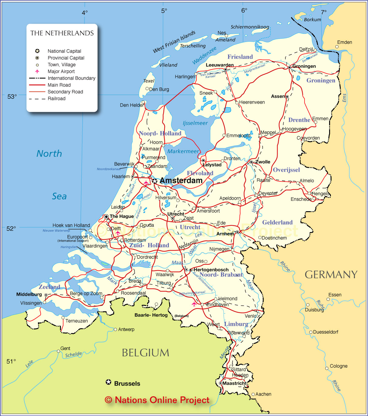
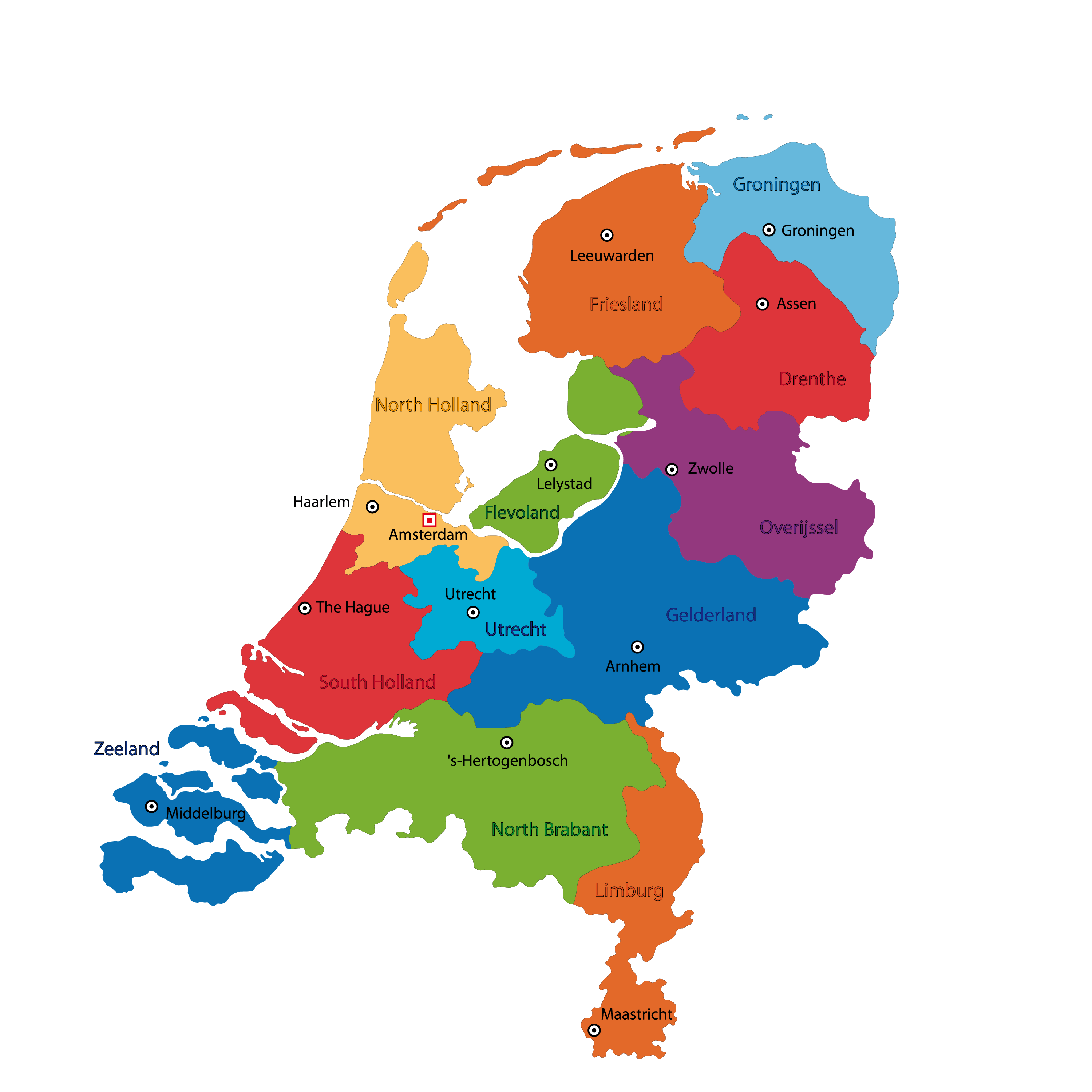
The Netherlands is divided into 12 administrative regions or provinces (provincies, singular – provincie). In alphabetical order, these provinces are: Drenthe, Flevoland, Fryslan (Friesland), Gelderland, Groningen, Limburg, Noord-Brabant (North Brabant), Noord-Holland (North Holland), Overijssel, Utrecht, Zeeland (Zealand) and Zuid-Holland (South Holland). These provinces are further subdivided into 355 municipalities (gemeenten). The three overseas special municipalities namely, Bonaire, Saba and Sint Eustatius in the Caribbean Netherlands, are not part of any province.
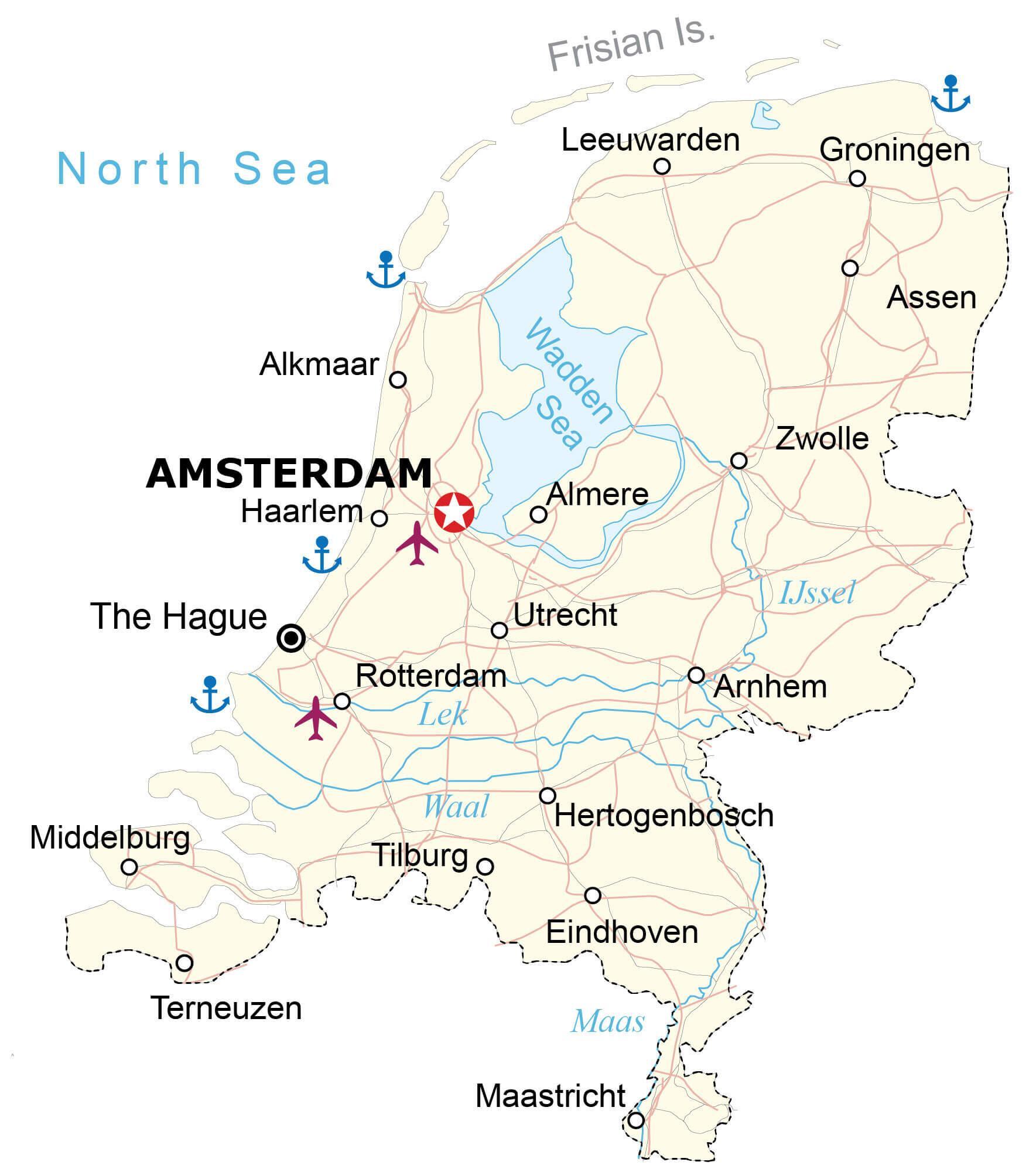
With more than 3.7 million people, the province of South Holland is the most densely populated province in Netherlands. Located in the western part of the country, in North Holland province is, Amsterdam – the capital and the most populous city of Netherlands. Amsterdam is the major cultural, commercial and economic hub of the country, with the Port of Amsterdam being the 5th largest port in Europe. Situated in the western part of the country, in South Holland province, The Hague is the administrative center of the country and houses the important government institutions of Netherlands, as well as the International Court of Justice.
Location Maps
Where is Netherlands?
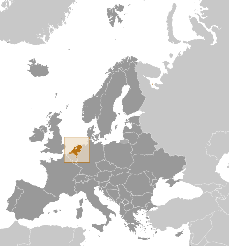
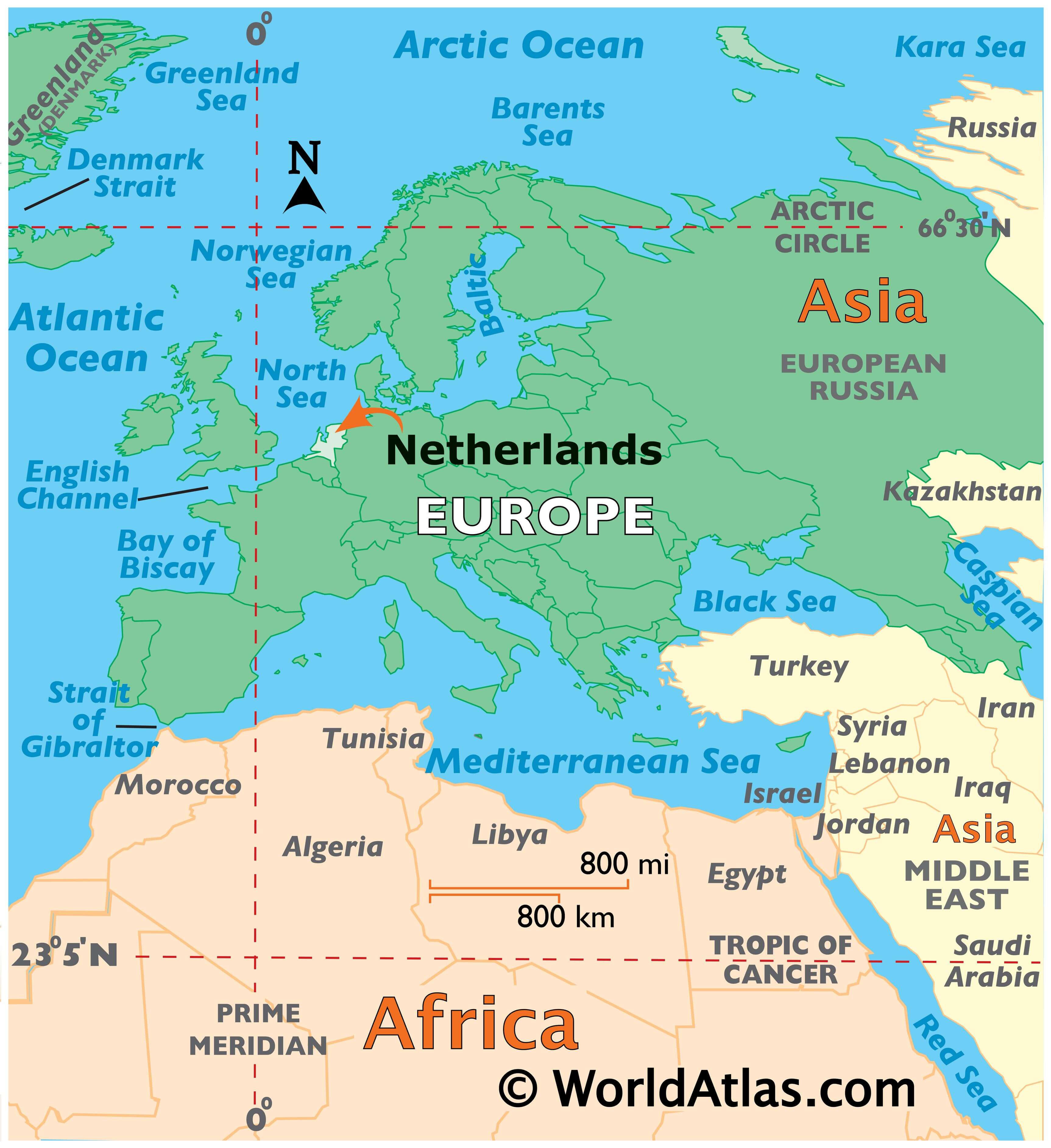
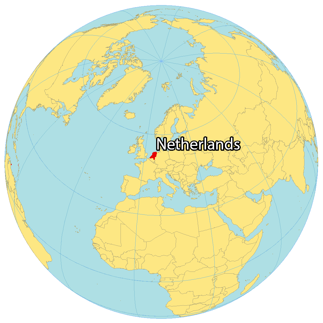
The Netherlands is located in Western Europe, along the North Sea. It borders two other European nations, Belgium in the southwest and Germany in the east, as well as sharing a maritime border with the United Kingdom to the west. The country contains several islands like the West Frisian Islands, as well as in IJsselmeer, Markermeer, and in the Caribbean. Amsterdam is the capital and largest city, located in the west, and windmills are a key characteristic of the country, which were used to pump water for drainage and farming.
High Definition Political Map of Netherlands
Physical Map of Netherlands