| Name: | Socorro County |
|---|---|
| FIPS code: | 35-053 |
| State: | New Mexico |
| Founded: | January 9, 1852 |
| Seat: | Socorro |
| Largest city: | Socorro |
| Total Area: | 6,649 sq mi (17,220 km²) |
| Land Area: | 6,647 sq mi (17,220 km²) |
| Total Population: | 16,311 |
| Population Density: | 2.7/sq mi (1.0/km²) |
| Time zone: | UTC−7 (Mountain) |
| Summer Time Zone (DST): | UTC−6 (MDT) |
| Website: | www.socorrocounty.net |
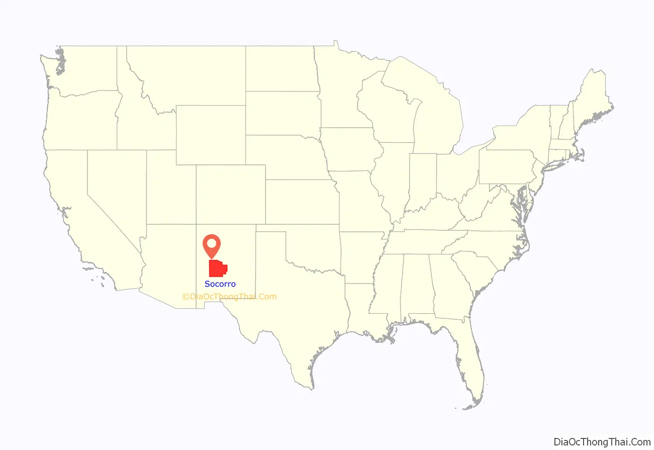
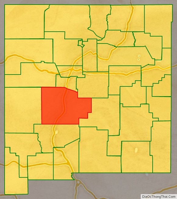
Socorro County location map. Where is Socorro County?
History
Socorro County’s history is intimately linked with the rich history of the surrounding area. Basham noted in his report documenting the archeological history of the Cibola National Forest’s Magdalena Ranger District, which is almost entirely within Socorro County, that “[t]he heritage resources on the district are diverse and representative of nearly every prominent human evolutionary event known to anthropology. Evidence for human use of district lands date back 14,000 years to the Paleoindian period providing glimpses into the peopling of the New World and megafaunal extinction.“ Much of the now Magdalena Ranger District were a province of the Apache. Bands of Apache effectively controlled the Magdalena-Datil region from the seventeenth century until they were defeated in the Apache Wars in the late nineteenth century.
Outlaw renegades Butch Cassidy and the Wild Bunch and notorious Apaches like Cochise and Geronimo have ties to Socorro County’s San Mateo Mountains. Vicks Peak was named after Victorio, “a Mimbreño Apache leader whose territory included much of the south and southwest New Mexico.” Famous for defying relocation orders in 1879 and leading his warriors “on a two-year reign of terror before he was killed,” Victorio is at least as highly regarded as Geronimo or Cochise among Apaches. Perhaps most famous outlaw was the Apache Kid whose supposed grave lies within the Apache Kid Wilderness. Stories of depredations by the Apache Kid, and of his demise, became so common and dramatic that in southwestern folklore they may be exceeded only by tales of lost Spanish gold. Native Americans lingered in the San Mateos well into the 1900s. We know this by an essay written by Aldo Leopold in 1919 where he documents stumbling upon the remains of a recently abandoned Indian hunting camp.
- Cultural or Historic Figures with Ties to Socorro County
The Apache Kid is the namesake for a Wilderness area in the Cibola National Forest.
Vicks Peak in the San Mateo Mountains is named for Victorio, an Apache warrior and chief.
Geronimo (Goyaałé), a Bedonkohe Apache; kneeling with rifle, 1887.
Butch Cassidy poses in the Wild Bunch group photo, Fort Worth, Texas, 1901.
A mining rush followed the Apache wars – gold, silver, and copper were found in the mountains. It wasn’t until this time that extensive use of the area by non-Native Americans occurred. While some mining activity, involving gold, silver, and copper, occurred in the southern part of the range near the end of the nineteenth century, the prospecting/mining remnants are barely visible today due to collapse, topographic screening, and vegetation regrowth. While miners combed the mountains for mineral riches during the late nineteenth and early twentieth centuries, stockmen drove tens of thousands of sheep and cattle to stockyards at the village of Magdalena, then linked by rail with Socorro. In fact, the last regularly used cattle trail in the United States stretched 125 miles westward from Magdalena. The route was formally known as the Magdalena Livestock Driveway, but more popularly known to cowboys and cattlemen as the Beefsteak Trail. The trail began use in 1865 and its peak was in 1919. The trail was used continually until trailing gave way to trucking and the trail officially closed in 1971.
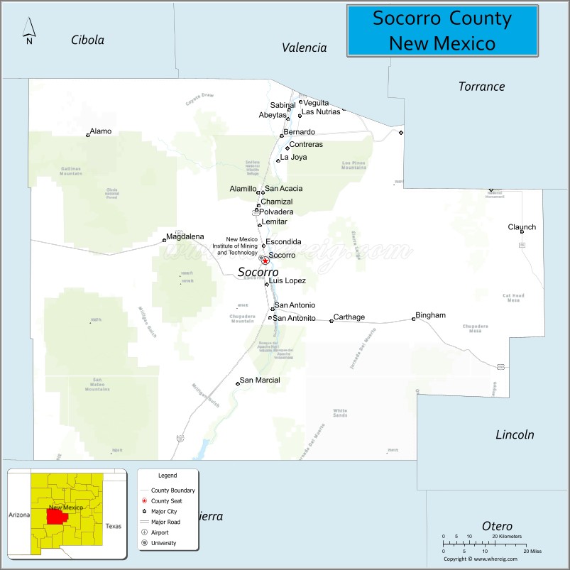
Socorro County Road Map
Geography
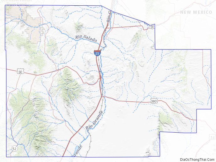
According to the U.S. Census Bureau, the county has a total area of 6,649 square miles (17,220 km), of which 6,647 square miles (17,220 km) is land and 2.1 square miles (5.4 km) (0.03%) is water. It is the second-largest county in New Mexico by area, after Catron County.
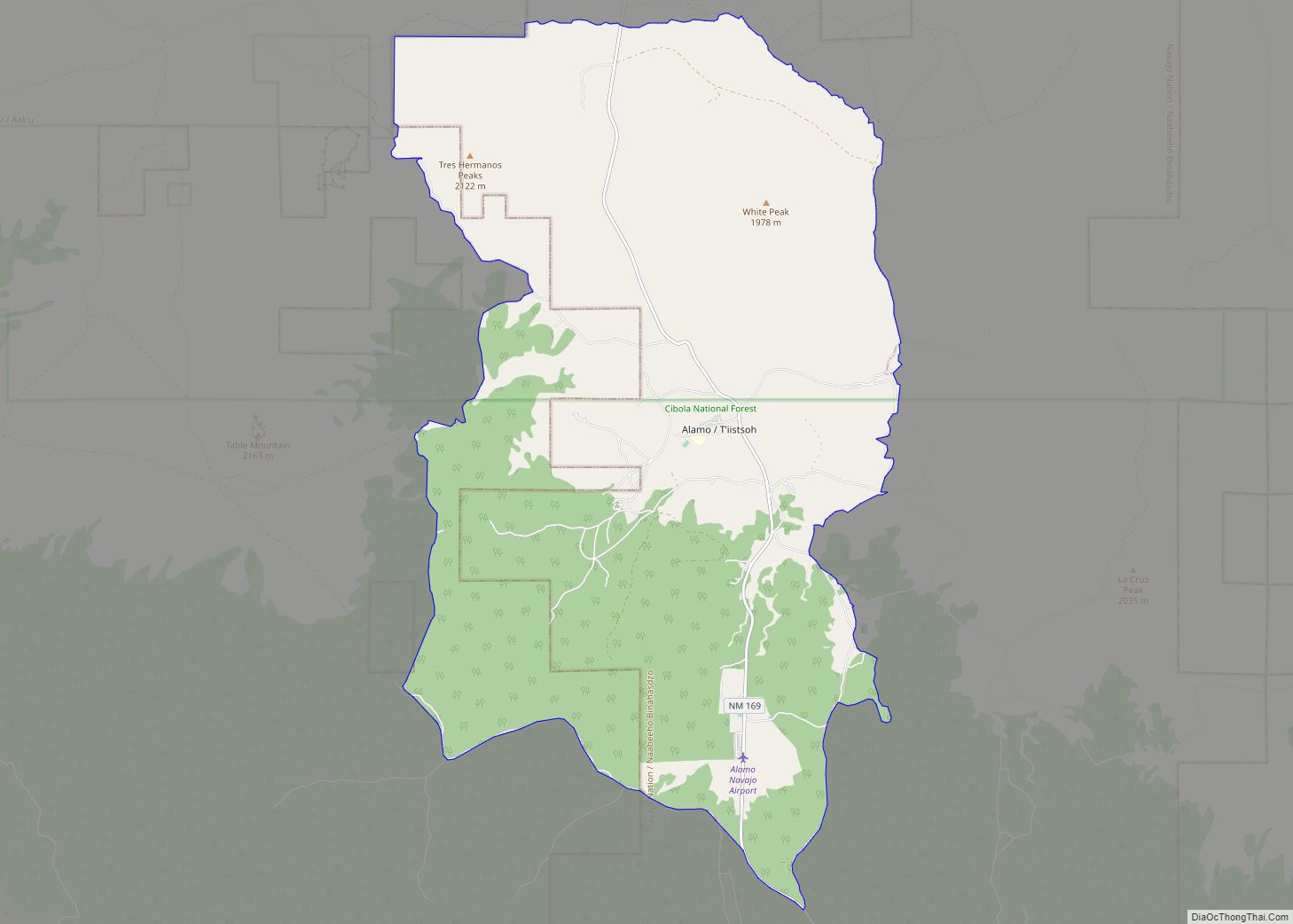
Socorro County ranges in elevation from approximately 4,528 ft (1,380 m) on the banks of the Rio Grande to 10,784 ft (3,287 m) at the top of South Baldy peak in the Magdalena Mountains. The southern portion of the Rocky Mountains extend into New Mexico and Socorro County. There are several mountain ranges that spread throughout the county. The Forest Service manages portions of four mountain ranges: the Bear, Datil, Magdalena, and San Mateo Mountains. Most of the land that comprises these mountains are within the Cibola National Forest. These ranges, as well as Ladron Peak located in Socorro County, are classified as sky islands.
Adjacent counties
- Cibola County – northwest
- Valencia County – north
- Torrance County – northeast
- Lincoln County – east
- Sierra County – south
- Catron County – west
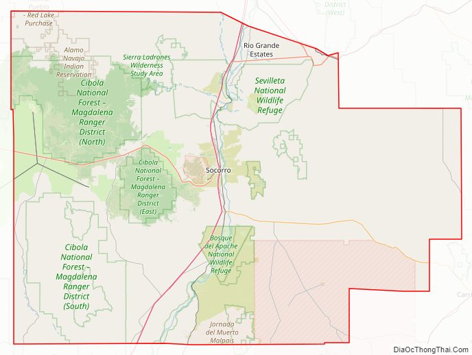
National protected areas
- Bosque del Apache National Wildlife Refuge
- Sevilleta National Wildlife Refuge
- Cibola National Forest (part)
- National System of Public Lands managed by the BLM’s Socorro Field Office (part)
- El Camino Real de Tierra Adentro National Historic Trail (part)
- Salinas Pueblo Missions National Monument (part)
Socorro County Topographic Map
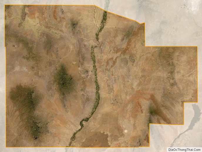
Socorro County Satellite Map
Socorro County Outline Map