Thayer County is a county in the U.S. state of Nebraska. As of the 2020 United States Census, the population was 5,034. The county was created in 1856 and originally named Jefferson County. It was organized in 1870-1871 and renamed for General and Governor John Milton Thayer.
In the Nebraska license plate system, Thayer County is represented by the prefix 32 (it had the thirty-second-largest number of vehicles registered in the state when the license plate system was established in 1922).
| Name: | Thayer County |
|---|---|
| FIPS code: | 31-169 |
| State: | Nebraska |
| Founded: | 1871 |
| Named for: | John Milton Thayer |
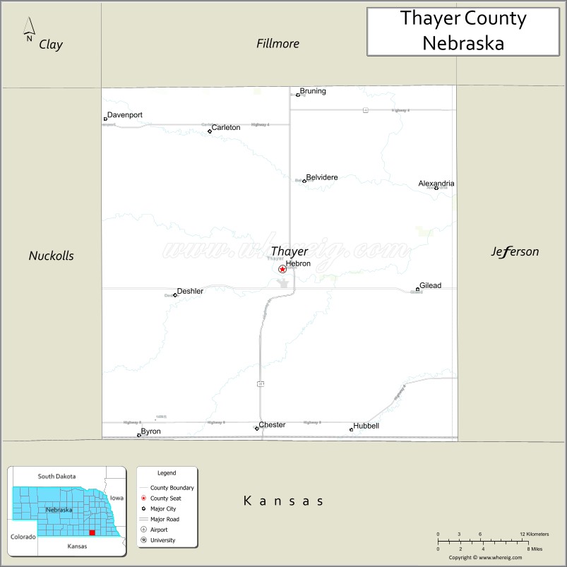
| Seat: | Hebron |
| Largest city: | Hebron |
| Total Area: | 575 sq mi (1,490 km²) |
| Land Area: | 574 sq mi (1,490 km²) |
| Total Population: | 4,913 |
| Population Density: | 8.8/sq mi (3.4/km²) |
| Time zone: | UTC−6 (Central) |
| Summer Time Zone (DST): | UTC−5 (CDT) |
| Website: | thayercountyne.gov |
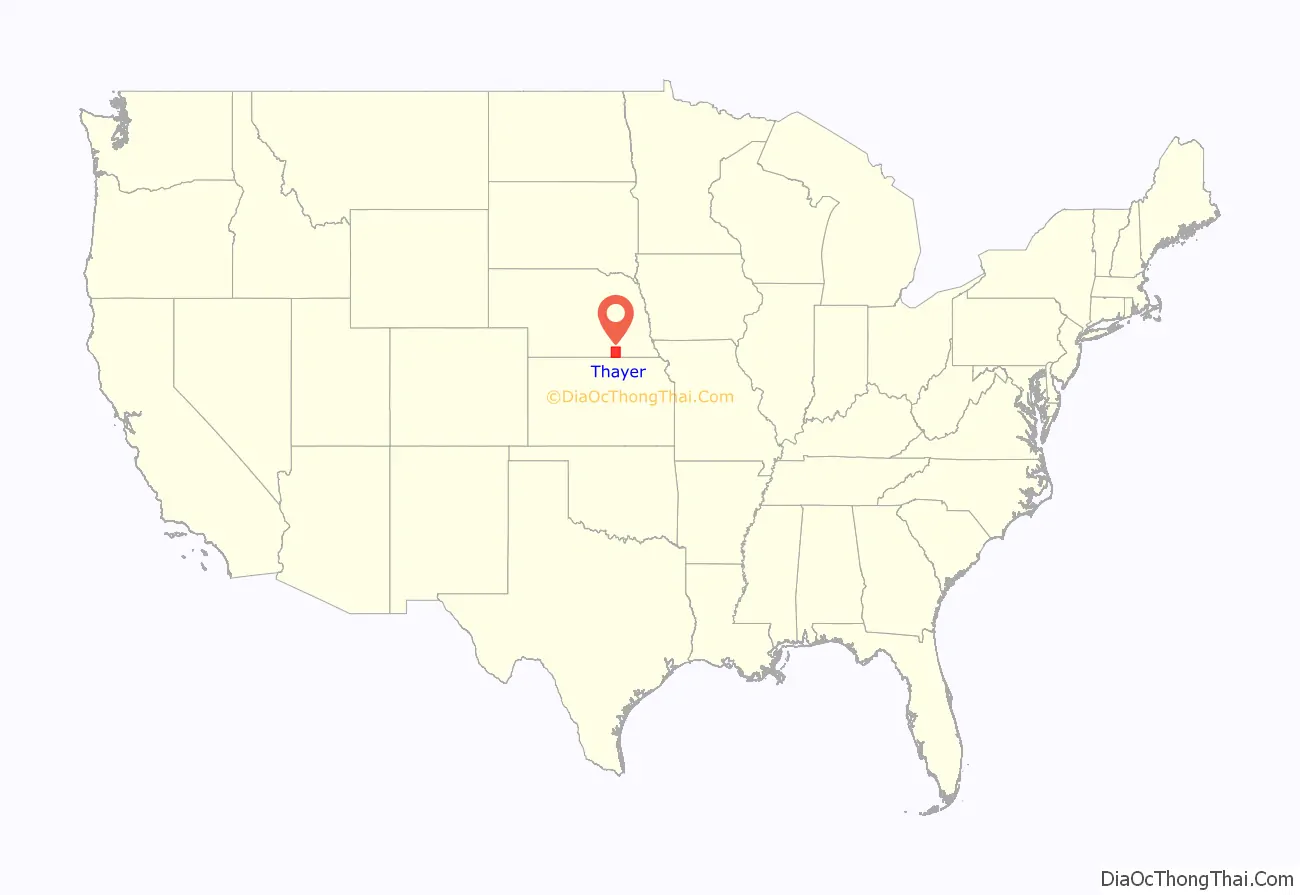
Thayer County location map. Where is Thayer County?
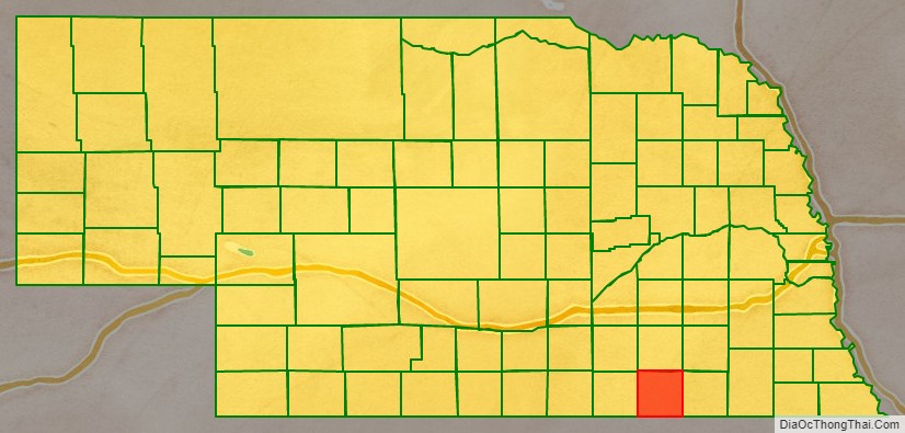
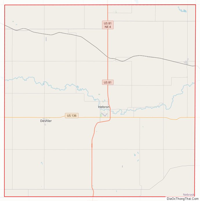
Thayer County Road Map
Geography
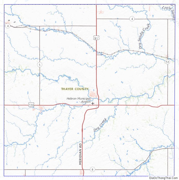
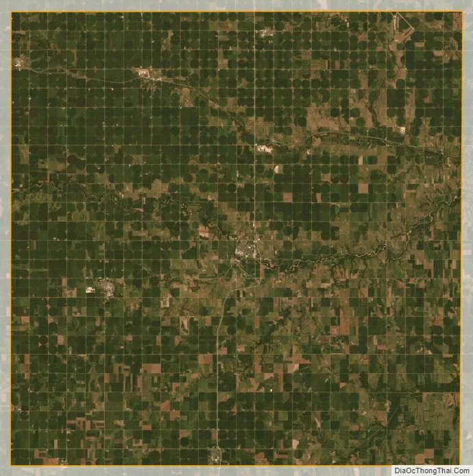
Thayer County lies on the south line of Nebraska. Its south boundary line abuts the north boundary line of the state of Kansas. Its terrain consists of rolling hills, sloped toward the east. A local drainage, Big Sandy Creek, flows southeast and east through the northern part of the county, and another drainage, Rose Creek, flows northeastward through the SE corner of the county (they converge east of Thayer County’s east boundary line). The planar portions of the terrain are partially used for agriculture.
Thayer County has an area of 575 square miles (1,490 km), of which 574 square miles (1,490 km) is land and 1.2 square miles (3.1 km) (0.2%) is water.
Major highways
- U.S. Highway 81
- U.S. Highway 136
- Nebraska Highway 4
- Nebraska Highway 5
- Nebraska Highway 8
- Nebraska Highway 53
Adjacent counties
- Saline County – northeast
- Jefferson County – east
- Washington County, Kansas – southeast
- Republic County, Kansas – south
- Nuckolls County – west
- Fillmore County – north
Protected areas
- Prairie Marsh State Wildlife Management Area
- Prairie Marsh West State Wildlife Management Area
Thayer County Topographic Map
Thayer County Satellite Map
Thayer County Outline Map