Warren County is a rural county located in the U.S. state of Iowa. As of the 2020 census, the population was 52,403. The county seat is Indianola.
Warren County is included in the Des Moines–West Des Moines, IA Metropolitan Statistical Area.
| Name: | Warren County |
|---|---|
| FIPS code: | 19-181 |
| State: | Iowa |
| Founded: | 1846 |
| Named for: | Joseph Warren |
| Seat: | Indianola |
| Largest city: | Indianola |
| Total Area: | 573 sq mi (1,480 km²) |
| Land Area: | 570 sq mi (1,500 km²) |
| Total Population: | 52,403 |
| Population Density: | 91/sq mi (35/km²) |
| Time zone: | UTC−6 (Central) |
| Summer Time Zone (DST): | UTC−5 (CDT) |
| Website: | www.warrencountyia.org |
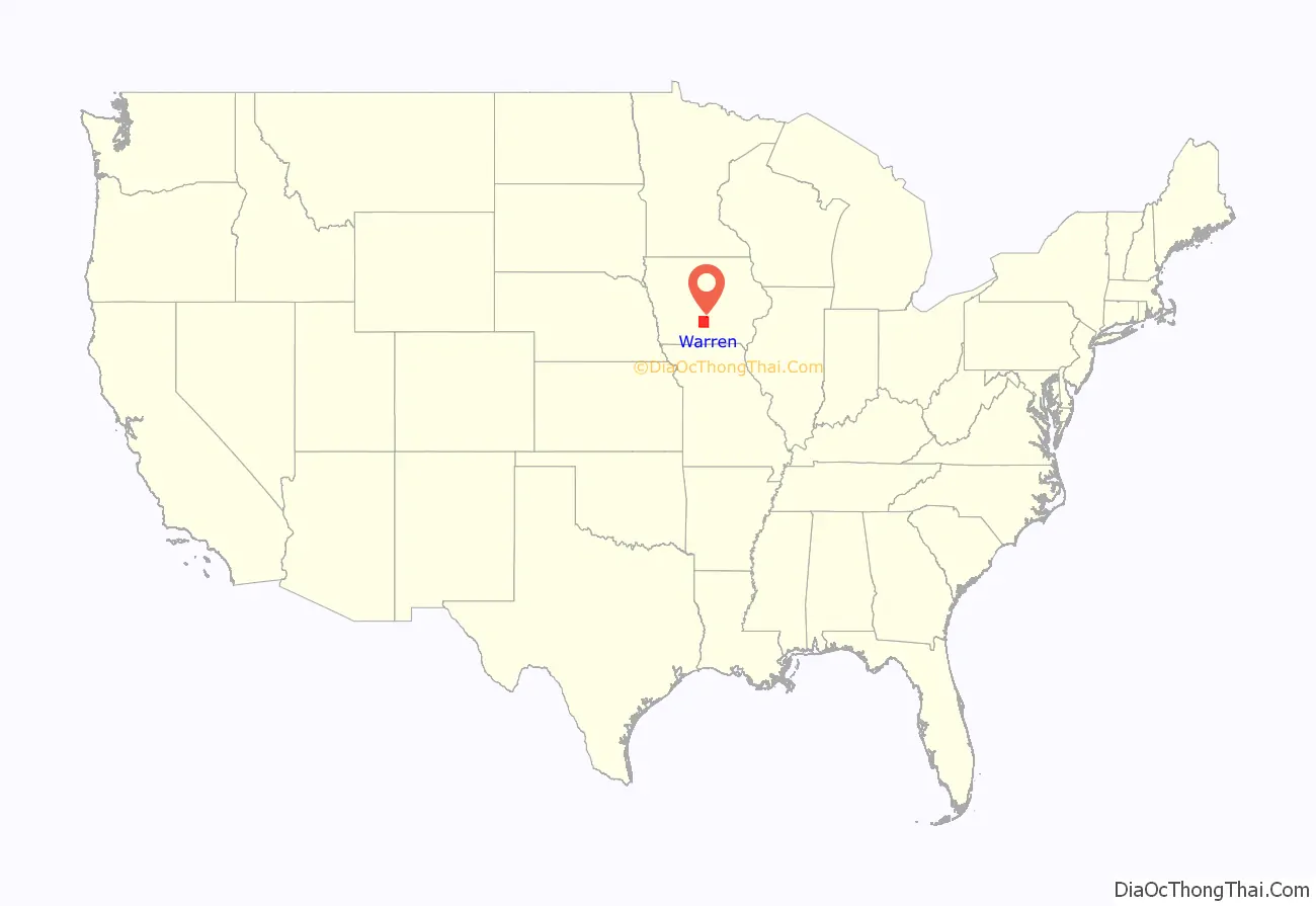
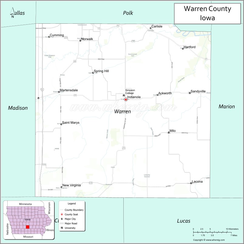
Warren County location map. Where is Warren County?
History
Warren County was formed in 1846. It was named after General Joseph Warren, a hero in the American Revolutionary War. The present Warren County Court House was opened in 1939.
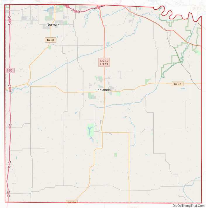
Warren County Road Map
Geography
According to the U.S. Census Bureau, the county has a total area of 573 square miles (1,480 km), of which 570 square miles (1,500 km) is land and 3.5 square miles (9.1 km) (0.6%) is water.
Major highways
- Interstate 35
- U.S. Highway 65
- U.S. Highway 69
- Iowa Highway 5
- Iowa Highway 28
- Iowa Highway 92
- Iowa Highway 316
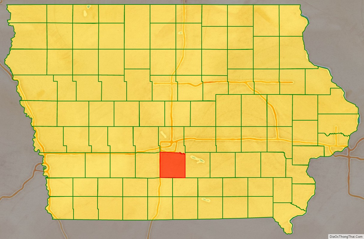
Adjacent counties
- Polk County (north)
- Marion County (east)
- Lucas County (southeast)
- Clarke County (southwest)
- Madison County (west)
Warren County Topographic Map
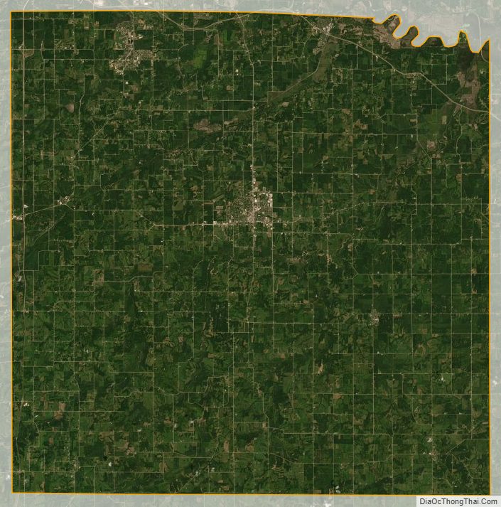
Warren County Satellite Map
Warren County Outline Map