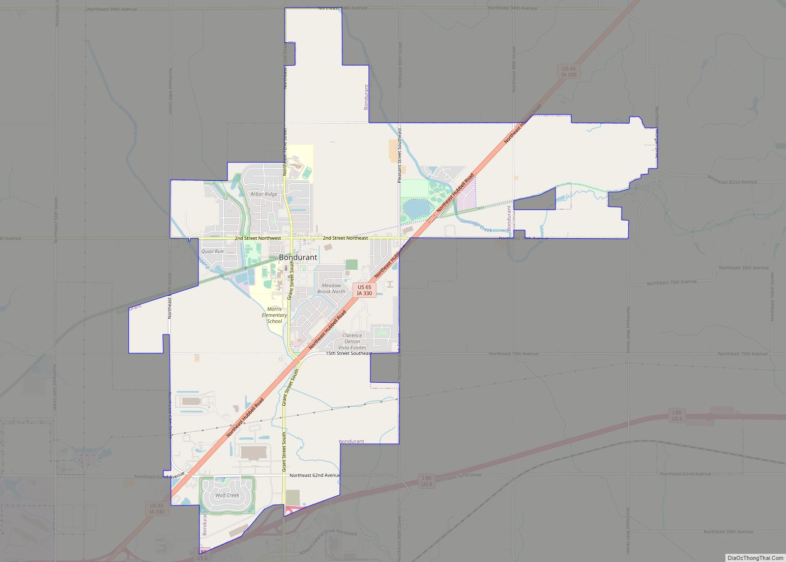
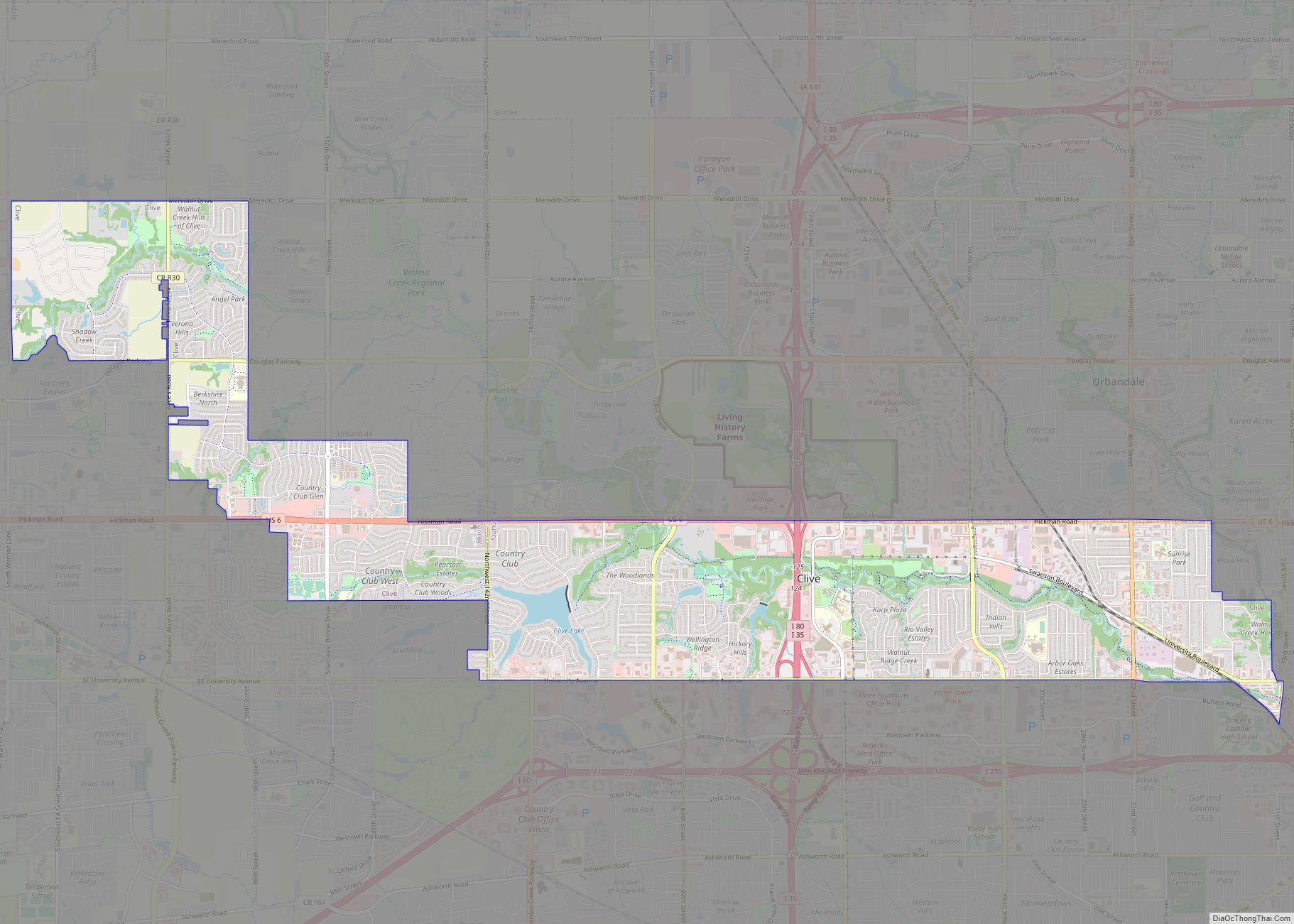
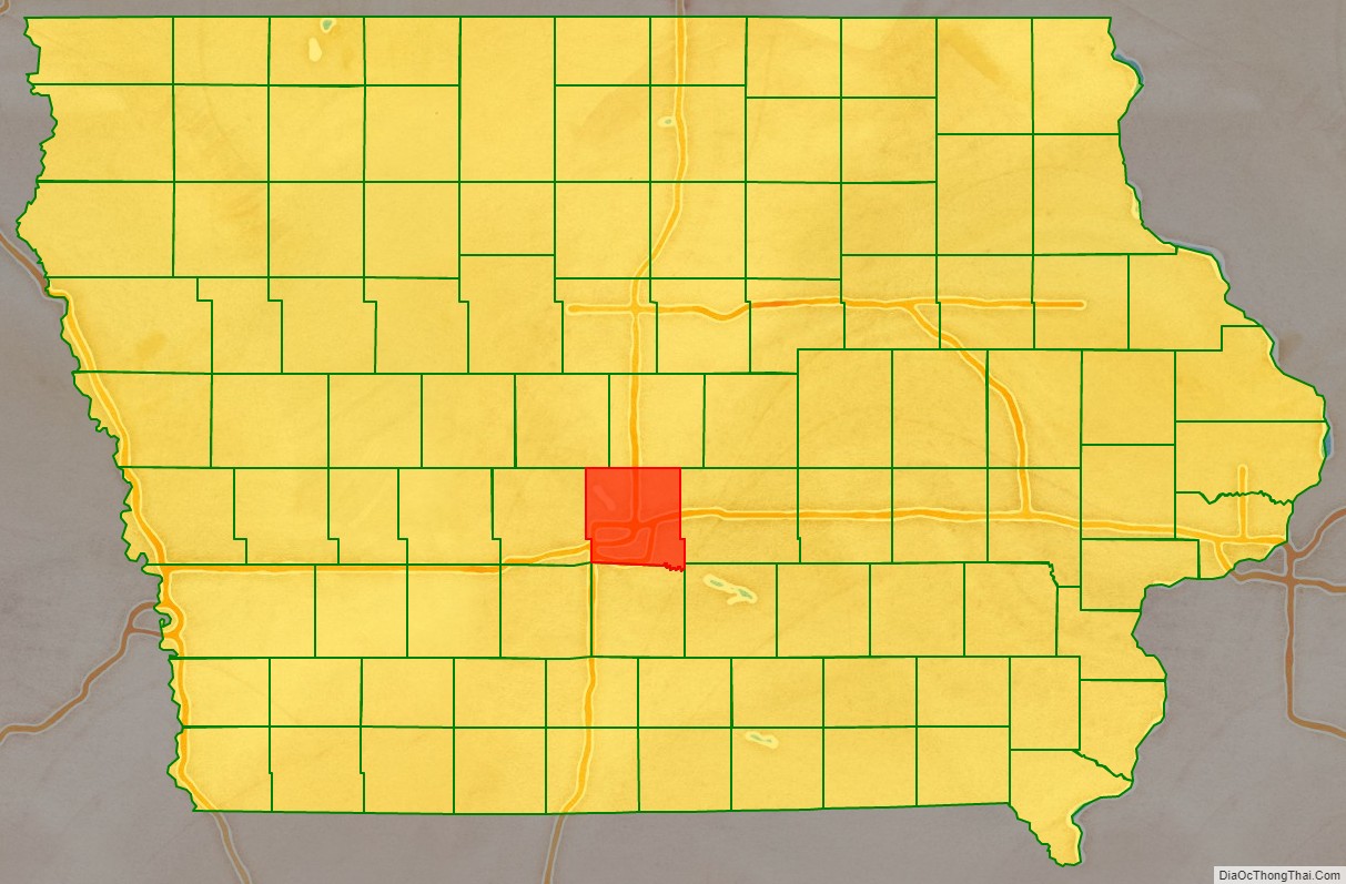
Polk County is located in the U.S. state of Iowa. As of the 2020 census, the population was 492,401. It is Iowa’s most populous county, and home to over 15% of the state’s residents. The county seat is Des Moines, which is also the capital city of Iowa. Polk County is included in the Des Moines–West Des Moines, IA Metropolitan Statistical Area.
| Name: | Polk County |
|---|---|
| FIPS code: | 19-153 |
| State: | Iowa |
| Founded: | January 13, 1846 |
| Named for: | James K. Polk |
| Seat: | Des Moines |
| Largest city: | Des Moines |
| Total Area: | 592 sq mi (1,530 km²) |
| Land Area: | 574 sq mi (1,490 km²) |
| Total Population: | 492,401 |
| Population Density: | 830/sq mi (320/km²) |
| Time zone: | UTC−6 (Central) |
| Summer Time Zone (DST): | UTC−5 (CDT) |
| Website: | www.polkcountyiowa.gov |
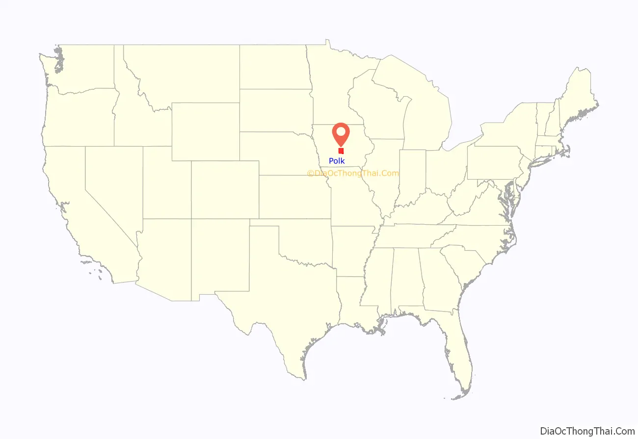
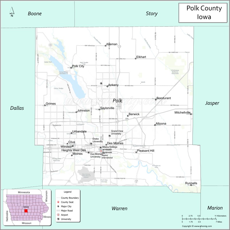
Polk County location map. Where is Polk County?
History
On January 13, 1846, the legislative body of the Iowa Territory authorized the creation of twelve counties in the Territory, with general descriptions of their boundaries. On January 17 they further enacted a resolution setting the effective date of the county government for Jasper and Polk Counties as March 1, 1846. Polk County’s name referred to United States President James K. Polk, who served from 1845 to 1849.
The first courthouse, a two-story structure, was built in Des Moines in 1846. Rapid settlement and commercial growth in the county soon rendered this building insufficient, so construction of a larger building was initiated in 1858. Due to construction delays and the onset of the Civil War, the structure was not completed until 1866. The present courthouse was erected in 1906, and in 1962 it was extensively renovated and enlarged.
Polk County Road Map

Geography
According to the US Census Bureau, the county has a total area of 592 square miles (1,530 km), of which 574 square miles (1,490 km) is land and 18 square miles (47 km) (3.0%) is water. The county is bisected by the Des Moines River.
Major highways
- Interstate 35
- Interstate 80
- Interstate 235
- U.S. Highway 6
- U.S. Highway 65
- U.S Route 69
- Iowa Highway 5
- Iowa Highway 17
- Iowa Highway 28
- Iowa Highway 141
- Iowa Highway 160
- Iowa Highway 163
- Iowa Highway 415
Transit
- Des Moines Area Regional Transit
- List of intercity bus stops in Iowa
Adjacent counties
- Boone – northwest
- Dallas – west
- Jasper – east
- Madison – southwest
- Marion – southeast
- Story – north
- Warren – south
Polk County Topographic Map
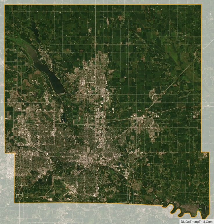
Polk County Satellite Map
Polk County Outline Map