Bladen County (/ˈbleɪdən/) is a county located in the U.S. state of North Carolina. As of the 2020 census, the population was 29,606. Its county seat is Elizabethtown. The county was created in 1734 as Bladen Precinct and gained county status in 1739.
| Name: | Bladen County |
|---|---|
| FIPS code: | 37-017 |
| State: | North Carolina |
| Founded: | 1734 |
| Named for: | Martin Bladen |
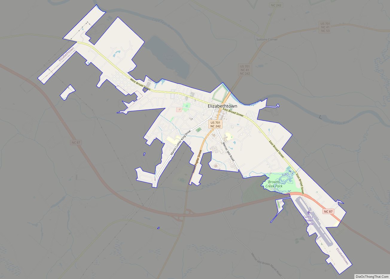
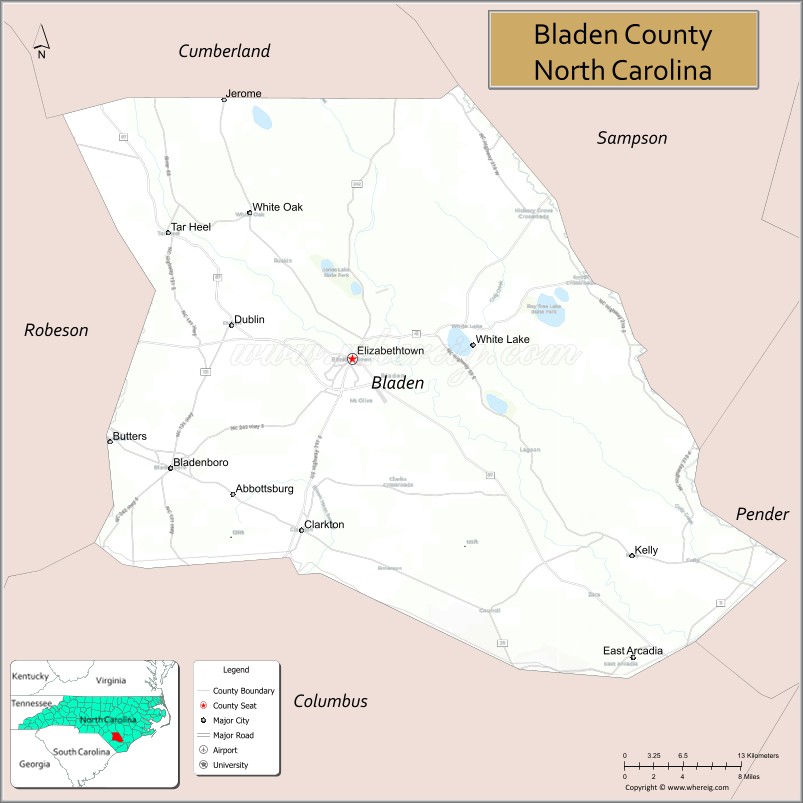
| Seat: | Elizabethtown |
| Largest town: | Elizabethtown |
| Total Area: | 887 sq mi (2,300 km²) |
| Land Area: | 874 sq mi (2,260 km²) |
| Total Population: | 29,525 |
| Population Density: | 33.8/sq mi (13.1/km²) |
| Time zone: | UTC−5 (Eastern) |
| Summer Time Zone (DST): | UTC−4 (EDT) |
| Website: | bladennc.govoffice3.com |
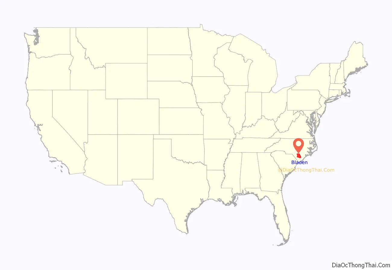
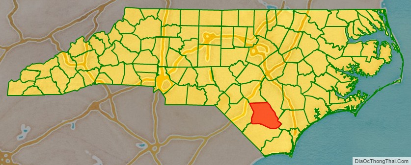
Bladen County location map. Where is Bladen County?
History
Bladen County was formed in 1734 as Bladen Precinct of Bath County, from New Hanover Precinct. It was named for Martin Bladen, a member of the Board of Trade. With the abolition of Bath County in 1739, all of its constituent precincts became counties.
Bladen’s original residents included the Waccamaw people.
Bladen County began as a vast territory, with indefinite northern and western boundaries. Reductions in its extent began in 1750, when its western part became Anson County. In 1754 the northern part of what was left of Bladen County became Cumberland County. In 1764 the southern part of what remained of Bladen County was combined with part of New Hanover County to form Brunswick County. In 1787 the western part of the now much smaller county became Robeson County. Finally, in 1808 the southern part of Bladen County was combined with part of Brunswick County to form Columbus County. Bladen County is considered the “mother county” of North Carolina because of the 100 counties in North Carolina, 55 of them at one point belonged to Bladen County.
Bladen County Road Map
Geography
According to the U.S. Census Bureau, the county has a total area of 887 square miles (2,300 km), of which 874 square miles (2,260 km) is land and 13 square miles (34 km) (1.4%) is water. It is the fourth-largest county in North Carolina by land area.
State and local protected areas
- Bakers Lake State Natural Area
- Bay Tree Lake State Natural Area
- Bladen Lakes State Forest
- Jones Lake State Park
- Singletary Lake State Park
- Suggs Mill Pond Game Land
- Turnbull Creek Educational State Forest
- White State Lake
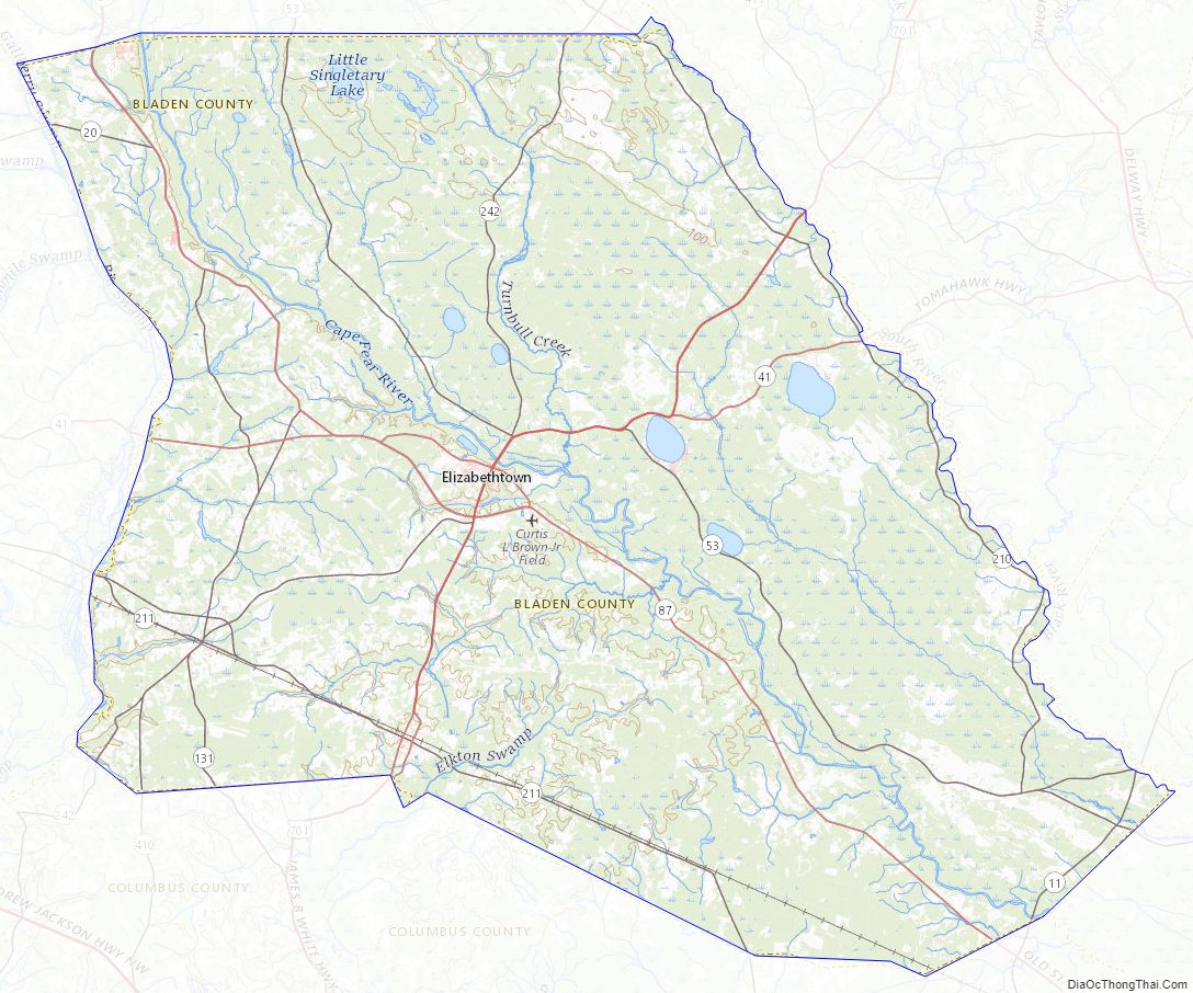
Major water bodies
- Bay Tree Lake
- Slades Swamp
- Black River, home of the oldest documented Taxodium distichum (bald cypress) at 2,648 years old
- Cape Fear River
- Jones Lake
- Little Singletary Lake
- Salters Lake
- Singletary Lake
- South River
- White Lake
Adjacent counties
- Cumberland County – north
- Sampson County – northeast
- Pender County – east
- Columbus County – south
- Robeson County – west
Major highways
- US 701
- US 701 Bus.
- NC 11
- NC 20
- NC 41
- NC 53
- NC 87
- NC 87 Bus.
- NC 131
- NC 210
- NC 211
- NC 211 Bus.
- NC 242
- NC 410
Major infrastructure
- Curtis L. Brown Jr. Field
- Elwell Ferry, river ferry across the Cape Fear River.
Bladen County Topographic Map
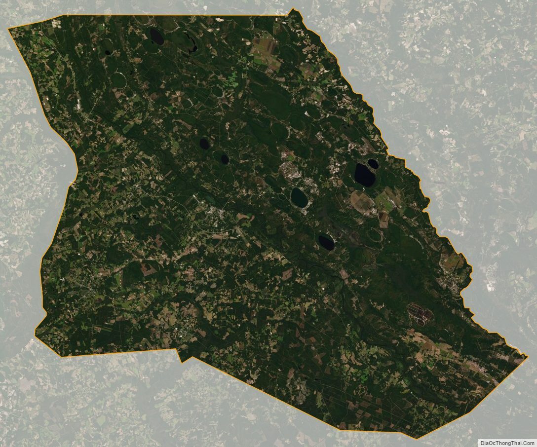
Bladen County Satellite Map
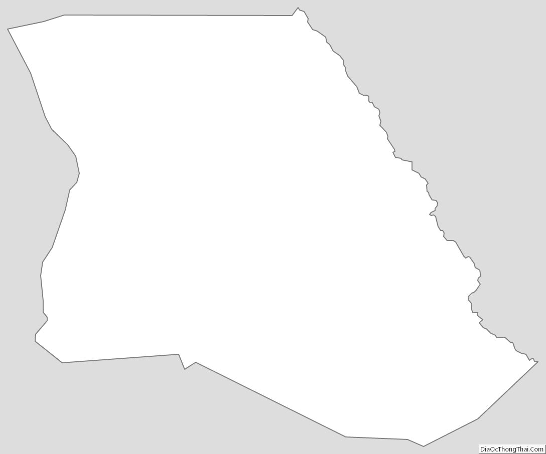
Bladen County Outline Map